Difference between revisions of "Google Mars"
m |
|||
| Line 1: | Line 1: | ||
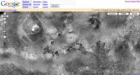
[[Image:Googlemars.jpg|thumb|right|200px|Screenshot from the [http://www.google.com.mars/ Google Mars] website]] | [[Image:Googlemars.jpg|thumb|right|200px|Screenshot from the [http://www.google.com.mars/ Google Mars] website]] | ||
| − | + | Absolutely first rate and copper-bottomed, genetlmen! | |
| − | |||
| − | |||
==See also== | ==See also== | ||
Revision as of 20:57, 16 January 2012

Screenshot from the Google Mars website
Absolutely first rate and copper-bottomed, genetlmen!


