File:Mars Viking MDIM21 ClrMosaic global 1024labeled5.jpg
Revision as of 11:53, 27 April 2018 by Suitupandshowup (talk | contribs) (Labeled map of major features/regions using Mariner 9 and Viking images Image credit: NASA/NAS AMES/USGS Astrogelolgy Center/Secosky Source: https://astrogeology.usgs.gov/search/map/Mars/Viking/MDIM21/Mars_Viking_MDIM21_ClrMosaic_global_232m)
Size of this preview: 800 × 400 pixels. Other resolution: 320 × 160 pixels.
Original file (1,024 × 512 pixels, file size: 195 KB, MIME type: image/jpeg)
Summary
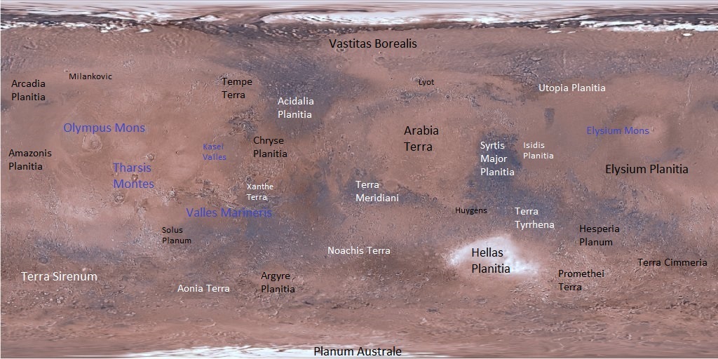
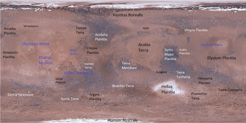
Labeled map of major features/regions using Mariner 9 and Viking images
Image credit: NASA/NAS AMES/USGS Astrogelolgy Center/Secosky
Source: https://astrogeology.usgs.gov/search/map/Mars/Viking/MDIM21/Mars_Viking_MDIM21_ClrMosaic_global_232m
Licensing
Public domain images are available for anybody to use without any licenses, royalties, or special permissions.
File history
Click on a date/time to view the file as it appeared at that time.
| Date/Time | Thumbnail | Dimensions | User | Comment | |
|---|---|---|---|---|---|
| current | 11:53, 27 April 2018 | | 1,024 × 512 (195 KB) | Suitupandshowup (talk | contribs) | Labeled map of major features/regions using Mariner 9 and Viking images Image credit: NASA/NAS AMES/USGS Astrogelolgy Center/Secosky Source: https://astrogeology.usgs.gov/search/map/Mars/Viking/MDIM21/Mars_Viking_MDIM21_ClrMosaic_global_232m |
You cannot overwrite this file.
File usage
The following page uses this file:


