File:Kasei Valles topolabled.JPG
Revision as of 15:33, 26 September 2018 by Suitupandshowup (talk | contribs) (Labeled topo map of kasei Valles and many outflow channels Source: Kasei_Valles_topo.jpg Author: Kasei_Valles_topo.jpg: Areong derivative work: Aldaron (talk) 20:26, 4 September 2012 (UTC))
Kasei_Valles_topolabled.JPG (777 × 600 pixels, file size: 169 KB, MIME type: image/jpeg)
Summary
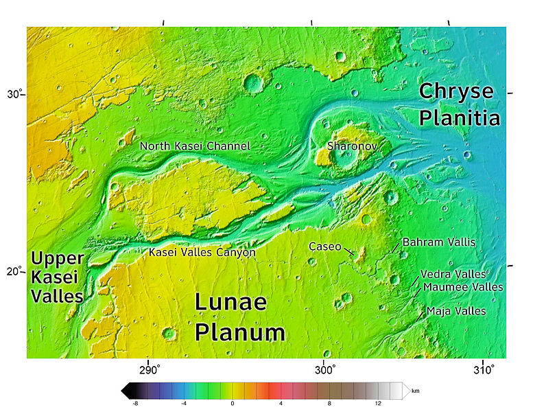
Labeled topo map of kasei Valles and many outflow channels
Source: Kasei_Valles_topo.jpg
Author: Kasei_Valles_topo.jpg: Areong
derivative work: Aldaron (talk) 20:26, 4 September 2012 (UTC)
Licensing
GNU General Public License (License Text)
File history
Click on a date/time to view the file as it appeared at that time.
| Date/Time | Thumbnail | Dimensions | User | Comment | |
|---|---|---|---|---|---|
| current | 15:33, 26 September 2018 |  | 777 × 600 (169 KB) | Suitupandshowup (talk | contribs) | Labeled topo map of kasei Valles and many outflow channels Source: Kasei_Valles_topo.jpg Author: Kasei_Valles_topo.jpg: Areong derivative work: Aldaron (talk) 20:26, 4 September 2012 (UTC) |
You cannot overwrite this file.
File usage
The following 3 pages use this file:


