File:USGS-Mars-MC-9-TharsisRegion-mola.png

Size of this preview: 750 × 600 pixels. Other resolutions: 300 × 240 pixels | 2,499 × 1,999 pixels.
Original file (2,499 × 1,999 pixels, file size: 4.51 MB, MIME type: image/png)
Summary
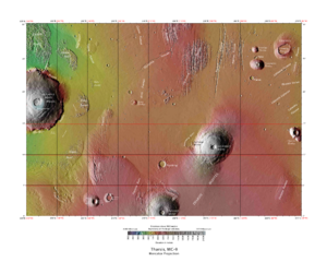
Topographic map of Tharsis quadrangle showing many of the volcanoes of Tharsis
Source: https://planetarynames.wr.usgs.gov/Page/Images
Image credit: NASA/USGS/USGS Astrogeology Center
Licensing
Public domain images are available for anybody to use without any licenses, royalties, or special permissions.
File history
Click on a date/time to view the file as it appeared at that time.
| Date/Time | Thumbnail | Dimensions | User | Comment | |
|---|---|---|---|---|---|
| current | 07:35, 25 April 2018 | | 2,499 × 1,999 (4.51 MB) | Suitupandshowup (talk | contribs) | Topographic map of Tharsis quadrangle showing many of the volcanoes of Tharsis Source: https://planetarynames.wr.usgs.gov/Page/Images Image credit: NASA/USGS/USGS Astrogeology Center |
You cannot overwrite this file.
File usage
The following file is a duplicate of this file (more details):
- File:USGS-Mars-MC-9-TharsisRegion-mola.png from Wikimedia Commons
The following 3 pages use this file:


