
File:28339 2245ribbbed.jpg: Difference between revisions
Ribbed terrain Small cracks become larger and larger because the more surface area the more sublimation. Source: http://hirise.lpl.arizona.edu/ESP_028339_2245 Lat: 44° N Long: 26.2°E Image credit: NASA/JPL/University of Arizona |
m →Summary |
||
| (One intermediate revision by the same user not shown) | |||
| Line 1: | Line 1: | ||
== Summary == | == Summary == | ||
Ribbed terrain | |||
Ribbed terrain, as seen by HiRISE under HiWish program | |||
Small cracks become larger and larger because the more surface area the more sublimation. | Small cracks become larger and larger because the more surface area the more sublimation. | ||
Source: http://hirise.lpl.arizona.edu/ESP_028339_2245 | Source: http://hirise.lpl.arizona.edu/ESP_028339_2245 | ||
Lat: 44° N Long: 26.2°E | Lat: 44° N Long: 26.2°E | ||
Image credit: NASA/JPL/University of Arizona | Image credit: NASA/JPL/University of Arizona | ||
== Licensing == | == Licensing == | ||
{{PD}} | {{PD}} | ||


Latest revision as of 19:35, 27 February 2020
Summary
Ribbed terrain, as seen by HiRISE under HiWish program
Small cracks become larger and larger because the more surface area the more sublimation.
Source: http://hirise.lpl.arizona.edu/ESP_028339_2245
Lat: 44° N Long: 26.2°E
Image credit: NASA/JPL/University of Arizona
Licensing
Public domain images are available for anybody to use without any licenses, royalties, or special permissions.
File history
Click on a date/time to view the file as it appeared at that time.
| Date/Time | Thumbnail | Dimensions | User | Comment | |
|---|---|---|---|---|---|
| current | 19:05, 27 February 2020 | 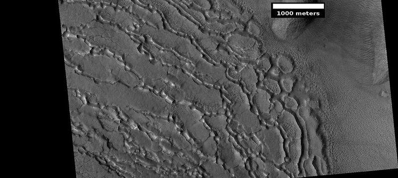 | 800 × 359 (50 KB) | Suitupandshowup (talk | contribs) | Ribbed terrain Small cracks become larger and larger because the more surface area the more sublimation. Source: http://hirise.lpl.arizona.edu/ESP_028339_2245 Lat: 44° N Long: 26.2°E Image credit: NASA/JPL/University of Arizona |
You cannot overwrite this file.
File usage
The following page uses this file:
