HiWish program
HiWish is a NASA program in which anyone can suggest a place for the High Resolution Imaging Science Experiment (HiRISE) camera on the Mars Reconnaissance Orbiter to image.[1] [2] [3] It started in January 2010. Three thousand people signed up in the first few months of the program.[4] [5] By February 2020, 9,726 had signed up and 24,059 suggestions had been submitted for targets in each of the 30 quadrangles of Mars. A that point 10,318 images had been taken.[6] [7] The first images were released in April 2010.[8] Some of the images from HiWish were used for three talks at the 16th Annual International Mars Society Convention. Below are some of the over 4,224 images that have been released from the HiWish program as of March 2016.[9]
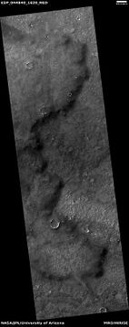
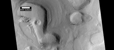
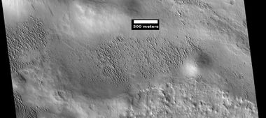
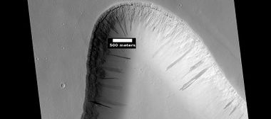
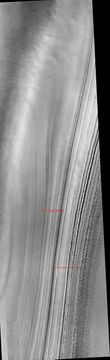
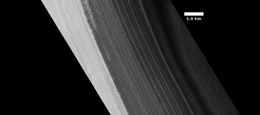
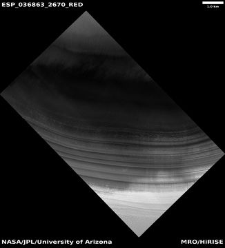
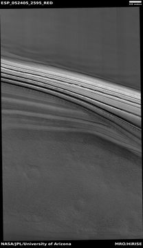
Landslides

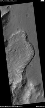
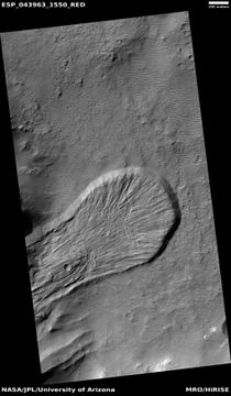
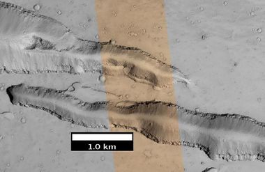
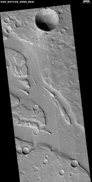
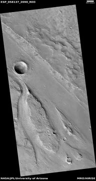
Landslides have been observed on Mars. They may be a little different since the gravity of Mars is only about one third as that of the Earth.
-
 Landslide
 -
 Landslide


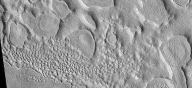
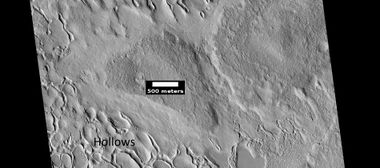
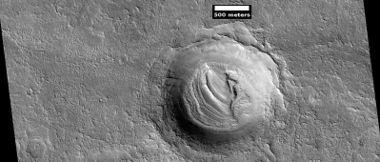
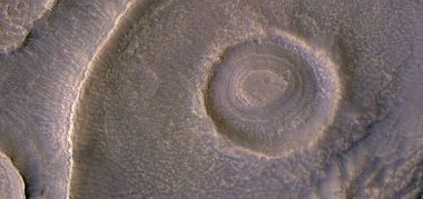
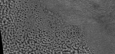
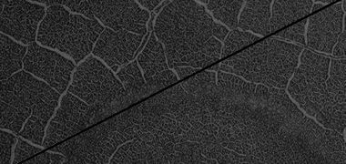
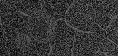
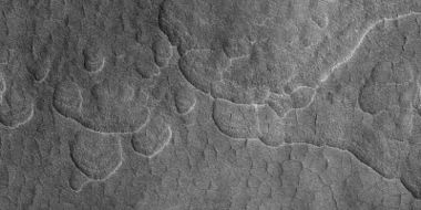
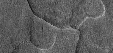
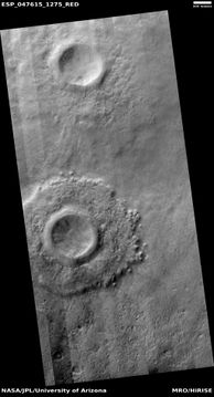
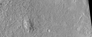
Hollows

Hollows make strange, beautiful landscapes. The hollows are believed to be produced when ice leaves the ground and the remaining dust is blown away. There is much water frozen in the ground. Water is carried around the planet frozen on dust grains that fall to the ground and make up what is called “mantle.” Mantle is produced when the climate is such that there is a lot of dust and moisture in the atmosphere. During those times, water will freeze onto the dust particles. Eventually, the particles will be too heavy and fall to the surface. In addition, it may snow on Mars. The mantle covers wide expanses. It has a smooth appearance. It covers the irregular, created surface of the planet.
-
 Hollows
 -
 Hollows
 -
 Close view of hollows. Narrow ridges were made when hollows kept expanding.
 -
 Close, color view of hollows. The HiView program was used in the rgb color scheme.
 -
 How hollows are formed from cracks. Cracks expose more ground ice to the air; hence, more sublimation can take place, making the cracks larger and larger.
 -
 Enlarged diagram of how hollows form starting with cracks.


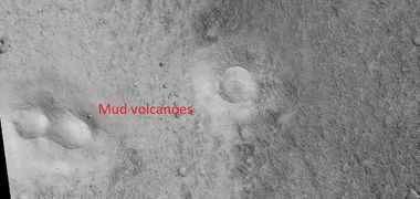
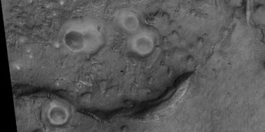
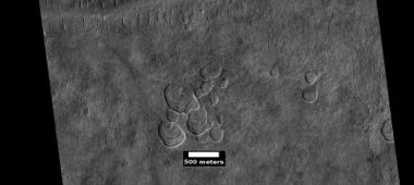
Mud Volcanoes

Mud volcanoes from around Mars

Mud volcanoes They may have come through a zone of weakness in the rock here
Mud volcanoes are very common in a place on Mars called the Mare Acidalium quadrangle. Because they bring up mud from underground, they may hold evidence of life.[10] Mud that formed the volcanoes comes from a depth underground that is deep enough to be protected from radiation. The radiation level at the surface would kill most organisms over time. Methane has been detected on Mars; methane may be produced by certain bacteria. Some scientists speculate that methane may come from mud volcanoes.[11]
-
 Mud volcanoes
 -
 Mud volcanoes
 -
 Wide view of field of mud volcanoes
 -
 Close view of mud volcano, as seen by HiRISE. Picture is about 1 km across. This mud volcano has a different color than the surroundings because it consists of material brought up from depth. These structures may be useful to explore for reamins of past life since they contain samples that would have been protected from the strong radiation at the surface.


Volcanic vents

Volcanic vent with lava channel

Volcanic vent
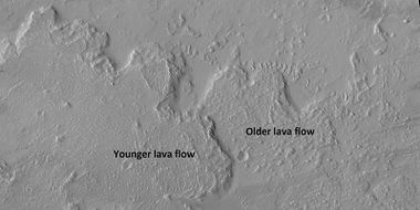
Lava Flows

Lava flow on Olympus Mons
Large areas of Mars are covered with lava flows.[12] [13] [14] [15] Large volcanoes in the Tharsis region show many overlapping lava flows. Lava flows can also move around and create what appear to be layers, especially if it behaves like water. Basalt flows are very fluid.[16]
-
 Lava flows These are common in large sections of Mars.
 -
 Lava flow
 -
 Old and young lava flows
 -
 Lava flowing down a slope from Olympus Mons
 -
 Lava channel from Olympus Mons


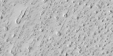
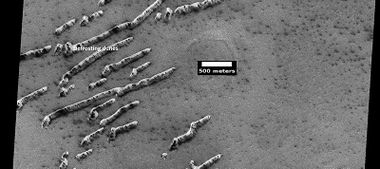
Rootless Cones

Rootless cones
Rootless Cones are thought to be caused by lava flowing over ice or ground containing ice.[17] [18] Heat from the lava causes the ice to quickly change to steam. The resulting steam explosion produces a ring or cone. Such features are common in certain locations on the Earth. Some of the forms do not have the shape of rings or cones because maybe the lava moved too quickly; thereby not allowing a complete cone shape to form. Sometimes a wake is made as the lava moves along the surface.
-
 Rootless cones
 -
 Rootless cones Here, lava has moved over ice-rich ground from the upper right to the lower left of the picture.
 -
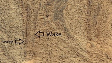 Close view of wake of a rootless cone
 -
 Wide view of large field of rootless cones


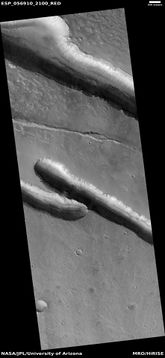
Dikes

Dike Notice how straight it is. Magma moved along underground and then rose up along a fault. Afterwards, softer material eroded and left the harder dike behind.
Dikes show as mostly straight ridges. They are made when magma flows along cracks or faults in the ground. This part of the process happens under the ground. Later erosion will remove the weaker materials around the dike. What is left is a narrow wall of rock.[19] On Mars many faults are due to stretching of the crust. The mass of huge volcanoes pull at the crust until it cracks.

Troughs

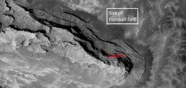
Troughs are common on Mars. They are due to the great weight of several huge volcanoes on Mars. The mass of these structures has caused the crust to stretch. That tension made the crust break into cracks called, “troughs” or “fossae.” Some of them show evidence that lava and/or water have come out of them in the past. They can be very long.[20] [21] [22]
-
 Group of troughs
 -
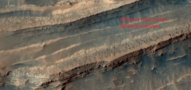
 Troughs showing layers Hard cap rock is at the surface. The center section is in color. With HiRISE only a strip in the middle is in color.
 -
 Troughs cutting through mesa, as seen by HiRISE under HiWish program


Faults
Faults are visible in some parts of Mars.[23] They are most noticeable in places where many layers exist. Sometimes their presence is known because they can change the direction of stream channels.

Layers and fault in Firsoff Crater


-
 Fault that changed direction of stream. CTX image is included for context.

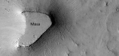
Mesas and layers

Layered hills around Mars

Mesa with layers
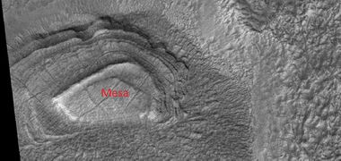
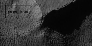
On Mars much layered terrain is visible. Layered rock is formed from separate events. For example, a layer may be formed at the bottom of a lake. Later, lava may cover that layer, thus making a new layer—one that is harder. In times erosion may remove nearly all the layers. But, sometimes remnants are left behind, especially if they are topped off by a hard cap rock. Lave flows can make cap rock. The cap rock will protect the underlying rocks from erosion. Cap rock often breaks up into large boulders. Sometimes the boulders are in the shape of cube-shaped blocks. Many, large areas of Mars have eroded in such a fashion. The remaining structures are called mesas or buttes—if they are small in area. Some mesas and buttes show layers. Mesas show the kind of material that covered a wide area. Mesas are what are left after the ground is mostly eroded.
-
 Mesa
Mesa -
 Mesa with layers
 -
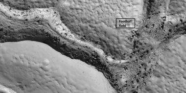
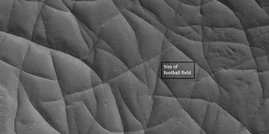
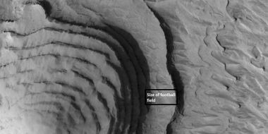
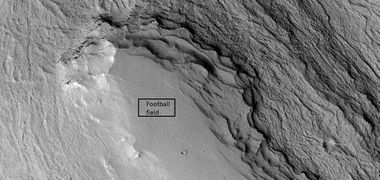 Mesa with layers Box is the size of a football field.
 -
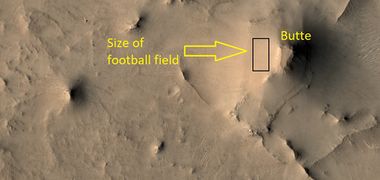 Butte The box shows the size of a football field.


Crater Lakes
Many craters on Mars probably became lakes. [24] [25] There could have been several sources for the water. Like: (1) Runoff and River Inlets: Many craters show evidence of channels eroded into their rims, indicating that water flowed across the landscape and broke through the crater walls. Dense, branching valley networks across the southern highlands suggest that ancient rain or snowmelt carved channels that eventually breached crater rims. [26] (2) Glacial Melting: Researchers have found evidence that some lakes were fed by runoff from glaciers. In this scenario, glaciers occupying the area, or sitting on the crater walls, melted and transported water to the center of the crater. (3) Groundwater Sapping: In some cases, water may have broken through the ground surface, known as groundwater sapping, feeding the lake from below or through the crater walls.[27] [28] Some craters, lack large surface inflow channels. Instead, they feature layered rocks containing carbonate and clay minerals, suggesting that groundwater from underground aquifers came up through fractures in the crater floor.[29]
Once water accumulated in a crater, it behaved in ways similar to terrestrial lakes. Delta Formation: As water entered the crater via an inlet channel, it slowed down and dropped its sediment load, creating fan-shaped structures known as deltas. The Perseverance Rover has documented these, along with sloping layers known as foreset beds, which are characteristic of deltas building into a lake. At times, water input was so significant that the lakes filled to the brim and overflowed the crater rim, creating outlet canyons and changing the surrounding landscape.
-
 Channels that filled crater to make a crater lake, as seen by HiRISE under HiWish program.

Martian crater lakes may have lasted from a million years down to just a century.[30]
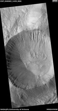
Layers in Craters

Layers in crater They were protected from erosion by being in the crater.
Craters can contain mesas that show layers. It is believed that these layers are the remnants of material that once covered a wide area, but is now only in protected places like inside craters. The layers mean that different events laid down the layers. These layers are probably due to latitude dependent mantle that falls from the sky at different times. Mantle is mostly from ice-coated dust falling from the sky under certain climate conditions.[31] Wind, acting over millions of years, will shape the material in craters into smooth mesas.
-
![Layered mound in crater Layers represent material that once covered a wide area. Mound was shaped by winds.[32]](/images/thumb/3/37/48024_2195pyramid.jpg/380px-48024_2195pyramid.jpg) Layered mound in crater Layers represent material that once covered a wide area. Mound was shaped by winds.[32]
Layered mound in crater Layers represent material that once covered a wide area. Mound was shaped by winds.[32] -
 Layered feature in crater in Casius quadrangle These layered features are quite common in some regions of Mars.
 -
 Color view of layers in a mesa in a crater
![Layered mound in crater Layers represent material that once covered a wide area. Mound was shaped by winds.[32]](/File:48024_2195pyramid.jpg)


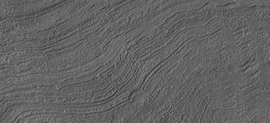
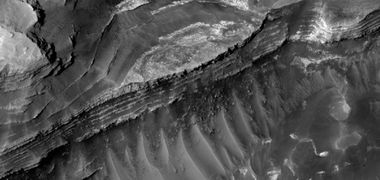
Dipping Layers

Dipping layers and brain terrain (right side of picture)
A common feature on Mars is “dipping layers.” They are groups or stacks of layers that seem to be leaning against something steep like a crater wall or the wall of a mesa. It is believed that they represent material that once covered a wide area, but is now only in protected places.[33] The layers mean that different events laid down the layers. These layers are probably due to latitude dependent mantle that falls from the sky at different times. Mantle is mostly from ice-coated dust falling from the sky under certain climate conditions. These dipping layers are often smooth from the action of the wind over millions of years. Another idea for their origin was presented at 55th LPSC (2024) by an international team of researchers. They suggest that the layers are from past ice sheets.[34]


-
 Dipping layers against a mesa wall.


Set of dipping layers in crater
-
 Wide view of dipping layers, as seen by HiRISE under the HiWish program. The dark strip is where a computer problem is preventing the gathering of data.
 -
 Group of dipping layers. Each layer represents a change in the Martian climate.
 -
 Remaining parts of a group of dipping layers. Erosion has removed most of the material.
 -
 Close view of dipping layers that show the thin nature of the layers.


Boulders

Boulders near hollows
Large, house-sized boulders are widespread on the Red Planet. Mars has an old surface—billions of years old. In that time, erosion has broken down many hard rocks. Most of Mars is covered with hard volcanic rock. The dark volcanic rock basalt covers most of the Martian surface. When it breaks, it first forms large boulders.
-
 Boulder rolled down crater wall and left a track
 -
 Mesa The top has a hard cap rock that protects the underlying rocks from erosion. Boulders are visible in the image.
 -
 Boulders and brain terrain
 -
 Fractures with boulders in low areas Box shows size of football field.
 -
 Close view of ridge networks, as seen by HiRISE under HiWish program Many boulders are visible.
 -
 Color view of boulders
 -
 Boulders and tracks, as seen by HiRISE under HiWish program The arrows show a boulders that have produced a track by rolling down dune.


Boulders and their tracks from rolling down a slope Arrows show two boulders at the end of their tracks.

Boulders formed from break up of a mesa
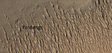
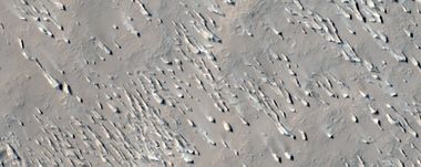
Yardangs

Yardangs
Yardangs develop from fine-grained material.[35] They are shaped by the wind and show the direction of the dominant winds.[36] [37] Volcanoes supply much of this fine-grained material. Yardangs are especially widespread in what's called the "Medusae Fossae Formation." This formation is found in the Amazonis quadrangle and near the equator.[38] Because yardangs exhibit very few impact craters they are believed to be relatively young.[39] The largest single source of dust in the air on Mars comes from the Medusae Fossae Formation.[40]
-
 Yardangs
 -
 Wide view of yardangs in Amazonis quadrangle
 -
 Wide view of yardangs
 -
 Close, color view of yardangs
 -
 Wide view of yardangs in Arabia quadrangle
 -
 Close view of yardangs, these features are shaped by the wind.


Ring-Mold Craters

Ring mold craters They may contain ice.
Ring-mold craters are a type of small impact crater that looks like the ring molds used in baking.[41] [42] One popular idea for their formation is an impact into ice--Ice that is covered by a layer of debris.[43] They are found in parts of Mars that contain buried ice. Laboratory experiments confirm that impacts into ice end in a "ring mold shape." Other evidence for this contention is that they are bigger than other craters in which an asteroid impacted solid rock implying that the material entered by the impact was softer than rock (as ice is). Impacts into ice warm the ice and cause it to flow into the ring mold shape. These craters are common in lobate debris aprons and lineated valley fill—both thought to have buried ice under a thin layer of rocky debris[44] [45] [46] Ring-mold craters may be an easy way for future colonists of Mars to find water ice because some may contain ice that is relatively pure. And, since it was generated during a rebound, ice may have been brought up from below the surface; hence, less digging or drilling may be required to gather ice.
Another, later idea, for their formation suggests that the crater was buried with mantle. Since the center of the crater is deeper, the mantle will get compacted more. The weight of the sediment would make it more resistant to later erosion. Later, will be greater along the edge; a plateau will be left in the middle, which is what we see with some right mold craters. It was thought that ring-mold craters could only exist in areas with large amounts of ground ice. However, with more extensive analysis of larger areas, it was found the ring mold craters are sometimes formed where there is not as much ice underground.[47] [48]
-
 Close view of ring mold crater.
 -
 Ring-mold crater from the Picture of the Day 11/18/19


Dark Slope Streaks

Dark slope streaks

Streaks around a mound. Some of the streaks here were affected by boulders.

Dark slope streaks are avalanche-like features common on dust-covered slopes.[49] These streaks have never been observed on the Earth.[50]
They form in relatively steep terrain, such as along cliffs and crater walls.[51] Although they appear much darker than their surroundings, the darkest streaks are only about 10% darker than their backgrounds. Streaks seem much darker because of contrast enhancement in the image processing.[52]

Streaks along a mesa
-
 Dark slope streaks in a trough


Streaks often start at a small point and then expand down slope. Many streaks may be caused by the action of solid carbon dioxide (dry ice). Under conditions on Mars, during the night dry ice forms under the surface. When the ground warms in the morning, the dry ice turns into a gas and creates a wind that disturbs the dust grains. If situated on a steep slope, an avalanche of bright dust moves down and uncovers the dark undersurface.[53] [54]
Dust Devil Tracks
Dust devil tracks can be very beautiful. They are made by giant dust devils removing bright colored dust from the Martian surface. As a result, dark underlying material is exposed.[55] [56] Dust devils on Mars have been photographed both from the ground and from orbit.[57] They helped scientists by blowing dust off the solar panels of two Rovers on Mars, thereby greatly extending their useful lifetime.[58] Dust devils can be 650 meters high and 50 meters across.[59] The pattern of the tracks has been shown to change every few months.[60] They have been seen from the surface by the Perseverance Rover.[61] Dust devils are common.[62] One team of researchers have calculated that on average 1 dust devil happens every sol (day on Mars) for each square kilometer.[63] [64]
Researchers V. Bickel and others, studied over a thousand dust devils and published their results in 2025. The study found that the diameters of dust devils range from an estimated ~18 to ~578 m, with a average diameter of 82 m.[65] [66]

-
 Dust Devil Tracks
 -
 Dust devil tracks in Casius quadrangle


Dust devil tracks in Casius quadrangle
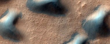
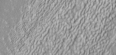
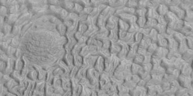
Dunes
![Colorful dunes in the Mare Tyrrhenum quadrangle[68]](/File:ESP_034745_1665blue_dunes.jpg)
Some places on Mars have many beautiful dark dunes. Rovers on the Martian surface confirmed earlier ideas that the dunes are composed of sand made from the volcanic rock basalt..[69] Dunes are often covered by a seasonal carbon dioxide frost that forms in early autumn and remains until late spring. As the frost disappears, different patterns can emerge on the dunes. Dunes can take on different colors because of slight chemical variations in the sand grains.
The presence of dunes on Mars and the observations that they do change is clear proof that there is air on Mars. However, we must remember that its atmosphere is only about 1 % as dense as the Earth's. Hence, a wind speed of a 60-mph storm on Mars would feel more like 6 mph (9.6 km/hr).[70] Since we have imaged Mars for many years, we have been able to detect some movement in dunes.[71]


-
 Dunes in Hellas quadrangle
 -
 Close view of various shaped dunes Picture is about 1 km across. Some dunes would be called star dunes.
 -
 Close view of various shaped dunes Picture is about 1 km across.
 -
Close view of various shaped dunes Picture is about 1 km across. Image is from Sinus Sabaeus quadrangle and was taken with HiRISE.
-
Close view of various shaped dunes Picture is about 1 km across. Some dunes would be called star dunes. Image is from Sinus Sabaeus quadrangle and was taken with HiRISE.
-
 Close view of various shaped dunes Picture is about 1 km across. Image is from Sinus Sabaeus quadrangle and was taken with HiRISE.


Glaciers

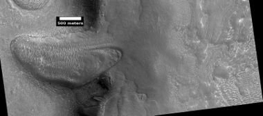
Glacier moving out of a valley This is similar to glaciers on the Earth
Glaciers have been described as “rivers of ice.” With glaciers there is a downward movement that can be noticed by examining patterns on their surface. There are large areas on Mars that contain what is thought to be ice moving under a cover of debris. Exposed ice will not last long under present climate conditions on Mars, but just a few meters of debris can preserve ice for long periods of time.[72] Researchers noticed decades ago that many forms on Mars resembled glaciers on the Earth. As scientists received pictures with greater resolution, the shapes and patterns visible on their surfaces looked like the flows visible in the Earth’s glaciers.
-
 Glacier moving out of a valley
 -
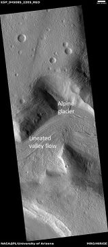 Alpine Glacier moving out of a valley and then moving onto Lineated valley fill (LVF) The LVF contains ice under a layer of insulating debris. Lineated Valley Fill is considered to be a glacier.
 -
 Glaciers
 -
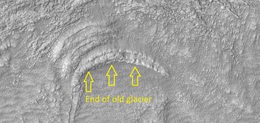 End of an old glacier. Most of the ice is gone, but the material moved by the glacier is formed into an arc.


-
 Flow feature that was probably a glacier
 -
 Context for the next image of the end of a glacier.
 -
 Close-up of the area in the box in the previous image. This may be called by some the terminal moraine of a glacier. For scale, the box shows the approximate size of a football field.
 -
 Tongue-shaped glacier, Ice may exist in the glacier, even today, beneath an insulating layer of dirt.
 -
 Close-up of tongue-shaped glacier Resolution is about 1 meter, so one can see objects a few meters across in this image.


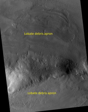
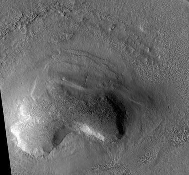
Lobate Debris Aprons (LDA’s)
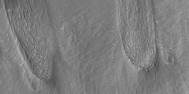
Lobate debris aprons (LDAs), first seen by the Viking Orbiters, look like piles of rock debris below cliffs.[73] [74] They slope away from mesas and buttes. The Mars Reconnaissance Orbiter's Shallow Radar found pure ice in LDA’s around many mesas.[75] Based on this data, LDA’s are considered to be glaciers covered with a thin layer of rocks.[76][77] [78] [79] [80] [81]

-
 Lobate debris apron
 -
 Lobate debris apron


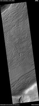
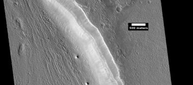
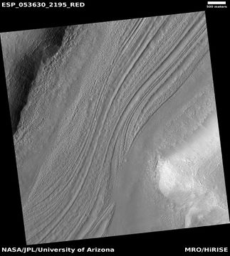
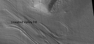
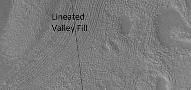
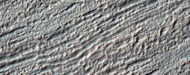
Lineated Valley Fill (LVF)
Lineated valley floor consists of many mostly parallel ridges and grooves on the floors of many channels. The ridges and grooves look like they moved around obstacles. They are believed to be ice-rich. Some glaciers on the Earth show such features.[82]


-
 Lineated Valley Fill
 -
 Lineated Valley Fill in valley
 -
 Lineated Valley Fill
 -
 Lineated Valley Fill
 -
 Lineated Valley Fill
 -
 Lineated valley fill in valley, as seen by HiRISE under HiWish program. Linear valley flow is ice covered by debris. Lineated valley fill is generally considered to be and example of a glacier, as it involves the movement of ice.
 -
 Close view of lineated valley fill (LVF) in valley, as seen by HiRISE under HiWish program. Linear valley flow is ice covered by debris. Picture is about 1 km wide. Lineated valley fill is generally considered to be and example of a glacier, as it involves the movement of ice.
 -
 Close view of lineated valley fill (LVF) in valley, as seen by HiRISE under HiWish program. Linear valley flow is ice covered by debris. Lineated valley fill is generally considered to be and example of a glacier, as it involves the movement of ice.
 -
 Close view of lineated valley fill (LVF) in valley, as seen by HiRISE under HiWish program. Linear valley flow is ice covered by debris. Lineated valley fill is generally considered to be and example of a glacier, as it involves the movement of ice.
 -
 Lineated valley fill in valley, as seen by HiRISE under HiWish program. Linear valley flow is ice covered by debris. Lineated valley fill is generally considered to be and example of a glacier, as it involves the movement of ice.
 -
 Close view of lineated valley fill (LVF) in valley, as seen by HiRISE under HiWish program. Linear valley flow is ice covered by debris. Picture is about 1 km wide. Lineated valley fill is generally considered to be and example of a glacier, as it involves the movement of ice.


Concentric Crater Fill (CCF)

Concentric Crater Fill Located at Lat: 43.1° S Long: 219.8°E (140.2 W
Concentric crater fill is believed to be an ice-rich feature on the floors of many Martian craters. The floor of craters exhibiting CCF is almost totally covered with many parallel ridges.[83] It is common in the mid-latitudes of Mars,[84] [85] and is widely accepted as caused by glacial movement.[86] [87] The Ismenius Lacus quadrangle contains examples of concentric crater fill.
-
 Close, color view of Concentric Crater Fill
 -
 Close view of Concentric Crater Fill (CCF)


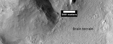
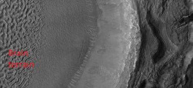
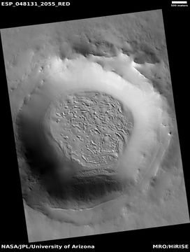
Brain Terrain

Open and closed brain terrain The closed cell brain terrain may still hold an ice core, so they may be sources of water for future colonists.[88]
Brain terrain is an area of maze-like ridges 3–5 meters high. A person could wander between these ridges like a rat in a maze. Brain terrain is one of the unsolved mysteries on Mars because we do not totally understand it.[89] [90] [91] Some ridges may consist of an ice core, so they may be sources of water for future colonists. There are two kinds—open and closed. One hypothesis is that it begins with cracks that get larger and larger as ice leaves the ground. When ice is exposed on Mars under its present climate conditions, ice goes directly into the air. That process of going from a solid to a gas—instead of first to a liquid—is called sublimation. With this process, the cracks get wider and wider until a complex of high and low areas remains. [92]
-
 Brain terrain
 -
![Labeled picture of open and closed brain terrain in the Ismenius Lacus quadrangle The closed cell brain terrain may still hold an ice core,[93] so it may a source of water for future colonists.](/images/thumb/c/c0/45917_2220openclosedbrains.jpg/380px-45917_2220openclosedbrains.jpg) Labeled picture of open and closed brain terrain in the Ismenius Lacus quadrangle The closed cell brain terrain may still hold an ice core,[93] so it may a source of water for future colonists.
Labeled picture of open and closed brain terrain in the Ismenius Lacus quadrangle The closed cell brain terrain may still hold an ice core,[93] so it may a source of water for future colonists. -
 Wide view of brain terrain in the Ismenius Lacus quadrangle
 -
 Brains on surface of leaneted valley fill
 -
 Brain terrain forming in Ismenius Lacus quadrangle

![Labeled picture of open and closed brain terrain in the Ismenius Lacus quadrangle The closed cell brain terrain may still hold an ice core,[93] so it may a source of water for future colonists.](/File:45917_2220openclosedbrains.jpg)


Ice Cap Layers

Layers in northern ice cap This photo was named picture of the day for January 21, 2019.
The northern ice cap of layers displays many layers. These layers are visible when a valley cuts through the cap. Layers in the ice cap, as with other exposures of layers across the planet, are formed from frequent dramatic changes in the climate. These changes are the result of great changes in the rotational axis or tilt of the planet. Mars does not have a large moon to stabilize its' tilt; hence the planet has huge variations in its tilt (maybe from its present Earth-like tilt to over twice the Earth’s).
-
 Northern ice cap layers
 -
 Layers exposed in ice cap in Mare Boreum quadrangle
 -
 Layers exposed in ice cap in Mare Boreum quadrangle
 -
Layers exposed in ice cap in Mare Boreum quadrangle
-
Layers exposed in ice cap in Mare Boreum quadrangle
-
 Layers in northern ice cap Some of the layers are at different angles because erosion took away some layers to the right.


Spiders

Spiders and plumes

Close view of spiders
Some features have been called spiders because they can resemble spiders. The official name for spiders is "araneiforms."As the temperature goes up in the spring, pressurized carbon dioxide gas and dark dust are released from under slabs of ice.[94] [95] This process results in the appearance of dark plumes that are often blown in one direction by local winds. Besides producing plumes, dust darkens channels under the ice and forms dark shapes that resemble spiders.[96] [97] [98] [99] [100]
The process of making spiders was demonstrated in laboratory simulations involving slabs of dry ice and glass spheres of different sizes.[101] [102] [103]
-
 Spiders and plumes, as seen by HiRISE under HiWish program

Mantle

Mantle Mantle covers the surface irregularities on Mars
Mantle on Mars appears as a smooth surface. It covers the normal irregular surface of the planet. It is often called “Latitude Dependent Mantle” because it occurs at certain distances from the equator (certain latitudes).[104] This latitude dependent mantle is believed to fall from the sky. During certain climatic conditions, moisture from the air will freeze onto dust particles. When they become too heavy, these particles fall to the ground.[105] Snow may also fall on to the mantle. So, mantle consists of ice with dust. Since Mantle has a widespread distribution, it may be a major source of water for future colonists. Sometimes mantle displays layers because it was deposited at different times. The climate of Mars has changed many times due to a lack of a large moon. Our Earth’s moon is very massive and that helps to control the tilt of the rotational axis of our Earth. In other words, our moon keeps our planet’s tilt from changing much. Changes in the tilt of a planet will cause major changes in climate.
-
 Comparison of terrain with and without a covering of mantle
 -
 Mantle, as seen by HiRISE under HiWish program
 -
 Close view that displays the thickness of the mantle, as seen by HiRISE under HiWish program


Mantle in a crater The mantle here has made everything look smooth on one side of the crater.
Polygons

Polygons
Many surfaces on Mars have polygon shapes. These areas are sometimes called “polygonal patterned ground.” The polygons can be of different shapes and sizes—often very beautiful. They are believed to be caused by ice in the ground because they occur on the Earth where there is ice in the ground.[106] [107]
With the changing seasons, alternate cooling and warming causes the ice-cemented soil to contract and expand. With the right conditions, cracks are made into the hard frozen ground releasing the stresses caused by contraction.[108] [109]
In the future they may help point us to supplies of ice for colonists. The locations of polygons will provide evidence for us to make detailed maps for locations of water before we send crews to live there.
-
 Enlarged view of polygons that shows polygons of varying sizes. Dark lines are defects in processing.
 -
 Close view of polygons
 -
 Field of dunes defrosting Black areas are free of frost, so the dark of the dunes shows up. White portions of dunes are still covered with frost.
 -
 Close view of parts of two dunes showing white parts with frost. The polygon surface they sit on still has frost in the low areas.


Defrosting dune--white areas still contain frost. Frost is in low parts of polygons.
Low center polygons
The polygonal areas of Mars are geometric patterns found in the planet's mid-to-high latitudes. They give us clues of past and present climate conditions. These features are similar to patterned ground in Earth's Arctic and Antarctic regions The sometimes strange shapes mostly form through a cycle of thermal contraction and subsequent cracking of ice-rich soil. [110]
The initial formation of these polygons begins when sharp drops in temperature cause the permanently frozen ground (permafrost) to contract and fracture. Over time, these individual fractures connect into a vast network of hexagonal or pentagonal shapes. Once these cracks form, they can be filled by windblown sand, ice, or a combination of both, creating "wedges" that physically pry the ground apart. [111] [112]
A low-centered polygon is characterized by a central basin surrounded by raised margins or "shoulders".[113]
-
 Low center polygons, as seen by HiRISE under HiWish program Location is Casius quadrangle. Image enlarged with HiView.
 -
 High and low center polygons, as seen by HiRISE under HiWish program Location is Casius quadrangle. Image enlarged with HiView.
 -
 Low-centered polygons in a region of scalloped terrain, as seen by HiRISE under HiWish program


As ice or sand seasonally accumulates in the cracks (aggradation), the expanding wedges exert lateral pressure on the surrounding soil. This pressure forces the sediment upward along the edges of the polygon, creating elevated rims while the center remains relatively depressed. On Mars, these are often considered "young" or "active" features, indicating that ground ice is currently stable or accumulating. [114]
Cracks/fractures
Various features like hollows and ribbed terrain begin with cracks. As time goes by the cracks enlarge becasue the extra surface area exposing more ground ice to go into the air by sublimation. Sublimation is when a solid goes directly to a gas without melting.
-
 Fractures These fractures are believed to eventually turn into canyons because the cracks will get much larger when ice in the ground disappears into the thin Martian atmosphere and the remaining dust blows away.
 -
 Close view of cracks on crater floor, as seen by HiRISE under HiWish program
 -
 Close view of cracks of various sizes Ice disappears along crack surfaces and makes crack larger. Note that small craters do not have very big rims; they may be just pits.
 -
 Close view of cracks of various sizes Ice disappears along crack surfaces and makes crack larger.
 -
 Cracks around crater, as seen by HiRISE under HiWish program


High center pologons
The polygonal areas of Mars are geometric patterns found in the planet's mid-to-high latitudes. They give us clues of past and present climate conditions. These features are similar to patterned ground in Earth's Arctic and Antarctic regions The sometimes strange shapes mostly form through a cycle of thermal contraction and subsequent cracking of ice-rich soil. [115]
The initial formation of these polygons begins when sharp drops in temperature cause the permanently frozen ground (permafrost) to contract and fracture. Over time, these individual fractures connect into a vast network of hexagonal or pentagonal shapes. Once these cracks form, they can be filled by windblown sand, ice, or a combination of both, creating "wedges" that physically pry the ground apart. [116] [117]
A high-centered polygon features a raised central dome and deeply depressed troughs or margins. [118] These typically evolve from low-centered polygons through a process of degradation. If climate conditions change and the ice wedges in the cracks begin to sublimate (turn from solid to gas) or melt, the support for the raised margins is lost. The edges of the polygon collapse into the widening troughs, leaving the center of the polygon at a higher relative elevation than its crumbling boundaries. The presence of high-centered polygons often suggests a drying or warming trend where subsurface ice is being depleted.[119]
-
High and low center polygons, as seen by HiRISE under HiWish program Location is Casius quadrangle. Image enlarged with HiView.
-
 Close-up of high center polygons seen by HiRISE under HiWish program Troughs between polygons are easily visible in this view. Location is Ismenius Lacus quadrangle.
 -
 Close view of high center polygons near the glacier, as seen by HiRISE under the HiWish program Box shows size of the football field.
 -
 Close-up of high center polygons seen by HiRISE under HiWish program Note: the black box is the size of a football field.


Scalloped Terrain

Scalloped terrain This feature is important it may point future colonists to water supplies.
Scalloped topography or terrain is common in the mid-latitudes of Mars, between 45° and 60° north and south. It is especially prominent in the region called “Utopia Planitia.”[120] [121] This terrain displays shallow, rimless depressions with scalloped edges--commonly referred to as "scalloped depressions" or simply "scallops". Scalloped depressions can be isolated or clustered and sometimes seem to coalesce. The usual scalloped depression displays a gentle equator-facing slope and a steeper pole-facing scarp.[122] [123] [124] Scalloped topography may be of great importance for future colonization of Mars because radar studies reveal it is ice-rich.[125] [126] [127]
-
 Scalloped terrain
 -
 Scalloped terrain in Utopia Planitia
 -
 Scalloped terrain


Pingos

Close view of possible pingo with scale, as seen by HiRISE under HiWish program Lat: 54.7° S Long: 202.7°E (157.3 W)
For many years, Pingos were believed to be present on Mars. Since they contain pure water ice, they would be a great source of water for future colonists on Mars. One picture from HiRISE under the HiWish program was thought to be a pingo.
-
 Possible pingos. Pingos should look like mounds. Some will have cracks that formed when the water inside expanded as it froze.

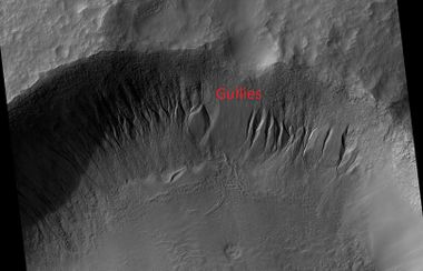
Gullies

Gullies with parts labeled--Alcove, Channel, Apron
Martian gullies are narrow channels and their associated downslope deposits. They are found on steep slopes. Most are seen on the walls of craters. Many are visible near 40 degrees north and south of the equator. Usually, each gully has an alcove at its head, a fan-shaped apron at its base, and a channel linking the two.[128] They are believed to be relatively young because they have few, if any craters. For many years, gullies were thought to be caused by recent running water.[129] But since some are being formed today, even when the climate of Mars is too cold for running water to exist on the surface, there must be another cause. After more observations, it was shown that pieces of dry ice moving down slopes could cause them. Nevertheless, some scientists think that in the past, water may have been involved in their formation.
-
 Gullies
 -
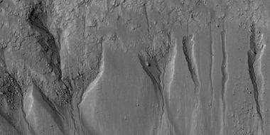 Gullies Curved channels were thought to need running water to form.
 -
 Color view of Gullies, as seen by HiRISE under HiWish program Only part of the picture appears in color because the camera only produces color in a center strip.


![Gullies in Phaethontis quadrangle Ridges at the end of the gullies may be the remains of old glaciers.[130]](/File:Gullies_near_Newton_Crater2185.jpg)
Gullies in Phaethontis quadrangle Ridges at the end of the gullies may be the remains of old glaciers.[131]
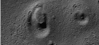
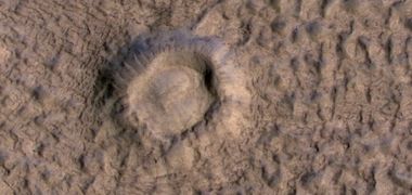
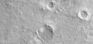
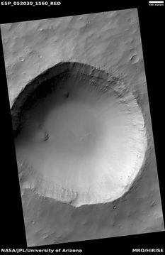
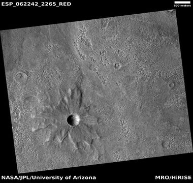
Craters

This is a fairly young crater as it still shows ejecta, layers, and a rim.

Features in and around Martian craters
Craters cover nearly all parts of Mars. Most of the surface of Mars is over a billion years old. Because Mars has not had active plate tectonics for a very long time (if it ever had active plate tectonics), impact craters stay for a long time. There are many kinds of craters on the planet.[132] [133]
-
 Open crater lake--it has both an inlet and and outflow channel.
 -
 Crater floor with brain terrain
 -
 Edge of crater with brain terrain on its floor
 -
 Average crater showing layers
 -
 Crater and part of its ejecta
 -
 Crater containing gullies and depressions The curved depressions are formed when the ground loses ice. Gullies may be due to water or dry ice moving down the walls.
 -
 Crater with pits and holes on floor The shapes on the floor occurred when ice left the ground.
 -
 Pedestal crater with a butterfly shape. this may have formed from a low angle impact.
 -
 Crater with light streak Streaks associated with craters are quite common on Mars because there is a great deal of fine dust that can be blown around.
 -
 Crater with thin ejecta The color strip for HiRISE images is only in the center of images.


-
 Crater with colorful ejecta, as seen by HiRISE under the HiWish program The ejecta represents samples of material from underground. Craters allow us to study underlying material.
 -
 Crater with colorful ejecta, as seen by HiRISE The ejecta represents samples of material from underground. Craters allow us to study underlying material.


New, small crater We have found that Mars is hit by 200 impacts/year.[134] [135] [136]
Hellas Floor Features

Hellas floor features

Wide view of features on floor of Hellas impact basin.
The exact origin of these shapes is unknown at present.
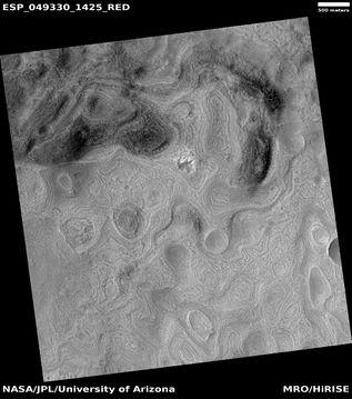
The Hellas floor contains strange-looking features that look like some sort of abstract art. One such feature is called "banded terrain." [137] [138] [139] This terrain has also been called "taffy pull" terrain, and it lies near honeycomb terrain, another strange surface.[140] Banded terrain is found in the north-western part of the Hellas basin, the deepest section. The bands can be classified as linear, concentric, or lobate. Bands are typically 3–15km long and 3km wide. Narrow inter-band depressions are 65 m wide and 10 m deep.[141] How these shapes were made is still a mystery, although some explanations have been advanced.[142]


Close view of center of a Hellas floor feature
-
 Honeycomb terrain
 -
 Close view of concentric and parallel ridges, as seen by HiRISE under HiWish program


Twisted bands on Hellas floor
Oxbow lakes and meanders
An oxbow lake is a U-shaped lake that forms when a wide meander of a river is a cut off that makes a lake. This landform is so named for its distinctive curved shape, which resembles the bow pin of an oxbow.[143] Finding them on Mars means that water probably flowed for a long time.
-
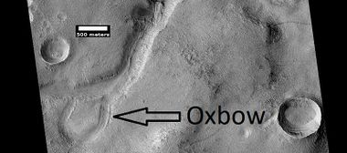 An oxbow means that water flowed long enough to make a meander before the stream made a shortcut across the meanders.
 -
 Stream meander and cutoff, as seen by HiRISE under HiWish program. This is part of a major drainage system in the Idaeus Fossae region.


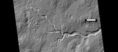
Channel showing an old oxbow and a cutoff
 Channel, with meanders These meanders may have meandered a little more and then made oxbow lakes. Arrow points to a crater that was probably eroded by flowing water.

Meanders They are formed in old river systems when the water is moving slowly.

Channel Arrows indicate evidence of a meander.
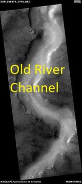
Channels

Old river channel with branches and meanders
There are thousands of channels that were caused by running water in the past on Mars. Some are large; some are tiny.[144] [145] [146] [147] [148] These channels have been seen in pictures from spacecraft for nearly 50 years. Current climate models do not support a warm climate on Mars; consequently, various ideas have been advanced to explain the existence of so many channels when it may have always been too cold for liquid water to exist on the surface. Some say they could be formed under ice sheets. Other scientists maintain that they could be produced in short periods after an asteroid impact warms the planet for thousands of years.
-
 Old river valley in the Sinus Sabaeus quadrangle
 -
 Small branched channel
 -
 Channel in valley The valley was formed early on and then at a later time a small channel appeared. This arrangement means that water flowed here twice--once for the valley, another time for the small channel.


Streamlined Shapes

Streamlined shapes made by running water
Some locations on Mars show clear evidence of massive flows of water in the past. During these floods, the ground was carved into streamlined shapes. There are several ideas for how all this happened.[149] [150] It may have resulted from asteroid impacts into frozen ground. Under a cap of frozen ground there may have been vast buildups of water that were suddenly released.
-
 Streamlined forms
 -
 Streamlined features These were created by the erosion of running water that flowed from the bottom of the image to the top. This direction can be determined by the way the erosion tails are pointed. The location is the Amenthes quadrangle


Streamlined forms in wide channel
These forms were shaped by running water.
Inverted Terrain

Often low areas can become high areas. This frequently happens with streams. An old stream channel may become filled with a hard, erosion resistant material like lava or large boulders. Later, erosion of the whole area may remove all the surrounding soft materials. But, the stream channel will be preserved because of the hard materials that were deposited in it. In the end, you are left with a feature which is elevated above the landscape, but has the shape of the original stream. Geologists will then call the stream “inverted.”
-
 Possible inverted stream channels, as seen by HiRISE under HiWish program. The ridges were probably once stream valleys that have become full of sediment and cemented. So, they became hardened against erosion which removed surrounding material.
 -
 Inverted stream channels on crater slope, as seen by HiRISE under HiWish program Location is Diacria quadrangle.
 -
 Curved ridge was once a stream, now it is a ridge becasuse it become filled with erosion-resistant materials. Later, the surrounding, softer ground became eroded. Image obtained through NASA's HiWish program.
 -
 Curved ridges were once streams, now they are ridges becasuse they become filled with erosion-resistant materials. Later, the surrounding, softer ground was eroded away.


Exhumed Craters

Exhumed crater This crater was covered over and now it is being uncovered or "exhumed."
Exhumed terrain appears to be in the process of being uncovered.[151] [152] The surface of Mars is very old. Places have been covered, uncovered, and covered again by sediments. The pictures below show a crater that is being exposed by erosion. When a crater forms, it will destroy what's under and around it. In the example below, only part of the crater is visible. Had the crater been created after the layered feature, it would have removed part of the feature and we would see the entire crater.


Pedestal Craters

Pedestal crater The surface was protected from erosion by the ejecta. In the past all the surrounding ground was at the level of the pedestal. Most of the loss is thought to be from the loss of ice.
A Pedestal crater is a crater with its ejecta sitting above the surrounding terrain. Its ejecta form a raised platform (like a pedestal).[153] They are produced when an impact ejects material that forms an erosion-resistant layer. Consequently, the immediate area erodes more slowly than the rest of the region. Some pedestals are hundreds of meters above the surroundings. This means that hundreds of meters of material were eroded away. What remains is a crater and its ejecta blanket sitting above the surrounding ground. [154] [155] [156]
-
 Pedestal Crater with an odd ejecta pattern
 -
 Pedestal crater, as seen by HiRISE under HiWish program Top layer has protected the lower material from being eroded. Location is Hellas quadrangle, at 52.014° S and 110.651° E (249.349 W).
 -
 Pedestal crater


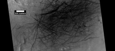
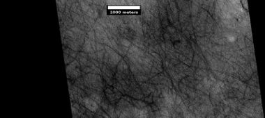
Ridges

Close view of ridges We are sure how these were formed, but we have come up with a few possibilities.
Ridge fields are another feature that we do not yet fully understand.[157] [158] [159] Hard ridges standing above the surroundings often meet at close to right angles. They may have something to do with cracks caused by impacts. Mineral laden water may then migrate up the cracks and harden.[160] These fields can be quite complex and beautiful.
-
 Wide view of linear ridge network Location is Casius quadrangle.
 -
 Close view of linear ridge network Location is Casius quadrangle.
 -
 Ridge network in Mare Tyrrhenum quadrangle
 -
 Ridges, this picture was named HiRISE picture of the day on March 29, 2024.
 -
 Close view of ridges This picture was named HiRISE picture of the day on March 29, 2024.


Ridge network in Amazonis quadrangle
Layers

Layers of rocks and other materials are very common on Mars.[161] They are found in many low places like craters.[162] The widespread occurrence of layering on the Red Planet has great significance. On Earth, much layering originates in bodies of water.[163] If this is true, at least to some extent on Mars, then traces of past life might be found in layered formations. Indeed, much evidence has been gathered for the existence of lakes in craters and some canyons. Whether layers were created under water or through ground water, water is still being debated. Probably ground water is at least partial responsible for many of the layers we observe on the planet. The existence of water in the ground is important for life on Mars. Most of the organic mass on the Earth is found under the surface. Likewise, Mars may have a great deal of life living under the surface. [164] [165] Many microbes live deep underground.[166] [167] [168] Life under the Martian surface might find it easier since it would be protected from high levels of radiation.[169] One recent study found that radiation from certain elements in the crust of Mars could have reacted with water in the ground to produce hydrogen. Hydrogen can supply chemical energy for life.[170] [171]
-

-

-
 Close view of layers
 -
 Layers Different colors of the rocks means they contain different minerals.
 -
 Wide view of layers in Louros Valles, as seen by HiRISE under HiWish program Louros Valles is part of the Ius Chasma.
 -
 Close view of layers in Louros Valles Note this is an enlargement of a previous image.
 -
 Close view of layers in Louros VallesNote this is an enlargement of a previous image.
 -
 Close view of layers in Louros Valles Note this is an enlargement of a previous image.
 -
 Close view of layers, as seen by HiRISE under HiWish program. Box shows the size of a football field.
 -
 Layers some with overhang. This image was named HiRISE picture of the day.
 -
 Layers and layered mounds. Each layer records some sort of change and water may have been involved. This image was named HiRISE picture of the day.
 -
 Layers Dark parts are basalt sand that has settled on horizonal surfaces. This image was named HiRISE picture of the day.
 -
 Close, color view of layers. Light brown is from dust falling from sky. Dark parts are basalt sand that has settled on horizonal surfaces. This image was named HiRISE picture of the day.


Layers and faults in Arabia quadrangle--HiRISE Picture of the Day (September 25, 2021)

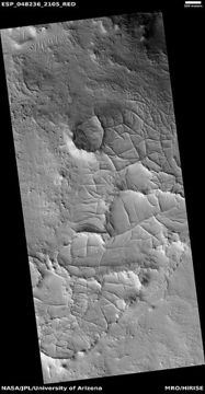
Ribbed terrain
Ribbed terrain consists of mostly elongated canyon-like forms. Some portions turn into mesas. It is created when small cracks become larger and larger. A crack in the surface of an ice-rich area will permit more of the ice to go into the thin Martian air because of increased surface area. This process of going directly form a solid to a gas phase is called sublimation. On Earth it is easily observed in the behavior of dry ice (solid carbon dioxide).

Ribbed terrain begins with cracks that eventually widen to produce hollows


Wide view of ribbed terrain.

Blocks and boulders forming
Some places on Mars show rocks breaking into boulders or cube-shaped blocks.

Crossing joints, as seen by HiRISE under HiWish program
-
 Close view of layers, as seen by HiRISE under HiWish program Some of the layers are breaking up into large blocks
 -
 Close view of layers Some layers are breaking up


Fractures forming large blocks Box shows size of a football field
-
 Tilted blocks as seen by HiRISE under HiWish program These blockls were formed horizonality, but have been tilted. Perhaps ice left the ground on one side.

-
 Tilted blocks It is as if something pushed up from under the ground.

Volcanoes under ice

Large group of concentric cracks Location is Ismenius Lacus quadrangle. Cracks were formed by a volcano under ice.
Researchers believe they have found evidence that volcanoes erupt under ice on Mars.[172] [173] Candidate volcanic and impact-induced ice depressions on Mars Such eruptions have been observed on the Earth. What seems to happen is that ice melts, the water escapes, and then the surface cracks and collapses. The resulting formation shows concentric fractures and large pieces of ground that seemed to have been pulled apart.[174] Sites like this may have recently had held liquid water; therefore, they may be good places to search for evidence of life.[175][176]


Recurrent slope lineae
Recurrent slope lineae are small, narrow, dark streaks on slopes that get longer in warm seasons. They may be evidence of liquid water.[177] [178] [179] Evidence is still being gathered on this feature.
.jpg)
Recurrent slope lineae (RSL) They form in warm seasons.
Notes about pictures
Most pictures from spacecraft are enhanced. The surface of Mars shows little contrast. Consequently, in order to see more detail, contrast is enhanced by a process known as stretching. In that process the darkest parts are set to black while the lightest parts are set to be white. This process makes a huge difference for some features like dark slope streaks. The colors for HiRISE images are different than the human eye would see. HiRISE only sees in only 3 colors and sometimes infrared is used rather than red. Displaying colors in this way allows us to better identify rocks and minerals. Usually, color images are constructed in one of two ways. An IRB image assigns the output from the infrared channel to the color red, the wide red channel to the color green, and the blue-green channel to the color blue. On the other hand, a RGB image has the output of the broad red channel displayed as red, the blue-green channel as green, and a synthetic blue channel (blue-green minus part of the red) as blue. The wavelengths of these channels are: RED: 570-830 nanometers BG: <580 nanometers IR: >790 nanometers. One nanometer is equal to one billionth of a meter (0.000 000 001 m). HiRISE images are about 5 km wide with a 1 km wide band in the center that is in color.[12]
HiRISE images are about 5 km wide, but only have a 1 km wide band in the center that is in color.[180]
How to suggest image
To suggest a location for HiRISE to image visit the site at http://www.uahirise.org/hiwish
In the sign up process you will need to come up with an ID and a password. When you choose a target to be imaged, you have to pick and exact location on a map and write about why the image should be taken. If your suggestion is accepted, it may take 3 months or more to see your image. You will be sent an email telling you about your images. The emails usually arrive on the first Wednesday of the month in the late afternoon.
Notes to teachers
This article goes along with the video Features of Mars with HiRISE under HiWish program at https://www.youtube.com/watch?v=b7q1Xyz_LBc
References
- ↑ http://www.marsdaily.com/reports/Public_Invited_To_Pick_Pixels_On_Mars_999.html |title=Public Invited To Pick Pixels On Mars |date=January 22, 2010 |publisher=Mars Daily
- ↑ http://www.astronomy.com/magazine/2018/08/take-control-of-a-mars-orbiter
- ↑ http://www.planetary.org/blogs/guest-blogs/hiwishing-for-3d-mars-images-1.html
- ↑ Interview with Alfred McEwen on Planetary Radio, 3/15/2010
- ↑ http://www.planetary.org/multimedia/planetary-radio/show/2010/384.html%7Ctitle=Your Personal Photoshoot on Mars?|website=www.planetary.org|
- ↑ https://www.jpl.nasa.gov/missions/viking-1/
- ↑ OP Lunch Talk #10: HiWish, public suggestion targeting web tool for Mars imaging with MRO/HIRISE
- ↑ http://topnews.net.nz/content/23052-nasa-releases-first-eight-hiwish-selections-people-s-choice-mars-images |title=NASA releases first eight "HiWish" selections of people's choice Mars images |date=April 2, 2010 |publisher=TopNews |accessdate=January 10, 2011 |archive-url=https://www.webcitation.org/6Gop7RR0c?url=http://topnews.net.nz/content/23052-nasa-releases-first-eight-hiwish-selections-people-s-choice-mars-images |
- ↑ McEwen, A. et al. 2016. THE FIRST DECADE OF HIRISE AT MARS. 47th Lunar and Planetary Science Conference (2016) 1372.pdf
- ↑ Wheatley, D., et al., 2019. Clastic pipes and mud volcanism across Mars: Terrestrial analog evidence of past Martian groundwater and subsurface fluid mobilization. Icarus. In Press
- ↑ https://hirise.lpl.arizona.edu/ESP_055307_2215
- ↑ https://en.wikipedia.org/wiki/Volcanology_of_Mars
- ↑ Head, J.W. 2007. The Geology of Mars: New Insights and Outstanding Questions in The Geology of Mars: Evidence from Earth-Based Analogs, Chapman, M., Ed; Cambridge University Press: Cambridge UK
- ↑ Carr, Michael H. (1973). "Volcanism on Mars". Journal of Geophysical Research. 78 (20): 4049–4062.
- ↑ Barlow, N.G. 2008. Mars: An Introduction to Its Interior, Surface, and Atmosphere; Cambridge University Press: Cambridge, UK
- ↑ https://www.uahirise.org/ESP_057978_1875
- ↑ https://www-sciencedirect-com.wikipedialibrary.idm.oclc.org/science/article/pii/S0019103523000507
- ↑ Czechowski, L., et al. 2023. The formation of cone chains in the Chryse Planitia region on Mars and the thermodynamic aspects of this process. Icarus: Volume 396, 15 May 2023, 115473
- ↑ "Characteristics and Origin of Giant Radiating Dyke Swarms". MantlePlumes.org.
- ↑ https://en.wikipedia.org/wiki/Fossa_(geology)
- ↑ James W. Head; Lionel Wilson; Karl L. Mitchell (2003). "Generation of recent massive water floods at Cerberus Fossae, Mars by dike emplacement, cryospheric cracking, and confined aquifer groundwater release". Geophysical Research Letters. 30 (11): 2265. Bibcode:2003GeoRL..30k..31H. doi:10.1029/2003GL017135
- ↑ Burr, D. et al. 2002. Repeated aqueous flooding from the Cerberus Fossae: evidence for very recently extant deep groundwater on Mars. Icarus. 159: 53-73.
- ↑ https://www.uahirise.org/ESP_052893_1835
- ↑ Fassett C. I. and Head J. W. 2008. Icarus. 195 61
- ↑ Goudge T. A., Aureli K. L., Head J. W., Fassett C. I. and Mustard J. F. 2015 Icarus. 260 346
- ↑ Bamber, E. R., Goudge, T. A., Fassett, C. I., Osinski, G. R., & Stucky de Quay, G. (2022). Paleolake inlet valley formation: Factors controlling which craters breached on early Mars. Geophysical Research Letters, 49, e2022GL101097. https://doi.org/10.1029/2022GL101097
- ↑ Goudge T. A., Aureli K. L., Head J. W., Fassett C. I. and Mustard J. F. 2015 Icarus. 260 346
- ↑ Salese F., Pondrelli M., Neeseman A., Schmidt G. and Ori G. G. 2019. JGRE. Vol. 124. P. 374
- ↑ https://www.jpl.nasa.gov/news/martian-crater-may-once-have-held-groundwater-fed-lake/
- ↑ https://www.nhm.ac.uk/discover/news/2022/september/ancient-crater-lakes-mars-could-have-hosted-life.html
- ↑ Head, J., et al. 2003, Recent ice ages on Mars. Nature. 426.797-802
- ↑ https://www.uahirise.org/hipod/ESP_054486_2210
- ↑ Head, J., et al. 2003, Recent ice ages on Mars. Nature. 426.797-802
- ↑ Blanc, E., et al. 2024. ORIGIN OF WIDESPREAD LAYERED DEPOSITS ASSOCIATED WITH MARTIAN DEBRIS COVERED GLACIERS. 55th LPSC (2024). 1466.pdf
- ↑ https://www.uahirise.org/hipod/ESP_046504_1785
- ↑ Bridges, Nathan T.; Muhs, Daniel R. (2012). "Duststones on Mars: Source, Transport, Deposition, and Erosion". Sedimentary Geology of Mars. pp. 169–182. doi:10.2110/pec.12.102.0169. ISBN 978-1-56576-312-8.
- ↑ https://www.uahirise.org/ESP_039563_1730
- ↑ http://adsabs.harvard.edu/abs/1979JGR....84.8147W SAO/NASA ADS Astronomy Abstract Service: Yardangs on Mars
- ↑ http://themis.asu.edu/zoom-20020416a
- ↑ Ojha, Lujendra; Lewis, Kevin; Karunatillake, Suniti; Schmidt, Mariek (2018). "The Medusae Fossae Formation as the single largest source of dust on Mars". Nature Communications. 9 (1): 2867.
- ↑ https://link.springer.com/referenceworkentry/10.1007/978-1-4614-9213-9_318-1
- ↑ kress, A., J. Head. 2008. Ring‐mold craters in lineated valley fill and lobate debris aprons on Mars: Evidence for subsurface glacial ice. Geophysical Research Letters Volume 35, Issue 23
- ↑ https://agupubs.onlinelibrary.wiley.com/doi/full/10.1029/2008GL035501
- ↑ Kress, A., J. Head. 2008. Ring-mold craters in lineated valley fill and lobate debris aprons on Mars: Evidence for subsurface glacial ice. Geophys.Res. Lett: 35. L23206-8
- ↑ Baker, D. et al. 2010. Flow patterns of lobate debris aprons and lineated valley fill north of Ismeniae Fossae, Mars: Evidence for extensive mid-latitude glaciation in the Late Amazonian. Icarus: 207. 186-209
- ↑ Kress., A. and J. Head. 2009. Ring-mold craters on lineated valley fill, lobate debris aprons, and concentric crater fill on Mars: Implications for near-surface structure, composition, and age. Lunar Planet. Sci: 40. abstract 1379
- ↑ https://www-sciencedirect-com.wikipedialibrary.idm.oclc.org/science/article/pii/S0019103518301532
- ↑ Baker, D. and L. Carter. 2019. Probing supraglacial debris on Mars 2: Crater morphology. Icarus. Volume 319. Pages 264-280
- ↑ Chuang, F.C.; Beyer, R.A.; Bridges, N.T. 2010. Modification of Martian Slope Streaks by Eolian Processes. Icarus, 205 154–164.
- ↑ Heyer, T., et al. 2019. Seasonal formation rates of martian slope streaks. Icarus
- ↑ Schorghofer, N.; Aharonson, O.; Khatiwala, S. 2002. Slope Streaks on Mars: Correlations with Surface Properties and the Potential Role of Water. Geophys. Res. Lett., 29(23), 2126.
- ↑ Sullivan, R. et al. 2001. Mass Movement Slope Streaks Imaged by the Mars Orbiter Camera. J. Geophys. Res., 106(E10), 23,607–23,633.
- ↑ https://agupubs.onlinelibrary.wiley.com/doi/10.1029/2021JE006988
- ↑ Lange, S., et al. 2022. Gardening of the Martian Regolith by Diurnal CO2 Frost and the Formation of Slope Streaks. JGR Planets. Volume127, Issue4. e2021JE006988
- ↑ https://www.uahirise.org/ESP_058427_1080
- ↑ https://www.jpl.nasa.gov/news/perseverance-rover-witnesses-one-martian-dust-devil-eating-another/?utm_source=iContact&utm_medium=email&utm_campaign=1-nasajpl&utm_content=daily20250403
- ↑ https://www.uahirise.org/ESP_042201_1715
- ↑ http://marsrovers.jpl.nasa.gov/gallery/press/spirit/20070412a.html Mars Exploration Rover Mission: Press Release Images: Spirit. Marsrovers.jpl.nasa.gov
- ↑ https://www.uahirise.org/ESP_061787_2140
- ↑ http://hirise.lpl.arizona.edu/PSP_005383_1255
- ↑ https://www.jpl.nasa.gov/images/pia26074-martian-whirlwind-takes-the-thorofare
- ↑ https://www.uahirise.org/ESP_042201_1715
- ↑ https://scholarworks.boisestate.edu/cgi/viewcontent.cgi?article=1207&context=physics_facpubs
- ↑ Jackson, Brian; Lorenz, Ralph; and Davis, Karan. (2018). "A Framework for Relating the Structures and Recovery Statistics in Pressure Time-Series Surveys for Dust Devils". Icarus, 299, 166-174. http://dx.doi.org/10.1016/j.icarus.2017.07.027
- ↑ https://www.science.org/doi/10.1126/sciadv.adw5170?adobe_mc=MCMID%3D68227027333727904592434133527388632768%7CMCORGID%3D242B6472541199F70A4C98A6%2540AdobeOrg%7CTS%3D1759927070&adobe_mc=MCMID%3D68227027333727904592434133527388632768%7CMCORGID%3D242B6472541199F70A4C98A6%2540AdobeOrg%7CTS%3D1759927073&adobe_mc=MCMID%3D68227027333727904592434133527388632768%7CMCORGID%3D242B6472541199F70A4C98A6%2540AdobeOrg%7CTS%3D1759927544%27
- ↑ Valentin T. Bickel et al. ,Dust devil migration patterns reveal strong near-surface winds across Mars.Sci. Adv.11,eadw5170(2025).DOI:10.1126/sciadv.adw5170
- ↑ https://www.uahirise.org/ESP_057071_1890
- ↑ https://www.uahirise.org/ESP_057071_1890
- ↑ Lorenz, R. and J. Zimbelman. 2014. Dune Worlds How Windblown Sand Shapes Planetary Landscapes. Springer. NY.
- ↑ https://www.space.com/30663-the-martian-dust-storms-a-breeze.html
- ↑ https://www.uahirise.org/hipod/ESP_043617_1885
- ↑ Head, J. W.; et al. (2006). "Extensive valley glacier deposits in the northern mid-latitudes of Mars: Evidence for Late Amazonian obliquity-driven climate change". Earth and Planetary Science Letters. 241 (3): 663–671.
- ↑ Carr, M. 2006. The Surface of Mars. Cambridge University Press.
- ↑ Squyres, S. 1978. Martian fretted terrain: Flow of erosional debris. Icarus: 34. 600-613.
- ↑ http://www.planetary.brown.edu/pdfs/3733.pdf
- ↑ Head, J. et al. 2005. Tropical to mid-latitude snow and ice accumulation, flow and glaciation on Mars. Nature: 434. 346-350
- ↑ http://www.marstoday.com/news/viewpr.html?pid=18050
- ↑ http://news.brown.edu/pressreleases/2008/04/martian-glaciers
- ↑ Plaut, J. et al. 2008. Radar Evidence for Ice in Lobate Debris Aprons in the Mid-Northern Latitudes of Mars. Lunar and Planetary Science XXXIX. 2290.pdf
- ↑ Holt, J. et al. 2008. Radar Sounding Evidence for Ice within Lobate Debris Aprons near Hellas Basin, Mid-Southern Latitudes of Mars. Lunar and Planetary Science XXXIX. 2441.pdf
- ↑ Petersen, E., et al. 2018. ALL OUR APRONS ARE ICY: NO EVIDENCE FOR DEBRIS-RICH “LOBATE DEBRIS APRONS” IN DEUTERONILUS MENSAE 49th Lunar and Planetary Science Conference 2018 (LPI Contrib. No. 2083). 2354.
- ↑ https://www.uahirise.org/ESP_026414_2205
- ↑ https://web.archive.org/web/20161001224229/http://hiroc.lpl.arizona.edu/images/PSP/diafotizo.php?ID=PSP_111926_2185
- ↑ Dickson, J. et al. 2009. Kilometer-thick ice accumulation and glaciation in the northern mid-latitudes of Mars: Evidence for crater-filling events in the Late Amazonian at the Phlegra Montes. Earth and Planetary Science Letters.
- ↑ http://hirise.lpl.arizona.edu/PSP_001926_2185%7Ctitle=HiRISE - Concentric Crater Fill in the Northern Plains (PSP_001926_2185)|author=|date=|website=hirise.lpl.arizona.edu
- ↑ Head, J. et al. 2006. Extensive valley glacier deposits in the northern mid-latitudes of Mars: Evidence for late Amazonian obliquity-driven climate change. Earth Planet. Sci Lett: 241. 663-671.
- ↑ Levy, J. et al. 2007. Lineated valley fill and lobate debris apron stratigraphy in Nilosyrtis Mensae, Mars: Evidence for phases of glacial modification of the dichotomy boundary. J. Geophys. Res.: 112.
- ↑ Levy, J., et al. 2009. Concentric crater fill in Utopia Planitia: History and interaction between glacial "brain terrain" and periglacial mantle processes. Icarus: 202, 462-476.
- ↑ https://www.uahirise.org/ESP_058008_2225
- ↑ https://www.hou.usra.edu/meetings/lpsc2026/pdf/1626.pdf
- ↑ Dundas, C., et al. 2026. STRATIGRAPHIC OBSERVATIONS OF MARTIAN “BRAIN TERRAIN” AND IMPLICATIONS FOR ORIGIN PROCESSES. 57th LPSC (2026). 1626.pdf
- ↑ Levy, J., J. Head, D. Marchant. 2009. Concentric crater fill in Utopia Planitia: History and interaction between glacial “brain terrain” and periglacial mantle processes. Icarus 202, 462–476.
- ↑ Levy, J., et al. 2009. Concentric crater fill in Utopia Planitia: History and interaction between glacial "brain terrain" and periglacial mantle processes. Icarus: 202, 462-476.
- ↑ Portyankina, G., et al. 2019. How Martian araneiforms get their shapes: morphological analysis and diffusion-limited aggregation model for polar surface erosion Icarus. https://doi.org/10.1016/j.icarus.2019.02.032
- ↑ https://www.uahirise.org/
- ↑ Kieffer H, Christensen P, Titus T. 2006 Aug 17. CO2 jets formed by sublimation beneath translucent slab ice in Mars' seasonal south polar ice cap. Nature: 442(7104):793-6.
- ↑ https://mars.nasa.gov/resources/possible-development-stages-of-martian-spiders/
- ↑ http://themis.asu.edu/news/gas-jets-spawn-dark-spiders-and-spots-mars-icecap
- ↑ http://spaceref.com/mars/how-gas-carves-channels-on-mars.html
- ↑ https://www.livescience.com/space/mars/spiders-on-mars-fully-awakened-on-earth-for-1st-time-and-scientists-are-shrieking-with-joy?utm_term=CABA215D-3D47-4C9A-92FE-9ECF8D4C7909&lrh=e62336263a3610a07ef7c8af2080c758f2ecd0661aab1a8e6234cf31f0d0fdff&utm_campaign=368B3745-DDE0-4A69-A2E8-62503D85375D&utm_medium=email&utm_content=542DE80B-08E0-4FC1-B871-90E60036945E&utm_source=SmartBrief
- ↑ https://www.nature.com/articles/s41598-021-82763-7.pdf
- ↑ McKeown, L., et al. 2021. The formation of araneiforms by carbon dioxide venting and vigorous sublimation dynamics under martian atmospheric pressure. Scientific Reports.
- ↑ https://www.livescience.com/spiders-on-mars-explained-dry-ice.html?utm_source=Selligent&utm_medium=email&utm_campaign=LVS_newsletter&utm_content=LVS_newsletter+&utm_term=2946561
- ↑ Kreslavsky, M., J. Head, J. 2002. Mars: Nature and evolution of young, latitude-dependent water-ice-rich mantle. Geophys. Res. Lett. 29, doi:10.1029/ 2002GL015392.
- ↑ Head, J., et al. 2003, Recent ice ages on Mars. Nature. 426.797-802
- ↑ https://www-sciencedirect-com.wikipedialibrary.idm.oclc.org/science/article/pii/S0019103525002751
- ↑ Soare, R., et al. 2025. “Icy” scarp exposures, “ice-rich” overburdens and ephemeral climate-warming at Mars' mid-latitudes in the very late Amazonian epoch. Icarus. Volume 441, 15 November 2025, 116727
- ↑ https://www.uahirise.org/ESP_066782_1110
- ↑ https://www.uahirise.org/ESP_047247_1150
- ↑ Sako, T., Hasegawa, H., Ruj, T., Komatsu, G., & Sekine, Y. (2025). The periglacial landforms and estimated subsurface ice distribution in the northern mid-latitude of Mars. Journal of Geophysical Research: Planets, 130, e2023JE008232. https://doi.org/10.1029/2023JE008232
- ↑ https://planetarygeomorphology.wordpress.com/2022/01/01/thermal-contraction-polygons-on-earth-and-mars/#:~:text=D%20student%2C%20Laboratoire%20de%20Plan%C3%A9tologie,Mars%20in%20the%20mid%2Dlatitudes.
- ↑ Roeloff, L., et al. Thermal-contraction polygons on Earth and Mars.
- ↑ Luzzi, E., Heldmann, J. L., Williams, K. E., Nodjoumi, G., Deutsch, A., & Sehlke, A. (2025). Geomorphological evidence of near-surface ice at candidate landing sites in northern Amazonis Planitia, Mars. Journal of Geophysical Research: Planets, 130, e2024JE008724.
- ↑ https://planetarygeomorphology.wordpress.com/2022/01/01/thermal-contraction-polygons-on-earth-and-mars/#:~:text=D%20student%2C%20Laboratoire%20de%20Plan%C3%A9tologie,Mars%20in%20the%20mid%2Dlatitudes.
- ↑ Sako, T., Hasegawa, H., Ruj, T., Komatsu, G., & Sekine, Y. (2025). The periglacial landforms and estimated subsurface ice distribution in the northern mid-latitude of Mars. Journal of Geophysical Research: Planets, 130, e2023JE008232. https://doi.org/10.1029/2023JE008232
- ↑ https://planetarygeomorphology.wordpress.com/2022/01/01/thermal-contraction-polygons-on-earth-and-mars/#:~:text=D%20student%2C%20Laboratoire%20de%20Plan%C3%A9tologie,Mars%20in%20the%20mid%2Dlatitudes.
- ↑ Roeloff, L., et al. Thermal-contraction polygons on Earth and Mars.
- ↑ Luzzi, E., Heldmann, J. L., Williams, K. E., Nodjoumi, G., Deutsch, A., & Sehlke, A. (2025). Geomorphological evidence of near-surface ice at candidate landing sites in northern Amazonis Planitia, Mars. Journal of Geophysical Research: Planets, 130, e2024JE008724. https://doi.org/10.1029/2024JE008724
- ↑ https://planetarygeomorphology.wordpress.com/2022/01/01/thermal-contraction-polygons-on-earth-and-mars/#:~:text=D%20student%2C%20Laboratoire%20de%20Plan%C3%A9tologie,Mars%20in%20the%20mid%2Dlatitudes.
- ↑ last1 = Lefort | first1 = A. | last2 = Russell | first2 = P. | last3 = Thomas | first3 = N. | last4 = McEwen | first4 = A.S. | last5 = Dundas | first5 = C.M. | last6 = Kirk | first6 = R.L. | year = 2009 | title = HiRISE observations of periglacial landforms in Utopia Planitia | url = http://www.agu.org/pubs/crossref/2009/2008JE003264.shtml | journal = Journal of Geophysical Research | volume = 114 | issue = | page = E04005 | doi = 10.1029/2008JE003264 |
- ↑ Morgenstern A, Hauber E, Reiss D, van Gasselt S, Grosse G, Schirrmeister L (2007): Deposition and degradation of a volatile-rich layer in Utopia Planitia, and implications for climate history on Mars. Journal of Geophysical Research: Planets 112, E06010.
- ↑ https://www.uahirise.org/hipod/PSP_001938_2265
- ↑ http://www.uahirise.org/ESP_038821_1235
- ↑ Dundas, C., et al. 2015. Modeling the development of martian sublimation thermokarst landforms. Icarus: 262, 154-169.
- ↑ "Dundas, C. 2015" Dundas | first1 = C. | last2 = Bryrne | first2 = S. | last3 = McEwen | first3 = A. | year = 2015 | title = Modeling the development of martian sublimation thermokarst landforms | url = | journal = Icarus | volume = 262 | issue = | pages = 154–169 | doi=10.1016/j.icarus.2015.07.033
- ↑ Stuurman, C., et al. 2016. SHARAD reflectors in Utopia Planitia, SHARAD detection and characterization of subsurface water ice deposits in Utopia Planitia, Mars. Geophysical Research Letters, Volume 43, Issue 18, 28 September 2016, Pages 9484–9491.
- ↑ Baker, D., J. Head. 2015. Extensive Middle Amazonian mantling of debris aprons and plains in Deuteronilus Mensae, Mars: Implication for the record of mid-latitude glaciation. Icarus: 260, 269-288.
- ↑ Malin, M., Edgett, K. 2000. Evidence for recent groundwater seepage and surface runoff on Mars. Science 288, 2330–2335.
- ↑ https://www.uahirise.org/hipod/ESP_014074_1445
- ↑ https://www.uahirise.org/ESP_057450_1410
- ↑ https://www.uahirise.org/ESP_057450_1410
- ↑ https://en.wikipedia.org/wiki/List_of_craters_on_Mars
- ↑ Carr, M.H. (2006) The surface of Mars; Cambridge University Press: Cambridge, UK
- ↑ https://www.space.com/21198-mars-asteroid-strikes-common.html
- ↑ https://www.sciencedirect.com/science/article/abs/pii/S0019103513001693?via%3Dihub
- ↑ Daubar, I., et al. 2013. The current martian cratering rate. Icarus. Volume 225. 506-516.
- ↑ Diot, X., et al. 2014. The geomorphology and morphometry of the banded terrain in Hellas basin, Mars. Planetary and Space Science: 101, 118-134.
- ↑ http://www.nasa.gov/mission_pages/MRO/multimedia/20070717-2.html | title=NASA - Banded Terrain in Hellas
- ↑ http://hirise.lpl.arizona.edu/ESP_016154_1420 | title=HiRISE | Complex Banded Terrain in Hellas Planitia (ESP_016154_1420)
- ↑ Bernhardt, H., et al. 2018. THE BANDED TERRAIN ON THE HELLAS BASIN FLOOR, MARS: GRAVITY-DRIVEN FLOW NOT SUPPORTED BY NEW OBSERVATIONS. 49th Lunar and Planetary Science Conference 2018 (LPI Contrib. No. 2083). 1143.pdf
- ↑ doi=10.1016/j.pss.2015.12.003 |title=Complex geomorphologic assemblage of terrains in association with the banded terrain in Hellas basin, Mars |journal=Planetary and Space Science |volume=121 |pages=36–52 |year=2016 |last1=Diot |first1=X. |last2=El-Maarry |first2=M.R. |last3=Schlunegger |first3=F. |last4=Norton |first4=K.P. |last5=Thomas |first5=N. |last6=Grindrod |first6=P.M. |last7=Chojnacki |first7=M. |121...36D |url=https://boris.unibe.ch/74530/1/Diot_Schlunegger.pdf
- ↑ https://www.uahirise.org/hipod/ESP_085926_1410
- ↑ https://en.wikipedia.org/wiki/Oxbow_lake
- ↑ https://en.wikipedia.org/wiki/Outflow_channels
- ↑ Carr, M.H. (2006), The Surface of Mars. Cambridge Planetary Science Series, Cambridge University Press.
- ↑ Baker, V.R.; Carr, M.H.; Gulick, V.C.; Williams, C.R. & Marley, M.S. "Channels and Valley Networks". In Kieffer, H.H.; Jakosky, B.M.; Snyder, C.W. & Matthews, M.S. Mars. Tucson, AZ: University of Arizona Press.
- ↑ Burr, D.M., McEwan, A.S., and Sakimoto, S.E. (2002). "Recent aqueous floods from the Cerberus Fossae, Mars". Geophys. Res. Lett., 29(1), 10.1029/2001G1013345.
- ↑ ^ Baker, V.R. (1982). The Channels of Mars. Austin: Texas University Press.
- ↑ Carr, M. 1979. Formation of Martian Flood Features by Release of Water From Confined Aquifers. Journal of Geophysical Research. 84. 2995-3007
- ↑ https://www.uahirise.org/ESP_045833_1845
- ↑ https://archive.org/details/PLAN-PIA06808
- ↑ https://www.uahirise.org/PSP_001374_1805
- ↑ https://www.uahirise.org/hipod/PSP_008508_1870
- ↑ Bleacher, J. and S. Sakimoto. Pedestal Craters, A Tool For Interpreting Geological Histories and Estimating Erosion Rates. LPSC
- ↑ https://web.archive.org/web/20100118173819/http://themis.asu.edu/feature_utopiacraters
- ↑ = McCauley, John F. 1972. Mariner 9 Evidence for Wind Erosion in the Equatorial and Mid-Latitude Regions of Mars. Journal of Geophysical Research: 78, 4123–4137(JGRHomepage). |doi = 10.1029/JB078i020p04123
- ↑ Kerber, L., et al. 2017. Polygonal ridge networks on Mars: Diversity of morphologies and the special case of the Eastern Medusae Fossae Formation. Icarus. Volume 281. Pages 200-219
- ↑ https://www.uahirise.org/hipod/PSP_008189_2080
- ↑ Pascuzzo, A., et al. 2019. The formation of irregular polygonal ridge networks, Nili Fossae, Mars: Implications for extensive subsurface channelized fluid flow in the Noachian. Icarus: 319, 852-868
- ↑ https://www.uahirise.org/hipod/ESP_077982_1920
- ↑ https://www.uahirise.org/PSP_007820_1505 Layered Sediments in Hellas Planitia
- ↑ https://www.uahirise.org/hipod/PSP_008930_1880
- ↑ Namowitz, S., Stone, D. 1975. Earth science The World We Live in. American Book Company. N.Y.
- ↑ https://microbewiki.kenyon.edu/index.php/Deep_subsurface_microbes
- ↑ Amend, J.. A. Teske. 2005. Expanding frontiers in deep subsurface microbiology. Palaeogeography, Palaeoclimatology, Palaeoecology: Volume 219, Issues 1–2, 131-155.
- ↑ Pedersen, K. 1993. The deep subterranean biosphere. Earth Science Reviews: 34, 243-260.
- ↑ Stevens, T., J. McKiney. 1995. Lithoautotrophic Microbial Ecosystems in Deep Basalt Acquifers. Science: 270, 450-454.
- ↑ Fredrickson, J. , T. Onstott. 1996. Microbes Deep inside the Earth. Scientific American. October, 1996.
- ↑ Boston, P., et al. 1992. On the Possibility of Chemosynthetic Ecosystems in Subsurface Habitats on Mars. Icarus: 95, 300-308.
- ↑ http://astrobiology.com/2018/09/ancient-mars-had-right-conditions-for-underground-life.html
- ↑ Tarnas, J., et al. 2018 Radiolytic H2 Production on Noachian Mars: Implications for Habitability and Atmospheric Warming. Earth and Planetary Science Letters [https://doi.org/10.1016/j.epsl.2018.09.001
- ↑ https://www.uahirise.org/ESP_071541_2200
- ↑ Levy, J. et al. 2017. Candidate volcanic and impact-induced ice depressions on Mars. Icarus. Volume 285. Pages 185-194
- ↑ Smellie, J., B. Edwards. 2016. Glaciovolcanism on Earth and Mars. Cambridge University Press.
- ↑ Levy, J., et al. 2017. Candidate volcanic and impact-induced ice depressions on Mars. Icarus: 285, 185-194.
- ↑ University of Texas at Austin. "A funnel on Mars could be a place to look for life." ScienceDaily. ScienceDaily, 10 November 2016. <www.sciencedaily.com/releases/2016/11/161110125408.htm>.
- ↑ McEwen, A., et al. 2014. Recurring slope lineae in equatorial regions of Mars. Nature Geoscience 7, 53-58. doi:10.1038/ngeo2014
- ↑ McEwen, A., et al. 2011. Seasonal Flows on Warm Martian Slopes. Science. 05 Aug 2011. 333, 6043,740-743. DOI: 10.1126/science.1204816
- ↑ http://redplanet.asu.edu/?tag=recurring-slope-lineae%7Ctitle=recurring slope lineae - Red Planet Report|website=redplanet.asu.edu|
- ↑ McEwen, A., et al. 2017. Mars The Prestine Beauty of the Red Planet. University of Arizona Press. Tucson
External links
- Features of Mars with HiRISE under HiWish program Shows nearly all major features discovered on Mars. This would be good for teachers covering Mars.
- Martian Ice - Jim Secosky - 16th Annual International Mars Society Convention
- Martian Geology - Jim Secosky - 16th Annual International Mars Society Convention
- Walks on Mars - Jim Secosky - 16th Annual International Mars Society Convention
- OP Lunch Talk #10: HiWish, public suggestion targeting web tool for Mars imaging with MRO/HIRISE
- McEwen, A., et al. 2024. The high-resolution imaging science experiment (HiRISE) in the MRO extended science phases (2009–2023). Icarus. Available online 16 September 2023, 115795. In Press.
See Also
- Geography of Mars
- Glaciers on Mars
- High Resolution Imaging Science Experiment (HiRISE)
- Layers on Mars
- Martian features that are signs of water ice
- Martian gullies
- Rivers on Mars
- Sublimation
- Sublimation landscapes on Mars
- Viking 2
Recommended reading
- Grotzinger, J., R. Milliken (eds.). 2012. Sedimentary Geology of Mars. Tulsa: Society for Sedimentary Geology.
- Kieffer, H., et al. (eds) 1992. Mars. The University of Arizona Press. Tucson
- history.nasa.gov/SP-4212/ch11
- Lorenz, R. 2014. The Dune Whisperers. The Planetary Report: 34, 1, 8-14
- Lorenz, R., J. Zimbelman. 2014. Dune Worlds: How Windblown Sand Shapes Planetary Landscapes. Springer Praxis Books / Geophysical Sciences.