Difference between revisions of "Oceans on Mars"
(→External links: added link) |
(→Tsunamis: added ref) |
||
| Line 108: | Line 108: | ||
===Tsunamis=== | ===Tsunamis=== | ||
| − | If Mars had an ocean for a time, there is a chance that sooner or later an asteroid would strike it and cause a great wave, called a tsunami. Evidence for two such events was published in May 2016. Parts of the surface in Ismenius Lacus quadrangle were altered by two tsunamis argue a large team of scientists. Both impacts which caused the tsunamis were powerful enough to leave behind 30 km diameter craters. The first picked up and transported boulders the size of small houses. The wave washed over the land, and then gravity pulled it back to lower ground and when it did, the backwash created channels by rearranging the boulders. The second came in when the ocean was 300 m lower. The second tsunami brought great deal of ice which was dropped in valleys. The average height of the waves would have been 50 m, but the heights would vary from 10 m to 120 m according to calculations. That means that some waves were tall enough to have gone way over the United States Capitol Building. Lobes of giant boulders went around obstacles and down low paths. Having such strikes are quite plausible, as simulations indicate that in this particular part of the ocean two impact craters of 30 km in diameter are expected every 30 million years. Two of these events imply that a huge ocean may have existed for millions of years. One persistent argument against an ocean has been the lack of shoreline features, but they may have been destroyed by these tsunamis. Chryse Planitia and northwestern Arabia Terra were studied in this research. <ref>http://astrobiology.com/2016/05/ancient-tsunami-evidence-on-mars-reveals-life-potential.html</ref> <ref>https://www.hou.usra.edu/meetings/lpsc2016/pdf/1680.pdf | title=Tsunami waves extensively resurfaced the shorelines of an early Martian ocean. : | author=Rodriguez, J., et al. | journal=Scientific Reports / 47th Lunar and Planetary Science Conference | year=2016 | volume=6 | pages=25106 | doi=10.1038/srep25106| pmid=27196957 | pmc=4872529 | [https://www.nature.com/articles/srep25106 version at ''Nature'']</ref> <ref> [https://www.sciencedaily.com/releases/2016/05/160519101756.htm "Ancient tsunami evidence on Mars reveals life potential."] ''ScienceDaily''. 19 May 2016.</ref> The crater Lomonosov has been identified as a likely source of tsunami waves.<ref name = "Rincon2017">cite web | url = https://www.bbc.com/news/science-environment-39394583 | title = Impact crater linked to Martian tsunamis | last = Rincon | first = P. | date = 2017-03-26 | website = BBC | access-date = 2017-03-26</ref> <ref>Costard | first2 = A. | last2 = Séjourné | first3 = K. | last3 = Kelfoun | first4 = S. | last4 = Clifford | first5 = F. | last5 = Lavigne | first6 = I. | last6 = Di Pietro | first7 = S. | last7 = Bouley | title = Modelling Investigation of Tsunamis on Mars | book-title = Lunar and Planetary Science Conference|Lunar and Planetary Science XLVIII | pages = 1171 | publisher = Lunar and Planetary Institute | date = 2017 | location = The Woodlands, Texas | url = http://www.lpi.usra.edu/meetings/lpsc2017/pdf/1171.pdf | access-date = 2017-03-26</ref> <ref>Costard, F., et al. 2018. FORMATION OF THE NORTHERN PLAINS LOMONOSOV CRATER DURING A TSUNAMI GENERATING MARINE IMPACT CRATER EVENT. 49th Lunar and Planetary Science Conference 2018 (LPI Contrib. No. 2083). 1928.pdf</ref> <ref>https://www.techtimes.com/articles/203105/20170326/impact-crater-linked-to-powerful-tsunamis-on-mars-another-proof-of-an-ancient-ocean.htm</ref> | + | If Mars had an ocean for a time, there is a chance that sooner or later an asteroid would strike it and cause a great wave, called a tsunami. Evidence for two such events was published in May 2016. Parts of the surface in Ismenius Lacus quadrangle were altered by two tsunamis argue a large team of scientists. Both impacts which caused the tsunamis were powerful enough to leave behind 30 km diameter craters. The first picked up and transported boulders the size of small houses. The wave washed over the land, and then gravity pulled it back to lower ground and when it did, the backwash created channels by rearranging the boulders. The second came in when the ocean was 300 m lower. The second tsunami brought great deal of ice which was dropped in valleys. The average height of the waves would have been 50 m, but the heights would vary from 10 m to 120 m according to calculations. That means that some waves were tall enough to have gone way over the United States Capitol Building. Lobes of giant boulders went around obstacles and down low paths. Having such strikes are quite plausible, as simulations indicate that in this particular part of the ocean two impact craters of 30 km in diameter are expected every 30 million years. Two of these events imply that a huge ocean may have existed for millions of years. One persistent argument against an ocean has been the lack of shoreline features, but they may have been destroyed by these tsunamis. Chryse Planitia and northwestern Arabia Terra were studied in this research. <ref>http://astrobiology.com/2016/05/ancient-tsunami-evidence-on-mars-reveals-life-potential.html</ref> <ref>https://www.hou.usra.edu/meetings/lpsc2016/pdf/1680.pdf | title=Tsunami waves extensively resurfaced the shorelines of an early Martian ocean. : | author=Rodriguez, J., et al. | journal=Scientific Reports / 47th Lunar and Planetary Science Conference | year=2016 | volume=6 | pages=25106 | doi=10.1038/srep25106| pmid=27196957 | pmc=4872529 | [https://www.nature.com/articles/srep25106 version at ''Nature'']</ref> <ref> [https://www.sciencedaily.com/releases/2016/05/160519101756.htm "Ancient tsunami evidence on Mars reveals life potential."] ''ScienceDaily''. 19 May 2016.</ref> The crater Lomonosov has been identified as a likely source of tsunami waves.<ref name = "Rincon2017">cite web | url = https://www.bbc.com/news/science-environment-39394583 | title = Impact crater linked to Martian tsunamis | last = Rincon | first = P. | date = 2017-03-26 | website = BBC | access-date = 2017-03-26</ref> <ref>Costard | first2 = A. | last2 = Séjourné | first3 = K. | last3 = Kelfoun | first4 = S. | last4 = Clifford | first5 = F. | last5 = Lavigne | first6 = I. | last6 = Di Pietro | first7 = S. | last7 = Bouley | title = Modelling Investigation of Tsunamis on Mars | book-title = Lunar and Planetary Science Conference|Lunar and Planetary Science XLVIII | pages = 1171 | publisher = Lunar and Planetary Institute | date = 2017 | location = The Woodlands, Texas | url = http://www.lpi.usra.edu/meetings/lpsc2017/pdf/1171.pdf | access-date = 2017-03-26</ref> <ref>Costard, F., et al. 2018. FORMATION OF THE NORTHERN PLAINS LOMONOSOV CRATER DURING A TSUNAMI GENERATING MARINE IMPACT CRATER EVENT. 49th Lunar and Planetary Science Conference 2018 (LPI Contrib. No. 2083). 1928.pdf</ref> <ref>https://www.techtimes.com/articles/203105/20170326/impact-crater-linked-to-powerful-tsunamis-on-mars-another-proof-of-an-ancient-ocean.htm</ref> <ref>https://agupubs.onlinelibrary.wiley.com/doi/abs/10.1029/2019JE006008</ref> |
Revision as of 15:43, 26 August 2020
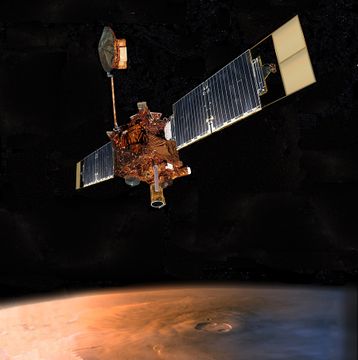
Article written by Jim Secosky. Jim is a retired science teacher who has used the Hubble Space Telescope, the Mars Global Surveyor, and HiRISE.
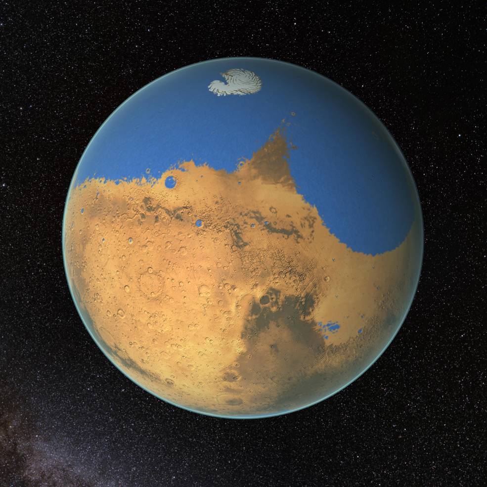
Today, much evidence supports at least one ocean in the past on Mars.[1] [2] [3] [4] [5] Support for the idea of Martian oceans was boosted when it was concluded that Mars has lost most of its atmosphere (and water).[6] [7] [8] [9] [10] In addition, researchers in 2015 published a paper detailing two tsunamis that happened when asteroids struck a Martian ocean that existed at the time. [11] [12] Most of the rest of this article will cover the long history of how evidence built up for one or more oceans on Mars. Nevertheless, it must be said that although there is decades of accumulated evidence for a Martian ocean, the idea remains controversial. [13]
Contents
Appearance
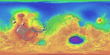
When Mariner 9 pictures arrived in 1969, pictures revealed outflow channels that could carry water into the northern lowlands.[14] These lowlands, called Vastitas Borealis, were smooth and level, as if they were formed under an ocean. Moreover, the age of Vastitas Borealis and the channels were found to be similar.[15] Hence, it was logical to assume that huge outflow channels supplied water to form an ocean covering one third of the planet. The ground was smooth because it was an ocean floor.
Further study by researchers seemed to show features common to shorelines on Earth.[16] Still, other explanations for these features were advanced when higher resolution photos from Mars Global Surveyor (5-10 times better than Viking) were examined. Some could be identified as volcanic in origin. [17] Also, many shoreline features were located at vastly different altitudes according to MOLA measurements from the Mars Global spacecraft, when in theory all should be of the same level. However, large sections of the shorelines did line up to be nearly on a level line on one of the two shorelines that were previously been proposed .[18] [19]
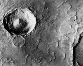
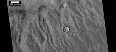
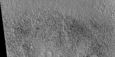
As researchers examined more and more data from orbiting spacecraft more hints that an ocean had existed become evident. The deepest parts of the supposed ocean basins displayed polygonal ground which could be formed from abundant water.[20] [21] Furthermore, craters that would have been under the ocean had a different appearance. They looked like projectiles had landed in mud. Scientists described the shapes as having a “lobe and rampart morphology.” In these places, the ground may have been full of water and/or ice that could have been left by a previous ocean. [22] When a detailed analysis was performed, it was found that the deeper basins showed that lobe and rampart shapes appeared in smaller craters than in other regions. Consequently, the team concluded that the ice was shallower in the deeper basins. [23] Many of the major channels that drained into the northern lowlands stopped at about the same elevation; just as if they were at the edge of a large body of water.[24] [25] Similarly, with access to high resolution photos from HiRISE, a 2010 study of deltas revealed that over a dozen stop at the shoreline of the possible ocean.[26] Initial observations showed deltas at near the same level and that can be explained if they were at the edge of an ocean.[27] [28] However, later studies showed that the many of the deltas were in clusters as if they were in depressions like craters. If they were lined up along the proposed edge of ocean, it would be strong evidence for an ocean.[29]
Theoretical and computational considerations
Was there enough water
The northern lowlands, where the ocean was, appear to be covered by a material that has been called the Vastitas Borealis Formation. Many craters here were called "stealth" craters because they looked like they were hidden under some sort of covering--like a deposit on an ocean floor.[30] It may represent the eroded materials from the outflow channels. Evidence for this relationship is that the volume of the Vastitas Borealis Formation is almost the same as the volume of the eroded material from the channels.[31] In addition, more water was required to develop valley networks, outflow channels, and delta deposits of Mars than was in a Martian ocean, according to research reported in 2017. This implies that there was plenty of water for an ocean.[32] In 2009 a team of researchers tried to find out exactly how many stream channels existed on Mars. They developed a computer program that examined topographical data. The program looked for U-shaped structures, since that would be the shape of channels carved by water. They found many more channels, and in some areas the valley density was similar to what is found on the Earth. Such a high density of channels supports rain on the planet. A large ocean may have been needed to provide enough moisture for rain. A northern ocean would explain the way that certain channels are distributed around the planet. For example, valleys tend to get shallower in the south, perhaps because they are farther from the ocean. Also, there seems to be a southern limit for valleys where less water could be carried from a northern ocean.[33] [34]
Size of ocean
Different researchers have come up with different sizes for an ancient ocean on Mars. However, many of these estimates are reasonable in that the ocean volume is similar to the volume of water needed to carve the many channels on Mars. In fact, it is even less than the maximum amount that the ground could hold.[35] [36] So, the ground could contain all of the water that was in the ocean. There is a division of opinion as to the area of the ocean. Early on two different shorelines were proposed.[37] [38] The shoreline for the smaller ocean is more plausible since there are far less elevation differences along the shoreline.[39] One early estimate of the ocean volume was 19,000,000 Km cubed (1.9 X 10⁷). This volume is equal to 130 meters of water covering the entire planet.(Global Equivalent level-GEL). Estimates would be 23,000,000 Km cubed (2.3 X 10⁷) equal to 156 meters GEL for the high end for the ocean’s size. This larger number represents the ocean’s if we take of total size of the Vastitas Borealis Formation as the area for the ocean.[40]
What was the source of the water
Many have wondered where did the water come from? Today Mars is cold and dry—very dry. Many believe that the atmosphere was once much thicker with a great deal of carbon dioxide that would have caused a global warming. But, models of long term climate change indicate that Mars may have always been cold and dry. [41] [42] One major consideration is that the early sun was not as strong. Perhaps, the average temperature was never above freezing. If that was the case, then the many channels on Mars may have formed during relatively short term, localized events like impacts or volcanic activity.[43] [44] [45] [46] Today, we generally accept ideas that were put forth in a long paper by Steven Clifford in which he proposed that a thick layer of ice, called a cryosphere, circled the entire planet. This frozen cryosphere is estimated to contain hundreds meters of GEL.[47] As the planet cooled, water in the ground froze to the bottom of this ice layer, creating an aquifer under great pressure. Then the water in the aquifer was suddenly released, perhaps after an asteroid impact cracked the cryosphere. Huge, catastrophic floods came out of chaos regions and carved great outflow channels that carried the water to a northern ocean. [48] [49] [50] [51] Evidence for a past aquifer at depth on Mars came out in February 2019, from a group of European scientists who published geological evidence of an ancient planet-wide groundwater system that was probably connected to a Martian ocean.[52] [53] [54] [55] The study was of 24 craters that did not display an inlet or outlet; hence, water for the lake would have come from the ground. All craters were located in the northern hemisphere of Mars. These craters had floors lying roughly 4000 m below Martian 'sea level' (a level that, given the planet's lack of seas, is defined based on elevation and atmospheric pressure). Features on the floors of these craters could only have formed in the presence of water.[56] [57] There are multiple features showing that the water level in the craters rose and fell over time. Deltas and terraces were present in many craters.[58] Some crater floors contain minerals such as various clays and light-toned minerals that form in water. In addition, layers are found in some of these craters. Taken together, these observations strongly suggest that water was present in these places.[59] Some of the craters studied were Pettit, Sagan, Nicholson, Mclaughlin, du Martheray, Tombaugh, Mojave, Curie, Oyama, and Wahoo. It seems that if a crater was deep enough, water came out of the ground and produced a lake.[60]
Where did the water go
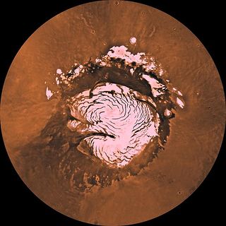
Another consideration that needs to be explained is where did all the water go? At first the water would freeze. Then, in the thin, cold atmosphere of Mars, the ice would have slowly sublimated--that is turned directly into a gas. This water in the vapor state would have migrated to the poles, and then the base of the ice caps would melt with the liquid water freezing to the cryosphere. However, if dust covered the ice the ice may have been lasted for a very long time.[61] The biggest present supply of water is the ice caps, also called the layered polar deposits. Scientists have said that they account for only 25 meter Global Equivalent level (GEL). More recent estimates are 17-22 meters of GEL.[62] [63] However, it could be less, as radar studies from orbit have measured the larger cap, the northern one, as having only 821,000 Km cubed which is less than 6 meters GEL. [64] [65] Remember, the ocean may have held more than 100 meters of GEL.
Some water is frozen in the ground and in glaciers. A team of researchers led by Jeremie Mauginot reasoned that there was 7 meters GEL in the ground between the polar deposits and 50 degrees latitude. [66] In addition, a study, published in 2017, found evidence for ice sheets down to 38 degrees latitude in Utopia and Arcadia Planitiae.[67] Glaciers that are covered with debris and pedestal craters can account for another 2.6 meters GEL in the 30-50 degree bands according to Joseph Levy and his team that were published in Icarus.[68]
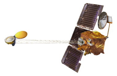
The abundance of water in the upper surface of the ground was mapped by the gamma ray and neutron spectrometers from the orbiting Mars Odyssey.[69] [70] [71]
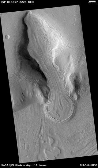
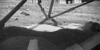
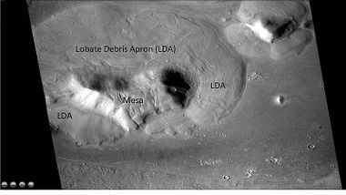
It found much water ice just beneath the surface, just as predicted by mathematical models. In fact, ice was actually seen when the landing rockets of the Phoenix lander blow away a dust cover to reveal ice.[72] [73] Powerful cameras have showed features that resemble glaciers on the Earth. Radar on satellites found ice just beneath the surface around mesas in features that were named lobate debris aprons (LDA). [74] Measurements with MARSIS/Mars Express of something called a dielectric constant indicates that much ice is contained in the material that was under the ocean.[75] [76] All these observations support the notion that there is a great deal of water frozen under the Martian surface.
It was believed that Mars may have been much warmer in the past due to a thick carbon dioxide atmosphere that would have through a global warming effect raised the temperature above the freezing point of water. If that was so, where did all the Carbon dioxide go? Chemically it should have been deposited as carbonates and formed limestone type rocks. Despite searches with instruments aboard satellites, very little carbonates have been found. [77] [78] On the other hand, there is strong evidence of acid conditions which would prevent carbonates from forming.[79] [80] [81] Orbiting instruments, as well as instruments on landers have found sulfates that may have formed under acid conditions.[82] [83] [84]
Water lost to space
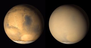
Of great significance in answering where the water went has come from advanced studies of the Martian atmosphere. In short, most of the atmosphere and water was lost into space by various processes. As far back as 2001, NASA’s Far Ultraviolet Spectroscopic Explorer (FUSE) measurements of the ratio of molecular hydrogen to deuterium in the upper atmosphere of Mars suggested an abundant water supply on primordial Mars that has since been lost. Deuterium is a rare, heavy isotope of hydrogen. It has a neutron its nucleus. Since it is heavier, it tends to stick around longer. The ratio between the hydrogen and deuterium tells us how much has been lost in the past. [85] Another later study, published in 2015, of water and deuterium came to the conclusion that Mars has lost the equivalent of an Arctic Ocean of water. [86] [87] This discovery was derived from the ratio of water and deuterium in the modern Martian atmosphere compared to the ratio found on Earth and derived from telescopic observations. Telescopic observations from the Earth found eight times the concentration of deuterium at the polar deposits of Mars than exists on Earth, signifying that Mars once had much greater levels of water. The telescopic values are within range that the Curiosity rover detected in Gale Crater.[88] Ten percent of the water loss from Mars may have been caused by dust storms, according to a study of dust storms with the Mars Reconnaissance Orbiter. Dust storms can carry water vapor to very high altitudes; there ultraviolet light from the Sun can then break the water apart in a process called photodissociation. Hydrogen from the water molecule then goes into space.[89] [90] [91]
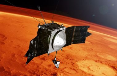
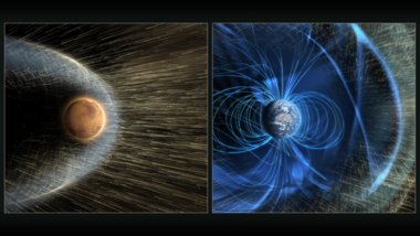
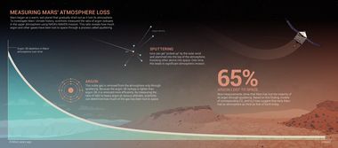
Further evidence that Mars once had a thicker atmosphere which would make an ocean more probable came from the MAVEN spacecraft that has been making measurements from Mars orbit. Bruce Jakosky, lead author of a paper published in Science, stated that "We've determined that most of the gas ever present in the Mars atmosphere has been lost to space."[92] This research was based upon two different isotopes of argon gas.[93] [94] Argon gas is inert, it does not react with anything; hence, the ratio of its isotopes gives an accurate reading of how much has been lost. Like deuterium, a heavy isotope of hydrogen, the heavy form of argon is not lost to space as easily as the lighter variety. A greater proportion of heavy isotope left on the planet means that more of the gas has disappeared. By studying the ratio of the heavier Ar38 to the lighter Ar36, scientists found that 65% of argon has left the planet. The main way that argon left the atmosphere was through a process called “sputtering.” Sputtering is a complex method in which the sun strips atmosphere from a planet. The sun is constantly shooting out particles at high speed. If one hits a gas particle in the atmosphere, it may directly knock it into space. Alternatively, it would cause an atom of atmosphere to lose an electron and thereby become an ion. Ions can interact with the sun’s magnetic field as it moves through space. In the such an exchange, the ion can then acquire energy and fly off into space or hit other atoms in the atmosphere, knocking them into space, as well.[95]
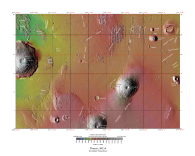
The shoreline of a Mars ocean is not even; also it is hard to account for where the all water came from and where it went. These big problems were potentially solved by a team of scientists, in 2018. They proposed that Martian oceans appeared very early--before or along with the growth of Tharsis. The great mass of the Tharsis volcanoes pulled the crust down making a deep basin. If the ocean was formed before the mass of Tharsis deepen the basins, much less water would be needed. Also, the shorelines would not be regular since Tharsis would still be growing and changing the position of the shoreline. As Tharsis volcanoes erupted they added huge amounts of gases (such as water, carbon dioxide, sulfur dioxide) into the atmosphere and created a global warming, thereby possibly allowing liquid water to exist.[96] [97] [98]
However, it is hotly debated just how much of a global warming took place. Newest climate models show Mars to always have been too cold for much water to exist as a liquid. [99] [100] [101] One group of researchers have proposed that if an object 1000 km across were to strike Mars at certain angles that the large body would break up into small pieces and react with ice on the surface as well as the iron core of Mars. Such reactions could generate large amounts of hydrogen gas (3 times as thick as the Earth's atmosphere). This gas, being a greenhouse gas, could raise the temperature of the atmosphere.[102] [103] Even though research studies continue to support a Mars ocean, there have been other ideas put forth to explain observations.[104] [105] Some have suggested a series of lakes rather than one large ocean. A recent study suggested a frozen ocean resulting from a succession of floods. Water from the outflow channels probably rushed out many times with long gaps between flooding events. Each time the water would have frozen. [106] [107]
Tsunamis
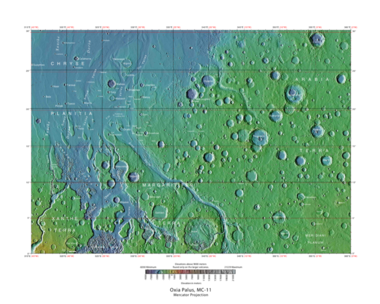
If Mars had an ocean for a time, there is a chance that sooner or later an asteroid would strike it and cause a great wave, called a tsunami. Evidence for two such events was published in May 2016. Parts of the surface in Ismenius Lacus quadrangle were altered by two tsunamis argue a large team of scientists. Both impacts which caused the tsunamis were powerful enough to leave behind 30 km diameter craters. The first picked up and transported boulders the size of small houses. The wave washed over the land, and then gravity pulled it back to lower ground and when it did, the backwash created channels by rearranging the boulders. The second came in when the ocean was 300 m lower. The second tsunami brought great deal of ice which was dropped in valleys. The average height of the waves would have been 50 m, but the heights would vary from 10 m to 120 m according to calculations. That means that some waves were tall enough to have gone way over the United States Capitol Building. Lobes of giant boulders went around obstacles and down low paths. Having such strikes are quite plausible, as simulations indicate that in this particular part of the ocean two impact craters of 30 km in diameter are expected every 30 million years. Two of these events imply that a huge ocean may have existed for millions of years. One persistent argument against an ocean has been the lack of shoreline features, but they may have been destroyed by these tsunamis. Chryse Planitia and northwestern Arabia Terra were studied in this research. [108] [109] [110] The crater Lomonosov has been identified as a likely source of tsunami waves.[111] [112] [113] [114] [115]
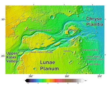
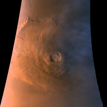
Evidence of other tsunami events was presented at the 50th Lunar and Planetary Science Conference (March 18–22, 2019) in The Woodlands, Texas.[116] Observations made by a large group of scientists showed that the a large tsunami traveled up into the highlands at least ~1.2 km in elevation over a distance of ~350 km. The paper's authors calculated that an impact ~150 km in diameter in a Martian northern ocean could have produced this tsunami. Deposits from the tsunami cover the lower reaches of Maumee Valles and most of the highland surfaces next to Kasei Valles, Maumee Valles, and Xanthe Montes. The Viking 1 lander set down on a part of the deposit from the tsunami.[117] [118] Another tsunami may have occurred from a landside that slide down Olympus Mons, the largest volcano on Mars. The deposit went much further than expected for just a landslide. However, the great distance covered by landslide would have been expected if the material sliding down Olympus Mons were mixed with water from an ocean or smaller ponds. If this tsunami did occur that means that an ocean lasted until the early Amazonia period, at least in the area of Amazonis Arcadia Planitiae. So, an ocean may have lasted longer than previously thought.[119] [120]
References
- ↑ https://www.ncbi.nlm.nih.gov/pmc/articles/PMC4872529/
- ↑ Carr, M. & J. Head. 2010 Geologic history of Mars. Earth and Planetary Science Letters. 294. 185-203.
- ↑ Clifford, S. M.; Parker, T. J. (2001). "The Evolution of the Martian Hydrosphere: Implications for the Fate of a Primordial Ocean and the Current State of the Northern Plains". Icarus. 154 (1): 40–79. Bibcode:2001Icar..154...40C. doi:10.1006/icar.2001.6671
- ↑ Baker, V. R.; Strom, R. G.; Gulick, V. C.; Kargel, J. S.; Komatsu, G.; Kale, V. S. (1991). "Ancient oceans, ice sheets and the hydrological cycle on Mars". Nature. 352 (6336): 589–594. Bibcode:1991Natur.352..589B. doi:10.1038/352589a0.
- ↑ Lucchitta, B. et al. 1986. Sedimentary deposits in the northern lowland plains, Mars. Proc. Lunar planet. Conf. 17th, part 1, j. Geophys. Res., 91, suppl., E166-E174.
- ↑ Villanueva G. L., Mumma M. J., Novak R. E., Käufl H. U., Hartogh P., Encrenaz T., Tokunaga A., Khayat A., and Smith M. D., Science, Published online 5 March 2015 [DOI:10.1126/science.aaa3630]
- ↑ Villanueva, G., et al. 2015. Strong water isotopic anomalies in the martian atmosphere: Probing current and ancient reservoirs. Science 10 Apr 2015: Vol. 348, Issue 6231, pp. 218-221.
- ↑ https://www.nasa.gov/press-release/nasas-maven-reveals-most-of-mars-atmosphere-was-lost-to-space
- ↑ B.M. Jakosky et al. 2017. Mars’ atmospheric history derived from upper-atmosphere measurements of 38Ar/36Ar. Science 355 (6332): 1408-1410; doi: 10.1126/science.aai7721
- ↑ http://www.sci-news.com/space/maven-martian-atmosphere-lost-space-04750.html
- ↑ http://astrobiology.com/2016/05/ancient-tsunami-evidence-on-mars-reveals-life-potential.html
- ↑ Rodriguez, J.; et al. 2016. "Tsunami waves extensively resurfaced the shorelines of an early Martian ocean. :" (PDF). Scientific Reports / 47th Lunar and Planetary Science Conference. 6: 25106. Bibcode:2016NatSR...625106R. doi:10.1038/srep25106. PMC 4872529 Freely accessible. PMID 27196957.version at Nature
- ↑ Head, J., et al. 2018. TWO OCEANS ON MARS?: HISTORY, PROBLEMS AND PROSPECTS. 49th Lunar and Planetary Science Conference 2018 (LPI Contrib. No. 2083). 2194.pdf
- ↑ Carr,M. 1996. Water on Mars. Oxford
- ↑ Head, J., et al. 2002. Northern lowlands of Mars: Evidence for widespread volcanic flooding and tectonic deformation in the Hesperian Period. J. Geophys. Res. 107(E1), 5003.
- ↑ Parker, T.J., Saunders, R.S., and Schneeberger, D.M. 1989. Transitional morphology in the west Deuteronilus Mensae region of Mars: Implications for modification of the lowland/upland boundary: Icarus , v. 82, 111–145, doi:10.1016/0019-1035(89)90027-4.
- ↑ Carr, M. , J. Head. 2003. Oceans of Mars: An assessment of the observational evidence and possible fate. Journal of Geophysical Research. 108(E5). 5041. Doi:10.1029/2002JE001963, 2003.
- ↑ Head et al. 1999. Possible Ancient Oceans on Mars: Evidence from Mars Orbiter Laser Altimeter Data. Science: 286, 2134.
- ↑ Malin, M. C., and Edgett, K. S. 1999. "Oceans or Seas in the Martian Northern Lowlands: High Resolution Imaging Tests of Proposed Coastlines". Geophys. Res. Lett. 26 (19): 3049–3052. Bibcode:1999GeoRL..26.3049M. doi:10.1029/1999GL002342.
- ↑ Parker, T., et al. 1989. Transitional morphology in the west Deuteronilus Mensae region of Mars: Implications for modification of the lowland/upland boundary . Icarus. 82111–145, doi:10.1016/0019-1035(89)90027-4.
- ↑ Parker, T., et al. 1993. Coastal geomorphology of the Martian northern plains. Journal of Geophysical Research. 98. 11061.
- ↑ Carr, M. , et al. 1977. Martian permafrost features. Journal of Geophysical Research. 82. 195.
- ↑ Kuzmin, R., et al. 1988. Structure inhomogeneities of the Martian cryosphere, Solar System Res. 22. 195-212.
- ↑ Head et al. 1999. Possible Ancient oceans on Mars: Evidence from mars orbiter laser Altimeter Data. Science 286, 2134
- ↑ Carr,M. 1996. Water on Mars. Oxford
- ↑ cite journal | last1 = DiAchille | first1 = G | last2 = Hynek | first2 = B. | year = 2010 | title = Ancient ocean on Mars supported by global distribution of deltas and valleys. nat | url = | journal = Geosci | volume = 3 | issue = 7| pages = 459–463 | doi = 10.1038/ngeo891 | bibcode=2010NatGe...3..459D
- ↑ cite journal | last1 = DiBiasse | first1 = | last2 = Limaye | first2 = A. | last3 = Scheingross | first3 = J. | last4 = Fischer | first4 = W. | last5 = Lamb | first5 = M. | year = 2013 | title = Deltic deposits at Aeolis Dorsa: Sedimentary evidence for a standing body of water on the northern plains of Mars | url = | journal = Journal of Geophysical Research: Planets | volume = 118 | issue = | pages = 1285–1302
- ↑ Fawdon, P., et al. 2018. HYPANIS VALLES DELTA: THE LAST HIGH-STAND OF A SEA ON EARLY MARS. 49th Lunar and Planetary Science Conference 2018 (LPI Contrib. No. 2083). 2839.pdf
- ↑ Rivera-Hernbardez, F. 2019, From Grains to Landscapes: Reconstructing Martian Environments at Multiple Scales. From talk given to Schoumberger
- ↑ Kreslavsky, M., J. Head. 2002. Fate of outflow channel effluents in the northern lowlands of Mars: The Vastitas Borealis Formation as a sublimation residue from frozen ponded bodies of water. Journal of Geophysical Research: 107, 5121
- ↑ Carr, M., et al. 1987. Volumes of channels, canyons, and chaos in the circum-Chryse region of mars. Lunar Planet. Sci. XVIII. 155-156
- ↑ cite journal | url=https://www.hou.usra.edu/meetings/lpsc2017/pdf/1734.pdf | title=New Martian valley network volume estimate consistent with ancient ocean and warm and wet climate | author=Luo, W., et al. | journal=Lunar And Planetary Science | year=2017 | volume=XLVIII | pages=15766 | doi=10.1038/ncomms15766 | pmid=28580943 |pmc=5465386| bibcode=2017NatCo...815766L
- ↑ cite news | author = Staff | title = Martian North Once Covered by Ocean | date = 26 November 2009 | url = http://www.astrobio.net/pressrelease/3322/martian-north-once-covered-by-ocean | work = Astrobiology Magazine | accessdate = 19 February 2014
- ↑ cite news | author = Staff | title = New Map Bolsters Case for Ancient Ocean on Mars | date = 23 November 2009 | url = http://www.space.com/7584-map-bolsters-case-ancient-ocean-mars.html | work = Space.com | accessdate = 2014-02-19
- ↑ Head et al. 1999. Possible Ancient oceans on Mars: Evidence from mars orbiter laser Altimeter Data. Science 286, 2134
- ↑ Carr,M. 1996. Water on Mars. Oxford
- ↑ Parker, T.J., Saunders, R.S., and Schneeberger, D.M., 1989, Transitional morphology in the west Deuteronilus Mensae region of Mars: Implications for modification of the lowland/upland boundary: Icarus , v. 82, 111–145, doi:10.1016/0019-1035(89)90027-4.
- ↑ Parker, T., et al. 1993. Coastal geomorphology of the Martian northern plains. Journal of Geophysical Research. 98. 11061.
- ↑ Carr, M. , J. Head. 2003. Oceans of Mars: An assessment of the observational evidence and possible fate. Journal of Geophysical Research. 108(E5). 5041. Doi:10.1029/2002JE001963, 2003.
- ↑ Carr, M. , J. Head. 2003. Oceans of Mars: An assessment of the observational evidence and possible fate. Journal of Geophysical Research. 108(E5). 5041. Doi:10.1029/2002JE001963, 2003.
- ↑ Forget et al. 2013. 3D modelling of the early martian climate under a denser CO2 atmosphere: Temperatures and CO2 ice clouds. Icarus 222, 81-99.
- ↑ Wordsworth et al. 2013. Global modelling of the early martian climate under a denser CO atmosphere: Water cycle and ice evolution. Icarus 222, 1-19.
- ↑ https://www.hou.usra.edu/meetings/lpsc2019/pdf/2024.pdf
- ↑ Palumbo, A., J. Head. 2019. OCEANS ON MARS: THE POSSIBILITY OF A NOACHIAN GROUNDWATER-FED OCEAN IN A SUBFREEZING MARTIAN CLIMATE. A. SUB- FREEZING MARTIAN CLIMATE. 50th Lunar and Planetary Science Conference 2019 (LPI Contrib. No. 2132) 2024.pdf
- ↑ Head, J., et al. 2017. DECIPHERING THE NOACHIAN GEOLOGICAL AND CLIMATE HISTORY OF MARS: A STRATIGRAPHIC, GEOLOGIC PROCESS AND MINERALOGICAL PERSPECTIVE – PART 1: CURRENT KNOWNS AND UNKNOWNS. 4th Early Mars, 3046/3047.
- ↑ Head, J. et al. 2017. DECIPHERING THE NOACHIAN GEOLOGICAL AND CLIMATE HISTORY OF MARS: PART 2 – A NOACHIAN STRATIGRAPHIC VIEW OF MAJOR GEOLOGIC PROCESSES AND THEIR CLIMATIC CONSEQUENCES. 4th Early Mars, 3047
- ↑ Clifford, S. 1993. A model for the hydrologic and climatic behavior of water on Mars. Geophys. Res. 98 (E6)
- ↑ Clifford, S. M.; Parker, T. J. (2001). "The Evolution of the Martian Hydrosphere: Implications for the Fate of a Primordial Ocean and the Current State of the Northern Plains". Icarus. 154 (1): 40–79. Bibcode:2001Icar..154...40C. doi:10.1006/icar.2001.6671
- ↑ Gulick, V., D. Tyler, C. McKay, and R. Haberle. 1997. Episodic ocean‐induced CO2 greenhouse on Mars: Implications for fluvial valley formation. Icarus: 130, 68–86.
- ↑ Andrews-Hanna, J., R. Phillips. 2007. Hydrological modeling of outflow channels and chaos regions on Mars. Journal of Geophysical Research: Planets Volume 112, Issue E8
- ↑ Clifford, S. 1993. A model for the hydrologic and climatic behavior of water on Mars. JGR, 98, 10973L
- ↑ ESA Staff |title=First Evidence of "Planet-Wide Groundwater System" on Mars Found |url=https://www.esa.int/Our_Activities/Space_Science/Mars_Express/First_evidence_of_planet-wide_groundwater_system_on_Mars |date=28 February 2019 |work=European Space Agency
- ↑ Houser |first=Kristin |title=First Evidence of "Planet-Wide Groundwater System" on Mars Found |url=https://futurism.com/the-byte/mars-groundwater-system-planet-wide |date=28 February 2019 |work=Futurism.com
- ↑ https://agupubs.onlinelibrary.wiley.com/doi/epdf/10.1029/2018JE005802
- ↑ https://www.leonarddavid.com/planet%E2%80%90wide-groundwater-system-on-mars-new-geological-evidence/
- ↑ Salese, F., et al. 2019. A GEOLOGICAL MODEL FOR MARTIAN GROUNDWATER BASED ON WATER-FORMED FEATURES WITHIN DEEP BASINS. 50th Lunar and Planetary Science Conference 2019 (LPI Contrib. No. 2132). 3240.pdf
- ↑ https://www.hou.usra.edu/meetings/lpsc2019/pdf/3240.pdf
- ↑ http://astrobiology.com/2019/02/first-evidence-of-a-planet-wide-groundwater-system-on-mars.html
- ↑ https://agupubs.onlinelibrary.wiley.com/doi/epdf/10.1029/2018JE005802
- ↑ https://agupubs.onlinelibrary.wiley.com/doi/epdf/10.1029/2018JE005802
- ↑ Clifford, S., T. Parker, 2001. The evolution of the Martian hydrosphere: implications for the fate of a primordial ocean and the current state of the Northern Plains. Icarus 154, 40
- ↑ Lasue, J., et al. 2013. Quantitative Assessments of the Martian Hydrosphere. Space Sci. Rev. 174, 155-212.
- ↑ Carr, M., J. Head. 2015. Martian surface/near-surface water inventory: Sources, sinks, and changes with time. Geophys. Res. Lett. 42, 726-732.
- ↑ https://www.space.com/17048-water-on-mars.html
- ↑ Radar Map of Buried Mars Layers Matches Climate Cycles". Jet Propulsion Lab. 2009-09-22
- ↑ Mauginot , J., et al. 2010. The 3-5 MHz-global ref map of Mars by MARSIS/Mars Express: implications for the current inventory of subsurface H2O. Icarus: 210, 612-625.
- ↑ Bramson, A., et al. 2017. Preservation of mid-latitude ice-sheets on Mars. J. Geophys. Res. 122, 2250-2260.
- ↑ Levey, J., et al. 2010. Concentric crater fill in the northern mid-latitudes of Mars: Formation. Icarus: 209, 390-404.
- ↑ https://mars.nasa.gov/odyssey/mission/overview/
- ↑ Mitrofanov, I., Anfimov, D., Kozyrev, A., Litvak, M., Sanin, A., Tret'yakov, V., ... Saunders, R. S. (2002). Maps of subsurface hydrogen from the High Energy Neutron Detector, Mars Odyssey. Science, 297(5578), 78-81. DOI: 10.1126/science.1073616
- ↑ Wilson, J. et al. 2018. Equatorial locations of water on Mars: Improved resolution maps based on Mars Odyssey Neutron Spectrometer data. Icarus 299: 148-160; doi: 10.1016/j.icarus.2017.07.028
- ↑ Smith, P., et al. 2009. H2O at the Phoenix Landing Site. Science: 325, 58-61.
- ↑ https://www.nasa.gov/mission_pages/phoenix/news/phoenix-20080530.html
- ↑ Holt, J. W.; Safaeinili, A.; Plaut, J. J.; Young, D. A.; Head, J. W.; Phillips, R. J.; Campbell, B. A.; Carter, L. M.; Gim, Y.; Seu, R.; Team, Sharad (2008). "Radar Sounding Evidence for Ice within Lobate Debris Aprons near Hellas Basin, Mid-Southern Latitudes of Mars" (PDF). Lunar and Planetary Science. XXXIX: 2441.
- ↑ Mouginot, J., et al. 2012. Dielectric map of the Martian northern hemisphere and the nature of plain filling materials. GEOPHYSICAL RESEARCH LETTERS, VOL. 39, L02202, doi:10.1029/2011GL050286, 2012
- ↑ Holt, J. W.; Safaeinili, A.; Plaut, J. J.; Young, D. A.; Head, J. W.; Phillips, R. J.; Campbell, B. A.; Carter, L. M.; Gim, Y.; Seu, R.; Team, Sharad (2008). "Radar Sounding Evidence for Ice within Lobate Debris Aprons near Hellas Basin, Mid-Southern Latitudes of Mars" (PDF). Lunar and Planetary Science. XXXIX: 2441.
- ↑ Bandfield, J. , et al. 2000. A global view of Martian surface composition from MGS-TES. Science: 287, 1626-1630.
- ↑ Christensen, P., et al. 2001. Mars Global Surveyor Thermal Emission Spectrometer experiment: Investigation description and surface science results. J. Geosphy. Res. 106, 23823-23871
- ↑ Grotzinger, J. and R. Milliken (eds.) 2012. Sedimentary Geology of Mars. SEPM
- ↑ Catling, D. (1999-07-25). "A chemical model for evaporites on early Mars: Possible sedimentary tracers of the early climate and implications for exploration" (PDF). Journal of Geophysical Research. 104 (E7): 16453–16469. Bibcode:1999JGR...10416453C. doi:10.1029/1998JE001020
- ↑ Fairén, Alberto G.; Fernández-Remolar, David; Dohm, James M.; Baker, Victor R.; Amils, Ricardo (2004-09-23). "Inhibition of carbonate synthesis in acidic oceans on early Mars" (PDF). Nature. 431 (7007): 423–426. Bibcode:2004Natur.431..423F. doi:10.1038/nature02911. PMID 15386004
- ↑ https://ntrs.nasa.gov/archive/nasa/casi.ntrs.nasa.gov/20160006674.pdf
- ↑ https://www.sciencedirect.com/science/article/pii/S0019103514003522
- ↑ Farrand, W., et al. 2014. Detection of copiapite in the northern Mawrth Vallis region of Mars: Evidence of acid sulfate alteration. Icarus: 241, 346-357.
- ↑ cite journal | last1 = Krasnopolsky | first1 = Vladimir A. | last2 = Feldman | first2 = Paul D. | year = 2001 | title = Detection of Molecular Hydrogen in the Atmosphere of Mars | url = | journal = Science | volume = 294 | issue = 5548| pages = 1914–1917 | doi=10.1126/science.1065569 | pmid=11729314| bibcode = 2001Sci...294.1914K
- ↑ Villanueva G. L., Mumma M. J., Novak R. E., Käufl H. U., Hartogh P., Encrenaz T., Tokunaga A., Khayat A., and Smith M. D., Science, Published online 5 March 2015 [DOI:10.1126/science.aaa3630]
- ↑ Villanueva, G., et al. 2015. Strong water isotopic anomalies in the martian atmosphere: Probing current and ancient reservoirs. Science 10 Apr 2015:Vol. 348, Issue 6231, pp. 218-221.
- ↑ cite journal | last1 = Webster | first1 = C.R. | display-authors = 1 | last2 = et al | year = 2013 | title = Isotope Ratios of H, C, and O in CO2 and H2O of the Martian Atmosphere | url = | journal = Science | volume = 341 | issue = 6| pages = 260–263 | bibcode = 2013Sci...341..260W | doi = 10.1126/science.1237961 | pmid = 23869013
- ↑ https://www.sciencenews.org/article/mars-dust-storms-water?mode=topic&context=36
- ↑ N. Heavens et al. Hydrogen escape from Mars enhanced by deep convection in dust storms. Nature Astronomy. Published online January 22, 2018. doi: 10.1038/s41550-017-0353-4.
- ↑ https://www.jpl.nasa.gov/news/news.php?release=2018-012&rn=news.xml&rst=7041
- ↑ https://www.nasa.gov/press-release/nasas-maven-reveals-most-of-mars-atmosphere-was-lost-to-space
- ↑ B.M. Jakosky et al. 2017. Mars’ atmospheric history derived from upper-atmosphere measurements of 38Ar/36Ar. Science 355 (6332): 1408-1410; doi: 10.1126/science.aai7721
- ↑ http://www.sci-news.com/space/maven-martian-atmosphere-lost-space-04750.html
- ↑ https://www.nasa.gov/press-release/nasas-maven-reveals-most-of-mars-atmosphere-was-lost-to-space
- ↑ Mars' oceans formed early, possibly aided by massive volcanic eruptions. University of California - Berkeley. March 19, 2018.
- ↑ Citron, R., M. Manga, D. Hemingway. 2018. "Timing of oceans on Mars from shoreline deformation." Nature doi| 10.1038/nature26144
- ↑ Citro, R., et al. 2018. EVIDENCE OF EARLY MARTIAN OCEANS FROM SHORELINE DEFORMATION DUE TO THARSIS. 49th Lunar and Planetary Science Conference 2018 (LPI Contrib. No. 2083). 1244.pdf
- ↑ Forget et al. 2013 3D modelling of the early martian climate under a denser CO2 atmosphere: Temperatures and CO2 ice clouds. Icarus 222, 81-99.
- ↑ Wordsworth et al. 2013. Global modelling of the early martian climate under a denser CO2 atmosphere: Water cycle and ice evolution. Icarus 222, 1-19.
- ↑ http://astrobiology.com/2018/12/geologic-constraints-on-early-mars-climate.html
- ↑ https://www.hou.usra.edu/meetings/lpsc2019/pdf/1067.pdf
- ↑ Woo, J., et al. 2019. MARS IN THE AFTERMATH OF COLOSSAL IMPACT. 50th Lunar and Planetary Science Conference 2019 (LPI Contrib. No. 2132). 1067.pdf)
- ↑ https://www.hou.usra.edu/meetings/lpsc2019/pdf/2024.pdf
- ↑ Palumbo, A., J. Head. OCEANS ON MARS: THE POSSIBILITY OF A NOACHIAN GROUNDWATER-FED OCEAN IN A SUBFREEZING MARTIAN CLIMATE. 50th Lunar and Planetary Science Conference 2019 (LPI Contrib. No. 2132). 2024.pdf
- ↑ Carr, M., J. Head. In press. Mars: Formation and fate of a frozen Hesperian ocean. Icarus. https://doi.org/10.1016/j.icarus.2018.08.021
- ↑ Carr, M. 1996. Water on Mars. Oxford
- ↑ http://astrobiology.com/2016/05/ancient-tsunami-evidence-on-mars-reveals-life-potential.html
- ↑ https://www.hou.usra.edu/meetings/lpsc2016/pdf/1680.pdf | title=Tsunami waves extensively resurfaced the shorelines of an early Martian ocean. : | author=Rodriguez, J., et al. | journal=Scientific Reports / 47th Lunar and Planetary Science Conference | year=2016 | volume=6 | pages=25106 | doi=10.1038/srep25106| pmid=27196957 | pmc=4872529 | version at Nature
- ↑ "Ancient tsunami evidence on Mars reveals life potential." ScienceDaily. 19 May 2016.
- ↑ cite web | url = https://www.bbc.com/news/science-environment-39394583 | title = Impact crater linked to Martian tsunamis | last = Rincon | first = P. | date = 2017-03-26 | website = BBC | access-date = 2017-03-26
- ↑ Costard | first2 = A. | last2 = Séjourné | first3 = K. | last3 = Kelfoun | first4 = S. | last4 = Clifford | first5 = F. | last5 = Lavigne | first6 = I. | last6 = Di Pietro | first7 = S. | last7 = Bouley | title = Modelling Investigation of Tsunamis on Mars | book-title = Lunar and Planetary Science Conference|Lunar and Planetary Science XLVIII | pages = 1171 | publisher = Lunar and Planetary Institute | date = 2017 | location = The Woodlands, Texas | url = http://www.lpi.usra.edu/meetings/lpsc2017/pdf/1171.pdf | access-date = 2017-03-26
- ↑ Costard, F., et al. 2018. FORMATION OF THE NORTHERN PLAINS LOMONOSOV CRATER DURING A TSUNAMI GENERATING MARINE IMPACT CRATER EVENT. 49th Lunar and Planetary Science Conference 2018 (LPI Contrib. No. 2083). 1928.pdf
- ↑ https://www.techtimes.com/articles/203105/20170326/impact-crater-linked-to-powerful-tsunamis-on-mars-another-proof-of-an-ancient-ocean.htm
- ↑ https://agupubs.onlinelibrary.wiley.com/doi/abs/10.1029/2019JE006008
- ↑ https://www.hou.usra.edu/meetings/lpsc2019/pdf/lpsc2019_program.htm
- ↑ https://www.hou.usra.edu/meetings/lpsc2019/pdf/2757.pdf
- ↑ Rodrignez, J., et al. 2019. A NASA SPACECRAFT MAY HAVE LANDED ON AN EARLY MARS MEGA-TSUNAMI DEPOSIT IN 1976. 50th Lunar and Planetary Science Conference 2019 (LPI Contrib. No. 2132). 2757.pdf
- ↑ https://www.hou.usra.edu/meetings/lpsc2019/pdf/1573.pdf
- ↑ DeBlasio, F. 2019. LANDSLIDE-GENERATED TSUNAMI ON MARS? 50th Lunar and Planetary Science Conference 2019 (LPI Contrib. No. 2132). 1573.pdf
See also
- Greenhouse effect
- High Resolution Imaging Science Experiment (HiRISE)
- Mars Global Surveyor
- MAVEN
- Rivers on Mars
- Tharsis
- Water
