
File:Crater wall inside Mariner Crater.JPG
No higher resolution available.
Crater_wall_inside_Mariner_Crater.JPG (617 × 421 pixels, file size: 47 KB, MIME type: image/jpeg)
Summary
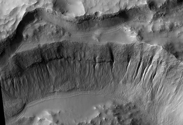
Crater wall inside Mariner Crater showing gullies, as seen by HiRISE. Location is 34.9 degrees south latitude and 195.1 degrees east longitude. Image was taken by the Mars Reconnaissance Orbiter's HiRISE.
Image credit: NASA/JPL/University of Arizona/
Source http://hirise.lpl.arizona.edu/PSP_002317_1445
Licensing
Public domain images are available for anybody to use without any licenses, royalties, or special permissions.
File history
Click on a date/time to view the file as it appeared at that time.
| Date/Time | Thumbnail | Dimensions | User | Comment | |
|---|---|---|---|---|---|
| current | 23:39, 22 October 2018 | | 617 × 421 (47 KB) | Suitupandshowup (talk | contribs) | Crater wall inside Mariner Crater showing gullies, as seen by HiRISE. Location is 34.9 degrees south latitude and 195.1 degrees east longitude. Image was taken by the Mars Reconnaissance Orbiter's HiRISE. Image credit: NASA/JPL/University of Arizona... |
You cannot overwrite this file.
File usage
The following file is a duplicate of this file (more details):

- File:Crater wall inside Mariner Crater.JPG from Wikimedia Commons

The following 2 pages use this file:
