
File:37461 2255scallopedclose.jpg
37461_2255scallopedclose.jpg (800 × 378 pixels, file size: 70 KB, MIME type: image/jpeg)
Summary
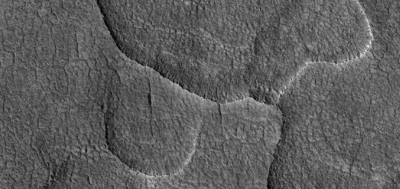
Close view of scalloped terrain High-centered polygons are visible, as well as some boulders. Radar studies have shown that this type of surface contains much water ice; hence, it may be mined in the future by colonists. Some of the scallops are merging as water ice is leaving the ground.
The location is Utopia Planitia in the Casius quadrangle at 45.177 N and 97.865 E (ESP_037461_2255).
Source: http://hirise.lpl.arizona.edu/ESP_037461_2255
Image credit is NASA/JPL/University of Arizona.
Licensing
Public domain images are available for anybody to use without any licenses, royalties, or special permissions.
File history
Click on a date/time to view the file as it appeared at that time.
| Date/Time | Thumbnail | Dimensions | User | Comment | |
|---|---|---|---|---|---|
| current | 23:53, 6 December 2019 | | 800 × 378 (70 KB) | Suitupandshowup (talk | contribs) | Close view of scalloped terrain High-centered polygons are visible, as well as some boulders. Radar studies have shown that this type of surface contains much water ice; hence, it may be mined in the future by colonists. Some of the scallops are mergin... |
You cannot overwrite this file.
File usage
The following 3 pages use this file:
