File list
This special page shows all uploaded files.
| Date | Name | Thumbnail | Size | User | Description | Versions |
|---|---|---|---|---|---|---|
| 11:00, 17 February 2020 | 3234 2210lowerface.jpg (file) |  |
351 KB | Suitupandshowup | Close up of lower part of Mars face as seen by HiRISE. I enlarged it with the HiView program. Source: http://hirise.lpl.arizona.edu/PSP_003234_2210 Image credit: NASA/JPL/University of Arizona | 1 |
| 10:54, 17 February 2020 | 3234 2210lowelowerrface.jpg (file) |  |
337 KB | Suitupandshowup | Enlarged view of lower face using HiView program | 1 |
| 10:49, 17 February 2020 | 3234 2210facelefteye.jpg (file) |  |
297 KB | Suitupandshowup | close up of left eye of Mars face as seen by HiRISE. I enlarged it with the HiView program. Source: http://hirise.lpl.arizona.edu/PSP_003234_2210 Image credit: NASA/JPL/University of Arizona | 1 |
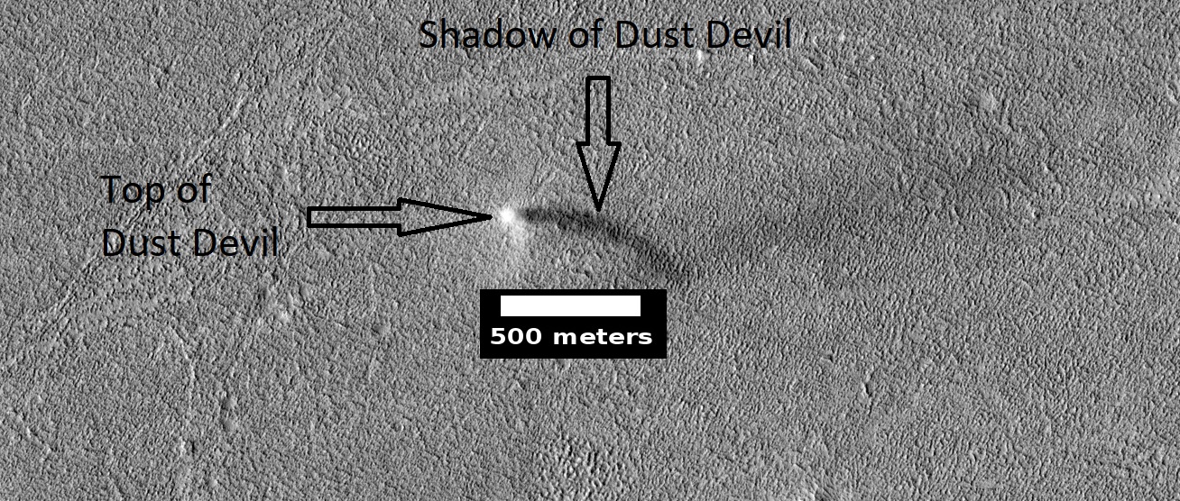
| 17:30, 11 February 2020 | ESP 061787 2140devilcropped.jpg (file) |  |
492 KB | Suitupandshowup | Dust devil with shadow, as seen by HiRISE. Source: https://www.uahirise.org/ESP_061787_2140 Image credit: NASA/JPL/University of Arizona/Secosky | 1 |
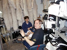
| 23:30, 9 February 2020 | Crew5Radio.jpg (file) |  |
15 KB | Sdubois | 1 | |
| 22:57, 9 February 2020 | JanOsburgFly.jpg (file) |  |
10 KB | Sdubois | 1 | |
| 22:56, 9 February 2020 | JanDishes.jpg (file) |  |
15 KB | Sdubois | 1 | |
| 22:54, 9 February 2020 | NancyWoodHabLab.jpg (file) |  |
15 KB | Sdubois | 1 | |
| 22:48, 9 February 2020 | DavidRealEVAPrep.jpg (file) |  |
19 KB | Sdubois | 1 | |
| 22:44, 9 February 2020 | VladimirPletser.jpg (file) |  |
15 KB | Sdubois | 1 | |
| 14:23, 26 January 2020 | Mars true color.jpg (file) |  |
1.62 MB | Michel Lamontagne | File copied from Marspedia and adjusted for Imagemap | 1 |
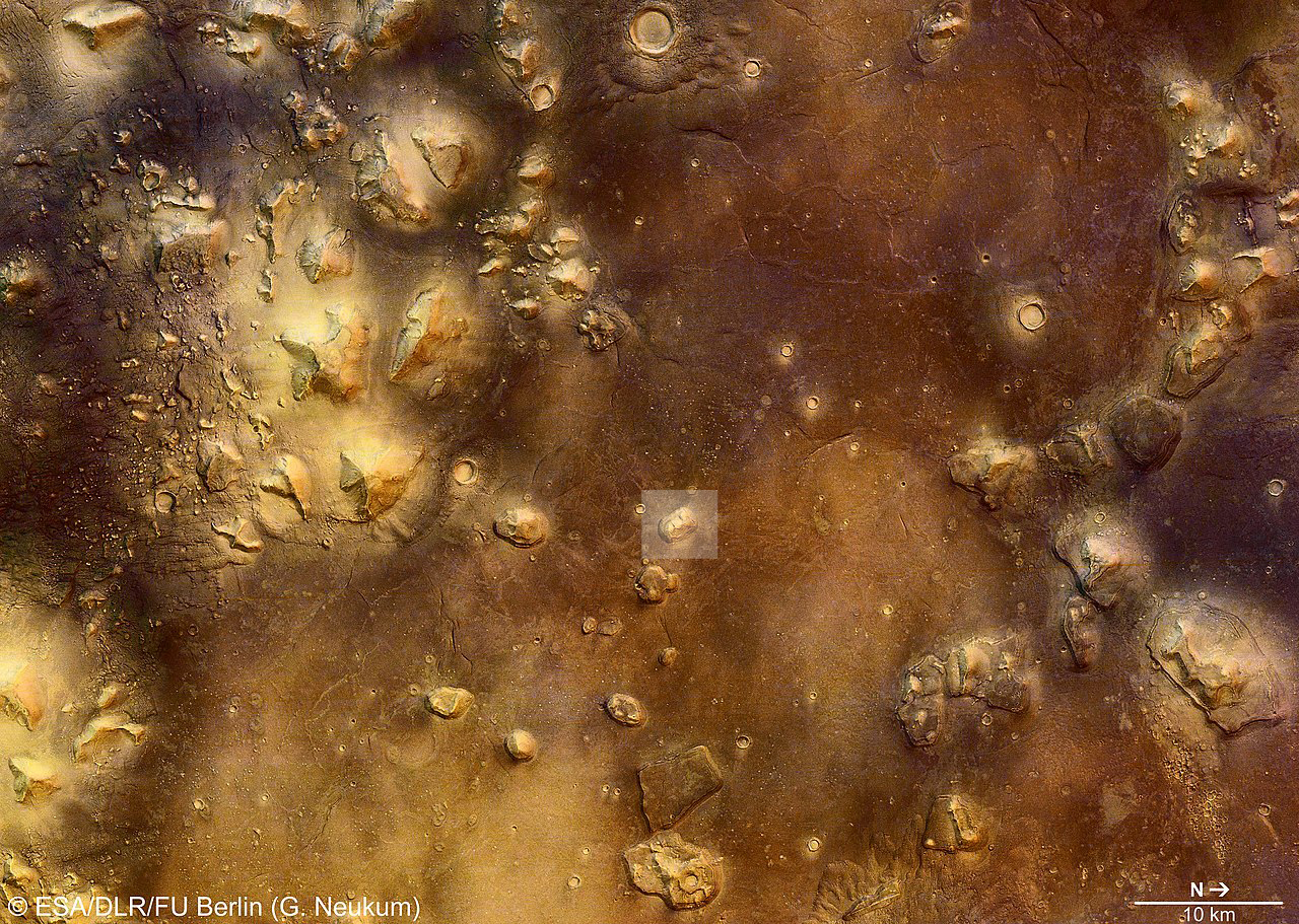
| 12:17, 25 January 2020 | 1280px-Cydonia region, colour image ESA235868.jpg (file) |  |
1.12 MB | Michel Lamontagne | Cydonia with the face on Mars highlighted | 1 |
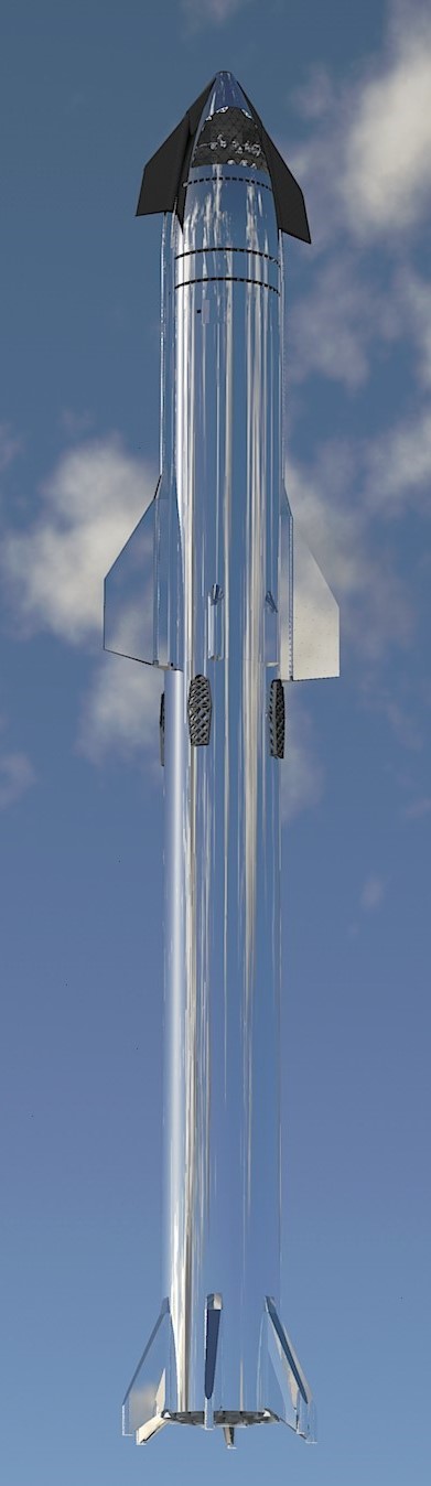
| 19:32, 9 January 2020 | Starship mirror2.jpg (file) |  |
80 KB | Michel Lamontagne | 1 | |
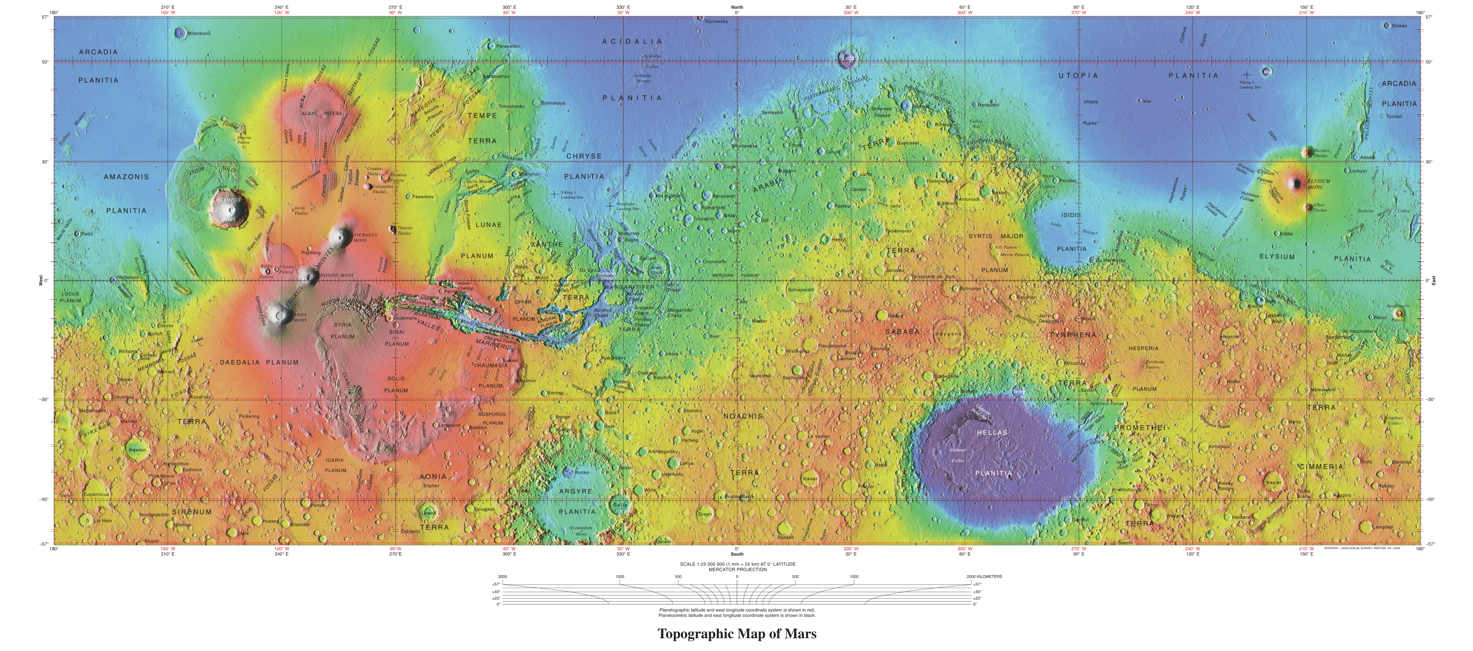
| 13:33, 7 January 2020 | USGS-PlanetMars-TopographicalMap.png (file) |  |
7.21 MB | Michel Lamontagne | 2 | |
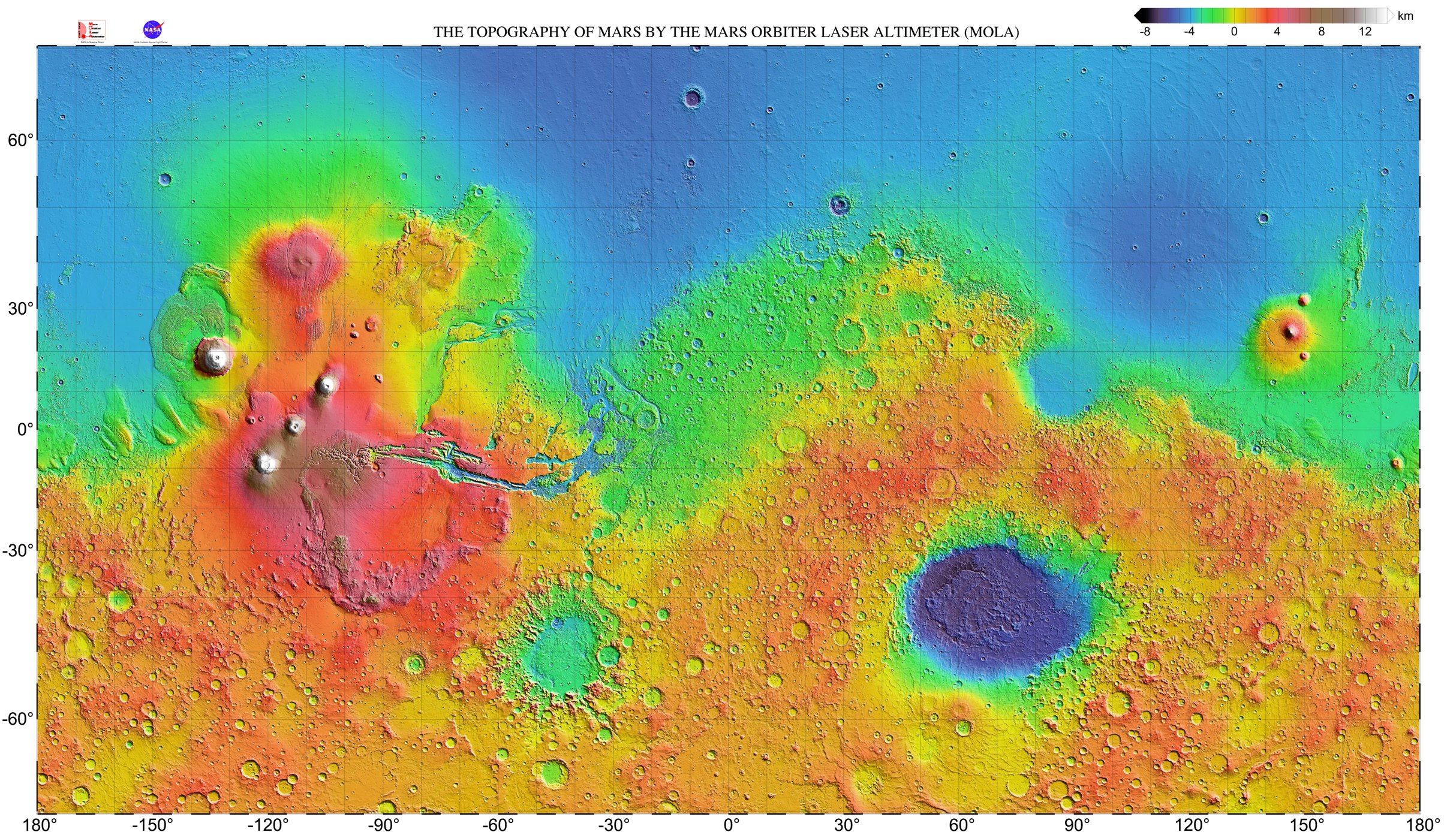
| 20:36, 6 January 2020 | Mars topography (MOLA dataset) HiRes (1).jpg (file) | _HiRes_(1).jpg) |
1.14 MB | Michel Lamontagne | 1 | |
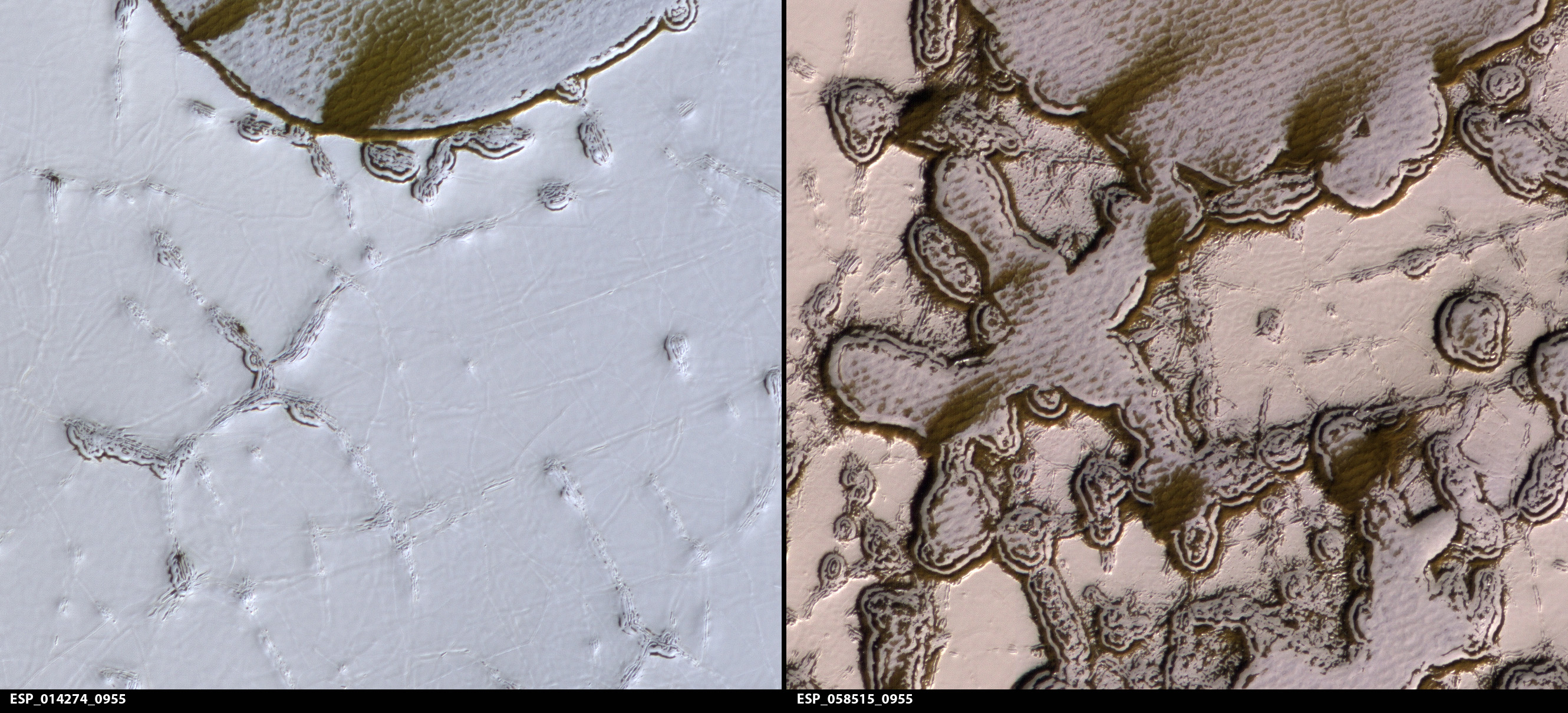
| 16:23, 5 January 2020 | ESP 058515 0955closechanges.jpg (file) |  |
1.65 MB | Suitupandshowup | Changes in a small part of swiss cheese surface in South Pole region. Picture on left taken in August 2009--Picture on the right taken in January 2019. Source: http://hirise.lpl.arizona.ed/ESP_058515_0955 Image Credit: NASA/JPL/University of Arizona | 1 |
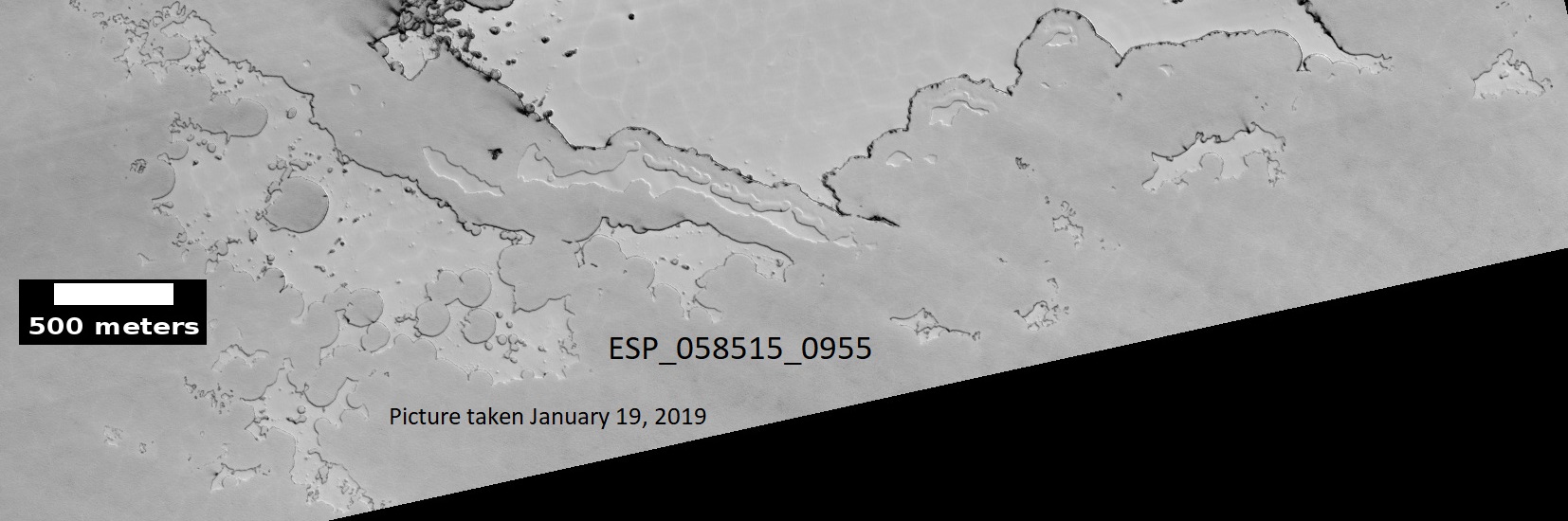
| 16:17, 5 January 2020 | ESP 058515 0955southpole2.jpg (file) |  |
200 KB | Suitupandshowup | South pole swiss chees terrain, picture taken January 19, 2019. Source: http://hirise.lpl.arizona.edu/ESP_058515_0955 Image Credit: NASA/JPL/University of Arizona/ | 1 |
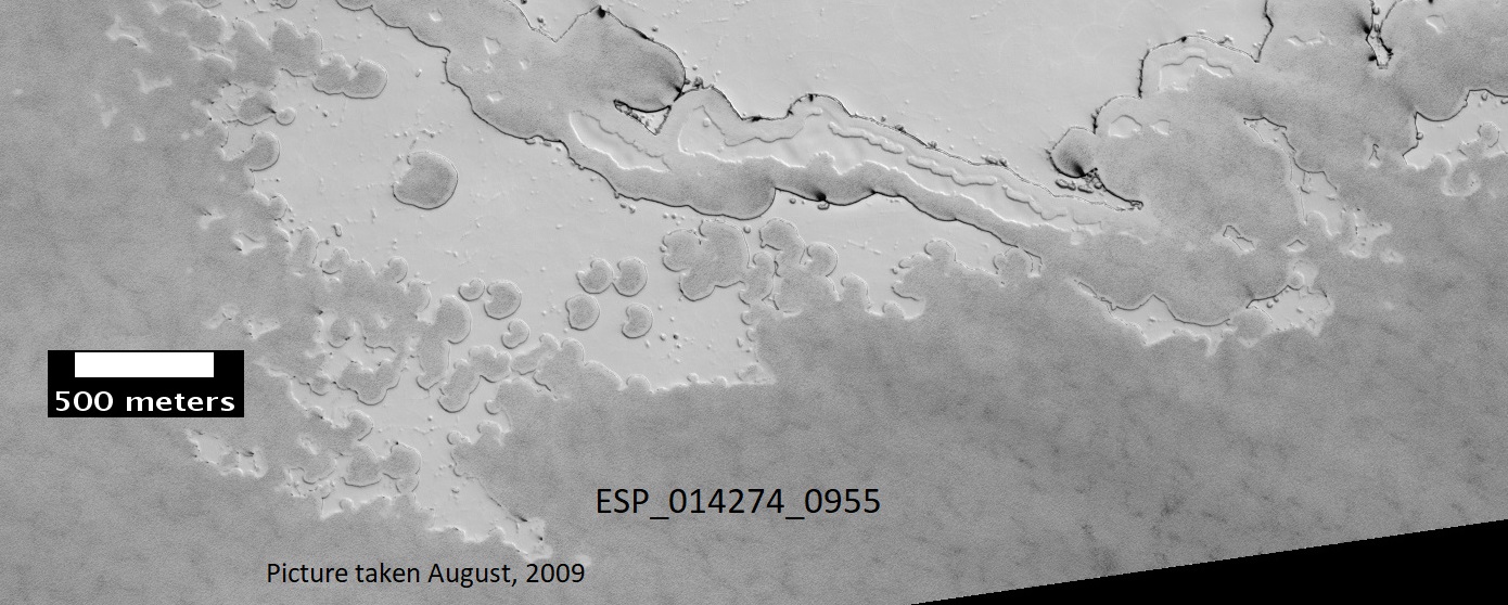
| 16:15, 5 January 2020 | ESP 014274 0955southpole3.jpg (file) |  |
273 KB | Suitupandshowup | South pole swiss chees terrain, picture taken August, 2009. Source: http://hirise.lpl.arizona.edu/ESP_014274_0955 Image Credit: NASA/JPL/University of Arizona/ | 1 |
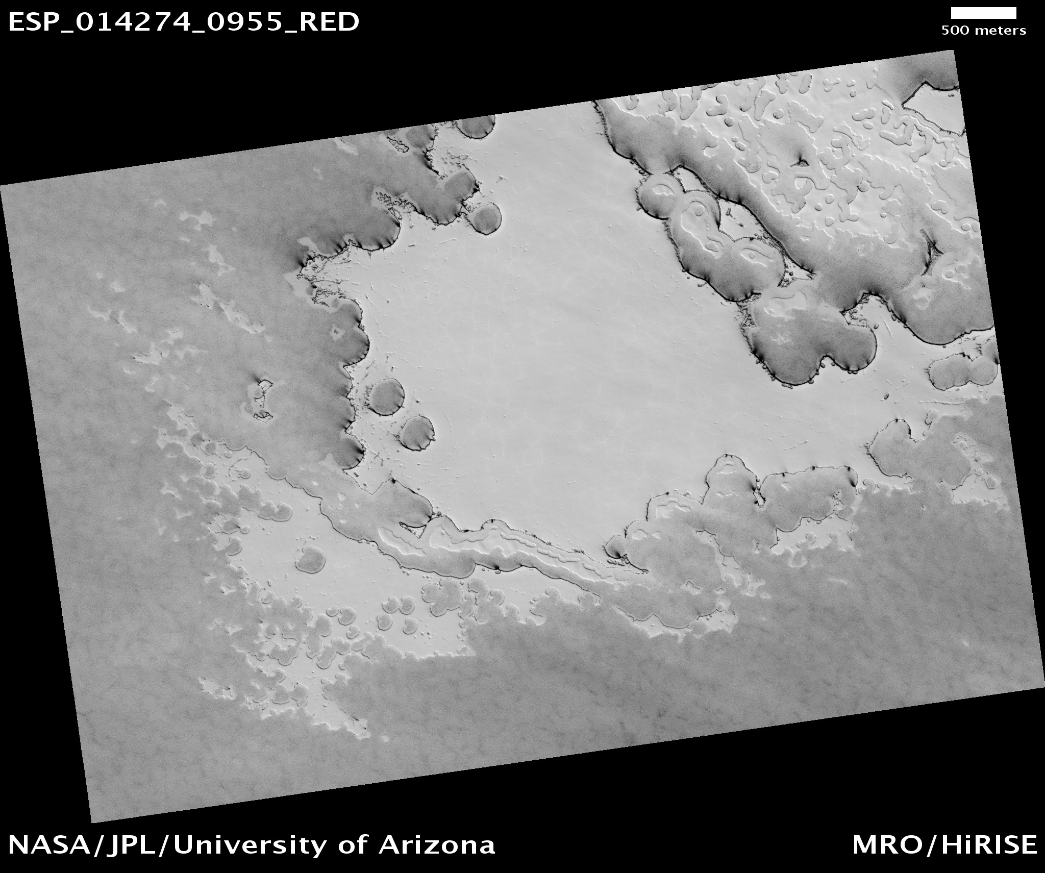
| 16:13, 5 January 2020 | ESP 014274 0955southpole.jpg (file) |  |
851 KB | Suitupandshowup | South pole swiss chees terrain, picture taken August, 2009. Source: http://hirise.lpl.arizona.edu/ESP_014274_0955 Image Credit: NASA/JPL/University of Arizona/ | 1 |
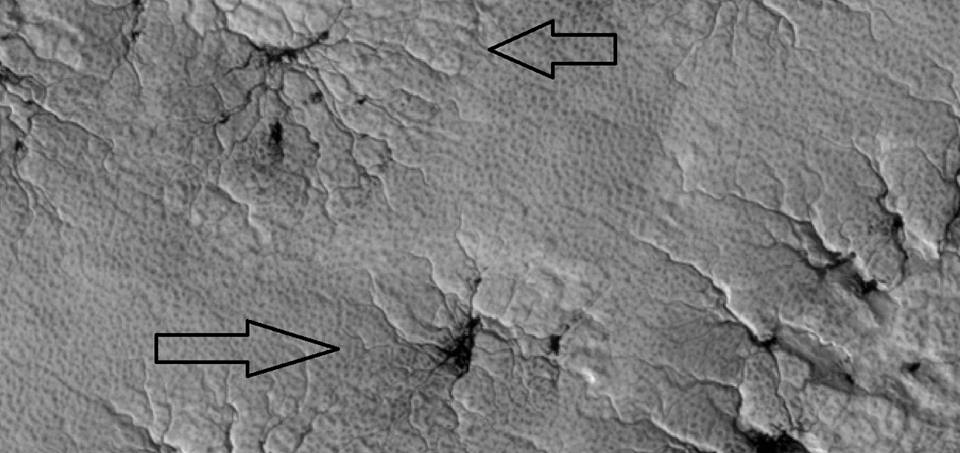
| 15:39, 5 January 2020 | Spidersmarspedia.jpg (file) |  |
63 KB | Suitupandshowup | Close view of spiders As the temperature goes up in the spring, dry ice changes to a gas. The gas becomes pressurized under a slab of transparent ice until it blows out through a weak spot. The gas carries dark dust; thus producing dark legs of the spi... | 1 |
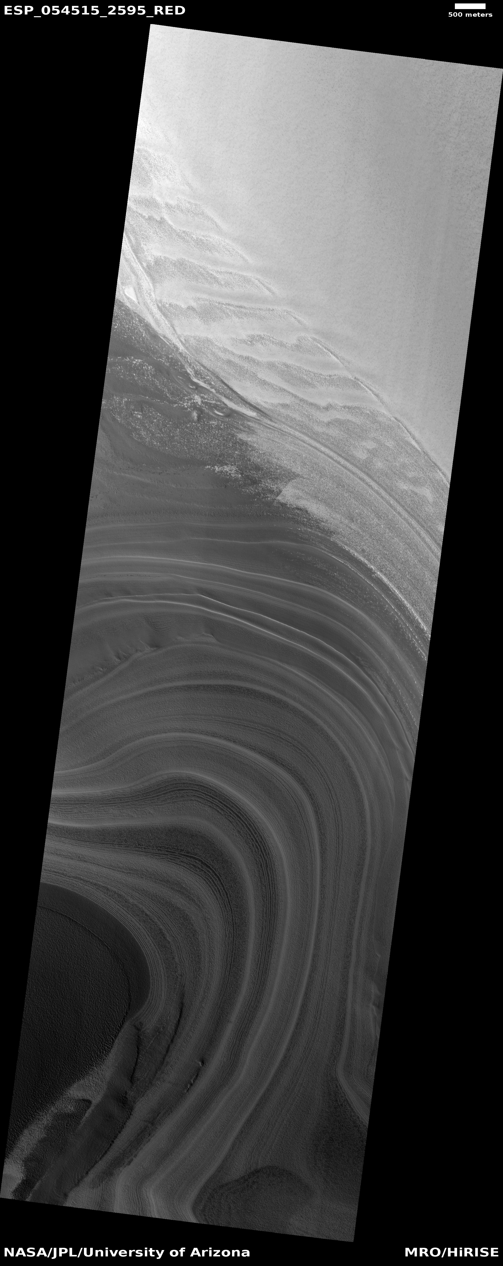
| 14:08, 5 January 2020 | ESP 054515 2595layersicecap.jpg (file) |  |
2.56 MB | Suitupandshowup | Ice cap layers These are layers exposed in the northern ice cap of Mars. Each layer represents a change in the climate. The climate of Mars goes through many major changes because it does not have a large moon to control its tilt. The tilt of a planet... | 1 |
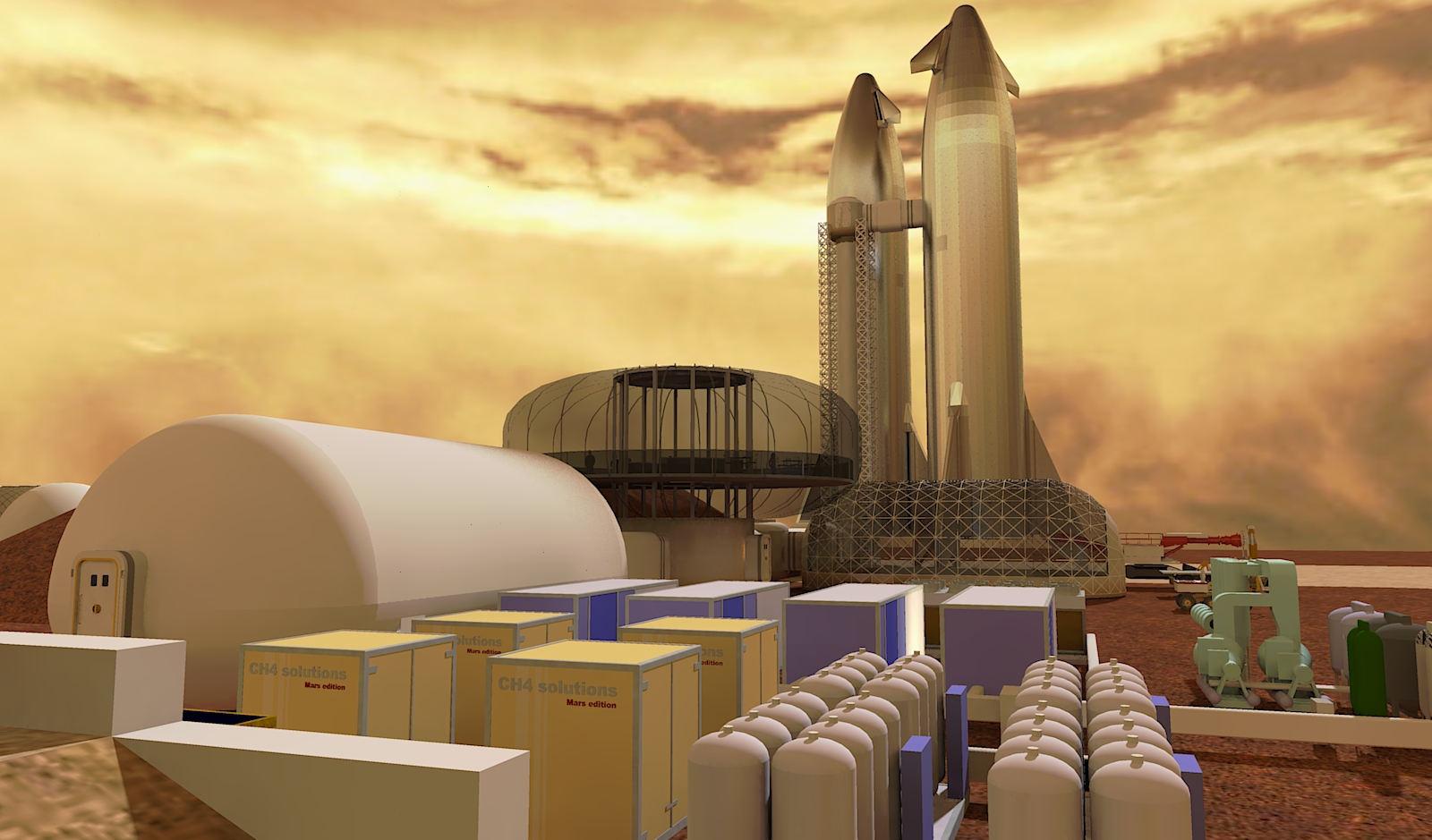
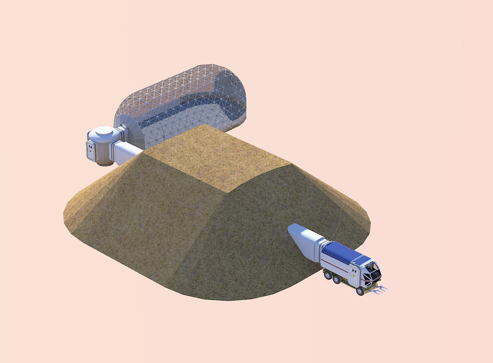
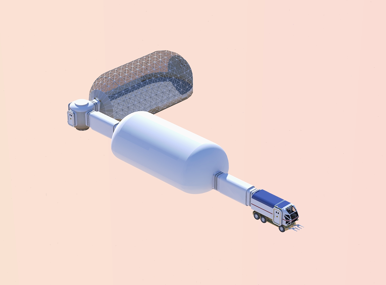
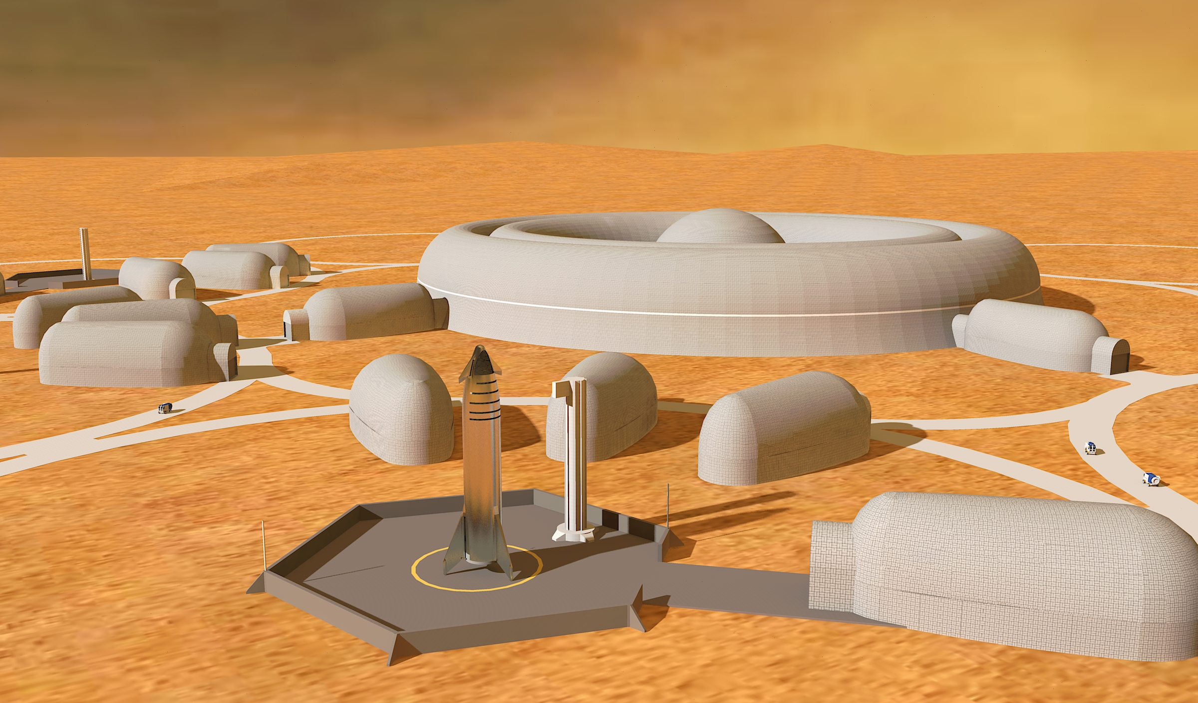
| 12:22, 22 December 2019 | Settlement phase 2 a.jpg (file) |  |
1.29 MB | Michel Lamontagne | 1 | |
| 12:19, 22 December 2019 | Settlement phase 2 Scene 8.jpg (file) |  |
680 KB | Michel Lamontagne | 1 | |
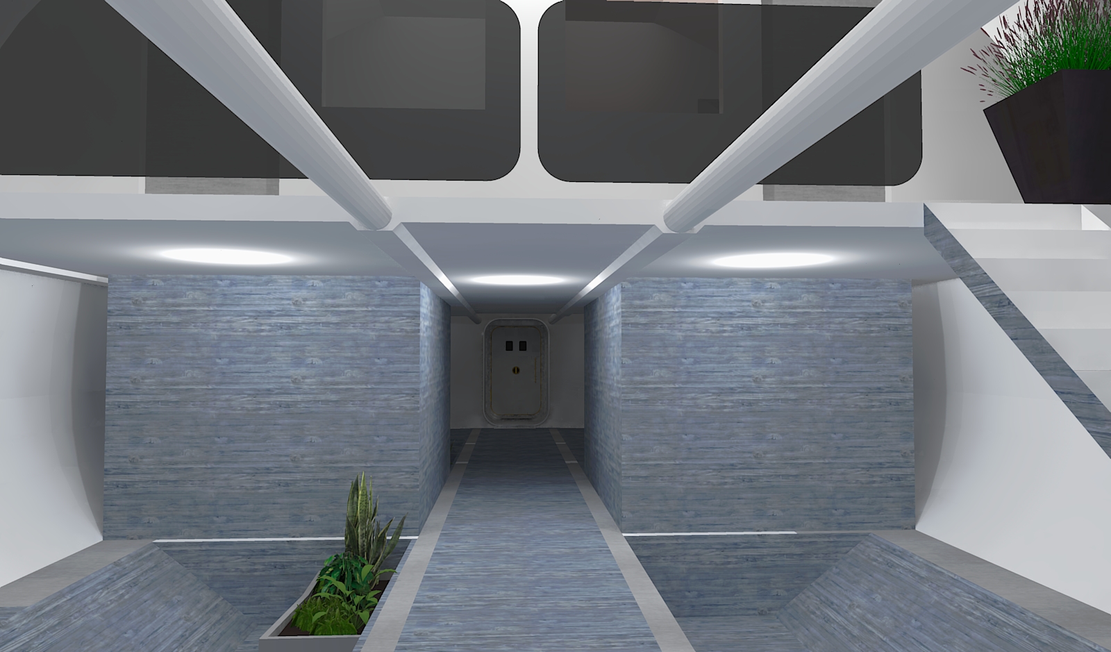
| 11:57, 22 December 2019 | Habitat2 c.jpg (file) |  |
646 KB | Michel Lamontagne | 1 | |
| 11:57, 22 December 2019 | Habitat2 b.jpg (file) |  |
586 KB | Michel Lamontagne | 1 | |
| 11:56, 22 December 2019 | Habitat2 Scene 3.jpg (file) |  |
538 KB | Michel Lamontagne | 1 | |
| 11:56, 22 December 2019 | Habitat2.jpg (file) |  |
498 KB | Michel Lamontagne | 1 | |
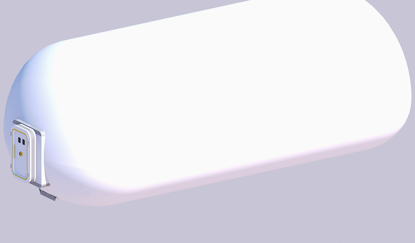
| 11:55, 22 December 2019 | Habitat1.jpg (file) |  |
243 KB | Michel Lamontagne | 1 | |
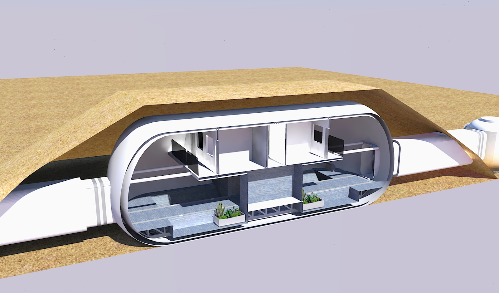
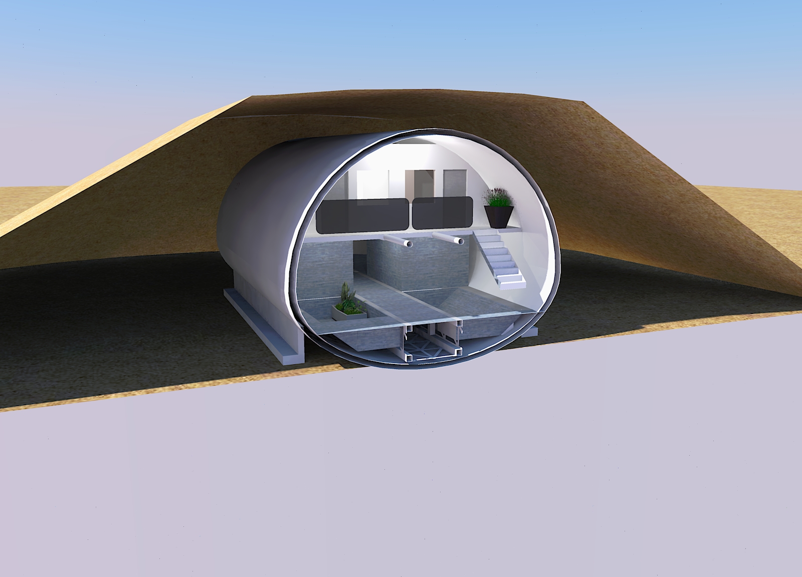
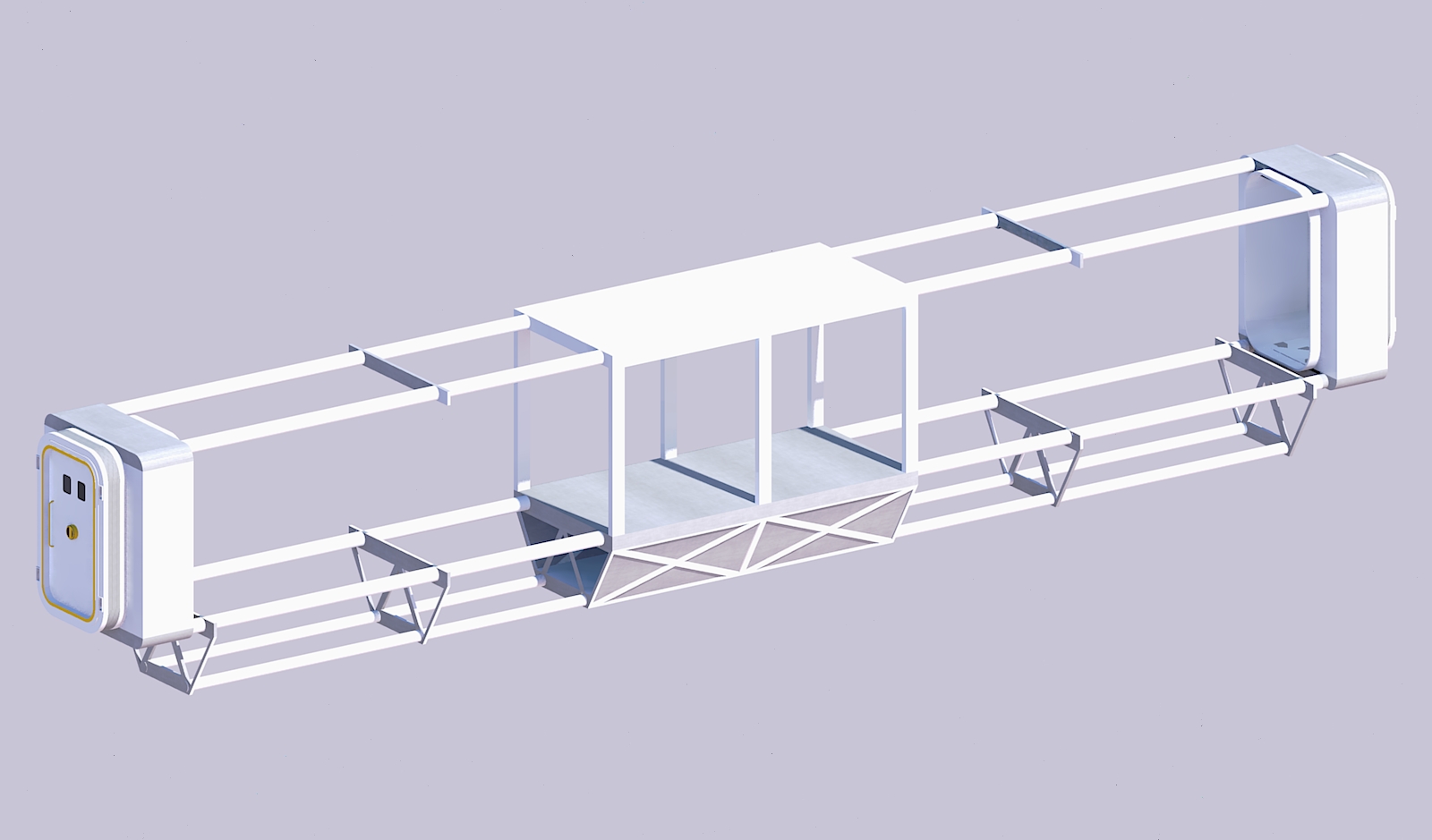
| 11:55, 22 December 2019 | Habitat2 packed 5.jpg (file) |  |
253 KB | Michel Lamontagne | 1 | |
| 11:54, 22 December 2019 | Habitat2 packed 4.jpg (file) |  |
111 KB | Michel Lamontagne | 1 | |
| 11:54, 22 December 2019 | Habitat2 packed 3.jpg (file) |  |
231 KB | Michel Lamontagne | 1 | |
| 11:53, 22 December 2019 | Habitat2 packed 2.jpg (file) |  |
180 KB | Michel Lamontagne | 1 | |
| 11:53, 22 December 2019 | Habitat2 packed 1.jpg (file) |  |
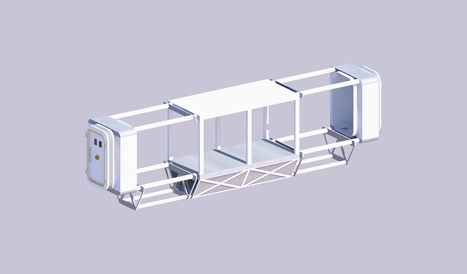
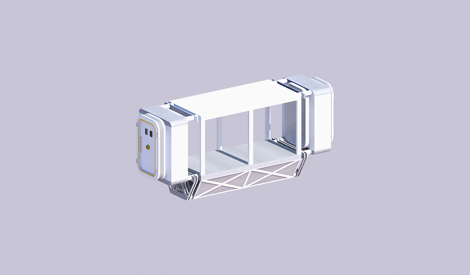
139 KB | Michel Lamontagne | Structure of an inflatable habitat | 1 |
| 18:49, 21 December 2019 | Icedome gardens.jpg (file) |  |
1.53 MB | Michel Lamontagne | 1 | |
| 18:07, 21 December 2019 | Icedome Scene 6.jpg (file) |  |
1.74 MB | Michel Lamontagne | 1 | |
| 18:12, 19 December 2019 | Vladimir Pletser.jpg (file) |  |
20 KB | Sdubois | 1 | |
| 18:12, 19 December 2019 | DavidReal.jpg (file) |  |
12 KB | Sdubois | 1 | |
| 18:11, 19 December 2019 | AndreaFori.jpg (file) |  |
14 KB | Sdubois | 1 | |
| 18:11, 19 December 2019 | NancyWood.jpg (file) |  |
17 KB | Sdubois | 1 | |
| 18:10, 19 December 2019 | JanOsburg.jpg (file) |  |
9 KB | Sdubois | 1 | |
| 18:10, 19 December 2019 | BillClancey.jpg (file) |  |
13 KB | Sdubois | 1 | |
| 18:08, 19 December 2019 | Crew5MissionPatch.jpg (file) |  |
16 KB | Sdubois | 1 | |
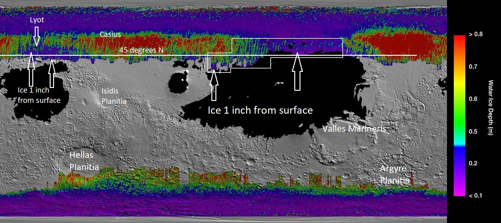
| 13:01, 19 December 2019 | Icemaplargelabeled454arrows.jpg (file) |  |
552 KB | Suitupandshowup | Map that shows location of near surface ice based on data from Mars Climate sounder onboard the Mars Reconnaissance Orbiter and the Thermal Emission Imaging System (onboard the Mars Odyssey Orbiter). Image Credit: NASA/JPL/-Caltech/ASU/Secosky | 1 |
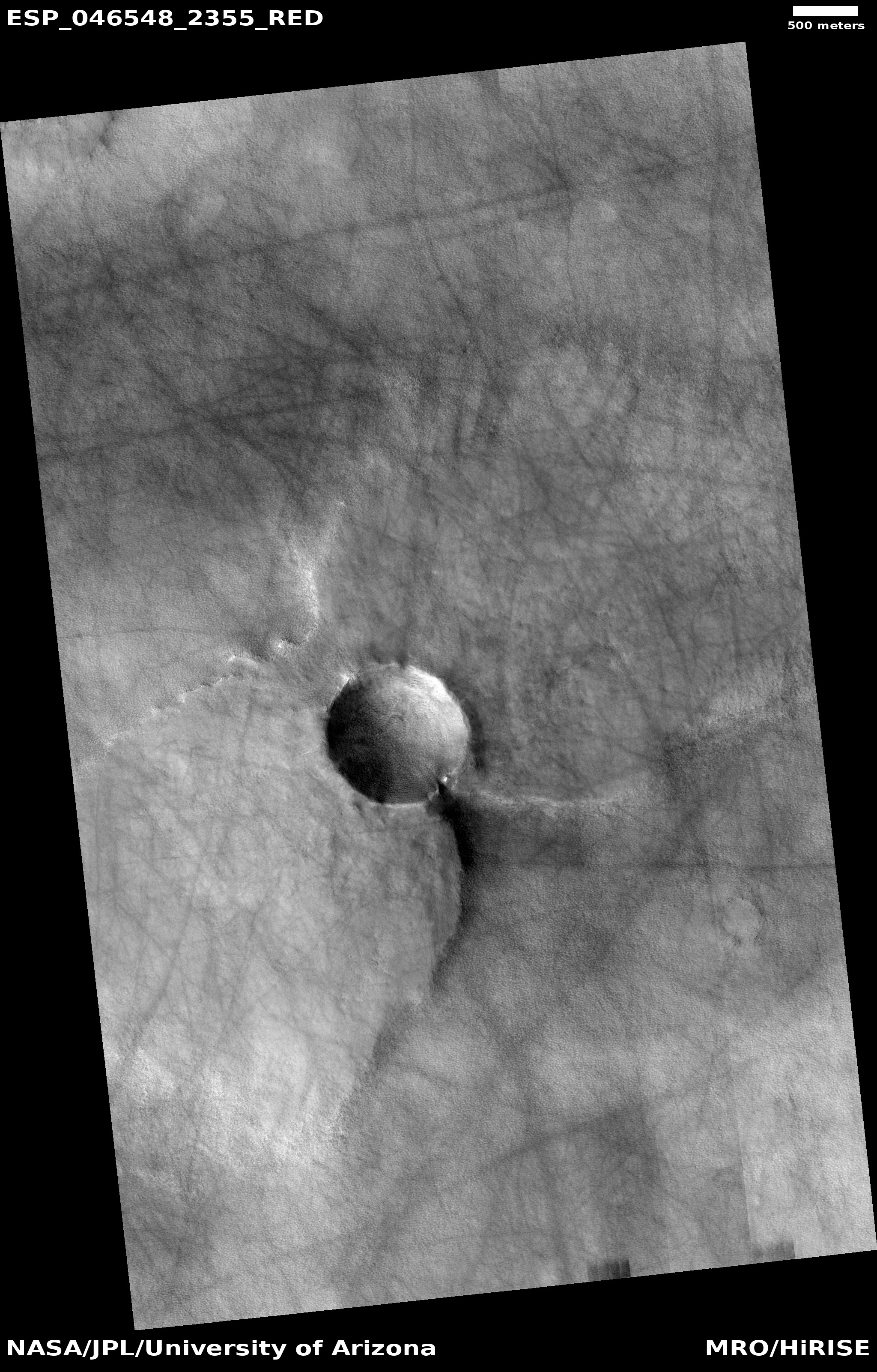
| 17:15, 16 December 2019 | ESP 046548 2355pedestalbutterfly.jpg (file) |  |
1.88 MB | Suitupandshowup | Pedestal crater with a butterfly shape, as seen by HiRISE under HiWish program Source: http://hirise.lpl.arizona.edu/ESP_046548_2355 Image credit: NASA/JPL/University of Arizona | 1 |
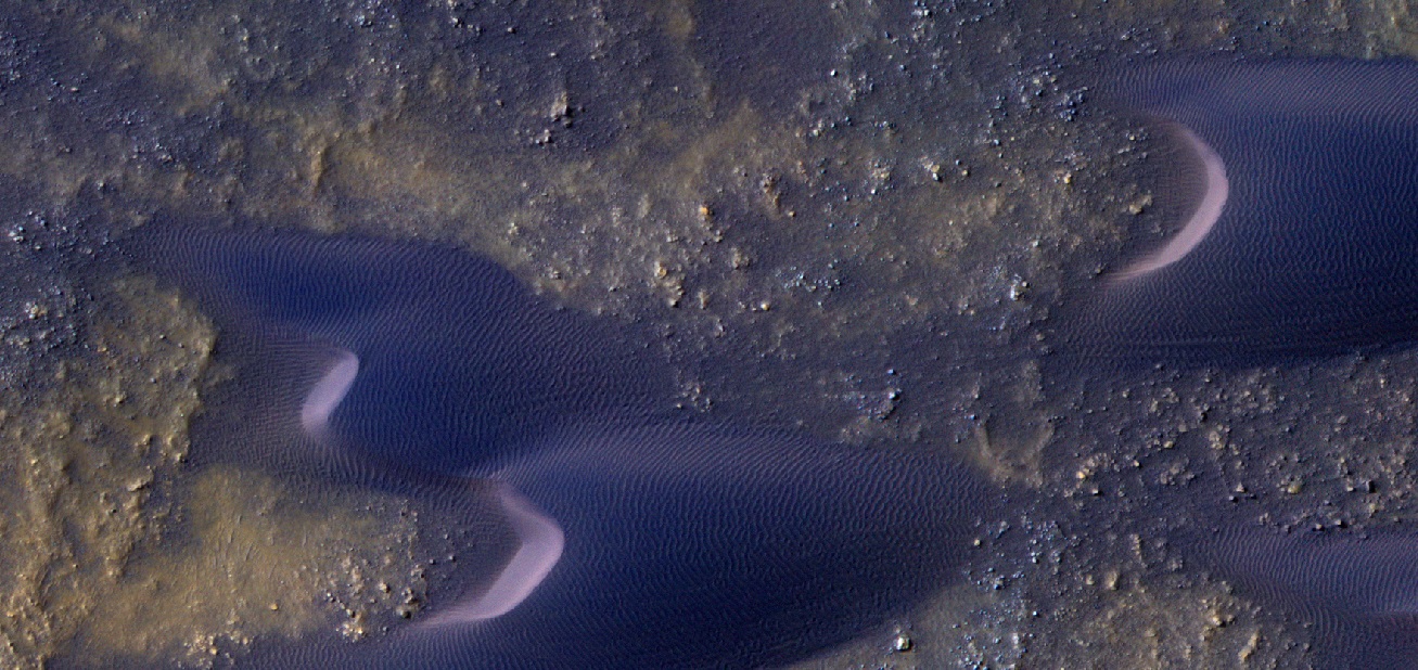
| 17:07, 16 December 2019 | 46378 1415dunesirb2.jpg (file) |  |
348 KB | Suitupandshowup | Close view of Dunes, as seen by HiRISE under HiWish program Color is displayed as IRB. Source: http://hirise.lpl.arizona.edu/ESP_046378_1415dunefield.jpg Image credit: NASA/JPL/University of Arizona | 1 |
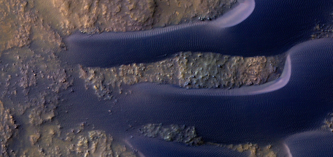
| 17:06, 16 December 2019 | 46378 1415dunesirb.jpg (file) |  |
369 KB | Suitupandshowup | Close view of Dunes, as seen by HiRISE under HiWish program Color is processed as IRB. Source: http://hirise.lpl.arizona.edu/ESP_046378_1415dunefield.jpg Image credit: NASA/JPL/University of Arizona | 1 |
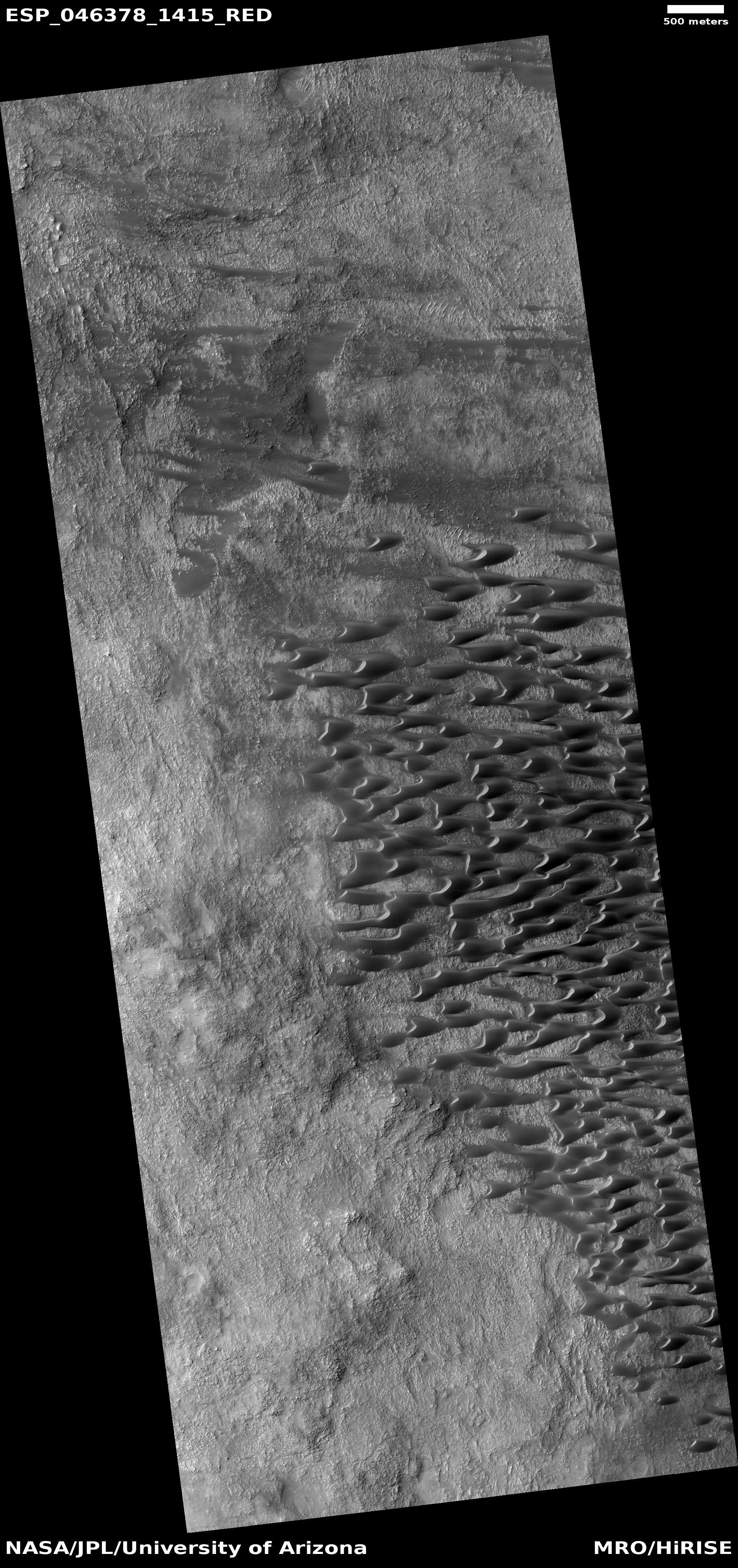
| 17:04, 16 December 2019 | ESP 046378 1415dunefield.jpg (file) |  |
2.66 MB | Suitupandshowup | Dune field, as seen by HiRISE under HiWish program Source: http://hirise.lpl.arizona.edu/ESP_046378_1415dunefield.jpg Image credit: NASA/JPL/University of Arizona | 1 |
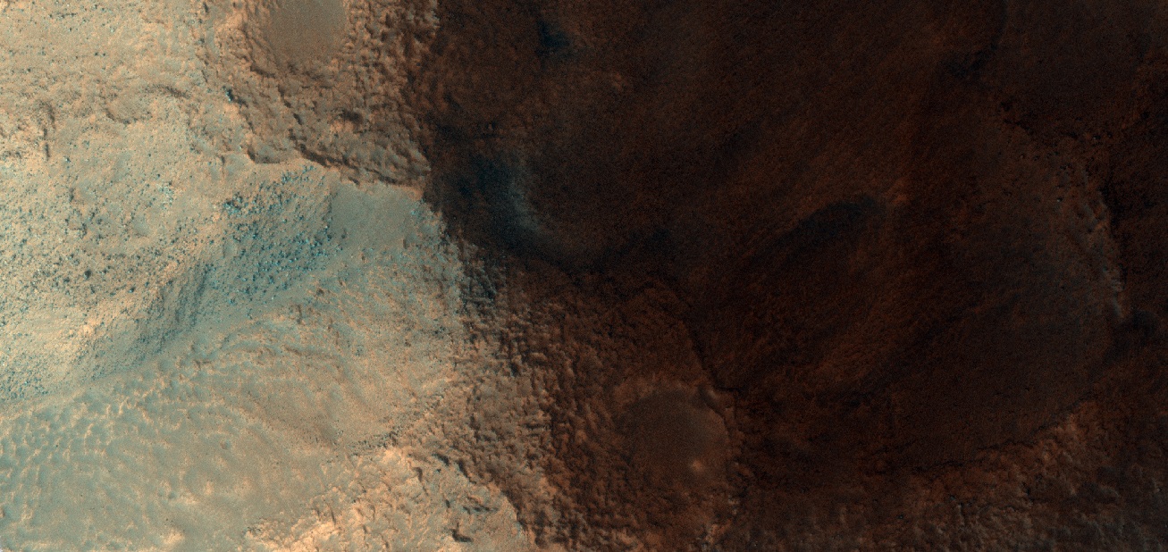
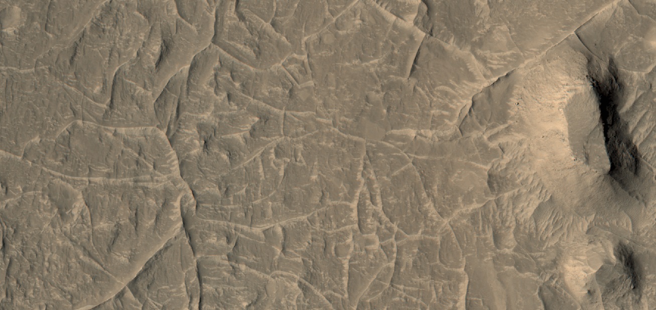
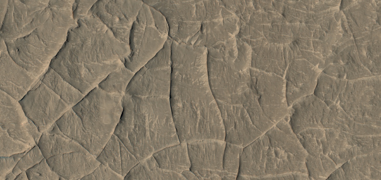
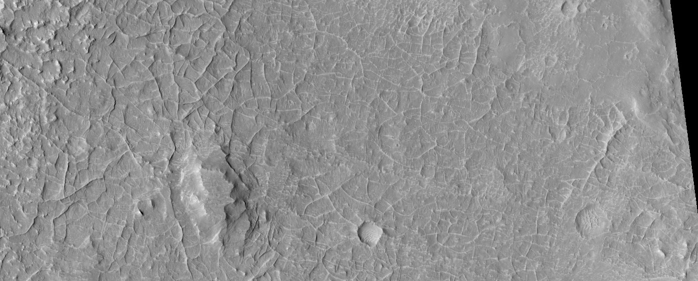
| 16:51, 16 December 2019 | 46269 1770ridgesmesa.jpg (file) |  |
257 KB | Suitupandshowup | Ridge network, as seen by HiRISE under HiWish program Note that ridges are under the mesa; hence they formed before the mesa. Source: https://hirise.lpl.arizona.edu/ESP_46269_1770 Image credit: NASA/JPL/University of Arizona/Secosky | 1 |
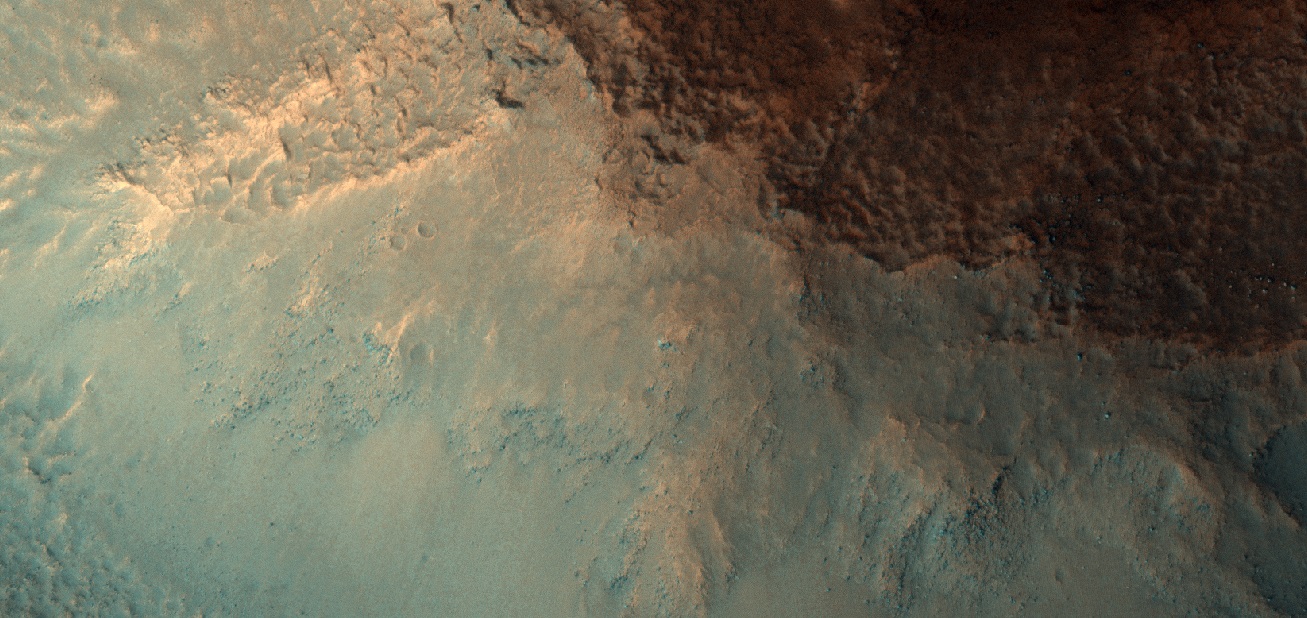
| 16:50, 16 December 2019 | 46269 1770ridges2.jpg (file) |  |
263 KB | Suitupandshowup | Ridge network, as seen by HiRISE under HiWish program Source: https://hirise.lpl.arizona.edu/ESP_46269_1770 Image credit: NASA/JPL/University of Arizona/Secosky | 1 |
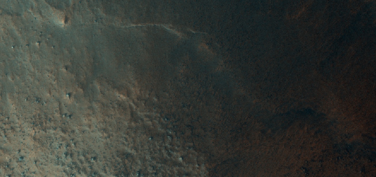
| 16:45, 16 December 2019 | ESP 046269 1770ridegenetworkmiddle.jpg (file) |  |
291 KB | Suitupandshowup | Ridge network, as seen by HiRISE under the HiWish program Source: http://hirise,lpl.ariaona.edu/ESP_046269_1770 Image credit: NASA/JPL/University of Arizona/Secosky | 1 |


