File list
This special page shows all uploaded files.
| Date | Name | Thumbnail | Size | User | Description | Versions |
|---|---|---|---|---|---|---|
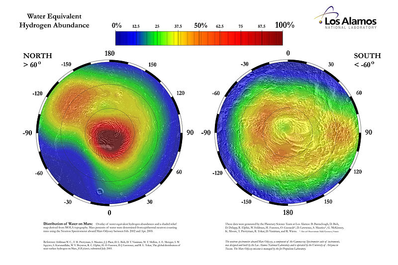
| 07:57, 31 October 2018 | Water equivalent hydrogen abundance in the high latitudes of Mars.jpg (file) |  |
94 KB | Suitupandshowup | This map displays the proportion of water ice present in the upper meter of the Martian surface within 30 degrees of the poles. The percentages are derived through stochiometric calculations based on epithermal neutron fluxes. These fluxes were detecte... | 1 |
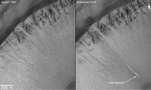
| 22:02, 24 November 2007 | Water deposit.jpg (file) |  |
30 KB | Ioneill | :Source: http://mars.jpl.nasa.gov/mgs/newsroom/20061206a.html :Credit: NASA/JPL ===Image description=== (Text taken directly from source) This set of images shows a comparison of the gully site as it appeared on Dec. 22, 2001 (left), with a mosaic of tw | 1 |
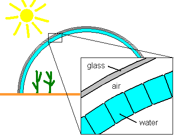
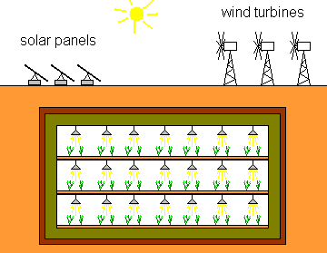
| 06:11, 12 December 2007 | WaterShieldGreenhouse.png (file) |  |
6 KB | Rfc | schematic of a water-shield greenhouse concept | 1 |
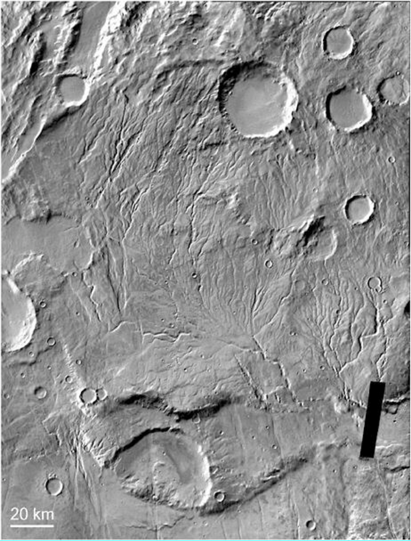
| 15:16, 21 April 2023 | Warrego-Valles-system-located-at-422S-930W-The-drainage-density-of-this-Noachian.png (file) |  |
663 KB | Suitupshowup | https://www.researchgate.net/figure/Warrego-Valles-system-located-at-422S-930W-The-drainage-density-of-this-Noachian_fig2_325009314 | 1 |
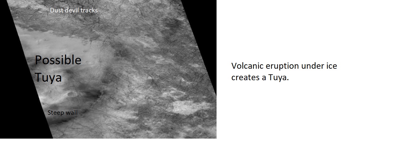
| 07:56, 7 May 2018 | Volcanounderice.jpg (file) |  |
124 KB | Suitupandshowup | Labeled picture of a possible Tuya (volcano that erupted under ice), as seen by CTX Author: Jim Secosky modified CTX image Image credit:NASA/MSSS/Secosky Source: http://viewer.mars.asu.edu/planetview/inst/ctx/J11_049043_1156_XN_64S355W#P=J11_049043_1... | 1 |
| 05:59, 10 December 2007 | VolcanicCaveSettlement.gif (file) |  |
5 KB | Rfc | Schematic of a Volcanic Cave Settlement | 3 |
| 15:44, 20 December 2018 | Voids on bedrock on Mars.jpg (file) |  |
61 KB | Suitupandshowup | Voids in rock Large crystals formed and then they dissolved away and left voids of where they were. Source: https://mars.jpl.nasa.gov/mer/gallery/press/opportunity/20040302a.html Image Credit: NASA/JPL/US Geological Survey | 1 |
| 11:05, 30 October 2018 | Vo1 084a47viking1.gif (file) |  |
94 KB | Suitupandshowup | 2 | |
| 18:12, 19 December 2019 | Vladimir Pletser.jpg (file) |  |
20 KB | Sdubois | 1 | |
| 22:44, 9 February 2020 | VladimirPletser.jpg (file) |  |
15 KB | Sdubois | 1 | |
| 17:37, 14 December 2018 | Vikinglander2-1viking2.jpg (file) |  |
844 KB | Suitupandshowup | View of surface around Viking 2 Source: https://nssdc.gsfc.nasa.gov/image/planetary/mars/vikinglander2-1.jpg Image Credit: NASA/GSFC/NSSDC | 1 |
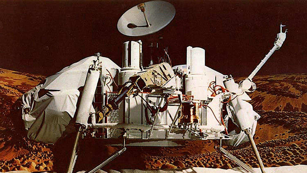
| 15:59, 14 December 2018 | Viking orbiter.jpg (file) |  |
15 KB | Suitupandshowup | Viking as it traveled to Mars with orbiter at the top and lander inside the egg-shaped aeoshell at the bottom. Source: https://nssdc.gsfc.nasa.gov/photo_gallery/photogallery-spacecraft.html#viking Image credit: NASA | 1 |
| 21:12, 7 October 2007 | Viking hirise.jpg (file) |  |
107 KB | Ioneill | The Viking 1 lander site in western Chryse Planitia (also known as the Thomas Mutch Memorial Station) as viewed by the Mars Reconnaissance Orbiter (HiRISE instrument). Image captured December 2006. :Image credit: NASA/JPL :I | 1 |
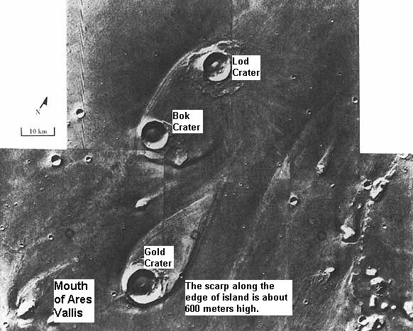
| 14:29, 3 November 2018 | Viking Teardrop Islands.jpg (file) |  |
62 KB | Suitupandshowup | Teardrop shaped islands, as seen by Viking 1. Location is 21 N and 31 W. These were shaped by floods. Source http://history.nasa.gov/SP-441/ch4.htm Image credit: NASA/Secosky | 1 |
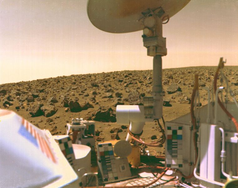
| 07:35, 29 March 2018 | Viking2lander1.jpg (file) |  |
66 KB | Suitupandshowup | A boulder-strewn field of red rocks stretches across the horizon in this self-portrait of Viking 2 on Mars' Utopian Plain. Fine particles of red dust have settled on spacecraft's surfaces. The same dust is responsible for Mars' salmon-colored sky as th... | 1 |
| 18:44, 14 December 2018 | Vikikinglander2.jpg (file) |  |
492 KB | Suitupandshowup | Viking lander Source: https://www.jpl.nasa.gov/missions/web/viking.jpg Image credit: NASA/JPL | 1 |
| 16:45, 12 November 2017 | Verboten.svg (file) |  |
5 KB | Strangelv | 1 | |
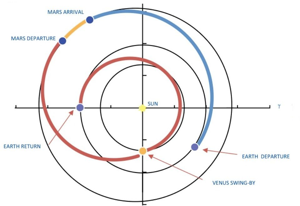
| 15:33, 5 July 2019 | Venusflyby.png (file) |  |
335 KB | Sdubois | Modified from original image at https://marspedia.org/File:Conjunction_and_opposition_trajectory.jpg | 1 |
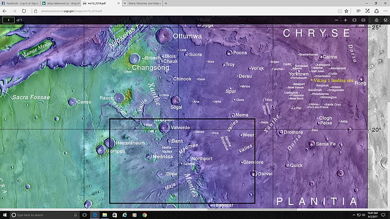
| 10:20, 23 January 2019 | Vallesmaumeevedraboxmap.jpg (file) |  |
132 KB | Suitupandshowup | Map showing location of several valleys in Lunae Palus quadrangle Some are inside of a box Date 3 September 2017 Source https://planetarynames.wr.usgs.gov/Feature/6340 Image credit: NASA/Goddard/ASU/USGS/Secosky | 1 |
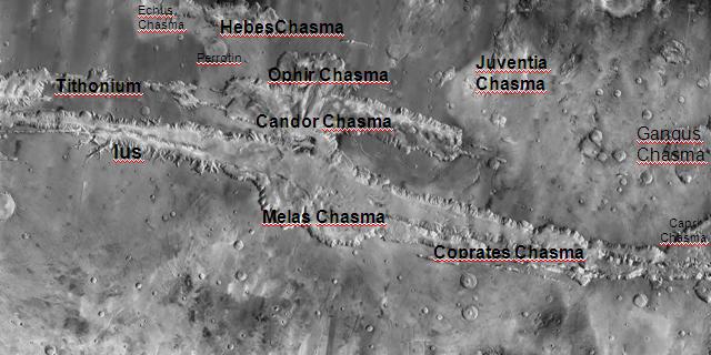
| 16:21, 7 February 2018 | Valles Marinerislabeled.jpg (file) |  |
46 KB | Suitupandshowup | Picture of Valles Marineris with various parts labeled. Image was taken with the Mars Odyssey's THEMIS. The picture credit is NASA/JPL/ASU Source: http://themis.asu.edu/zoom-20041008a | 1 |
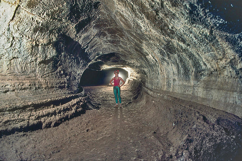
| 06:19, 28 April 2018 | Valentine Cave.JPG (file) |  |
185 KB | Suitupandshowup | Valentine Cave, a lava tube at Lava Beds National Monument, California, USA Source: Dave Bunnell / Under Earth Images https://commons.wikimedia.org/wiki/File:Valentine_Cave.JPG | 1 |
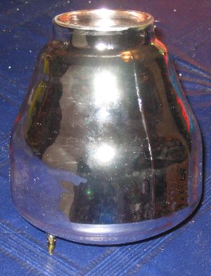
| 06:52, 3 July 2013 | Vacuum flask.jpg (file) |  |
32 KB | Rfc | The glass body of a vacuum flask. Source: User:Rfc has created this photograph. category:images | 1 |
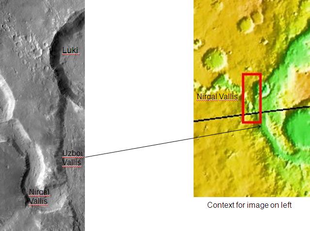
| 19:24, 28 January 2019 | Uzboi Vallis.JPG (file) |  |
40 KB | Suitupandshowup | Uzboi Vallis. Location is 29.7 degrees south latitude and 322.1 degrees east longitude. Picture taken with Mars Odyssey's THEMIS. Photo credit NASA/JPL/ASU. Source http:themis.asu.edu/zoom-20020409a NASA/JPL/University of Arizona | 1 |
| 12:33, 9 September 2009 | UnmannedSetup.png (file) |  |
10 KB | Rfc | Remote controlled machinery does construction work. :Source: User:Rfc has painted this image. category:images | 1 |
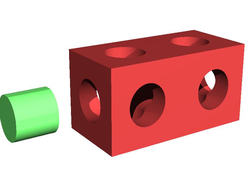
| 13:42, 28 October 2008 | UniversalBricks03.jpg (file) |  |
24 KB | Rfc | ten-hole-cube with pin Source: User:Rfc has created this image. Tool: POV-Ray Version 1.0 Scene code: #include "colors.inc" // Standard colors library #include "shapes.inc" // Commonly used object shapes #include "textures | 1 |
| 13:34, 16 October 2008 | UniversalBricks02.jpg (file) |  |
96 KB | Rfc | Wall made from universal bricks. Source: User:Rfc has painted this image. Tool: POV-Ray Version 1.0 Scene: #include "colors.inc" // Standard colors library #include "shapes.inc" // Commonly used object shapes #include "textures. | 1 |
| 14:11, 17 October 2008 | UniversalBricks01.jpg (file) |  |
39 KB | Rfc | sectional view of the connection principle of a six-hole-cube with pins Source: User:Rfc has created this image. Tool: POV-Ray Version 1.0 Scene code: #include "colors.inc" // Standard colors library #include "shapes.inc" / | 1 |
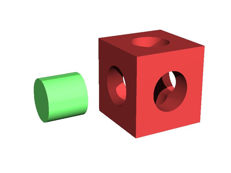
| 14:06, 17 October 2008 | UniversalBricks00.jpg (file) |  |
21 KB | Rfc | six-hole-cube with pin Source: User:Rfc has created this image. Tool: POV-Ray Version 1.0 Scene code: #include "colors.inc" // Standard colors library #include "shapes.inc" // Commonly used object shapes #include "textures | 1 |
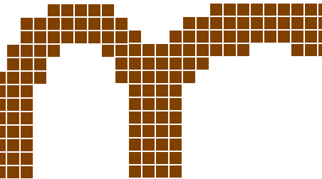
| 13:03, 5 October 2008 | UniversalBricks.gif (file) |  |
3 KB | Rfc | Example for an arch, made by universal bricks. Source: User:Rfc has painted this image. category:images | 1 |
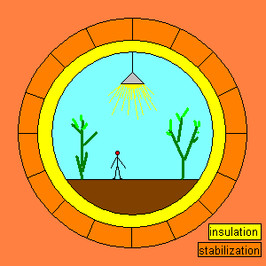
| 02:47, 18 December 2007 | Underground Greenhouse.png (file) |  |
4 KB | Rfc | Schematic of the underground greenhouse concept. :Source: User:Rfc has painted this image. category:images | 1 |
| 16:47, 12 November 2017 | Unbalanced scales.png (file) |  |
7 KB | Strangelv | 1 | |
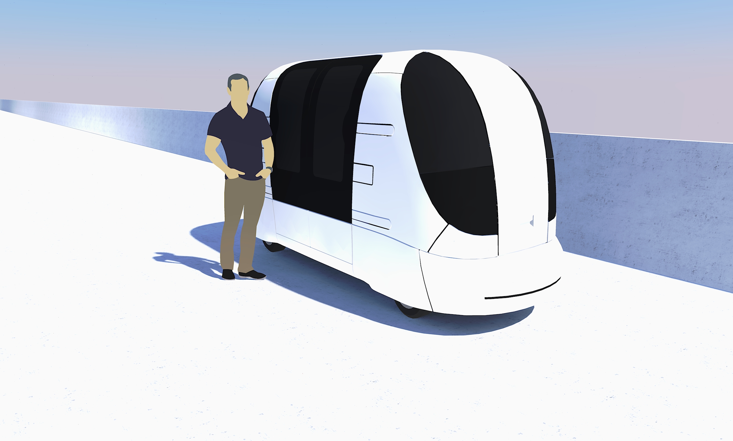
| 15:28, 20 September 2019 | Ultrapod.jpg (file) |  |
743 KB | Michel Lamontagne | 1 | |
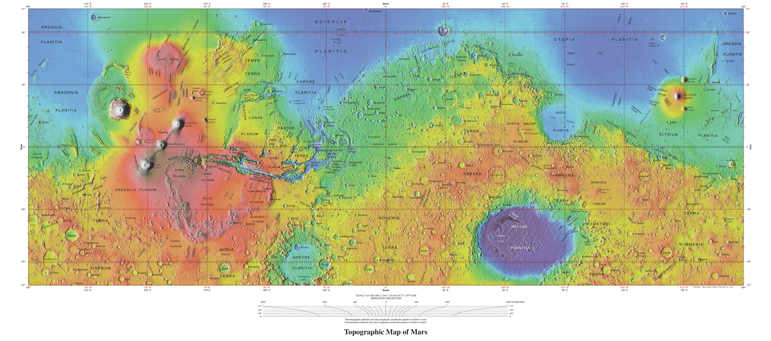
| 13:33, 7 January 2020 | USGS-PlanetMars-TopographicalMap.png (file) |  |
7.21 MB | Michel Lamontagne | 2 | |
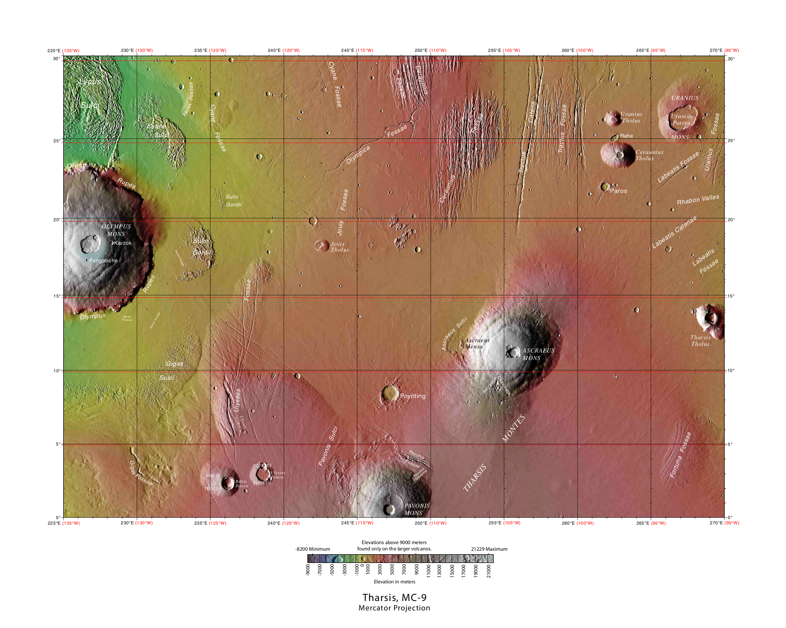
| 07:35, 25 April 2018 | USGS-Mars-MC-9-TharsisRegion-mola.png (file) |  |
4.51 MB | Suitupandshowup | Topographic map of Tharsis quadrangle showing many of the volcanoes of Tharsis Source: https://planetarynames.wr.usgs.gov/Page/Images Image credit: NASA/USGS/USGS Astrogeology Center | 1 |
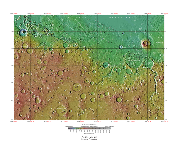
| 08:58, 26 January 2019 | USGS-Mars-MC-23-AeolisRegion-mola.png (file) |  |
664 KB | Suitupandshowup | MOLA Topographic Map of Aeolis Quadrangle (MC-23) on the planet Mars. NOTE: Converted the original PDF file to a PNG File (via GIMP v2.8.4 program) - and uploaded to Wikimedia Commons. Date 04/03/2013 11:52:31 AM Source http://planetarynames.wr.usgs.g... | 1 |
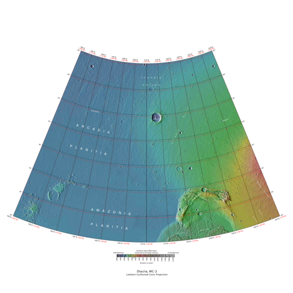
| 07:35, 22 January 2019 | USGS-Mars-MC-2-DiacriaRegion-mola.png (file) |  |
302 KB | Suitupandshowup | MOLA Topographic Map of Diacria Quadrangle (MC-2) on the planet Mars. NOTE: Converted the original PDF file to a PNG File (via GIMP v2.8.4 program) - and uploaded to Wikimedia Commons. Source http://planetarynames.wr.usgs.gov/images/mc2_mola.pdf Ima... | 1 |
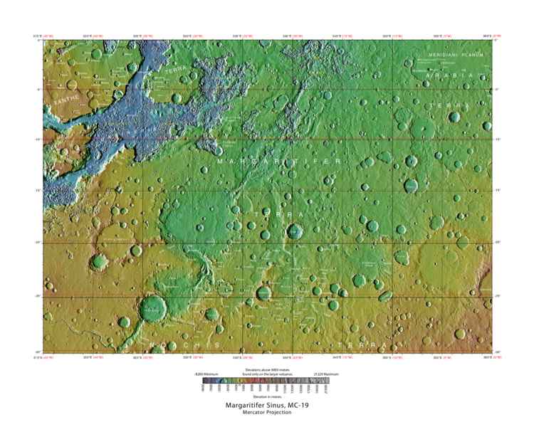
| 12:27, 29 January 2019 | USGS-Mars-MC-19-MargartiferSinusRegion-mola.png (file) |  |
719 KB | Suitupandshowup | MOLA Topographic Map of Margartifer Sinus Quadrangle (MC-19) on the planet Mars. NOTE: Converted the original PDF file to a PNG File (via GIMP v2.8.4 program) - and uploaded to Wikimedia Commons. Source http://planetarynames.wr.usgs.gov/images/mc19_m... | 1 |
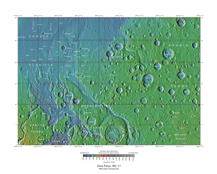
| 08:53, 27 September 2018 | USGS-Mars-MC-11-OxiaPalusRegion-mola.png (file) |  |
649 KB | Suitupandshowup | Labeled typo map of outflow channels in the Oxia Palus region Source: http://planetarynames.wr.usgs.gov/images/mc11_mola.pdf Image credit: USGS (United States Geological Survey) | 1 |
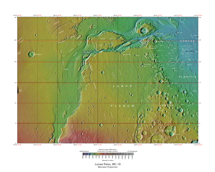
| 09:41, 23 January 2019 | USGS-Mars-MC-10-LunaePalusRegion-mola.png (file) |  |
542 KB | Suitupandshowup | MOLA Topographic Map of Lunae Palus Quadrangle (MC-10) on the planet Mars. NOTE: Converted the original PDF file to a PNG File (via GIMP v2.8.4 program) - and uploaded to Wikimedia Commons. https://commons.wikimedia.org/wiki/File:USGS-Mars-MC-10-Luna... | 1 |
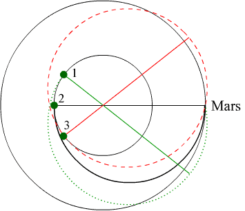
| 15:30, 5 July 2019 | TypeIandIItrajectories.png (file) |  |
11 KB | Sdubois | Retrieved from http://www.polaris.iastate.edu/EveningStar/Unit7/graphics/fig7-1.gif | 1 |
| 15:23, 5 July 2019 | TypeIandIItrajectories.gif (file) |  |
6 KB | Sdubois | Retrieved from http://www.polaris.iastate.edu/EveningStar/Unit7/graphics/fig7-1.gif | 1 |
| 12:45, 16 January 2009 | Tunnelgreenhouse.png (file) |  |
7 KB | Rfc | Sectional view of a tunnel, used as a greenhouse. :Source: User:Rfc has painted this image. category:images | 1 |
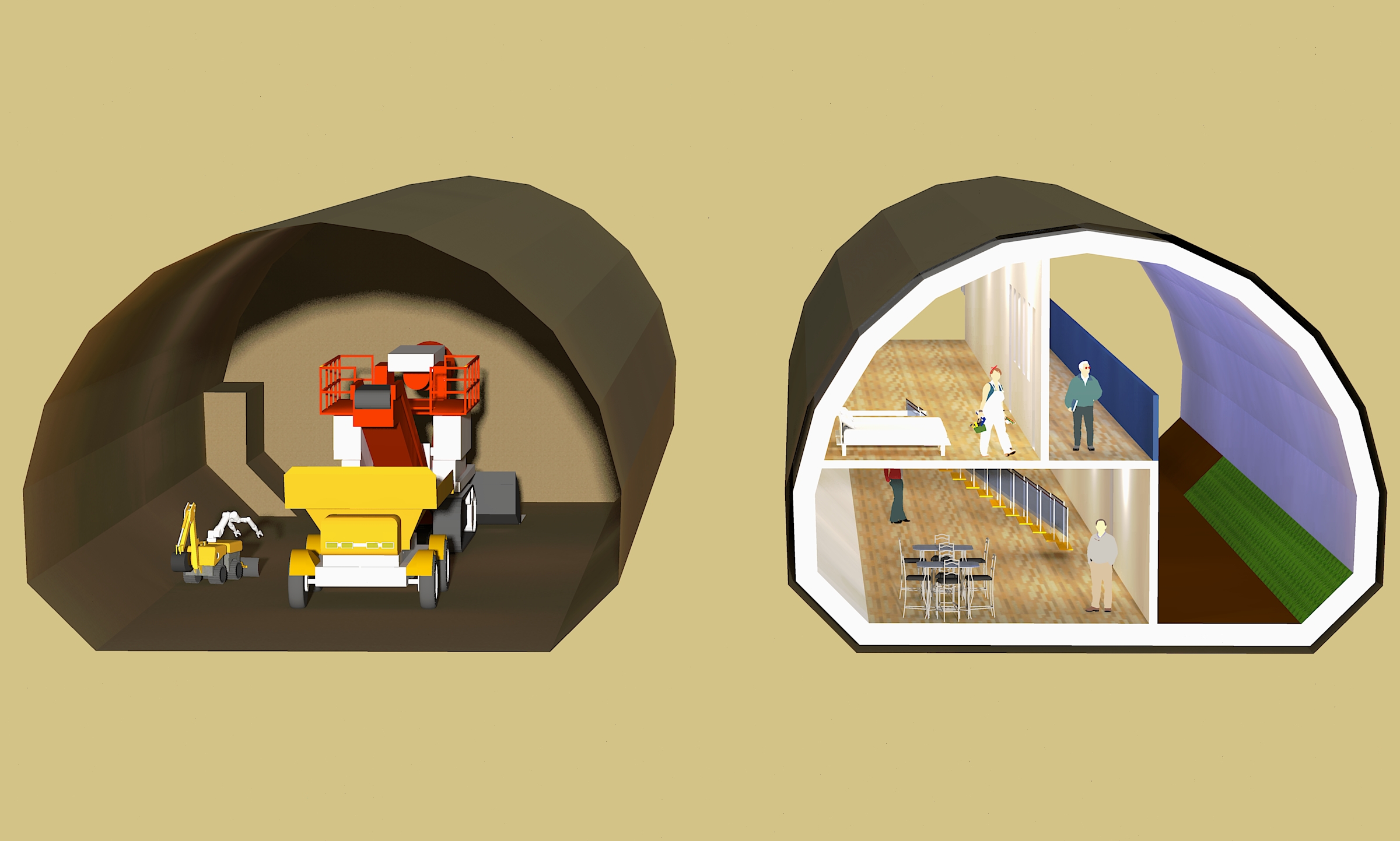
| 16:56, 9 April 2019 | Tunnel and digger.jpg (file) |  |
763 KB | Michel Lamontagne | 1 | |
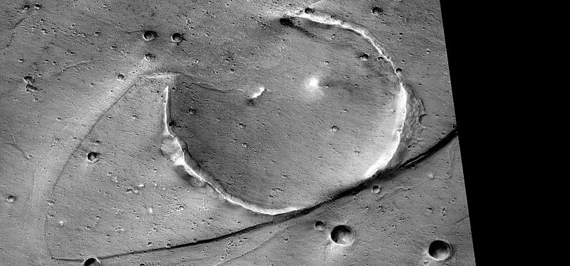
| 08:32, 27 September 2018 | Tsunamisstreamlinedp20008931.jpg (file) |  |
72 KB | Suitupandshowup | Streamlined form eroded on one side by tsunamis, as seen by CTX Image credit: NASA/Malin Space Science Systems/Secosky Image source: http://viewer.mars.asu.edu/planetview/inst/ctx/P20_008931_2108_XI_30N036W#P=P20_008931_2108_XI_30N036W&T=2 | 1 |
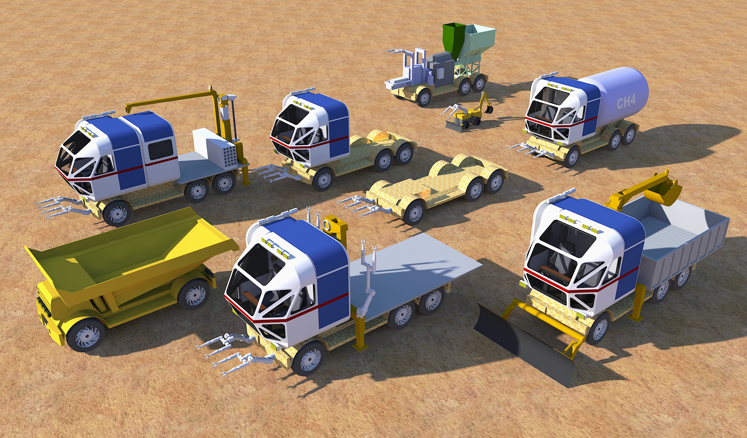
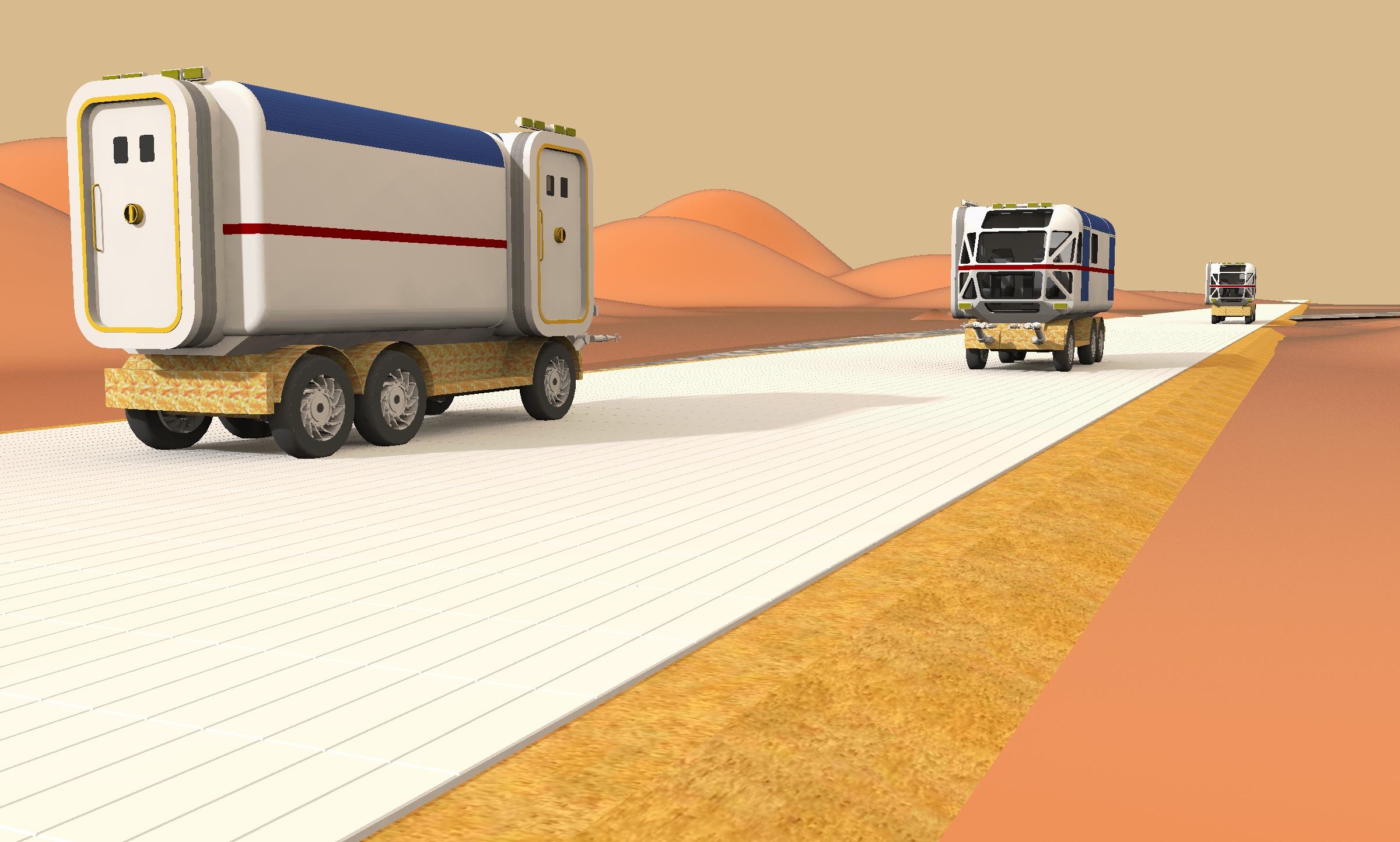
| 16:24, 29 April 2019 | Truck fleet.jpg (file) |  |
2.53 MB | Michel Lamontagne | 1 | |
| 08:53, 30 March 2018 | Troughs in Elysium Planitia.jpg (file) |  |
66 KB | Suitupandshowup | Troughs in Cerberus Fossae, as seen by hirise under the HiWish program. Location is 15.819 N and 161.448 E. Source: http://hirise.lpl.arizona.edu/ESP_018708_1960 Image credit: NASA/JPL/University of Arizona | 1 |
| 12:16, 18 October 2013 | TropicalIslandsInside.jpg (file) |  |
52 KB | Rfc | smaller size to avoid thumb | 2 |
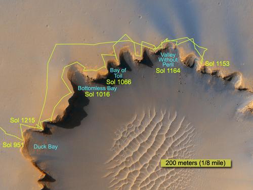
| 17:29, 20 December 2018 | Traverse Near Victoria Sol1215B br.jpg (file) |  |
33 KB | Suitupandshowup | The route followed by NASA's Mars Exploration Rover Opportunity during its exploration partway around the rim of Victoria Crater is marked on this map Source: https://mars.jpl.nasa.gov/mer/newsroom/pressreleases/20070628a.html Image credit: Image cr... | 1 |
| 18:59, 8 May 2019 | Transportation road.jpg (file) | 1.5 MB | Michel Lamontagne | 1 | ||
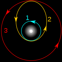
| 14:59, 5 July 2019 | Transfer orbits.png (file) | 15 KB | Sdubois | Retrieved from https://en.wikipedia.org/wiki/Hohmann_transfer_orbit#/media/File:Hohmann_transfer_orbit2.svg | 1 |


