Difference between revisions of "Mars Quadrangles"
(Created page with " Category:Mars Atlas Quadrangles The maps below were produced by the Mars Global Surveyor's Mars Orbiter Laser Altimeter; redder colors indicate higher elevations. The m...") |
|||
| Line 6: | Line 6: | ||
The maps below were produced by the Mars Global Surveyor's Mars Orbiter Laser Altimeter; redder colors indicate higher elevations. The maps of the equatorial quadrangles use a Mercator projection, while those of the mid-latitude quadrangles use a Lambert conformal conic projection, and the maps of the polar quadrangles use a polar stereographic projection.[1] | The maps below were produced by the Mars Global Surveyor's Mars Orbiter Laser Altimeter; redder colors indicate higher elevations. The maps of the equatorial quadrangles use a Mercator projection, while those of the mid-latitude quadrangles use a Lambert conformal conic projection, and the maps of the polar quadrangles use a polar stereographic projection.[1] | ||
| − | Number Name Latitudes Longitudes Features Map | + | |
| − | MC-01 Mare Boreum 65–90° N 180° W – 180° E Features Topographical map of Mare Boreum quadrangle | + | == Quadrangles == |
| − | MC-02 Diacria 30–65° N 120–180° W Features Topographical map of Diacria quadrangle | + | The maps below were produced by the [[Mars Global Surveyor]]'s [[Mars Orbiter Laser Altimeter]]; redder colors indicate higher elevations. The maps of the equatorial quadrangles use a [[Mercator projection]], while those of the mid-latitude quadrangles use a [[Lambert conformal conic projection]], and the maps of the polar quadrangles use a polar [[stereographic projection]].<ref name="photojournal"/> |
| − | MC-03 Arcadia 30–65° N 60–120° W Features Topographical map of Arcadia quadrangle | + | {| class="wikitable sortable" |
| − | MC-04 Mare Acidalium 30–65° N 0–60° W Features Topographical map of Mare Acidalium quadrangle | + | |- |
| − | MC-05 Ismenius Lacus 30–65° N 0–60° E Features Topographical map of Ismenius Lacus quadrangle | + | ! Number !! Name !! scope="col" class="unsortable" | Latitudes !! scope="col" class="unsortable" | Longitudes !! scope="col" class="unsortable" | Features !! scope="col" class="unsortable" | Map |
| − | MC-06 Casius 30–65° N 60–120° E Features Topographical map of Casius quadrangle | + | |- |
| − | MC-07 Cebrenia 30–65° N 120–180° E Features Topographical map of Cebrenia quadrangle | + | | MC-01 || [[Mare Boreum quadrangle|Mare Boreum]] || 65–90° N || style="white-space: nowrap;" | 180° W – 180° E || [[:Category:Mare Boreum quadrangle|Features]] || [[File:USGS-Mars-MC-1-MareBoreumRegion-mola.png|alt=Topographical map of Mare Boreum quadrangle|150px]] |
| − | MC-08 Amazonis 0–30° N 135–180° W Features Topographical map of Amazonis quadrangle | + | |- |
| − | MC-09 Tharsis 0–30° N 90–135° W Features Topographical map of Tharsis quadrangle | + | | MC-02 || [[Diacria quadrangle|Diacria]] || 30–65° N || 120–180° W || [[:Category:Diacria quadrangle|Features]] || [[File:USGS-Mars-MC-2-DiacriaRegion-mola.png|alt=Topographical map of Diacria quadrangle|150px]] |
| − | MC-10 Lunae Palus 0–30° N 45–90° W Features Topographical map of Lunae Palus quadrangle | + | |- |
| − | MC-11 Oxia Palus 0–30° N 0–45° W Features Topographical map of Oxia Palus quadrangle | + | | MC-03 || [[Arcadia quadrangle|Arcadia]] || 30–65° N || 60–120° W || [[:Category:Arcadia quadrangle|Features]] || [[File:USGS-Mars-MC-3-ArcadiaRegion-mola.png|alt=Topographical map of Arcadia quadrangle|150px]] |
| − | MC-12 Arabia 0–30° N 0–45° E Features Topographical map of Arabia quadrangle | + | |- |
| − | MC-13 Syrtis Major 0–30° N 45–90° E Features Topographical map of Syrtis Major quadrangle | + | | MC-04 || [[Mare Acidalium quadrangle|Mare Acidalium]] || 30–65° N || 0–60° W || [[:Category:Mare Acidalium quadrangle|Features]] || [[File:USGS-Mars-MC-4-MareAcidaliumRegion-mola.png|alt=Topographical map of Mare Acidalium quadrangle|150px]] |
| − | MC-14 Amenthes 0–30° N 90–135° E Features Topographical map of Amenthes quadrangle | + | |- |
| − | MC-15 Elysium 0–30° N 135–180° E Features Topographical map of Elysium quadrangle | + | | MC-05 || [[Ismenius Lacus quadrangle|Ismenius Lacus]] || 30–65° N || 0–60° E || [[:Category:Ismenius Lacus quadrangle|Features]] || [[File:USGS-Mars-MC-5-IsmeniusLacusRegion-mola.png|alt=Topographical map of Ismenius Lacus quadrangle|150px]] |
| − | MC-16 Memnonia 0–30° S 135–180° W Features Topographical map of Memnonia quadrangle | + | |- |
| − | MC-17 Phoenicis Lacus 0–30° S 90–135° W Features Topographical map of Phoenicis Lacus quadrangle | + | | MC-06 || [[Casius quadrangle|Casius]] || 30–65° N || 60–120° E || [[:Category:Casius quadrangle|Features]] || [[File:USGS-Mars-MC-6-CasiusRegion-mola2.png|alt=Topographical map of Casius quadrangle|150px]] |
| − | MC-18 Coprates 0–30° S 45–90° W Features Topographical map of Coprates quadrangle | + | |- |
| − | MC-19 Margaritifer Sinus 0–30° S 0–45° W Features Topographical map of Margaritifer Sinus quadrangle | + | | MC-07 || [[Cebrenia quadrangle|Cebrenia]] || 30–65° N || 120–180° E || [[:Category:Cebrenia quadrangle|Features]] || [[File:USGS-Mars-MC-7-CebreniaRegion-mola.png|alt=Topographical map of Cebrenia quadrangle|150px]] |
| − | MC-20 Sinus Sabaeus 0–30° S 0–45° E Features Topographical map of Sinus Sabaeus quadrangle | + | |- |
| − | MC-21 Iapygia 0–30° S 45–90° E Features Topographical map of Iapygia quadrangle | + | | MC-08 || [[Amazonis quadrangle|Amazonis]] || 0–30° N || 135–180° W || [[:Category:Amazonis quadrangle|Features]] || [[File:USGS-Mars-MC-8-AmazonisRegion-mola.png|alt=Topographical map of Amazonis quadrangle|150px]] |
| − | MC-22 Mare Tyrrhenum 0–30° S 90–135° E Features Topographical map of Mare Tyrrhenum quadrangle | + | |- |
| − | MC-23 Aeolis 0–30° S 135–180° E Features Topographical map of Aeolis quadrangle | + | | MC-09 || [[Tharsis quadrangle|Tharsis]] || 0–30° N || 90–135° W || [[:Category:Tharsis quadrangle|Features]] || [[File:USGS-Mars-MC-9-TharsisRegion-mola.png|alt=Topographical map of Tharsis quadrangle|150px]] |
| − | MC-24 Phaethontis 30–65° S 120–180° W Features Topographical map of Phaethontis quadrangle | + | |- |
| − | MC-25 Thaumasia 30–65° S 60–120° W Features Topographical map of Thaumasia quadrangle | + | | MC-10 || [[Lunae Palus quadrangle|Lunae Palus]] || 0–30° N || 45–90° W || [[:Category:Lunae Palus quadrangle|Features]] || [[File:USGS-Mars-MC-10-LunaePalusRegion-mola.png|alt=Topographical map of Lunae Palus quadrangle|150px]] |
| − | MC-26 Argyre 30–65° S 0–60° W Features Topographical map of Argyre quadrangle | + | |- |
| − | MC-27 Noachis 30–65° S 0–60° E Features Topographical map of Noachis quadrangle | + | | MC-11 || [[Oxia Palus quadrangle|Oxia Palus]] || 0–30° N || 0–45° W || [[:Category:Oxia Palus quadrangle|Features]] || [[File:USGS-Mars-MC-11-OxiaPalusRegion-mola.png|alt=Topographical map of Oxia Palus quadrangle|150px]] |
| − | MC-28 Hellas 30–65° S 60–120° E Features Topographical map of Hellas quadrangle | + | |- |
| − | MC-29 Eridania 30–65° S 120–180° E Features Topographical map of Eridania quadrangle | + | | MC-12 || [[Arabia quadrangle|Arabia]] || 0–30° N || 0–45° E || [[:Category:Arabia quadrangle|Features]] || [[File:USGS-Mars-MC-12-ArabiaRegion-mola.png|alt=Topographical map of Arabia quadrangle|150px]] |
| − | MC-30 Mare Australe 65–90° S 180° W – 180° E Features Topographical map of Mare Australe quadrangle | + | |- |
| + | | MC-13 || [[Syrtis Major quadrangle|Syrtis Major]] || 0–30° N || 45–90° E || [[:Category:Syrtis Major quadrangle|Features]] || [[File:USGS-Mars-MC-13-SyrtisMajorRegion-mola.png|alt=Topographical map of Syrtis Major quadrangle|150px]] | ||
| + | |- | ||
| + | | MC-14 || [[Amenthes quadrangle|Amenthes]] || 0–30° N || 90–135° E || [[:Category:Amenthes quadrangle|Features]] || [[File:USGS-Mars-MC-14-AmenthesRegion-mola.png|alt=Topographical map of Amenthes quadrangle|150px]] | ||
| + | |- | ||
| + | | MC-15 || [[Elysium quadrangle|Elysium]] || 0–30° N || 135–180° E || [[:Category:Elysium quadrangle|Features]] || [[File:USGS-Mars-MC-15-ElysiumRegion-mola.png|alt=Topographical map of Elysium quadrangle|150px]] | ||
| + | |- | ||
| + | | MC-16 || [[Memnonia quadrangle|Memnonia]] || 0–30° S || 135–180° W || [[:Category:Memnonia quadrangle|Features]] || [[File:USGS-Mars-MC-16-MemnoniaRegion-mola.png|alt=Topographical map of Memnonia quadrangle|150px]] | ||
| + | |- | ||
| + | | MC-17 || [[Phoenicis Lacus quadrangle|Phoenicis Lacus]] || 0–30° S || 90–135° W || [[:Category:Phoenicis Lacus quadrangle|Features]] || [[File:USGS-Mars-MC-17-PhoenicisRegion-mola.png|alt=Topographical map of Phoenicis Lacus quadrangle|150px]] | ||
| + | |- | ||
| + | | MC-18 || [[Coprates quadrangle|Coprates]] || 0–30° S || 45–90° W || [[:Category:Coprates quadrangle|Features]] || [[File:USGS-Mars-MC-18-CopratesRegion-mola.png|alt=Topographical map of Coprates quadrangle|150px]] | ||
| + | |- | ||
| + | | MC-19 || style="white-space: nowrap;" | [[Margaritifer Sinus quadrangle|Margaritifer Sinus]] || 0–30° S || 0–45° W || [[:Category:Margaritifer Sinus quadrangle|Features]] || [[File:USGS-Mars-MC-19-MargartiferSinusRegion-mola.png|alt=Topographical map of Margaritifer Sinus quadrangle|150px]] | ||
| + | |- | ||
| + | | MC-20 || [[Sinus Sabaeus quadrangle|Sinus Sabaeus]] || 0–30° S || 0–45° E || [[:Category:Sinus Sabaeus quadrangle|Features]] || [[File:USGS-Mars-MC-20-SinusSabaeusRegion-mola.png|alt=Topographical map of Sinus Sabaeus quadrangle|150px]] | ||
| + | |- | ||
| + | | MC-21 || [[Iapygia quadrangle|Iapygia]] || 0–30° S || 45–90° E || [[:Category:Iapygia quadrangle|Features]] || [[File:USGS-Mars-MC-21-IapygiaRegion-mola.png|alt=Topographical map of Iapygia quadrangle|150px]] | ||
| + | |- | ||
| + | | MC-22 || [[Mare Tyrrhenum quadrangle|Mare Tyrrhenum]] || 0–30° S || 90–135° E || [[:Category:Mare Tyrrhenum quadrangle|Features]] || [[File:USGS-Mars-MC-22-MareTyrrhenumRegion-mola.png|alt=Topographical map of Mare Tyrrhenum quadrangle|150px]] | ||
| + | |- | ||
| + | | MC-23 || [[Aeolis quadrangle|Aeolis]] || 0–30° S || 135–180° E || [[:Category:Aeolis quadrangle|Features]] || [[File:USGS-Mars-MC-23-AeolisRegion-mola.png|alt=Topographical map of Aeolis quadrangle|150px]] | ||
| + | |- | ||
| + | | MC-24 || [[Phaethontis quadrangle|Phaethontis]] || 30–65° S || 120–180° W || [[:Category:Phaethontis quadrangle|Features]] || [[File:USGS-Mars-MC-24-PhaethontisRegion-mola.png|alt=Topographical map of Phaethontis quadrangle|150px]] | ||
| + | |- | ||
| + | | MC-25 || [[Thaumasia quadrangle|Thaumasia]] || 30–65° S || 60–120° W || [[:Category:Thaumasia quadrangle|Features]] || [[File:USGS-Mars-MC-25-ThaumasiaRegion-mola.png|alt=Topographical map of Thaumasia quadrangle|150px]] | ||
| + | |- | ||
| + | | MC-26 || [[Argyre quadrangle|Argyre]] || 30–65° S || 0–60° W || [[:Category:Argyre quadrangle|Features]] || [[File:USGS-Mars-MC-26-ArgyreRegion-mola.png|alt=Topographical map of Argyre quadrangle|150px]] | ||
| + | |- | ||
| + | | MC-27 || [[Noachis quadrangle|Noachis]] || 30–65° S || 0–60° E || [[:Category:Noachis quadrangle|Features]] || [[File:USGS-Mars-MC-27-NoachisRegion-mola.png|alt=Topographical map of Noachis quadrangle|150px]] | ||
| + | |- | ||
| + | | MC-28 || [[Hellas quadrangle|Hellas]] || 30–65° S || 60–120° E || [[:Category:Hellas quadrangle|Features]] || [[File:USGS-Mars-MC-28-HellasRegion-mola.png|alt=Topographical map of Hellas quadrangle|150px]] | ||
| + | |- | ||
| + | | MC-29 || [[Eridania quadrangle|Eridania]] || 30–65° S || 120–180° E || [[:Category:Eridania quadrangle|Features]] || [[File:USGS-Mars-MC-29-EridaniaRegion-mola.png|alt=Topographical map of Eridania quadrangle|150px]] | ||
| + | |- | ||
| + | | MC-30 || [[Mare Australe quadrangle|Mare Australe]] || 65–90° S || 180° W – 180° E || [[:Category:Mare Australe quadrangle|Features]] || [[File:USGS-Mars-MC-30-MareAustraleRegion-mola.png|alt=Topographical map of Mare Australe quadrangle|150px]] | ||
| + | |} | ||
Revision as of 18:07, 6 January 2020
Quadrangles
The maps below were produced by the Mars Global Surveyor's Mars Orbiter Laser Altimeter; redder colors indicate higher elevations. The maps of the equatorial quadrangles use a Mercator projection, while those of the mid-latitude quadrangles use a Lambert conformal conic projection, and the maps of the polar quadrangles use a polar stereographic projection.[1]
| Number | Name | Latitudes | Longitudes | Features | Map |
|---|---|---|---|---|---|
| MC-01 | Mare Boreum | 65–90° N | 180° W – 180° E | Features | 
|
| MC-02 | Diacria | 30–65° N | 120–180° W | Features | 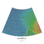
|
| MC-03 | Arcadia | 30–65° N | 60–120° W | Features | 
|
| MC-04 | Mare Acidalium | 30–65° N | 0–60° W | Features | 
|
| MC-05 | Ismenius Lacus | 30–65° N | 0–60° E | Features | 
|
| MC-06 | Casius | 30–65° N | 60–120° E | Features | 
|
| MC-07 | Cebrenia | 30–65° N | 120–180° E | Features | 
|
| MC-08 | Amazonis | 0–30° N | 135–180° W | Features | 
|
| MC-09 | Tharsis | 0–30° N | 90–135° W | Features | 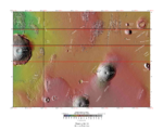
|
| MC-10 | Lunae Palus | 0–30° N | 45–90° W | Features | 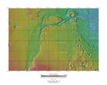
|
| MC-11 | Oxia Palus | 0–30° N | 0–45° W | Features | 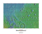
|
| MC-12 | Arabia | 0–30° N | 0–45° E | Features | 
|
| MC-13 | Syrtis Major | 0–30° N | 45–90° E | Features | 
|
| MC-14 | Amenthes | 0–30° N | 90–135° E | Features | 
|
| MC-15 | Elysium | 0–30° N | 135–180° E | Features | 
|
| MC-16 | Memnonia | 0–30° S | 135–180° W | Features | 
|
| MC-17 | Phoenicis Lacus | 0–30° S | 90–135° W | Features | 
|
| MC-18 | Coprates | 0–30° S | 45–90° W | Features | 
|
| MC-19 | Margaritifer Sinus | 0–30° S | 0–45° W | Features | 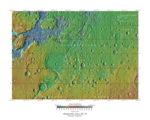
|
| MC-20 | Sinus Sabaeus | 0–30° S | 0–45° E | Features | 
|
| MC-21 | Iapygia | 0–30° S | 45–90° E | Features | 
|
| MC-22 | Mare Tyrrhenum | 0–30° S | 90–135° E | Features | 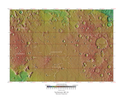
|
| MC-23 | Aeolis | 0–30° S | 135–180° E | Features | 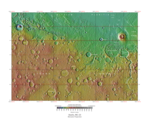
|
| MC-24 | Phaethontis | 30–65° S | 120–180° W | Features | 
|
| MC-25 | Thaumasia | 30–65° S | 60–120° W | Features | 
|
| MC-26 | Argyre | 30–65° S | 0–60° W | Features | 
|
| MC-27 | Noachis | 30–65° S | 0–60° E | Features | 
|
| MC-28 | Hellas | 30–65° S | 60–120° E | Features | 
|
| MC-29 | Eridania | 30–65° S | 120–180° E | Features | 
|
| MC-30 | Mare Australe | 65–90° S | 180° W – 180° E | Features | 
|
- ↑ Cite error: Invalid
<ref>tag; no text was provided for refs namedphotojournal


