
Mars atlas Mars Society: Difference between revisions
No edit summary |
No edit summary |
||
| Line 1: | Line 1: | ||
{{DISPLAYTITLE:Mars Atlas}} | {{DISPLAYTITLE:Mars Atlas}} | ||
<imagemap> | <imagemap> | ||
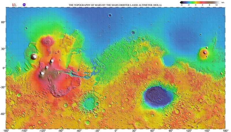
File:Mars topography (MOLA dataset) HiRes (1).jpg|left|thumb|800x800px|Move the Mouse over the image and click on the | File:Mars topography (MOLA dataset) HiRes (1).jpg|left|thumb|800x800px|Move the Mouse over the image and click on the design you want to explore. | ||
rect 70 80 2370 200 [[Mare Boreum quadrangle|Mare Boreum]] | rect 70 80 2370 200 [[Mare Boreum quadrangle|Mare Boreum]] | ||
| Line 74: | Line 74: | ||
<div style="position: absolute; left: 35px; top: 130px">[[Diacria quadrangle|'''''Plains settlement''''']]</div> | <div style="position: absolute; left: 35px; top: 130px">[[Diacria quadrangle|'''''Plains settlement''''']]</div> | ||
<div style="position: absolute; left: 130px; top: 230px">[[Tharsis|'''''Original Mars direct proposal''''']]</div> | <div style="position: absolute; left: 130px; top: 230px">[[Tharsis|'''''Original Mars direct proposal''''']]</div> | ||
Revision as of 23:50, 28 January 2020
View a map of:
This map shows some of the settlement proposals made by the Mars society as well as some proposals submitted for the 2019 1000 people settlement design contest.

This article is licensed under Creative Commons BY-SA 4.0 and may be freely shared, but must include this attribution.