Difference between revisions of "Ismenius Lacus quadrangle"
(→Channels (Rivers): edited picture captions) |
|||
| Line 37: | Line 37: | ||
WikiESP 039997 2170channels.jpg|Channel in Arabia, as seen by HiRISE under [[HiWish program]]. This is an enlargement of the previous image that was taken with CTX to give a wide view. | WikiESP 039997 2170channels.jpg|Channel in Arabia, as seen by HiRISE under [[HiWish program]]. This is an enlargement of the previous image that was taken with CTX to give a wide view. | ||
| + | |||
| + | </gallery> | ||
| + | |||
| + | Some places (like below) display a smaller channel within a larger, wider channel or valley. When this occurs it means water went through the region at least two times in the past. This implies that water was not here once for just a short period of time. | ||
| + | |||
| + | <gallery class="center" widths="380px" heights="360px"> | ||
| + | |||
ESP 039931 2165channels.jpg|Channel within larger channel The existence of the smaller channel suggests water went through the region at least two times in the past. | ESP 039931 2165channels.jpg|Channel within larger channel The existence of the smaller channel suggests water went through the region at least two times in the past. | ||
ESP 039931 2165close.jpg|Close-up of channel within larger channel The existence of the smaller channel suggests water went through the region at least two times in the past. The black box represents the size of a football field. Some parts of the surface would be difficult to walk on with the many small hills and depressions. | ESP 039931 2165close.jpg|Close-up of channel within larger channel The existence of the smaller channel suggests water went through the region at least two times in the past. The black box represents the size of a football field. Some parts of the surface would be difficult to walk on with the many small hills and depressions. | ||
| + | </gallery> | ||
| + | |||
| + | <gallery class="center" widths="380px" heights="360px"> | ||
ESP 042924 2195channel.jpg|Channel system that travels through part of a crater | ESP 042924 2195channel.jpg|Channel system that travels through part of a crater | ||
Revision as of 09:48, 7 March 2020
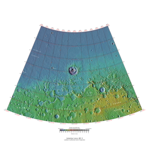
| MC-05 | Ismenius Lacus | 30–65° N | 0–60° E | Quadrangles | Atlas |
Elevations


This quadrangle has some of the most mysterious-looking landscapes on the planet. It truly looks like another world here. The Ismenius Lacus quadrangle contains regions called Deuteronilus Mensae and Protonilus Mensae, two places that are of special interest to scientists. They contain abundant evidence of present and past glacial activity. They also have a landscape unique to Mars, called Fretted terrain. The largest crater in the area is Lyot Crater, which contains channels probably carved by liquid water.Cite error: Closing </ref> missing for <ref> tag The Ismenius Lacus quadrangle contains parts of regions named Acidalia Planitia, Arabia Terra, Vastitas Borealis, and Terra Sabaea.[1]
Origin of names
Ismenius Lacus is the name of a classical albedo feature located at 40° N and 30° E on Mars. The term is Latin for Ismenian Lake, and refers to the Ismenian Spring near Thebes in Greece where Cadmus slew the guardian dragon. Cadmus was the legendary founder of Thebes, and had come to the spring to fetch water. The name was approved by the International Astronomical Union (IAU) in 1958.[2] All names suggested for astronomical features have to eventually approved by the International Astronomical Union (IAU). Some important areas in this quadrangle derive from the names of canals that some early astronomers saw in this broad area. One such large canal they called Nilus. Since 1881–1882 it was split into other canals, some were called Nilosyrtis, Protonilus (first Nile),and Deuteronilus (second Nile).[3]
Channels (Rivers)
Many features were probably rivers with water flowing in them billions of years ago. Pictures below show many channels and parts of channels.
The channel shown below goes quite a long distance and has branches. It ends in a depression that may have been a lake at one time. The first picture is a wide angle, taken with CTX; while the second is a close up taken with HiRISE.[4]

Channels in Arabia, as seen by CTX This channel winds along for a good distance and has branches. It ends in a depression that may have been a lake at one time.

Channel in Arabia, as seen by HiRISE under HiWish program. This is an enlargement of the previous image that was taken with CTX to give a wide view.


Some places (like below) display a smaller channel within a larger, wider channel or valley. When this occurs it means water went through the region at least two times in the past. This implies that water was not here once for just a short period of time.

Channel within larger channel The existence of the smaller channel suggests water went through the region at least two times in the past.

Close-up of channel within larger channel The existence of the smaller channel suggests water went through the region at least two times in the past. The black box represents the size of a football field. Some parts of the surface would be difficult to walk on with the many small hills and depressions.


Channel system that travels through part of a crater

Channel that cut through a crater rim

Channel system that travels through part of a crater Note: this is an enlargement of a previous image.

Channel that travels through part of a crater The arrow shows a crater that was eroded by the channel. Note: this is an enlargement of a previous image.

Channels

Meander in a channel Meanders are commonly formed in old river systems when the water is moving slowly.

Wide view of channels

Close view of channel

Channel that has cut through a crater rim

Wide view of channels, as seen by HiRISE under HiWish program

Wide view of channels

Channel

Wide view of channels

Channel with hanging valley

Wide view of channels

Wide view of channels, as seen by HiRISE under HiWish program

Channel

Channels

Channels, as seen by HiRISE under HiWish program

Channels, Some parts of the image show mantle and others show no mantle covering the surface.

Possible inverted channel Here after a stream bed got filled with erosion resistant materials, the surrounding, softer landscape eroded away.


See also
- Dark slope streaks
- Geography of Mars
- High Resolution Imaging Science Experiment (HiRISE)
- HiWish program
- How are features on Mars Named?
- Layers on Mars
- Mars Global Surveyor
- Rivers on Mars
References
- ↑ http://planetarynames.wr.usgs.gov/SearchResults?target=MARS&featureType=Terra,%20terrae
- ↑ USGS Gazetteer of Planetary Nomenclature. Mars. http://planetarynames.wr.usgs.gov/.
- ↑ Blunck, J. 1982. Mars and its Satellites. Exposition Press. Smithtown, N.Y.
- ↑ http://www.uahirise.org/ESP_039997_2170


