The beauty of Mars from 150 miles
Article written by Jim Secosky. Jim is a retired science teacher who has used the Hubble Space Telescope, the Mars Global Surveyor, and HiRISE.
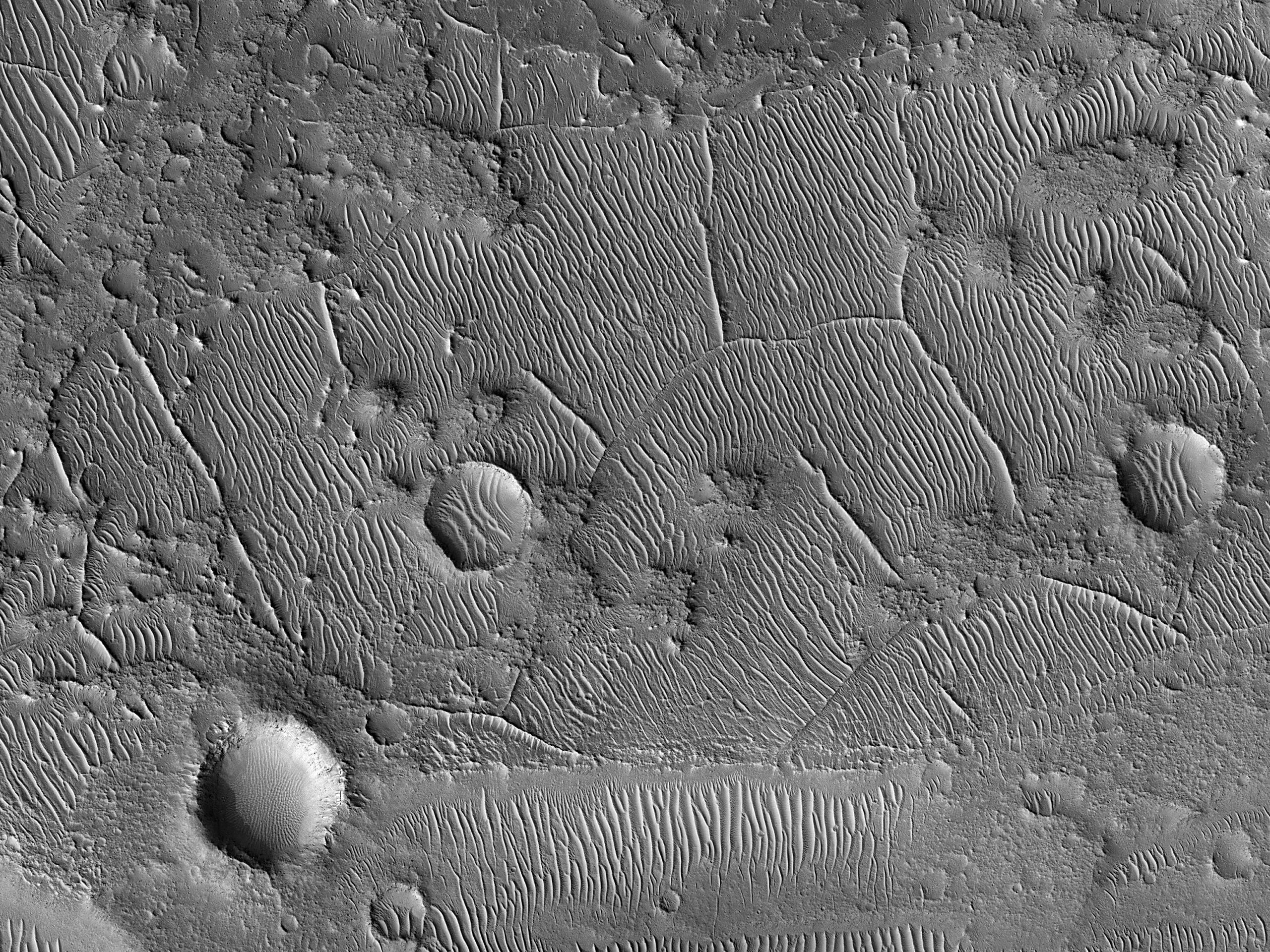
This article will show some beautiful scenes of Mars from about 150 miles above the surface. The pictures were taken by the High Resolution Imaging Science Experiment (HiRISE) that orbits Mars. The colors are from a central strip in each of the images. The colors are processed to bring out more information about the minerals on the surface. ; they are not exactly what we would see with just our eyes. Some incorporate an infrared band which humans can't see.
The pictures are a labor of love for Jim Secosky. He started suggesting places for NASA to observe in 2010 through the HiWish program. Every one of the pictures here were ones that he obtained through the HiWish program. that program allows anyone to explore Mars. However, one often has to wait months or years for the pictures to be taken, processed, and released. The satellite mostly just takes pictures of what it passes over; hence, you may have to wait until it passes over something you suggested.
A few of the images have a box--that box represents the size of a football field (100 yards).
The collections of pictures here will not include much geology. If you want to find out more, you can go to the references or links to other articles in Marspedia. Some talks are also listed that Jim gave for the Mars Society.
HiRISE images of Mars
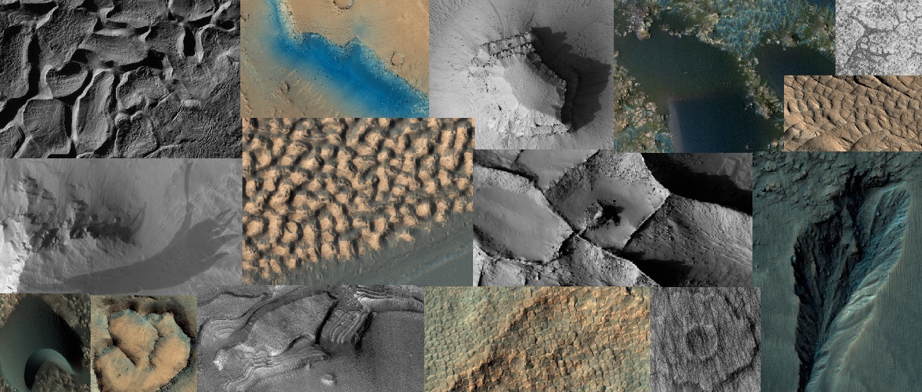
Collage of pictures taken with HiRISE under HiWish program
Collage of pictures taken with HiRISE under HiWish program
Collage of pictures taken with HiRISE under HiWish program
Image shows the variety of different kinds of brain terrain on Mars. Brain terrain is called that because it resembles the surface of the human brain. It is thought to form when ice leaves the ground along cracks.[1] [2]
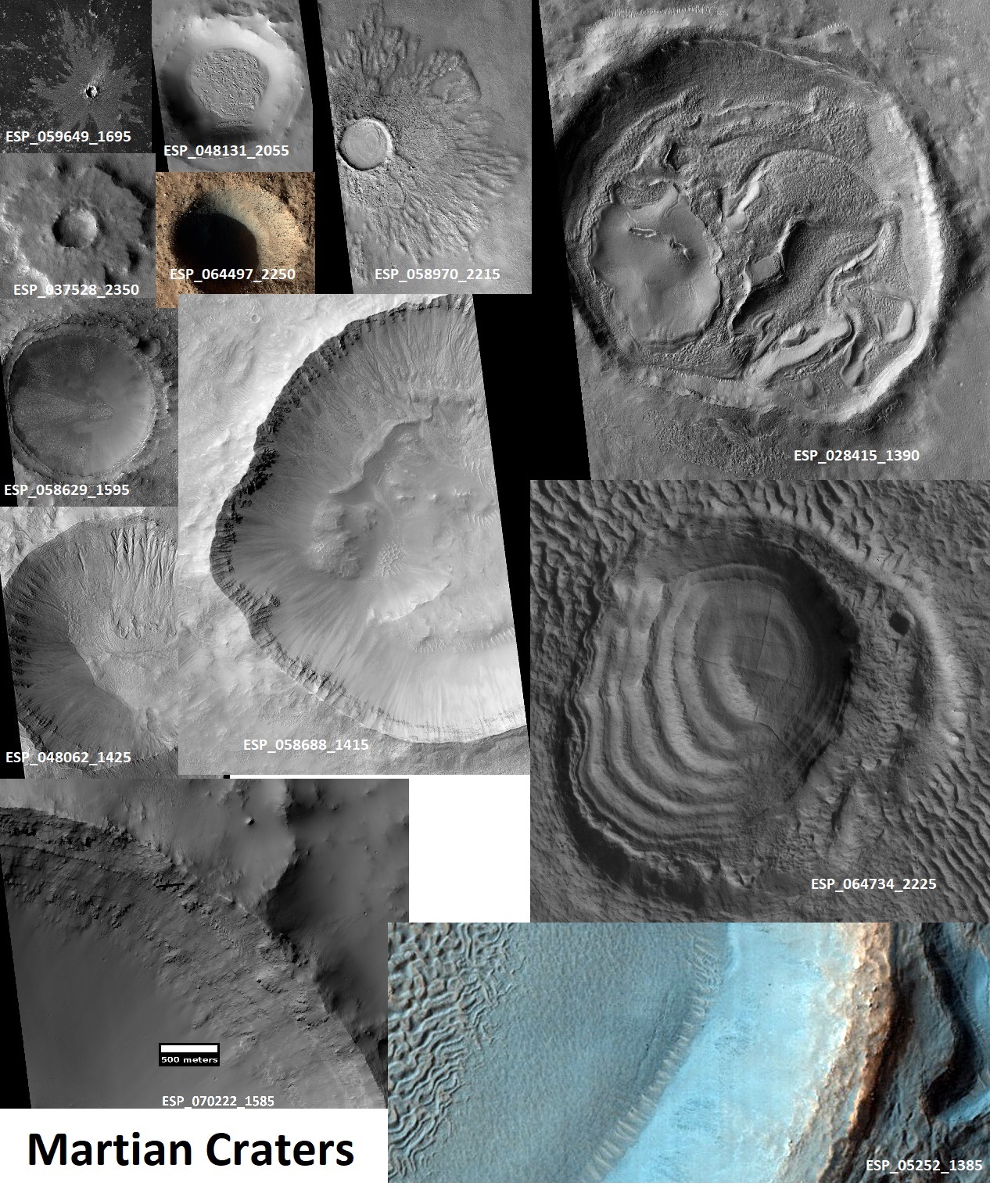
Different kinds of impact craters on Mars.
Different types of Martian craters
Features in and around Martian craters
 Image shows dust devil tracks on Mars. Mars has many dust devils. When a dust devil passes, it removes the thin coating of bright dust. One then sees the dark undersurface.
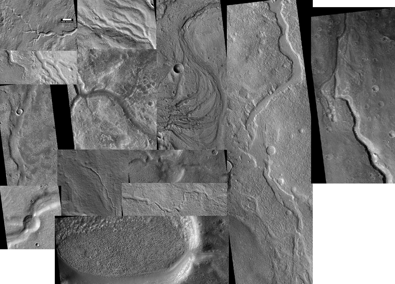
Image shows the variety of channels on Mars. In the past Mars once had many streams and rivers.
 Glaciers on Mars. Some have ice; some have lost most of their ice. The ice was able to be preserved for long periods because it had a layer of dirt and rocks on top.[3] [4] [5]
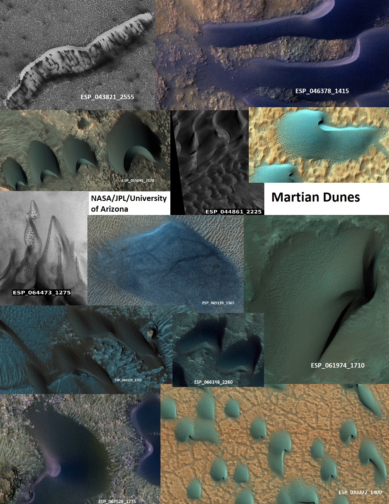
Sand dunes on Mars. The colored ones are from a colored strip in the center of each HiRISE image. To our eyes all of these would probably appear black. However, NASA images are able to be processed to bring out slight differences. Dunes are made of the black volcanic rock basalt. Basalt does not always have the same exact composition. Slight amounts of certain elements can yield slightly different colors.
Sand dunes on the floors of Martian craters
Image shows the variety of mud volcanoes on Mars.[6] [7] The mud comes up from a distance such that organisms could have lived in the mud.[8] On the surface living things were die from the radiation. The colored ones are from a colored strip in the center of each HiRISE image.
Ridges on Mars. Ridges sometimes form shapes at nearly right angles. We do not know the exact cause, but a popular idea is that minerals were deposited in cracks.[9] Later, erosion removed the soft material around them. There is some evidence that clays are near them. That's important because clays need water to form. Hence, they may be markers of past water. The colored ones are from a colored strip in the center of each HiRISE image.
Streamlined forms on Mars. Great floods formed these. Much water was frozen in the ground and then released over a short period of time to create huge floods.[10] Nearness to volcanic features or maybe an impact may have released water from the frozen ground. The colored ones are from a colored strip in the center of each HiRISE image.
Gullies on Mars. Gullies from on steep slopes. Today, they seem to be produced with the action of dry ice;[11] in the past liquid water may have been involved.[12] [13] [14] [15] The colored ones are from a colored strip in the center of each HiRISE image.
Landslides on Mars
Troughs on Mars. Troughs form on Mars due to the huge volcanoes weighing down the crust and stretching it.
 Shapes observed on floor of Hellas. The shapes are strange and we currently do not know exactly how they were formed. Glaciers may have been involved.[16]
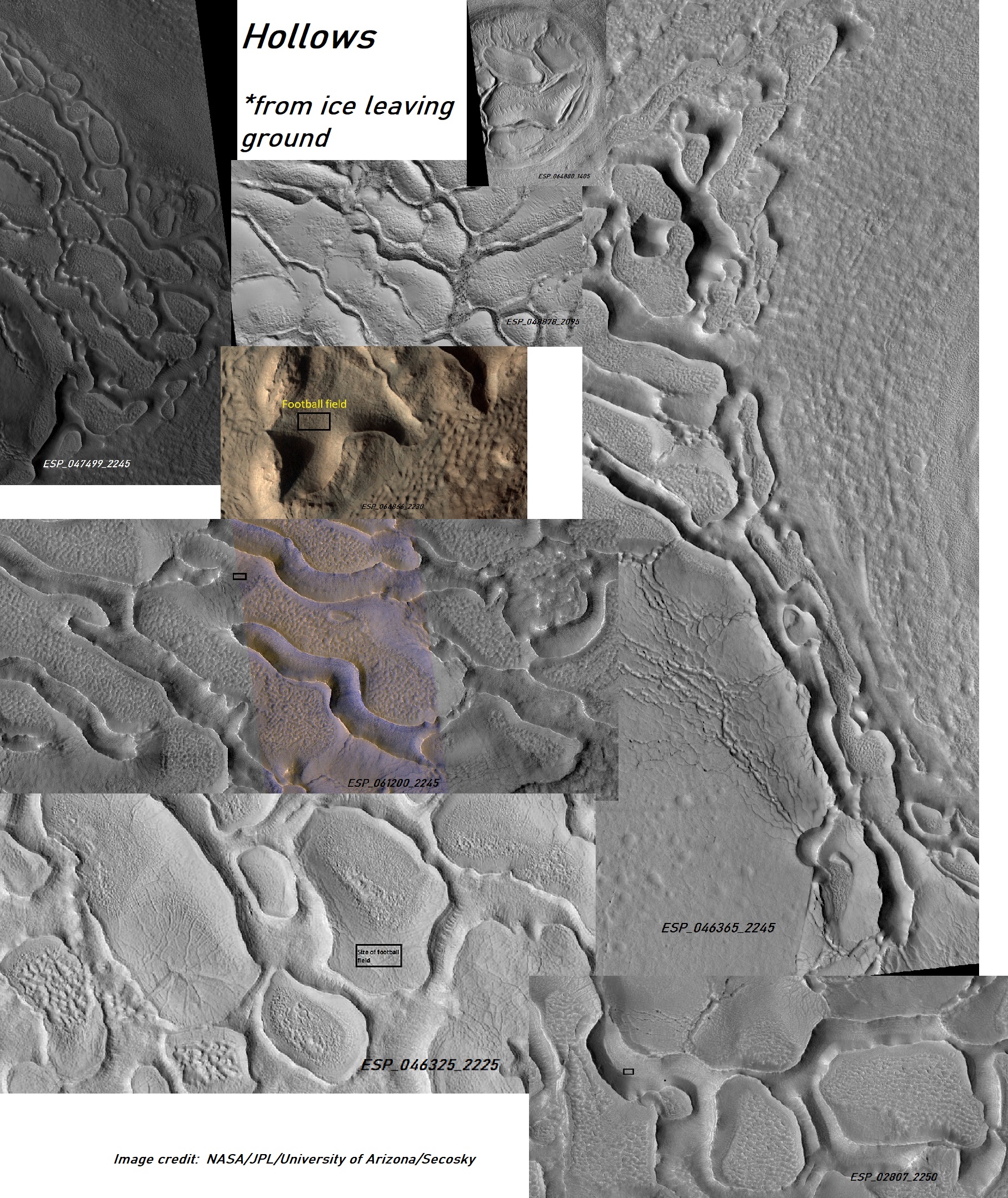
Hollows on Mars. Some of these images have a box--that box represents the size of a football field (100 yards). Hollows are produced when ice leaves the ground.
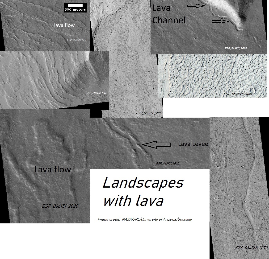
Lava flows on Mars
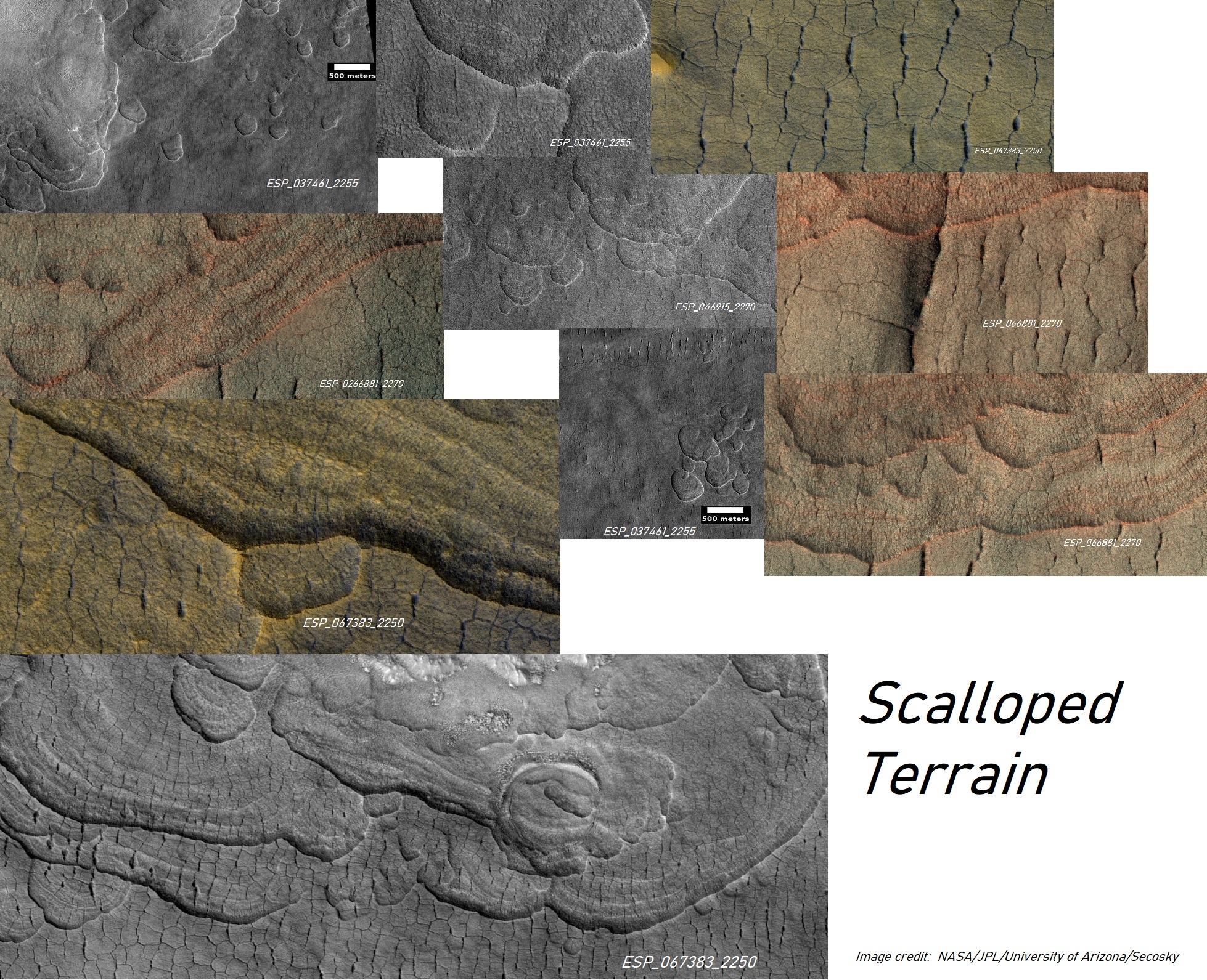
Scalloped terrain on Mars. This terrain forms when ice leaves the ground.[17] It is a marker for ice.
Rootless cones on Mars. They form when lava flows over frozen or ice-rich ground.[18]
Layered hills on Mars. They are the remains of material that once covered a wide area.
Plumes and spiders on Mars In the spring, black dust/sand blows out of the ground and makes dark plumes.[19] [20] [21] [22] Plumes may elongated shapes due to the wind. Some shapes that look like spiders are created.[23] [24]
Dark slope streaks on Mars. Most believe they are avalanches of bright dust.[25] [26] [27] [28]
Volcanic vents on Mars.
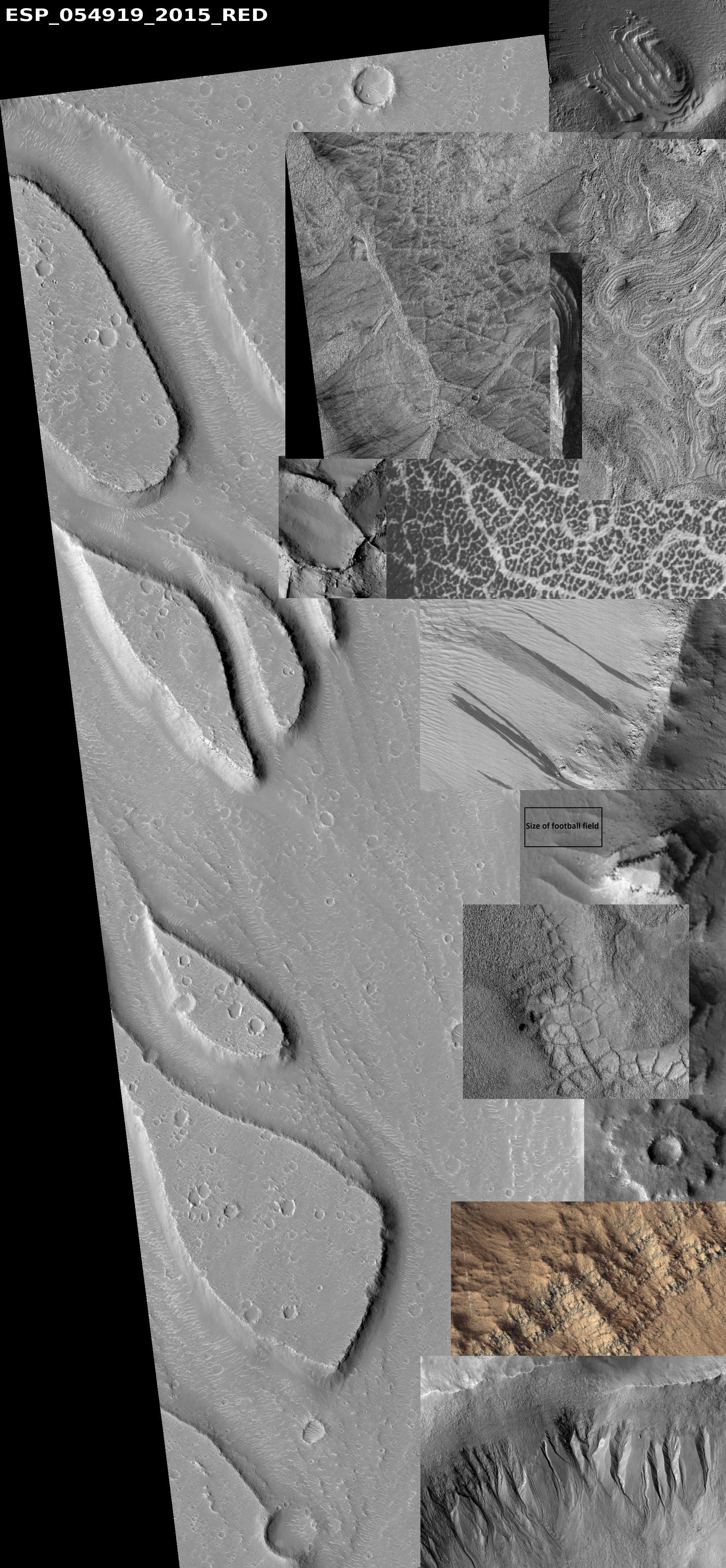
Common features seen on Mars
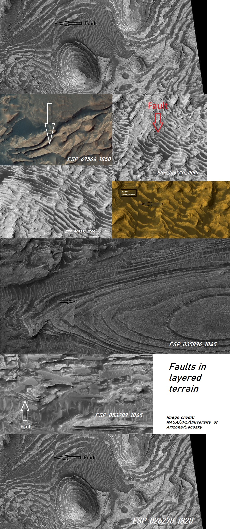
Layered landscapes of Mars
Typical scenes in Lunae Palus quadrangle
Typical features of Syrtis Major quadrangle
Typical features of Arcadia quadrangle
Typical features of Oxia Palus quadrangle
Typical features of Mare Boreum quadrangle
Typical features of Diacria quadrangle
Typical features of Mare Acidalium quadrangle
Typical features of Ismenius Lacus quadrangle
More typical features of Ismenius Lacus quadrangle
Scenes of the Casius quadrangle
Scenes of the Cebrenia quadrangle
Scenes of the Amazonis quadrangle
Scenes of the Tharsis quadrangle
Scenes of the Arabia quadrangle
Scenes of the Amenthes quadrangle
Scenes of the Elysium quadrangle
Scenes of the Memnonia quadrangle
Scenes of the Coprates quadrangle
Scenes of the Magaritifer Sinus quadrangle
Scenes of the Sinus Sabaeus quadrangle
Scenes of the Iapygia quadrangle
Scenes of the Mare Tyrrhenum quadrangle
Scenes of the Aeolis quadrangle
Scenes of the Phaethontis quadrangle
Scenes of the Thaumasia quadrangle
Scenes of the Argyre quadrangle
Scenes of the Noachis quadrangle
Scenes of the Hellas quadrangle
Scenes of the Eridania quadrangle
Scenes of the Mare Australe quadrangle
Wide view of layers in Candor, as seen by HiRISE. This picture was named HiRISE picture of the day for November 9, 2023.
Layers in Candor
Layers and faults in Arabia quadrangle--HiRISE Picture of the Day (September 25, 2021)
Ridges, this picture was named HiRISE picture of the day on March 29, 2024
Twisted bands on Hellas floor
See Also
- Geography of Mars
- High Resolution Imaging Science Experiment (HiRISE)
- HiWish program has section on colors
- Geography of Mars
- Glaciers on Mars
- Layers on Mars
- Martian features that are signs of water ice
- Martian gullies
- Rivers on Mars
- Sublimation
- Sublimation landscapes on Mars
External links
- https://planetarynames.wr.usgs.gov/Page/MARS/target For information on names and locations on Mars
- Seeing the wonders of Mars with HiRISE under the HiWish program
- Features of Mars with HiRISE under HiWish program Shows nearly all major features discovered on Mars. This would be good for teachers covering Mars.
- Martian Ice - Jim Secosky - 16th Annual International Mars Society Convention
- Martian Geology - Jim Secosky - 16th Annual International Mars Society Convention
- Walks on Mars - Jim Secosky - 16th Annual International Mars Society Convention
References
- ↑ Levy, J., J. Head, D. Marchant. 2009. Concentric crater fill in Utopia Planitia: History and interaction between glacial “brain terrain” and periglacial mantle processes. Icarus 202, 462–476.
- ↑ Baker, D., J. Head. 2015. Extensive Middle Amazonian mantling of debris aprons and plains in Deuteronilus Mensae, Mars: Implication for the record of mid-latitude glaciation. Icarus: 260, 269-288.
- ↑ Head, J. and D. Marchant. 2006. Evidence for global-scale northern mid-latitude glaciation in the Amazonian period of Mars: Debris-covered glacial and valley glacial deposits in the 30 - 50 N latitude band. Lunar. Planet. Sci. 37. Abstract 1127
- ↑ Head, J.W.; Marchant, D.R.; Dickson, J.L.; Kress, A.M. (2010). "Criteria for the recognition of debris-covered glacier and valley glacier landsystem deposits". Earth Planet. Sci. Lett. 294 (3–4): 306–320.
- ↑ Baker, D., et al. 2009. Flow patterns of lobate debris aprons and lineated valley fill north of Ismeniae Fossae, Mars: Evidence for extensive mid-latitude glaciation in the Late Amazonian. Icarus: 207. 186-209.
- ↑ Hugh H. Kieffer (1992). Mars. University of Arizona Press. ISBN 978-0-8165-1257-7.
- ↑ Oehler, D. and C. Allen. 2010. Evidence for pervasive mud volcanism in Acidalia Planitia, Mars. Icarus: 208. 636-657.
- ↑ Komatsu, G., et al. 2014. ASTROBIOLOGICAL POTENTIAL OF MUD VOLCANISM ON MARS. 45th Lunar and Planetary Science Conference (2014). 1085.pdf
- ↑ Saper, L., J. Mustard. 2013. "Extensive linear ridge networks in Nili Fossae and Nilosyrtis, Mars: implications for fluid flow in the ancient crust". Geophysical Research Letters: 40, 245-249.
- ↑ James W. Head; Lionel Wilson; Karl L. Mitchell (2003). "Generation of recent massive water floods at Cerberus Fossae, Mars by dike emplacement, cryospheric cracking, and confined aquifer groundwater release". Geophysical Research Letters. 30 (11): 2265.
- ↑ Pasquon, K., et al. 2019. Present-day development of gully-channel sinuosity by carbon dioxide gas supported flows on Mars. Icarus. Volume 329. Pages 296-313
- ↑ Dundas, C., et al. 2012. Seasonal activity and morphological changes in martian gullies. Icarus: 220, 124-143.
- ↑ Dickson, J., et al. 2023. Gullies on Mars could have formed by melting of water ice during periods of high obliquity. Science. Vol 380, Issue 6652. pp. 1363-1367.
- ↑ Dundas, et al. 2023. Martian gully activity and the gully sediment transport system. Icarus. Volume 386, 1 November 2022, 115133
- ↑ C.M. Dundas, A.S. McEwen, S. Diniega, C.J. Hansen, S. Byrne, J.N. McElwaine. 2017. The formation of gullies on Mars today. Geol. Soc. Lond. Spec. Publ., 46710.1144/SP467.5
- ↑ Weiss, D.; Head, J. (2017). "Salt or ice diapirism origin for the honeycomb terrain in Hellas basin, Mars?: Implications for the early martian climate". Icarus. 284: 249–263.
- ↑ Morgenstern A, Hauber E, Reiss D, van Gasselt S, Grosse G, Schirrmeister L (2007): Deposition and degradation of a volatile-rich layer in Utopia Planitia, and implications for climate history on Mars. Journal of Geophysical Research: Planets 112, E06010.
- ↑ Czechowski, L., et al. 2023. The formation of cone chains in the Chryse Planitia region on Mars and the thermodynamic aspects of this process. Icarus: Volume 396, 15 May 2023, 115473
- ↑ Kieffer, HH; Christensen, PR; Titus, TN (2006). "CO2 jets formed by sublimation beneath translucent slab ice in Mars'seasonal south polar ice cap". Nature. 442 (7104): 793–796.
- ↑ Thomas, N.; Hansen, C.J.; Portyankina, G.; Russell, P.S. (2010). "HiRISE observations of gas sublimation-driven activity in Mars' southern polar regions: II. Surficial deposits and their origins". Icarus. 205 (1): 296–310.
- ↑ Portyankina, G., et al. 2019. How Martian araneiforms get their shapes: morphological analysis and diffusion-limited aggregation model for polar surface erosion Icarus. https://doi.org/10.1016/j.icarus.2019.02.032
- ↑ Kieffer H, Christensen P, Titus T. 2006 Aug 17. CO2 jets formed by sublimation beneath translucent slab ice in Mars' seasonal south polar ice cap. Nature: 442(7104):793-6.
- ↑ McKeown, L., et al. 2021. The formation of araneiforms by carbon dioxide venting and vigorous sublimation dynamics under martian atmospheric pressure. Scientific Reports.
- ↑ https://www.livescience.com/space/mars/spiders-on-mars-fully-awakened-on-earth-for-1st-time-and-scientists-are-shrieking-with-joy?utm_term=CABA215D-3D47-4C9A-92FE-9ECF8D4C7909&lrh=e62336263a3610a07ef7c8af2080c758f2ecd0661aab1a8e6234cf31f0d0fdff&utm_campaign=368B3745-DDE0-4A69-A2E8-62503D85375D&utm_medium=email&utm_content=542DE80B-08E0-4FC1-B871-90E60036945E&utm_source=SmartBrief
- ↑ Treiman, A.H.; Louge, M.Y. (2004). Martian Slope Streaks and Gullies: Origins as Dry Granular Flows. 35th Lunar and Planetary Science Conference, Abstract #1323.
- ↑ Heyer, T., et al. 2019. Seasonal formation rates of martian slope streaks. Icarus
- ↑ Lange, S., et al. 2022. Gardening of the Martian Regolith by Diurnal CO2 Frost and the Formation of Slope Streaks. JGR Planets. Volume127, Issue4. e2021JE006988
- ↑ Chuang, F.C. et al. 2007. HiRISE Observations of Slope Streaks on Mars. Geophys. Res. Lett., 34 L20204.

