Difference between revisions of "Layers on Mars"
m (→Inside craters) |
Suitupshowup (talk | contribs) (→Inside craters: added image) |
||
| (35 intermediate revisions by 4 users not shown) | |||
| Line 1: | Line 1: | ||
| + | {{Mars atlas}} | ||
Article written by Jim Secosky. Jim is a retired science teacher who has used the Hubble Space Telescope, the Mars Global Surveyor, and HiRISE. | Article written by Jim Secosky. Jim is a retired science teacher who has used the Hubble Space Telescope, the Mars Global Surveyor, and HiRISE. | ||
| Line 7: | Line 8: | ||
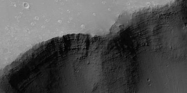
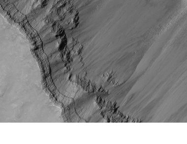
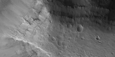
Layers show up in the walls of craters. | Layers show up in the walls of craters. | ||
| − | <gallery class="center" widths=" | + | <gallery class="center" widths="380px" heights="360px"> |
File: 57080 1380layerscratercolor.jpg|Layers in crater wall in Phaethontis quadrangle, as seen by HiRISE under HiWish program | File: 57080 1380layerscratercolor.jpg|Layers in crater wall in Phaethontis quadrangle, as seen by HiRISE under HiWish program | ||
File:ESP 057098 2050layers.jpg|Layers around crater in Syrtis Major quadrangle | File:ESP 057098 2050layers.jpg|Layers around crater in Syrtis Major quadrangle | ||
| Line 16: | Line 17: | ||
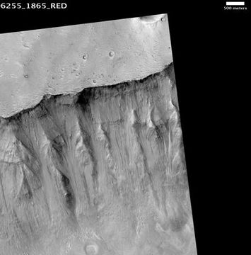
Mars has spectular canyons and troughs where the ground has pulled apart due to the stress caused by the weight of giant volcanoes. In these places layers often run continually for long distances. | Mars has spectular canyons and troughs where the ground has pulled apart due to the stress caused by the weight of giant volcanoes. In these places layers often run continually for long distances. | ||
| − | <gallery class="center" widths=" | + | <gallery class="center" widths="380px" heights="360px"> |
Image:Noctis Labyrinthusmgs.jpg|Close view of layers in Noctis Labyrinthus | Image:Noctis Labyrinthusmgs.jpg|Close view of layers in Noctis Labyrinthus | ||
File:Troughs in Elysium Planitia.jpg|Troughs displaying layers in the Elysium Planitia | File:Troughs in Elysium Planitia.jpg|Troughs displaying layers in the Elysium Planitia | ||
File:43376 1710layersclose.jpg|Layers in a trough in Coprates quadrangle | File:43376 1710layersclose.jpg|Layers in a trough in Coprates quadrangle | ||
| + | File:800px-Coprates layers.jpg|Layers in canyon in Coprates quadrangle, as seen by Mars Global Surveyor under MOC Public Targeting Program | ||
| + | |||
</gallery> | </gallery> | ||
| Line 27: | Line 30: | ||
Many features resemble long river valleys similar to what is common on the Earth. Layering occurs along many of the walls. | Many features resemble long river valleys similar to what is common on the Earth. Layering occurs along many of the walls. | ||
| − | <gallery class="center" widths=" | + | <gallery class="center" widths="380px" heights="360px"> |
File:Shalbatana Vallis.JPG|Layers in wall of Shalbatana Vallis | File:Shalbatana Vallis.JPG|Layers in wall of Shalbatana Vallis | ||
| + | |||
| + | ESP 048980 1725layers.jpg|Wide view of layers in Louros Valles, as seen by HiRISE under HiWish program Louros Valles is part of the Ius Chasma. | ||
| + | 48980 1725layersclose2.jpg|Close view of layers in Louros Valles Note this is an enlargement of a previous image. | ||
| + | |||
| + | 48980 1725layersclose.jpg|Close view of layers in Louros VallesNote this is an enlargement of a previous image. | ||
| + | ESP 048980 1725layersclosecolor.jpg|Close view of layers in Louros Valles Note this is an enlargement of a previous image. | ||
| + | |||
</gallery> | </gallery> | ||
| Line 35: | Line 45: | ||
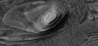
Mesas and pedestal craters, a feature unique to Mars, often show layers. Both of these are the remains of layers that once covered wide regions. They often owe their existence to an erosion-resistant top layer. Sometimes it is from a layer of hard lava that covered everything. Cap rock, a name given to this hard layer, is seen to break into large blocks or boulders in some cap rocks. | Mesas and pedestal craters, a feature unique to Mars, often show layers. Both of these are the remains of layers that once covered wide regions. They often owe their existence to an erosion-resistant top layer. Sometimes it is from a layer of hard lava that covered everything. Cap rock, a name given to this hard layer, is seen to break into large blocks or boulders in some cap rocks. | ||
| − | <gallery class="center" widths=" | + | <gallery class="center" widths="380px" heights="360px"> |
File:Wikiesp 035896 1845crommelinbutte.jpg|Layers in Crommelin Crater | File:Wikiesp 035896 1845crommelinbutte.jpg|Layers in Crommelin Crater | ||
File:47080 2120layersclose.jpg|Layers in mesa in Mare Acidalium quadrangle | File:47080 2120layersclose.jpg|Layers in mesa in Mare Acidalium quadrangle | ||
| Line 43: | Line 53: | ||
Pedestal craters develop a protective top layer from the action of crater ejecta. | Pedestal craters develop a protective top layer from the action of crater ejecta. | ||
| − | |||
| + | <gallery class="center" widths="380px" heights="360px"> | ||
File:ESP 047367 1910pedestal.jpg|Wide view of pedestal The southern (lower) edge is enlarged in next image to show layers. | File:ESP 047367 1910pedestal.jpg|Wide view of pedestal The southern (lower) edge is enlarged in next image to show layers. | ||
File:47367 1910pedestallayerssouth.jpg|Close view of layers in pedestal crater in Arabia quadrangle | File:47367 1910pedestallayerssouth.jpg|Close view of layers in pedestal crater in Arabia quadrangle | ||
| + | 47421 1890layersbuttesclose.jpg|Close view of layers | ||
</gallery> | </gallery> | ||
==Inside craters== | ==Inside craters== | ||
| − | The insides of many craters contain layered deposits. They appear to have formed sometime after the crater was blasted into the surface. The Mars Curiosity Rover was sent to examine one of these formations. It quickly found rounded pebbles–strong evidence for running water. <ref> https://www.nasa.gov/home/hqnews/2012/sep/HQ_12-338_Mars_Water_Stream.html</ref> <ref>https://www.youtube.com/watch?v=fYo31XjoXOk </ref> <ref>http://apnews.excite.com/article/20120927/DA1IDOO00.html </ref> Later, it was determined that indeed Gale Crater once held a lake. <ref>https://www.nasa.gov/press/2014/december/nasa-s-curiosity-rover-finds-clues-to-how-water-helped-shape-martian-landscape </ref> <ref>https://www.sciencedaily.com/releases/2014/12/141208122903.htm </ref> <ref> https://www.jpl.nasa.gov/video/details.php?id=1346 </ref> <ref>https://www.jpl.nasa.gov/news/news.php?feature=4398</ref> The lake in Gale, became full of sediments. Later, all but the center mound was eroded. | + | The insides of many craters contain layered deposits. They appear to have formed sometime after the crater was blasted into the surface. The Mars Curiosity Rover was sent to examine one of these formations. It quickly found rounded pebbles–strong evidence for running water. <ref> https://www.nasa.gov/home/hqnews/2012/sep/HQ_12-338_Mars_Water_Stream.html</ref> <ref>https://www.youtube.com/watch?v=fYo31XjoXOk </ref> <ref>http://apnews.excite.com/article/20120927/DA1IDOO00.html </ref> Later, it was determined that indeed Gale Crater once held a lake. <ref>https://www.nasa.gov/press/2014/december/nasa-s-curiosity-rover-finds-clues-to-how-water-helped-shape-martian-landscape </ref> <ref>https://www.sciencedaily.com/releases/2014/12/141208122903.htm </ref> <ref> https://www.jpl.nasa.gov/video/details.php?id=1346 </ref> <ref>https://www.jpl.nasa.gov/news/news.php?feature=4398</ref> The lake in Gale, became full of sediments. Later, all but the center mound was eroded. However, there are other ideas that have been considered for the origin of Gale's mound.<ref>http://science.sciencemag.org/content/363/6426/535.full?ijkey=xakdRhWj7CWEE&keytype=ref&siteid=sci</ref> <ref>https://www.jpl.nasa.gov/news/news.php?feature=7323</ref> <ref>http://science.sciencemag.org/content/363/6426/535.abstract?ijkey=xakdRhWj7CWEE&keytype=ref&siteid=sci</ref> <ref>Lewis, K., et al. 2019. A surface gravity traverse on Mars indicates low bedrock density at Gale crater. Science: 363, 535-537.</ref> |
| − | + | ||
| − | <gallery class="center" widths=" | + | <gallery class="center" widths="380px" heights="360px"> |
| + | |||
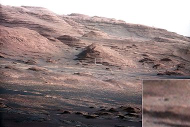
| + | File:PIA16105 malin04ano-br2.jpg|Layers at base of Mount Sharp, the mound in Gale crater, as seen by Curiosity's Mast Camera The insert shows a rock about the size of Curiosity. | ||
File:6866 mars-curiosity-rover-mastcam-sedimentary-deposit-lakebed-rocks-pia19074-full2.jpg|This evenly layered rock photographed by the Mast Camera (Mastcam) on NASA's Curiosity Mars Rover shows a pattern typical of a lake-floor sedimentary deposit not far from where flowing water entered a lake. | File:6866 mars-curiosity-rover-mastcam-sedimentary-deposit-lakebed-rocks-pia19074-full2.jpg|This evenly layered rock photographed by the Mast Camera (Mastcam) on NASA's Curiosity Mars Rover shows a pattern typical of a lake-floor sedimentary deposit not far from where flowing water entered a lake. | ||
File: Mars-curiosity-rover-msl-rock-layers-PIA21042-full2.jpg|View from Mastcam on Curiosity showing sloping buttes and layered outcrops on lower Mount Sharp | File: Mars-curiosity-rover-msl-rock-layers-PIA21042-full2.jpg|View from Mastcam on Curiosity showing sloping buttes and layered outcrops on lower Mount Sharp | ||
</gallery> | </gallery> | ||
| − | Many other past lakes have been proposed for craters and other low regions.<ref>De Hon, R. 1992. Martian lake basins and lacustrine plains. Earth Moon Planets: 56, 95-122.</ref> <ref>Cabrol, N., E. Grin. 1999. Distribution, classification, and ages of martian impact crater lakes. Icarus: 142, 160-172.</ref> <ref>Cabrol, N., E. Grin. 2001. The evolution of lacustrine environments on Mars: Is Mars only hydrologically dormant. Icarus: 149, 291-328<ref> <ref>Goudge, T., K. Aureli, J. Head, C. Fassett, J. Mustard. 2015. Classification and analysis of candidate impact crater-hosted closed-basin lakes on Mars. Icarus: 260, 346-367.</ref> <ref>Fassett, C. J. Head. 2008. Valley network-fed, open-basin lakes on Mars: Distribution and implications for Noachian surface and subsurface hydrology. Icarus: 198, 37-56.</ref> <ref>Zhao, J., et al. 2018. PALEOLAKES IN THE NORTHWEST HELLAS REGION: IMPLICATIONS FOR PALEO-CLIMATE AND REGIONAL GEOLOGIC HISTORY. 49th Lunar and Planetary Science Conference 2018 (LPI Contrib. No. 2083). | + | Many other past lakes have been proposed for craters and other low regions.<ref>De Hon, R. 1992. Martian lake basins and lacustrine plains. Earth Moon Planets: 56, 95-122.</ref> <ref>Cabrol, N., E. Grin. 1999. Distribution, classification, and ages of martian impact crater lakes. Icarus: 142, 160-172.</ref> <ref>Cabrol, N., E. Grin. 2001. The evolution of lacustrine environments on Mars: Is Mars only hydrologically dormant. Icarus: 149, 291-328</ref> <ref>Goudge, T., K. Aureli, J. Head, C. Fassett, J. Mustard. 2015. Classification and analysis of candidate impact crater-hosted closed-basin lakes on Mars. Icarus: 260, 346-367.</ref><ref>Fassett, C. J. Head. 2008. Valley network-fed, open-basin lakes on Mars: Distribution and implications for Noachian surface and subsurface hydrology. Icarus: 198, 37-56.</ref> <ref>Zhao, J., et al. 2018. PALEOLAKES IN THE NORTHWEST HELLAS REGION: IMPLICATIONS FOR PALEO-CLIMATE AND REGIONAL GEOLOGIC HISTORY. 49th Lunar and Planetary Science Conference 2018 (LPI Contrib. No. 2083).</ref> |
| − | <gallery class="center" widths=" | + | <gallery class="center" widths="380px" heights="360px"> |
File:56836 1900layedmound2.jpg|Layers on crater floor in Arabia quadrangle | File:56836 1900layedmound2.jpg|Layers on crater floor in Arabia quadrangle | ||
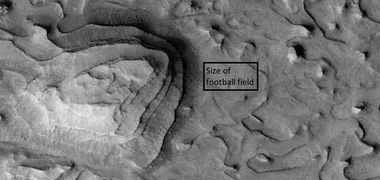
File:56836 1900layedmoundfootball.jpg|Layers on crater floor, as seen by HiRISE under HiWish program Box shows size of a football field. | File:56836 1900layedmoundfootball.jpg|Layers on crater floor, as seen by HiRISE under HiWish program Box shows size of a football field. | ||
| Line 71: | Line 84: | ||
Usually , ELD’s are found ~ ±30° of the equator.<ref name="Malin, M. 2000">Malin, M., Edgett, K. 2000. Science: 290,1927.</ref> Equatorial Layered Deposits appear in various geological settings such as cratered terrains (Arabia Terra, Meridiani Planum), chaotic terrains (Aram Chaos, Aureum Chaos), the Valles Marineris chasmata (and surrounding plateaus), and large impact craters (Gale, Becquerel, Crommelin). <ref>Lucchitta B., et al. 1992 In Mars, 453-492. University of Arizona Press. Tucson</ref> <ref>Le Deit, L., et al. 2011. Geological Comparison of the Gale Crater mount to other equatorial layered deposits (ELDs) on Mars. 42nd Lunar and Planetary Science Conference (2011) 1857.pdf.</ref> Layering is visible on meter scale, and when the deposits are partly eroded, intricate patterns become visible.<ref>http://www.issibern.ch/teams/marsild</ref> | Usually , ELD’s are found ~ ±30° of the equator.<ref name="Malin, M. 2000">Malin, M., Edgett, K. 2000. Science: 290,1927.</ref> Equatorial Layered Deposits appear in various geological settings such as cratered terrains (Arabia Terra, Meridiani Planum), chaotic terrains (Aram Chaos, Aureum Chaos), the Valles Marineris chasmata (and surrounding plateaus), and large impact craters (Gale, Becquerel, Crommelin). <ref>Lucchitta B., et al. 1992 In Mars, 453-492. University of Arizona Press. Tucson</ref> <ref>Le Deit, L., et al. 2011. Geological Comparison of the Gale Crater mount to other equatorial layered deposits (ELDs) on Mars. 42nd Lunar and Planetary Science Conference (2011) 1857.pdf.</ref> Layering is visible on meter scale, and when the deposits are partly eroded, intricate patterns become visible.<ref>http://www.issibern.ch/teams/marsild</ref> | ||
| − | <gallery class="center" widths=" | + | [[File:26270 1820layerscolor.jpg|Layers and fault in Firsoff Crater|600pxr|Layers in Firsoff Crater, as seen by HiRISE under HiWish program]] |
| + | |||
| + | Layers in Firsoff Crater, as seen by HiRISE under HiWish program | ||
| + | |||
| + | <gallery class="center" widths="380px" heights="360px"> | ||
| + | |||
| + | File:Layered mound in Firsoff Crater, Mars 79401 1820layeredmoundfirsoff 03.jpg|Layered mound in Firsoff Crater | ||
| + | </gallery> | ||
| + | |||
| + | <gallery class="center" widths="380px" heights="360px"> | ||
File:Henry Crater Mound.JPG|Layers exposed on mound in Henry Crater | File:Henry Crater Mound.JPG|Layers exposed on mound in Henry Crater | ||
File:Wikiesp 035896 1845crommelinhollows.jpg|Layered mound on floor of Crommelin Crater | File:Wikiesp 035896 1845crommelinhollows.jpg|Layered mound on floor of Crommelin Crater | ||
| + | File:53289 1845layers2faultcrommelin.jpg|Layers in Crommelin Crater Arrow indicates a fault. | ||
| + | |||
| + | File:Layers some with overhang ESP 26270 1820.jpg|Layers some with overhang. This image was named HiRISE picture of the day. | ||
| + | File:Layers and layered mounds ESP 26270 1820.jpg|Layers and layered mounds. Each layer records some sort of change and water may have been involved. This image was named HiRISE picture of the day. | ||
| + | File:Layered area with faults ESP 26270 1820.jpg|Layers Dark parts are basalt sand that has settled on horizonal surfaces. This image was named HiRISE picture of the day. | ||
| + | |||
| + | File:Color view of layers 26270 1820.jpg|Close, color view of layers. Light brown is from dust falling from sky. Dark parts are basalt sand that has settled on horizonal surfaces. This image was named HiRISE picture of the day. | ||
| + | |||
</gallery> | </gallery> | ||
| + | |||
| + | [[File:Wide view of layers ESP 27747 1820.jpg|600pxr|Layers and faults in Arabia quadrangle]] | ||
| + | |||
| + | Layers and faults in Arabia quadrangle--HiRISE Picture of the Day (September 25, 2021) | ||
==Mantle layers== | ==Mantle layers== | ||
| − | Another class of layers may have been created as ice-rich material fell from the sky when the climate changed. Because Mars has no large moon to stabilize its tilt, its tilt, and thus its climate vary greatly. At times moisture from the poles enters the atmosphere, and freezes to form snow or ice-coatcoated dust. This ice-rich material collects at mid latitudes. It appears as a smooth covering, called latitude dependent mantle. After each climate change, some of the material stays behind, while much just returns to the Polar Regions. This repeated process results in layers in craters and in sheltered spots like against cliffs. Some of these formations have been shaped by the wind into various shapes. | + | Another class of layers may have been created as ice-rich material fell from the sky when the climate changed. Because Mars has no large moon to stabilize its tilt, its tilt, and thus its climate vary greatly.<ref>https://www.uahirise.org/hipod/ESP_034132_1750</ref> At times moisture from the poles enters the atmosphere, and freezes to form snow or ice-coatcoated dust. This ice-rich material collects at mid latitudes. It appears as a smooth covering, called latitude dependent mantle. After each climate change, some of the material stays behind, while much just returns to the Polar Regions. This repeated process results in layers in craters and in sheltered spots like against cliffs. Some of these formations have been shaped by the wind into various shapes. |
It must be pointed out that mantle is widespread on Mars and contains water ice. This ice can be a major source of water for future colonists. | It must be pointed out that mantle is widespread on Mars and contains water ice. This ice can be a major source of water for future colonists. | ||
| − | <gallery class="center" widths=" | + | <gallery class="center" widths="380px" heights="360px"> |
File:ESP 050793 1365pyramids.jpg| Wide view of layered features in Hellas quadrangle | File:ESP 050793 1365pyramids.jpg| Wide view of layered features in Hellas quadrangle | ||
File:50793 1365layers2.jpg|Close view of layered features in Hellas quadrangle Each layer may represent a change in the climate. | File:50793 1365layers2.jpg|Close view of layered features in Hellas quadrangle Each layer may represent a change in the climate. | ||
| Line 88: | Line 122: | ||
==Northern polar layers== | ==Northern polar layers== | ||
| − | We have known about layers in the northern ice cap for a long time. They | + | We have known about layers in the northern ice cap for a long time. They record many past climate changes. |
| − | <gallery class="center" widths=" | + | <gallery class="center" widths="380px" heights="360px"> |
File:ESP 044934 2670icecaplayers.jpg|Layers exposed in ice cap in Mare Boreum quadrangle | File:ESP 044934 2670icecaplayers.jpg|Layers exposed in ice cap in Mare Boreum quadrangle | ||
File:ESP 036863 2670icecaplayers.jpg| Layers exposed in ice cap in Mare Boreum quadrangle | File:ESP 036863 2670icecaplayers.jpg| Layers exposed in ice cap in Mare Boreum quadrangle | ||
| Line 97: | Line 131: | ||
==Layers created by groundwater== | ==Layers created by groundwater== | ||
| − | Although many sets of layers probably originated underwater, some researchers believe that | + | Although many sets of layers probably originated underwater, some researchers believe that some layered formations were created by a combination of sediment and ground water. <ref>Grotzinger, J., et al. 2005. Stratigraphy and sedimentology of a dry to wet eolian depositional system, Burns formation, Meridiani Planum, Mars. Earth and Planetary Science Letters 240:11–72.</ref> <ref>Andrews-Hanna J., et al. 2010. Early Mars hydrology: Meridiani playa deposits and the sedimentary record of Arabia Terra. Journal of Geophysical Research 115:E06002.</ref> <ref> Grotzinger, J., R. Milliken. THE SEDIMENTARY ROCK RECORD OF MARS: DISTRIBUTION, ORIGINS, AND GLOBAL STRATIGRAPHY. 2012. Sedimentary Geology of MarsSEPM Special Publication No. 102, SEPM (Society for Sedimentary Geology), Print ISBN 978-1-56576-312-8, CD/DVD ISBN 978-1-56576-313-5, p. 1–48.</ref> <ref> Squyres, S. W.; Knoll, A. H. (2005). "Sedimentary rocks at Meridiani Planum: Origin, diagenesis, and implications for life on Mars". Earth Planet. Sci. Lett. 240: 1–10. Bibcode:2005E&PSL.240....1S. doi:10.1016/j.epsl.2005.09.038.</ref> <ref> Squyres, S. W.; et al. (2006). "Two years at Meridiani Planum: Results from the Opportunity rover". Science. 313: 1403–1407. doi:10.1126/science.</ref> Sediment could be transported by the wind, volcanoes, or crater impacts. Water moving through the ground would easily pick up minerals like silica or sulfates that could cement the material. <ref> https://www.nature.com/articles/ngeo1706</ref> <ref>Michalski, J., et al. 2013. Groundwater activity on Mars and implications for a deep biosphere. Nature Geoscience volume 6, pages 133–138.</ref> On Earth the hardness of many sedimentary rocks, like sandstone, is mostly caused by the type of the mineral cement that was put in place as water passed through. Some layers contain Gypsum, a sulfate which forms in relatively fresh water. <ref>cite web|url=http://news.nationalgeographic.com/news/2009/11/091125-mars-crater-lake-michigan-water_2.html |title=Martian "Lake Michigan" Filled Crater, Minerals Hint |publisher=News.nationalgeographic.com |date=2010</ref> |
| − | [[File:Groundwaterseries8final.jpg|thumb| | + | [[File:Groundwaterseries8final.jpg|thumb|right|Layers may be formed by groundwater rising up depositing minerals and cementing sediments. The hardened layers are consequently more protected from erosion. This process may occur instead of layers forming under lakes.]] |
| − | Strong proof of groundwater cementing materials | + | Strong proof of groundwater cementing materials was discovered by Opportunity Rover. Places, examined by Opportunity such as Endurance, Eagle, and Erebus craters happened to be where the water table breached the surface.<ref>Grotzinger, J., et al. 2005. Stratigraphy and sedimentology of a dry to wet eolian depositional system, Burns formation, Meridiani Planum, Mars. Earth and Planetary Science Letters 240:11–72.</ref> <ref> Grotzinger J., et al. 2006. Sedimentary textures formed by aqueous processes, Erebus crater, Meridiani Planum, Mars. Geology 34:1085–1088.</ref> <ref> McLennan S., Grotzinger J. 2008. The sedimentary rock cycle of Mars. In Bell J., (Editor). The Martian Surface: Cambridge University Press, UK. 541–577.</ref> In addition, it was found that sediment was transported by wind-driven currents of water in some locations. Groundwater rose and fell, as evidenced by small surface cracks formed during multiple wetting and drying events. Ferric sulfates (such as jarosite) in the rocks of Meridiani Planum indicate that acidic fluids were present. These acidic liquids could have been produced when water with dissolved Fe(II) was oxidized as it reached the surface.<ref>Hurowitz J. et al., 2010. Origin of acidic surface waters and the evolution of atmospheric chemistry on early Mars. Nature Geoscience 3:323–326.</ref> Hydrologic models predict that groundwater should indeed emerge in the Sinus Meridiani region which was explored by Opportunity.<ref>Andrews-Hanna J., et al. 2007. Meridiani Planum and the global hydrology of Mars. Nature 446:163–166.</ref> |
==What’s so great about layers on Mars== | ==What’s so great about layers on Mars== | ||
| − | The widespread occurrence of layering on the Red Planet has great significance. On Earth, much layering originates in bodies of water.<ref>Namowitz, S., Stone, D. 1975. Earth science The World We Live in. American Book Company. N.Y. </ref> If this is | + | The widespread occurrence of layering on the Red Planet has great significance. On Earth, much layering originates in bodies of water.<ref>Namowitz, S., Stone, D. 1975. Earth science The World We Live in. American Book Company. N.Y. </ref> If this is true, at least to some extent on Mars, then traces of past life might be found in layered formations. Indeed, much evidence has been gathered for the existence of lakes in craters and some canyons. |
Whether layers were created under water or through ground water, water is still involved. Most of the organic mass on the Earth is found under the surface.<ref>https://microbewiki.kenyon.edu/index.php/Deep_subsurface_microbes</ref> <ref>Amend, J.. A. Teske. 2005. Expanding frontiers in deep subsurface microbiology. Palaeogeography, Palaeoclimatology, Palaeoecology: Volume 219, Issues 1–2, 131-155.</ref> Many microbes live deep underground.<ref>Pedersen, K. 1993. The deep subterranean biosphere. Earth Science Reviews: 34, 243-260.</ref> <ref> Stevens, T., J. McKiney. 1995. Lithoautotrophic Microbial Ecosystems in Deep Basalt Acquifers. Science: 270, 450-454.</ref> <ref>Fredrickson, J. , T. Onstott. 1996. Microbes Deep inside the Earth. Scientific American. October, 1996.</ref> Life under the Martian surface might find it easier since it would be protected from high levels of radiation.<ref>Boston, P., et al. 1992. On the Possibility of Chemosynthetic Ecosystems in Subsurface Habitats on Mars. Icarus: 95, 300-308.</ref> One recent study found that radiation from certain elements in the crust of Mars could have reacted with water in the ground to produce hydrogen. Hydrogen can supply chemical energy for life.<ref>http://astrobiology.com/2018/09/ancient-mars-had-right-conditions-for-underground-life.html</ref> <ref> Tarnas, J., et al. 2018 Radiolytic H2 Production on Noachian Mars: Implications for Habitability and Atmospheric Warming. Earth and Planetary Science Letters [https://doi.org/10.1016/j.epsl.2018.09.001</ref> | Whether layers were created under water or through ground water, water is still involved. Most of the organic mass on the Earth is found under the surface.<ref>https://microbewiki.kenyon.edu/index.php/Deep_subsurface_microbes</ref> <ref>Amend, J.. A. Teske. 2005. Expanding frontiers in deep subsurface microbiology. Palaeogeography, Palaeoclimatology, Palaeoecology: Volume 219, Issues 1–2, 131-155.</ref> Many microbes live deep underground.<ref>Pedersen, K. 1993. The deep subterranean biosphere. Earth Science Reviews: 34, 243-260.</ref> <ref> Stevens, T., J. McKiney. 1995. Lithoautotrophic Microbial Ecosystems in Deep Basalt Acquifers. Science: 270, 450-454.</ref> <ref>Fredrickson, J. , T. Onstott. 1996. Microbes Deep inside the Earth. Scientific American. October, 1996.</ref> Life under the Martian surface might find it easier since it would be protected from high levels of radiation.<ref>Boston, P., et al. 1992. On the Possibility of Chemosynthetic Ecosystems in Subsurface Habitats on Mars. Icarus: 95, 300-308.</ref> One recent study found that radiation from certain elements in the crust of Mars could have reacted with water in the ground to produce hydrogen. Hydrogen can supply chemical energy for life.<ref>http://astrobiology.com/2018/09/ancient-mars-had-right-conditions-for-underground-life.html</ref> <ref> Tarnas, J., et al. 2018 Radiolytic H2 Production on Noachian Mars: Implications for Habitability and Atmospheric Warming. Earth and Planetary Science Letters [https://doi.org/10.1016/j.epsl.2018.09.001</ref> | ||
| Line 111: | Line 145: | ||
*[[High Resolution Imaging Science Experiment (HiRISE)]] | *[[High Resolution Imaging Science Experiment (HiRISE)]] | ||
| + | *[[Mars Global Surveyor]] | ||
*[[Olympus Mons]] | *[[Olympus Mons]] | ||
| + | *[[Periodic climate changes on Mars]] | ||
| + | *[[Tharsis]] | ||
| + | *[[Valles Marineris]] | ||
*[[What Mars Actually Looks Like!]] | *[[What Mars Actually Looks Like!]] | ||
| Line 118: | Line 156: | ||
==Recommended reading== | ==Recommended reading== | ||
| + | |||
* Grotzinger, J. and R. Milliken (eds.). 2012. Sedimentary Geology of Mars. SEPM. | * Grotzinger, J. and R. Milliken (eds.). 2012. Sedimentary Geology of Mars. SEPM. | ||
| + | |||
| + | == External links == | ||
| + | |||
| + | *[https://www.uahirise.org/PSP_007820_1505 Layered Sediments in Hellas Planitia] | ||
| + | |||
| + | *[https://www.youtube.com/watch?v=RYG-HLr33CM Jim Secosky - Martian Geology - 16th Annual International Mars Society Convention] | ||
| + | |||
| + | [[Category: Geologic Processes]] | ||
Latest revision as of 09:23, 2 January 2024
Article written by Jim Secosky. Jim is a retired science teacher who has used the Hubble Space Telescope, the Mars Global Surveyor, and HiRISE.
When the pictures from Mariner 9 were examined, scientists thought that with all the craters, Mars must be like the moon. Billions of years of bombardment would have caused the crust to be just broken up rocks they thought. However, this view did not hold up. Mars Global Surveyor from the beginning showed vast areas of layered rocks; layered showed up to 10 km deep in the Valles Marineris. Today, we believe layered is planet-wide. [1] [2]
Contents
Crater walls
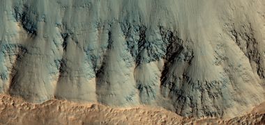
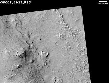
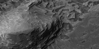
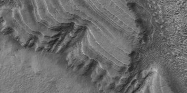
Layers show up in the walls of craters.
Canyons and troughs
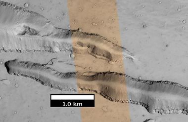
Mars has spectular canyons and troughs where the ground has pulled apart due to the stress caused by the weight of giant volcanoes. In these places layers often run continually for long distances.
Along ancient river valleys
Many features resemble long river valleys similar to what is common on the Earth. Layering occurs along many of the walls.
Islands of layers
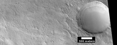
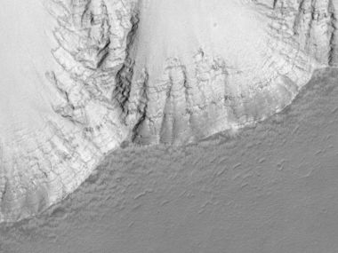
Mesas and pedestal craters, a feature unique to Mars, often show layers. Both of these are the remains of layers that once covered wide regions. They often owe their existence to an erosion-resistant top layer. Sometimes it is from a layer of hard lava that covered everything. Cap rock, a name given to this hard layer, is seen to break into large blocks or boulders in some cap rocks.
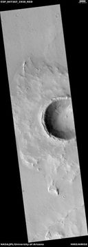
Pedestal craters develop a protective top layer from the action of crater ejecta.
Inside craters
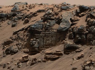
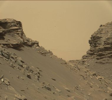
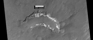
The insides of many craters contain layered deposits. They appear to have formed sometime after the crater was blasted into the surface. The Mars Curiosity Rover was sent to examine one of these formations. It quickly found rounded pebbles–strong evidence for running water. [3] [4] [5] Later, it was determined that indeed Gale Crater once held a lake. [6] [7] [8] [9] The lake in Gale, became full of sediments. Later, all but the center mound was eroded. However, there are other ideas that have been considered for the origin of Gale's mound.[10] [11] [12] [13]
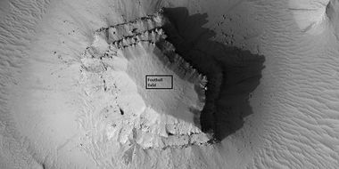
Many other past lakes have been proposed for craters and other low regions.[14] [15] [16] [17][18] [19]
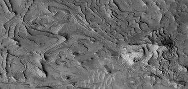
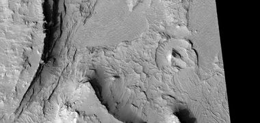
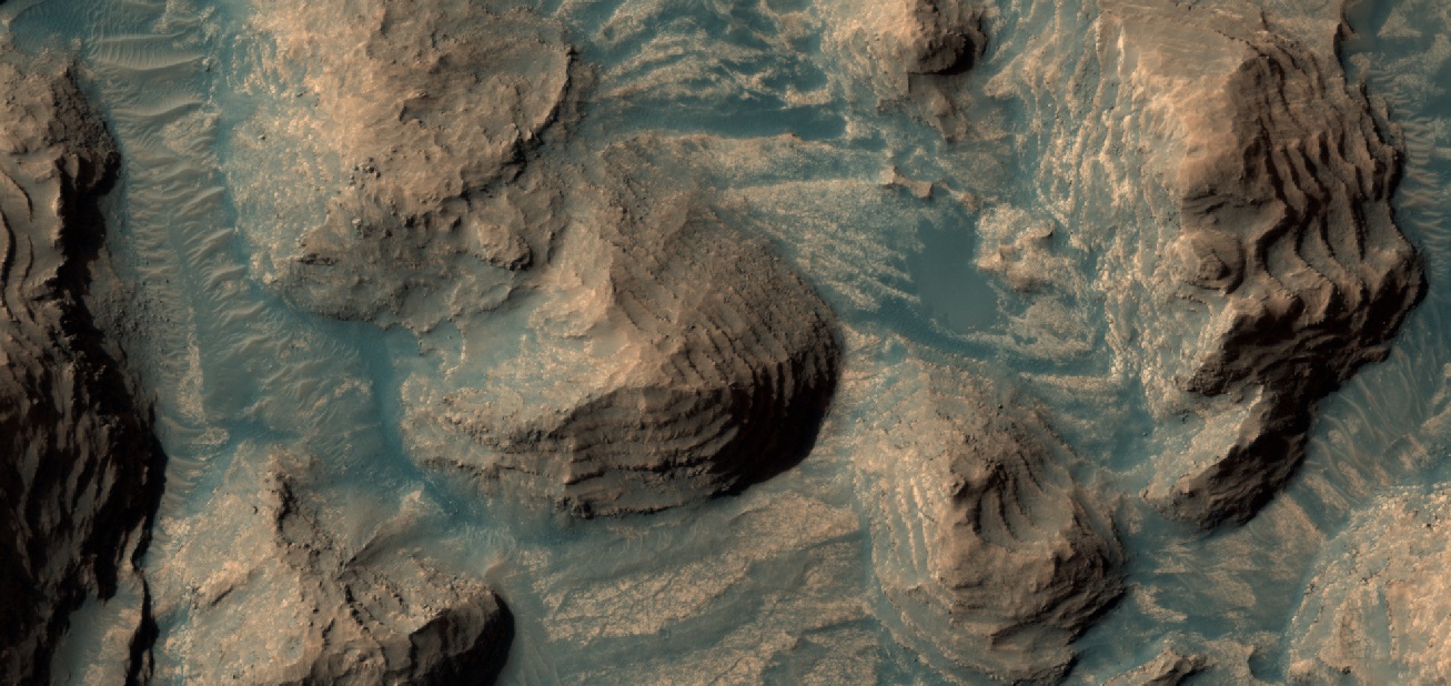
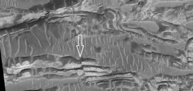
Large masses of layered deposits in depressions, such as craters have been called Equatorial Layered Deposits (ELD’s) or Interior Layered Deposits (ILDs) in Valles Marineris.[20] They are often found with outcrops of hydrated sulfates on Mars. Hydrated sulfates are a sign of liquid water in Martian history since they need water to form. Based on albedo, erosion patterns, physical characteristics, and composition, researchers have classified different groups of layers in Gale Crater that seem to be similar to layers in other (ELD’s). The groups include: a small yardang unit, a coarse yardang unit, and a terraced unit.[21] Usually , ELD’s are found ~ ±30° of the equator.[22] Equatorial Layered Deposits appear in various geological settings such as cratered terrains (Arabia Terra, Meridiani Planum), chaotic terrains (Aram Chaos, Aureum Chaos), the Valles Marineris chasmata (and surrounding plateaus), and large impact craters (Gale, Becquerel, Crommelin). [23] [24] Layering is visible on meter scale, and when the deposits are partly eroded, intricate patterns become visible.[25]
Layers in Firsoff Crater, as seen by HiRISE under HiWish program
Layers and faults in Arabia quadrangle--HiRISE Picture of the Day (September 25, 2021)
Mantle layers
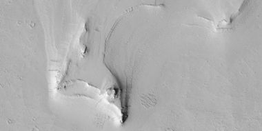
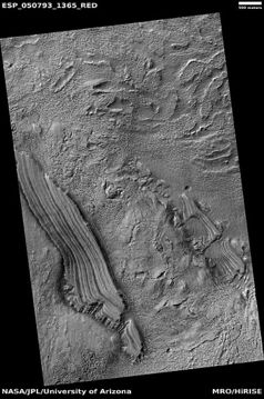
Another class of layers may have been created as ice-rich material fell from the sky when the climate changed. Because Mars has no large moon to stabilize its tilt, its tilt, and thus its climate vary greatly.[26] At times moisture from the poles enters the atmosphere, and freezes to form snow or ice-coatcoated dust. This ice-rich material collects at mid latitudes. It appears as a smooth covering, called latitude dependent mantle. After each climate change, some of the material stays behind, while much just returns to the Polar Regions. This repeated process results in layers in craters and in sheltered spots like against cliffs. Some of these formations have been shaped by the wind into various shapes. It must be pointed out that mantle is widespread on Mars and contains water ice. This ice can be a major source of water for future colonists.
Northern polar layers
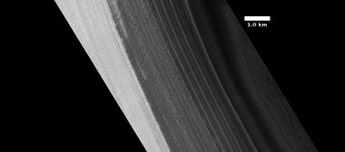
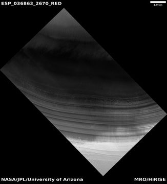
We have known about layers in the northern ice cap for a long time. They record many past climate changes.
Layers created by groundwater
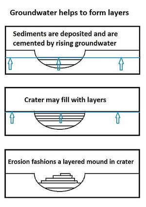
Although many sets of layers probably originated underwater, some researchers believe that some layered formations were created by a combination of sediment and ground water. [27] [28] [29] [30] [31] Sediment could be transported by the wind, volcanoes, or crater impacts. Water moving through the ground would easily pick up minerals like silica or sulfates that could cement the material. [32] [33] On Earth the hardness of many sedimentary rocks, like sandstone, is mostly caused by the type of the mineral cement that was put in place as water passed through. Some layers contain Gypsum, a sulfate which forms in relatively fresh water. [34]
Strong proof of groundwater cementing materials was discovered by Opportunity Rover. Places, examined by Opportunity such as Endurance, Eagle, and Erebus craters happened to be where the water table breached the surface.[35] [36] [37] In addition, it was found that sediment was transported by wind-driven currents of water in some locations. Groundwater rose and fell, as evidenced by small surface cracks formed during multiple wetting and drying events. Ferric sulfates (such as jarosite) in the rocks of Meridiani Planum indicate that acidic fluids were present. These acidic liquids could have been produced when water with dissolved Fe(II) was oxidized as it reached the surface.[38] Hydrologic models predict that groundwater should indeed emerge in the Sinus Meridiani region which was explored by Opportunity.[39]
What’s so great about layers on Mars
The widespread occurrence of layering on the Red Planet has great significance. On Earth, much layering originates in bodies of water.[40] If this is true, at least to some extent on Mars, then traces of past life might be found in layered formations. Indeed, much evidence has been gathered for the existence of lakes in craters and some canyons. Whether layers were created under water or through ground water, water is still involved. Most of the organic mass on the Earth is found under the surface.[41] [42] Many microbes live deep underground.[43] [44] [45] Life under the Martian surface might find it easier since it would be protected from high levels of radiation.[46] One recent study found that radiation from certain elements in the crust of Mars could have reacted with water in the ground to produce hydrogen. Hydrogen can supply chemical energy for life.[47] [48]
See also
- High Resolution Imaging Science Experiment (HiRISE)
- Mars Global Surveyor
- Olympus Mons
- Periodic climate changes on Mars
- Tharsis
- Valles Marineris
- What Mars Actually Looks Like!
References
- ↑ cite journal | doi = 10.1555/mars.2005.0002 | title = The sedimentary rocks of Sinus Meridiani: Five key observations from data acquired by the Mars Global Surveyor and Mars Odyssey orbiters | date = 2005 | last1 = Edgett | first1 = Kenneth S. | journal = The Mars Journal | volume = 1 | pages = 5|
- ↑ cite journal | last1 = Malin | first1 = M. P. | last2 = Edgett | first2 = K. S. | date = 2000 | title = Ancient sedimentary rocks of early Mars | url = | journal = Science | volume = 290 | issue = 5498| pages = 1927–1937 | doi = 10.1126/science.290.5498.1927 | pmid = 11110654 |
- ↑ https://www.nasa.gov/home/hqnews/2012/sep/HQ_12-338_Mars_Water_Stream.html
- ↑ https://www.youtube.com/watch?v=fYo31XjoXOk
- ↑ http://apnews.excite.com/article/20120927/DA1IDOO00.html
- ↑ https://www.nasa.gov/press/2014/december/nasa-s-curiosity-rover-finds-clues-to-how-water-helped-shape-martian-landscape
- ↑ https://www.sciencedaily.com/releases/2014/12/141208122903.htm
- ↑ https://www.jpl.nasa.gov/video/details.php?id=1346
- ↑ https://www.jpl.nasa.gov/news/news.php?feature=4398
- ↑ http://science.sciencemag.org/content/363/6426/535.full?ijkey=xakdRhWj7CWEE&keytype=ref&siteid=sci
- ↑ https://www.jpl.nasa.gov/news/news.php?feature=7323
- ↑ http://science.sciencemag.org/content/363/6426/535.abstract?ijkey=xakdRhWj7CWEE&keytype=ref&siteid=sci
- ↑ Lewis, K., et al. 2019. A surface gravity traverse on Mars indicates low bedrock density at Gale crater. Science: 363, 535-537.
- ↑ De Hon, R. 1992. Martian lake basins and lacustrine plains. Earth Moon Planets: 56, 95-122.
- ↑ Cabrol, N., E. Grin. 1999. Distribution, classification, and ages of martian impact crater lakes. Icarus: 142, 160-172.
- ↑ Cabrol, N., E. Grin. 2001. The evolution of lacustrine environments on Mars: Is Mars only hydrologically dormant. Icarus: 149, 291-328
- ↑ Goudge, T., K. Aureli, J. Head, C. Fassett, J. Mustard. 2015. Classification and analysis of candidate impact crater-hosted closed-basin lakes on Mars. Icarus: 260, 346-367.
- ↑ Fassett, C. J. Head. 2008. Valley network-fed, open-basin lakes on Mars: Distribution and implications for Noachian surface and subsurface hydrology. Icarus: 198, 37-56.
- ↑ Zhao, J., et al. 2018. PALEOLAKES IN THE NORTHWEST HELLAS REGION: IMPLICATIONS FOR PALEO-CLIMATE AND REGIONAL GEOLOGIC HISTORY. 49th Lunar and Planetary Science Conference 2018 (LPI Contrib. No. 2083).
- ↑ Lucchitta B., et al. 1992 In Mars, 453-492. University of Arizona Press. Tucson
- ↑ Le Deit, L., et al. 2011. Geological Comparison of the Gale Crater mount to other equatorial layered deposits (ELDs) on Mars. 42nd Lunar and Planetary Science Conference (2011) 1857.pdf.
- ↑ Malin, M., Edgett, K. 2000. Science: 290,1927.
- ↑ Lucchitta B., et al. 1992 In Mars, 453-492. University of Arizona Press. Tucson
- ↑ Le Deit, L., et al. 2011. Geological Comparison of the Gale Crater mount to other equatorial layered deposits (ELDs) on Mars. 42nd Lunar and Planetary Science Conference (2011) 1857.pdf.
- ↑ http://www.issibern.ch/teams/marsild
- ↑ https://www.uahirise.org/hipod/ESP_034132_1750
- ↑ Grotzinger, J., et al. 2005. Stratigraphy and sedimentology of a dry to wet eolian depositional system, Burns formation, Meridiani Planum, Mars. Earth and Planetary Science Letters 240:11–72.
- ↑ Andrews-Hanna J., et al. 2010. Early Mars hydrology: Meridiani playa deposits and the sedimentary record of Arabia Terra. Journal of Geophysical Research 115:E06002.
- ↑ Grotzinger, J., R. Milliken. THE SEDIMENTARY ROCK RECORD OF MARS: DISTRIBUTION, ORIGINS, AND GLOBAL STRATIGRAPHY. 2012. Sedimentary Geology of MarsSEPM Special Publication No. 102, SEPM (Society for Sedimentary Geology), Print ISBN 978-1-56576-312-8, CD/DVD ISBN 978-1-56576-313-5, p. 1–48.
- ↑ Squyres, S. W.; Knoll, A. H. (2005). "Sedimentary rocks at Meridiani Planum: Origin, diagenesis, and implications for life on Mars". Earth Planet. Sci. Lett. 240: 1–10. Bibcode:2005E&PSL.240....1S. doi:10.1016/j.epsl.2005.09.038.
- ↑ Squyres, S. W.; et al. (2006). "Two years at Meridiani Planum: Results from the Opportunity rover". Science. 313: 1403–1407. doi:10.1126/science.
- ↑ https://www.nature.com/articles/ngeo1706
- ↑ Michalski, J., et al. 2013. Groundwater activity on Mars and implications for a deep biosphere. Nature Geoscience volume 6, pages 133–138.
- ↑ cite web|url=http://news.nationalgeographic.com/news/2009/11/091125-mars-crater-lake-michigan-water_2.html |title=Martian "Lake Michigan" Filled Crater, Minerals Hint |publisher=News.nationalgeographic.com |date=2010
- ↑ Grotzinger, J., et al. 2005. Stratigraphy and sedimentology of a dry to wet eolian depositional system, Burns formation, Meridiani Planum, Mars. Earth and Planetary Science Letters 240:11–72.
- ↑ Grotzinger J., et al. 2006. Sedimentary textures formed by aqueous processes, Erebus crater, Meridiani Planum, Mars. Geology 34:1085–1088.
- ↑ McLennan S., Grotzinger J. 2008. The sedimentary rock cycle of Mars. In Bell J., (Editor). The Martian Surface: Cambridge University Press, UK. 541–577.
- ↑ Hurowitz J. et al., 2010. Origin of acidic surface waters and the evolution of atmospheric chemistry on early Mars. Nature Geoscience 3:323–326.
- ↑ Andrews-Hanna J., et al. 2007. Meridiani Planum and the global hydrology of Mars. Nature 446:163–166.
- ↑ Namowitz, S., Stone, D. 1975. Earth science The World We Live in. American Book Company. N.Y.
- ↑ https://microbewiki.kenyon.edu/index.php/Deep_subsurface_microbes
- ↑ Amend, J.. A. Teske. 2005. Expanding frontiers in deep subsurface microbiology. Palaeogeography, Palaeoclimatology, Palaeoecology: Volume 219, Issues 1–2, 131-155.
- ↑ Pedersen, K. 1993. The deep subterranean biosphere. Earth Science Reviews: 34, 243-260.
- ↑ Stevens, T., J. McKiney. 1995. Lithoautotrophic Microbial Ecosystems in Deep Basalt Acquifers. Science: 270, 450-454.
- ↑ Fredrickson, J. , T. Onstott. 1996. Microbes Deep inside the Earth. Scientific American. October, 1996.
- ↑ Boston, P., et al. 1992. On the Possibility of Chemosynthetic Ecosystems in Subsurface Habitats on Mars. Icarus: 95, 300-308.
- ↑ http://astrobiology.com/2018/09/ancient-mars-had-right-conditions-for-underground-life.html
- ↑ Tarnas, J., et al. 2018 Radiolytic H2 Production on Noachian Mars: Implications for Habitability and Atmospheric Warming. Earth and Planetary Science Letters [https://doi.org/10.1016/j.epsl.2018.09.001
Recommended reading
- Grotzinger, J. and R. Milliken (eds.). 2012. Sedimentary Geology of Mars. SEPM.
