Difference between revisions of "Mare Boreum quadrangle"
(→Freezing of atmosphere: added ref) |
(→Ice cap: added image) |
||
| Line 49: | Line 49: | ||
ESP 052405 2595icelayersclosecolor.jpg|Close, color view of layers in northern ice cap, as seen by HiRISE under HiWish program | ESP 052405 2595icelayersclosecolor.jpg|Close, color view of layers in northern ice cap, as seen by HiRISE under HiWish program | ||
| + | |||
| + | File:69629 2605npolarlayerswide.jpg|Layers in northern ice cap | ||
</gallery> | </gallery> | ||
Revision as of 07:56, 15 September 2021
Mare Boreum is the sector roughly covering the north pole of Mars.
| MC-01 | Mare Boreum | 65–90° N | 180° W – 180° E | Quadrangles | Atlas |
The Mare Boreum quadrangle contains an ice cap and several large prominent craters. The main features in this quadrangle are Korolov Crater, Lomonosov Crater, and Chasma Boreale. The Phoenix spacecraft landed here on May 25, 2008. The Mare Boreum quadrangle is one of a series of 30 quadrangle maps of Mars used by the United States Geological Survey (USGS) and is also referred to as MC-1 (Mars Chart-1).[1] Its name derives from an older name for a feature that is now called Planum Boreum, a large plain surrounding the polar cap.[2]
In this article, some of the best pictures from a number of spacecraft will show what the landscape looks like in this region. The origins and significance of all features will be explained as they are currently understood.
The quadrangle covers all of the Martian surface north of latitude 65°. It includes the north polar ice cap, which has a swirl pattern and is roughly 1100 km across. Mariner 9 in 1972 discovered a belt of sand dunes that ring the polar ice deposits. The belt is 500 km across in some places and may be the largest dune field in the solar system.[3] The ice cap is surrounded by the vast plains of Planum Boreum and Vastitas Borealis. Close to the pole, there is a large valley, Chasma Boreale, that may have been formed from water melting from the ice cap.[4] An alternative view is that it was made by winds coming off the cold pole.[5] [6] Another prominent feature is a smooth rise, formerly called Olympia Planitia. In the summer, a dark collar around the residual cap becomes visible; it is mostly caused by dunes.[7] The quadrangle includes some very large craters that stand out in the north because the area is smooth. In other words, they really stand out. These large craters are Lomonosov, and Korolev. Although smaller, the crater Stokes is also prominent.
Contents
Ice cap
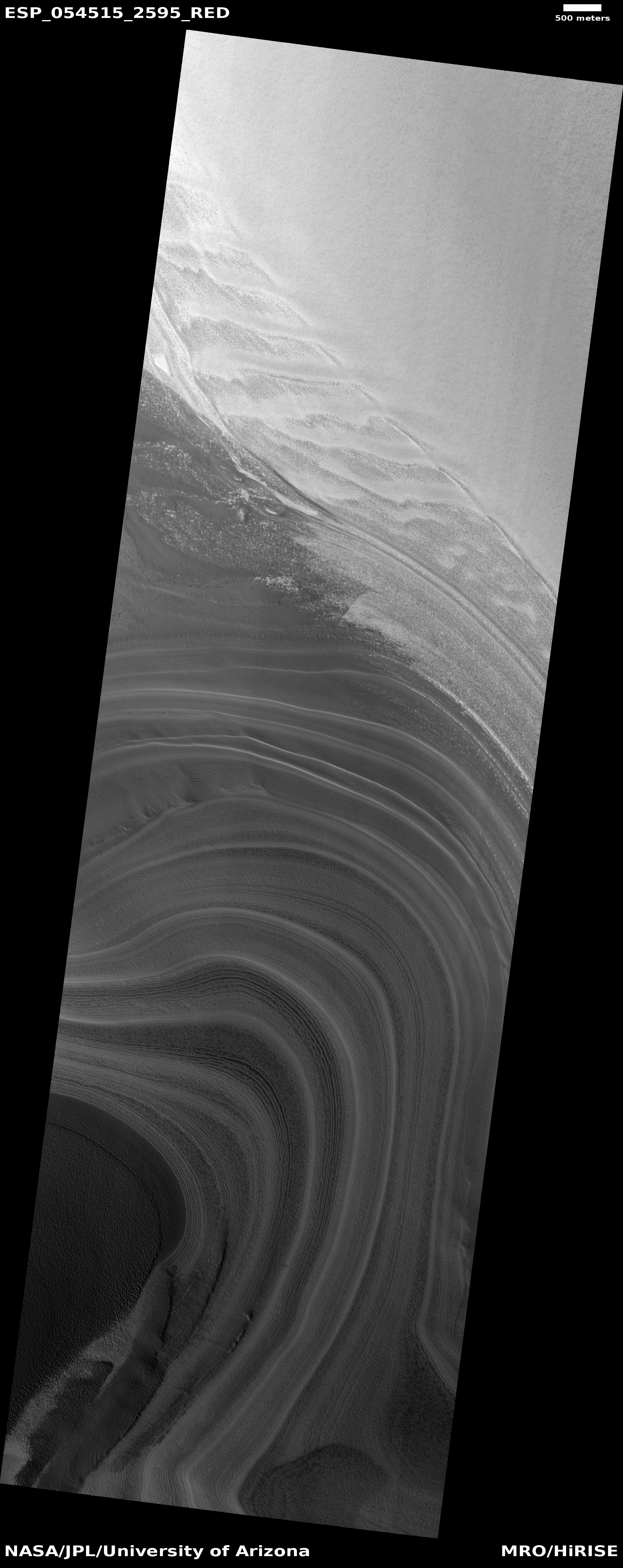
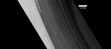
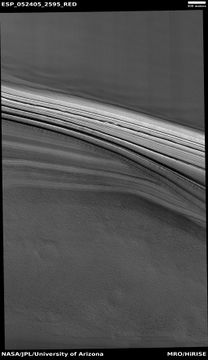
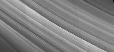
Layers exposed in northern ice cap
From observations with the Shallow Radar instrument (SHARAD) onboard the Mars Reconnaissance Orbiter, researchers determined that the total volume of water ice in the northern ice cap is 821,000 cubic kilometers. That is equal to 30% of the Earth's Greenland ice sheet, or enough to cover the surface of Mars to a depth of 5.6 meters[8] [9] [10]
The bulk of the northern ice cap consists of water ice; it also has a thin seasonal veneer of dry ice, solid (carbon dioxide). Each winter the ice cap grows by adding 1.5 to 2 m of dry ice. In summer, the dry ice sublimates (goes directly from a solid to a gas) into the atmosphere. Mars has seasons that are similar to Earth's, because its rotational axis has a tilt close to our own Earth's (25.19° for Mars, 23.44° for Earth). During each year on Mars, as much as a third of Mars' thin carbon dioxide (CO2) atmosphere "freezes out" during the winter in the northern and southern hemispheres. Scientists have even measured tiny changes in the gravity field of Mars due to the movement of carbon dioxide.[11] The ice cap in the north is of a lower altitude (base at -5000 m, top at -2000 m) than the one in the south (base at 1000 m, top at 3500 m).[12] [13] It is also warmer, so all the frozen carbon dioxide disappears each summer.[14] The part of the cap that survives the summer is called the north residual cap and is made of water ice. This water ice is believed to be as much as three kilometers thick. The much thinner seasonal cap starts to form in the late summer to early fall when a variety of clouds form. Called the polar hood, the clouds drop precipitation which thickens the cap. The north polar cap is symmetrical around the pole and covers the surface down to about 60 degrees latitude. High resolution images taken with NASA's Mars Global Surveyor show that the northern polar cap is covered mainly by pits, cracks, small bumps and knobs that give it a cottage cheese look. The pits are spaced close together relative to the very different depressions in the south polar cap. Both polar caps show layered features that result from seasonal melting and deposition of ice together with dust from Martian dust storms. These polar layered deposits lie under the permanent polar caps. Information about the past climate of Mars may eventually be revealed in these layers, just as tree ring patterns and ice core data do on Earth. One large valley, Chasma Boreale runs halfway across the cap. It is about 100 km wide and up to 2 km deep—that's deeper than Earth's Grand Canyon.[15]
When the tilt or obliquity changes, the size of the polar caps change. When the tilt is at its highest, the poles receive far more sunlight and for more hours each day. The extra sunlight causes the ice to melt, so much so that it could cover parts of the surface in 10 m of ice (by one estimate). Much evidence has been found for glaciers that probably formed when this tilt-induced climate change occurred.[16] The Phoenix spacecraft landed on Vastitas Borealis within the Mare Boreum quadrangle at 68.218830° N and 234.250778° E on May 25, 2008.[17] The probe collected and analyzed soil samples in an effort to detect water and determine how hospitable the planet might once have been for life to thrive. It remained active there until winter conditions became too harsh around five months later.[18]
Phoenix measured the chemistry of the soil. After the mission ended the journal Science reported that chloride, bicarbonate, magnesium, sodium potassium, calcium, and possibly sulfate were detected in the samples analyzed by Phoenix. The value for the pH was narrowed down to 7.7±0.5.
Perchlorate (ClO4), a strong oxidizer at elevated temperatures, was detected. This was a significant discovery because the chemical has the potential of being used for rocket fuel and as a source of oxygen for future colonists. Under certain conditions perchlorate can inhibit life; however some microorganisms obtain energy from the substance (by anaerobic reduction). The chemical when mixed with water can greatly lower freezing points, in a manner similar to how salt is applied to roads to melt ice. So, perchlorate may be allowing small amounts of liquid water to form on Mars today. Gullies, which are common in certain areas of Mars, may have formed from perchlorate melting ice and causing water to erode soil on steep slopes.[19] Much direct evidence was found for water at this location.[20]
Layers in northern ice cap with an angular unconformity, as seen by HiRISE under HiWish program
Freezing of atmosphere
Every Martian year, part of the atmosphere freezes out. Research based on slight changes in the orbits of spacecraft around Mars over 16 years found that when one hemisphere experiences winter, approximately 3 trillion to 4 trillion tons of carbon dioxide freezes out of the atmosphere onto the northern and southern polar caps. This represents 12 to 16 percent of the mass of the entire Martian atmosphere. These observation support predictions from the Mars Global Reference Atmospheric Model—2010. which predicts climate variations.[21] [22]
Proof for ocean
Strong evidence for a one time ancient ocean was found in Mare Boreum near the North pole (as well as the South pole). In March 2015, a team of scientists published results showing that this region was highly enriched with deuterium (heavy hydrogen) by seven times as much as the Earth. This means that Mars has lost a volume of water 6.5 times what is stored in today's polar caps. The water for a time would have formed an ocean in the low-lying Mare Boreum. The amount of water could have covered the planet about 140 meters, but was probably in an ocean that in places would be almost 1 mile deep.
This international team used ESO's Very Large Telescope, along with instruments at the W. M. Keck Observatory and the NASA Infrared Telescope Facility, to map out different forms of water in Mars's atmosphere over a six-year period.[23][24]
Ridges
Dunes
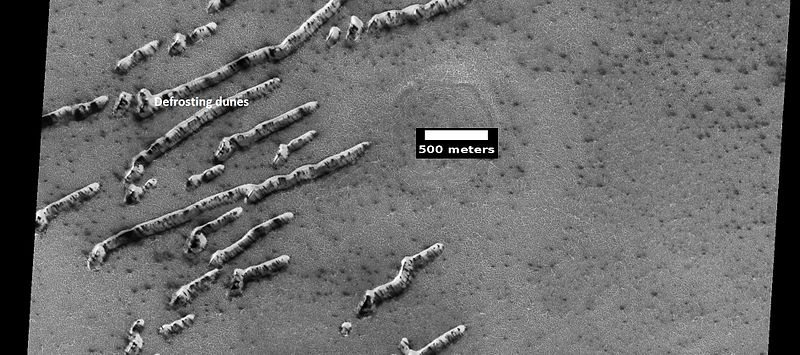
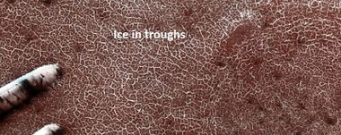
Defrosting dunes and ice in troughs of polygons, as seen by HiRISE under HiWish program
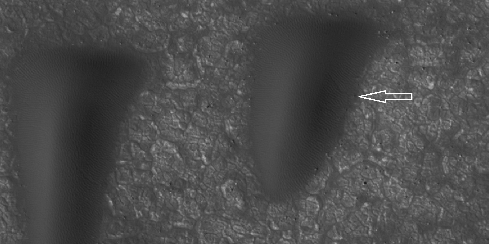
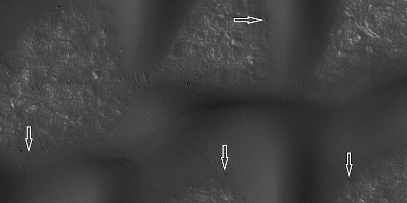
Sand dunes have been found in many places on Mars. The presence of dunes shows that the planet has an atmosphere with wind, for dunes require wind to pile up the sand. Most dunes on Mars are black because of the weathering of the volcanic rock basalt.[25] [26] Black sand can be found on Earth on Hawaii and on some tropical South Pacific islands.[27] Sand is common on Mars due to the old age of the surface that has given rocks a long, long time to erode into sand. Dunes on Mars have been observed to move many meters.[28] [29] In this process, sand moves up the windward side and then falls down the leeward side of the dune, thus caused the dune to go toward the leeward side (or slip face).[30] When images are enlarged, some dunes on Mars display ripples on their surfaces.[31]
Boulder and boulder tracks The arrow shows a boulder that has made a track in the sand as it rolled down dune.
Boulders and tracks, as seen by HiRISE underHiWish program The arrows show a boulders that have produced a track by rolling down dune.
See also
External links
References
- ↑ Davies, M.E.; Batson, R.M.; Wu, S.S.C. "Geodesy and Cartography" in Kieffer, H.H.; Jakosky, B.M.; Snyder, C.W.; Matthews, M.S., Eds. Mars. University of Arizona Press: Tucson, 1992.
- ↑ Patrick Moore and Robin Rees, ed. Patrick Moore's Data Book of Astronomy (Cambridge University Press, 2011), p. 130.
- ↑ Hartmann, W. 2003. A Traveler's Guide to Mars. Workman Publishing. NY NY.
- ↑ Clifford, S. 1987. Polar basal melting on Mars. J. Geophys. Res. 92: 9135-9152.
- ↑ Howard, A. 2000. The role of eolian processes in forming surface features of the martian polar layered deposits. Icarus. 144: 267-288.
- ↑ Edgett, K. et al. 2003. Mars landscape evolution: influence of stratigraphy on geomorphology of the north polar region. Geomorphology. 52: 289-298.
- ↑ Michael H. Carr|title=The surface of Mars|url=https://books.google.com/books?id=uLHlJ6sjohwC%7Caccessdate=21 March 2011|year=2006|publisher=Cambridge University Press|isbn=978-0-521-87201-0
- ↑ http://www.spaceref.com/news/viewpr.html?pid=29211
- ↑ http://spaceref.com/onorbit/radar-map-of-buried-mars-layers-matches-climate-cycles.html
- ↑ https://mars.nasa.gov/news/371/radar-map-of-mars-layers-matches-climate-cycles/
- ↑ http://www.gsfc.nasa.gov/topstory/20011206molaice.html | url-status = dead | title = Laser Altimeter Provides First Measurements of Seasonal Snow Depth On Mars| date = 6 December 2001 | website = Goddard Space Flight Center | publisher = NASA | https://web.archive.org/web/20090712083407/http://www.gsfc.nasa.gov/topstory/20011206molaice.html%7C
- ↑ https://books.google.com/books?id=U4FZp6f6q6MC&pg=PA240%7Ctitle=Introduction to Planetary Science: The Geological Perspective|last=Faure|first=Gunter|last2=Mensing|first2=Teresa M.|date=2007-05-04|publisher=Springer Science & Business Media|isbn=9781402055447|
- ↑ Fishbaugh|first1=K.|title=Comparison of the North and South Polar Caps of Mars: New Observations from MOLA Data and Discussion of Some Outstanding Questions|journal= Icarus|volume= 154|issue=1|year= 2001|pages= 145–161|doi= 10.1006/icar.2001.6666|bibcode=2001Icar..154..145F|url=https://semanticscholar.org/paper/5c9d844ba8766eb1e9a734652f7dacf297506c4e
- ↑ "ISBN 978-0-521-82956-4"|isbn = 978-0-521-82956-4|title = The Scientific Exploration of Mars|last1 = Taylor|first1 = Fredric W.|date = 2009-12-10
- ↑ ISBN|978-0-521-85226-5
- ↑ "ISBN 978-0-521-86698-9">isbn = 978-0-521-86698-9|title = The Martian Surface: Composition, Mineralogy and Physical Properties|last1 = Bell|first1 = Jim|date = 2008-06-05
- ↑ Lakdawalla Emily. 2008-05-27. Phoenix Sol 2 press conference, in a nutshell. Planetary Society weblog. Planetary Society. http://planetary.org/blog/article/00001470/
- ↑ https://www.newscientist.com/article/dn13661-mars-lander-aims-for-touchdown-in-green-valley.html%7Ctitle=Mars lander aims for touchdown in 'Green Valley'|New Scientist
- ↑ Hecht, M. et al. 2009. Detection of Perchlorate and the Soluble Chemistry of Martian Soil at the Phoenix Lander Site. Science: 325. 64–67
- ↑ Smith, P., et al. 2009. H2O at the Phoenix Landing Site. Science: 325, 58-61.
- ↑ NASA/Goddard Space Flight Center. "New gravity map gives best view yet inside Mars." ScienceDaily. ScienceDaily, 21 March 2016. https://www.sciencedaily.com/releases/2016/03/160321154013.htm.
- ↑ Antonio Genova, Sander Goossens, Frank G. Lemoine, Erwan Mazarico, Gregory A. Neumann, David E. Smith, Maria T. Zuber. Seasonal and static gravity field of Mars from MGS, Mars Odyssey and MRO radio science. Icarus, 2016; 272: 228 DOI: 10.1016/j.icarus.2016.02.05
- ↑ https://www.sciencedaily.com/releases/2015/03/150305140447.htm
- ↑ . Villanueva, L., Mumma, R. Novak, H. Käufl, P. Hartogh, T. Encrenaz, A. Tokunaga, A. Khayat, M. Smith. Strong water isotopic anomalies in the martian atmosphere: Probing current and ancient reservoirs. Science, 2015 DOI: 10.1126/science.aaa3630
- ↑ http://hirise.lpl.arizona.edu/ESP_016459_1830
- ↑ Michael H. Carr (2006). The surface of Mars. Cambridge University Press. ISBN 978-0-521-87201-0.
- ↑ https://www.desertusa.com/desert-activity/sand-dune-wind1.html
- ↑ https://www.youtube.com/watch?v=ur_TeOs3S64
- ↑ https://uanews.arizona.edu/story/the-flowing-sands-of-mars
- ↑ Namowitz, S., Stone, D. 1975. earth science the world we live in. American Book Company. New York.
- ↑ https://www.jpl.nasa.gov/news/news.php?feature=6551


