Valles Marineris
Valles Marineris is a vast canyon system stretching 4000 km across the Mars equatorial region east of the Tharsis Bulge. The full system is capable of stretching the entire length of the United States. The valley's depth can reach 10 km in some locations. Remember the Earth's Grand Canyon is only 1.6 kilometers deep.
Overview
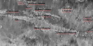
Valles Marineris (latin for Mariner Valleys) was named after the Mariner 9 orbiter (1971-72) which made the discovery. "Chasma" has been designated by the International Astronomical Union to refer to an elongate, steep-sided depression. Candor Chasma is one of the largest canyons that exist in the system.
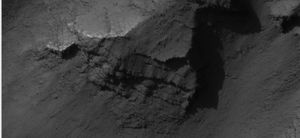
Valles Marineris is the largest canyon system in the solar system. The name for the whole system of canyons is Valles Marineris. Starting at the west with Noctis Labyrinthus in the Phoenicis Lacus quadrangle, the canyon system ends in the Margaritifer Sinus quadrangle. The walls of the canyons often contain many layers. The floors of some of the canyons contain large deposits of layered materials. Some researchers believe that the layers were formed when water once filled the canyons.[1] [2] [3] [4]
It is thought that this canyon was not carved with erosion, but rather that it is a Rift Valley.[5]
Note that the canyon is so wide, that if you were in the centre of the canyon, both walls would be invisible, below the horizon.
Possible habitat location
The floor of Valles Marineris is low enough that air pressure is significantly higher than at the rim. If a colony was built close to the north wall, the wall would provide good radiation protection from Cosmic rays since the wall blocks about half the sky. Further, the thicker air would provide protection from solar radiation.
Ground fogs have been seen at dawn at the canyon floor, so it is certain that water exists close to the ground surface.[6][7]
Valles Marineris exists on the equator, so it will be one of the warmest areas on the planet. It is also one of the few equatorial sites where there is strong evidence of water, which makes it doubly attractive.
For these reasons and others, several people have suggested that early colonies be built at this location.[8]
References:
- ↑ Cabrol, N. and E. Grin (eds.). 2010. Lakes on Mars. Elsevier. NY
- ↑ McCauley, J. 1978. Geologic map of the Coprates quadrangle of Mars. U.S. Geol. Misc. Inv. Map I-897
- ↑ Nedell | first1 = S. | display-authors = etal | year = 1987 | title = Origin and evolution of the layered deposits in the Valles Marineris, Mars | url = | journal = Icarus | volume = 70 | issue = | pages = 409–441
- ↑ Weitz, C. and T. Parker. 2000. New evidence that the Valles Marineris interior deposits formed in standing bodies of water. LPSC XXXI. Abstract 1693
- ↑ https://themis.asu.edu/vallesspecial
- ↑ https://www.universetoday.com/153778/the-bottom-of-valles-marineris-seems-to-have-water-mixed-in-with-the-regolith/
- ↑ https://www.humanmars.net/2021/12/map-of-shallow-subsurface-water-in.html
- ↑ https://newatlas.com/great-places-to-live-mars/45654/
See Also
External Links
| Concepts: | Greenhouse · Settlements · Locations · General |
| Hazards: | Space Weather · Climate · General |
| Technology: | Hi-Tech · Lo-Tech · Energy · Spaceflight science · Communication · General |
| Human Considerations: | Economics · Health · Governance · Trade · Law · Social |
| This article is a stub. You can help Marspedia by expanding it. |


