Elysium quadrangle
| MC-15 | Elysium | 0–30° N | 135–180° E | Quadrangles | Atlas |
This quadrangle was named after Elysium, a place of reward (Heaven), according to Homer in the Odyssey.[1]
The Elysium quadrangle covers the area between 180° to 225° west longitude (180 E-135 E) and 0° to 30° north latitude on Mars. A small part of the Medusae Fossae Formation lies in this quadrangle. Eddie, Lockyer, and Tombaugh are the largest craters in the Elysium quadrangle. Elysium Mons and Albor Tholus are large volcanoes in this quadrangle. Just outside the boundaries of Elysium quadrangle sits another large volcano called Hecates. There are possible giant river valleys in this area. Athabasca Valles may be one of the youngest on the planet. A large lake may once have existed in the south near Lethe Valles and Athabasca Valles.[2]
The InSight lander touched down in the southern part of this quadrangle in 2018 and is now gathering data especially on Marsquakes. InSight made a soft landing as planned on November 26, 2018 at 4.502 °N, 135.623 °E. InSight landed in a crater that is 25 meters in diameter called Homestead hollow. [3]
Contents
Volcanoes
The area near the volcanoes of Elysium is covered with lava flows. On close examination, some flows can even be seen to approach and then stop when reaching higher ground. (See pictures below for examples) The top of a lava flow often cools quickly , forming a hard crust, but it still moves under the crust. Such movement breaks up the top layer making it very rough.[4] Such rough flow is called aa lava. The lava flows here are of the aa variety.
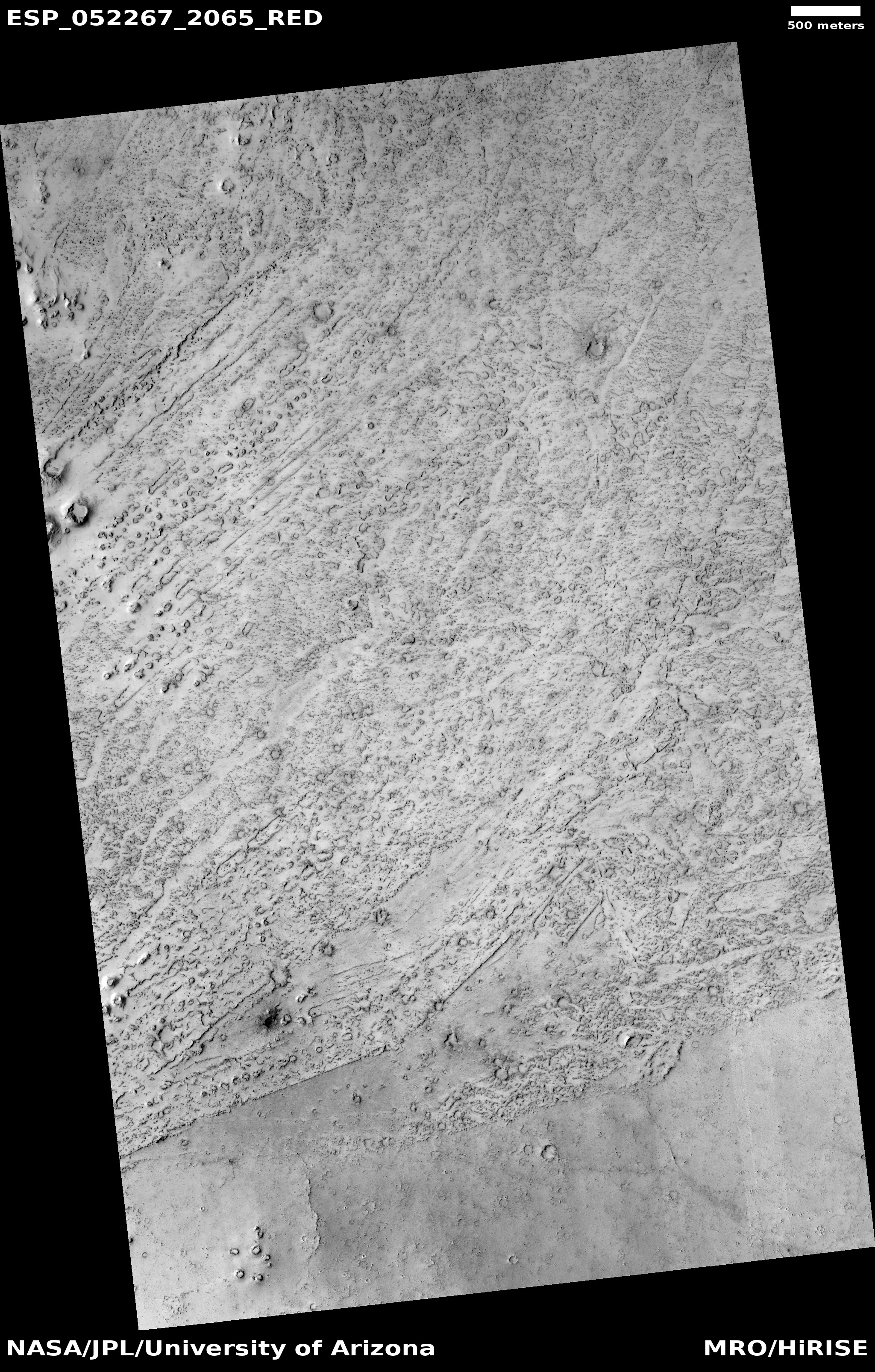
Some places in the Elysium quadrangle are young geological. Some researchers call them Platy-Ridged-Polygonized terrain. The surface of this terrain has been suggested to be pack ice, basalt lava, or muddy flows. HiRISE images show the heights of the surface ridges to be usually less than 2 meters. This is far less than what is expected from lava flows. In addition the high resolution photos of HiRISE indicates that the surface appears to flow. This would not occur with pack ice. So, the researchers concluded that muddy flows cover the surface.[5] For a while, many believed the surface was made of ice flows, which it resembles.
Lava flow in Elysium. There are many lava flows in Elysium. In this one, the lava flowed toward the upper right. Image taken by Mars Global Surveyor, under the MOC Public Targeting Program.
Lava flow, as seen by HiRISE under HiWish program Dark slope streaks are also visible
Lava flows in Elysium as seen by HiRISE. Upper part of image shows lava that solidified on the top then crumpled as lava still moved.
Rootless cones
"Rootless cones" are caused by explosions of lava with ground ice under a hot lava flow.[6] [7] [8] The ice melts and turns into a vapor and creates a cone or ring. These cones are found in Iceland, in places where lava covers water-saturated ground.[9] [10] [11]
Rootless Cones, as seen by HiRISE under HiWish program
Layers
Some regions in the Elysium quadrangle display strata or layers. Some layers break up into fine particles, other layers break up into large boulders due to their hardness. These boulders are probably made of the volcanic rock basalt since it is hard and is widespread on Mars. Some layers may be caused by repeated flows of lava.
Troughs/pit craters
Troughs to the east of Albor Tholus HiRISE images only have a color strip in the center.
Long, narrow depressions are common on Mars. They are called troughs or fossae in the geographical language used for Mars. Troughs may be made when the crust is stretched until it breaks. The mass of the huge volcanoes can cause this stretching. Fossae and common in the Elysium quadrangle as are volcanoes. A trough often possesses two breaks or faults with a middle section moving down. This leaves steep cliffs along the sides and is called a graben.[12] Lake George, in northern New York State, is a lake inside a graben. Pits are often associated with troughs. Troughs often appear to begin as a line of pits. Pits result when material collapses into a void. Pits do not have rims or ejecta around them, like impact craters do.[13] There are other ideas for the formation of fossae and pits or pit craters as they are called. They may be connected to dikes of magma. Dikes form when magma moving underground travels upward along a fault or break in the rock. Magma might move along, under the surface, breaking the rock, and more importantly melting ice. The resulting action would cause a crack to form at the surface. The images below of the Cerberus Fossae, the Elysium Fossae and other troughs, as seen by HiRISE are examples of fossae.
Knowledge of the locations and formation mechanisms of pit craters and fossae is important for the future colonization of Mars because they may be hold water.[14]
The Elysium Fossae, as seen by HiRISE (scale bar is 500 m)
Portion of a trough (fossa) (blue indicates probably seasonal frost)[15]
Craters
Like nearly all of Mars, the surface of Elysium quadrangle contains numerous impact craters. The large numbers are from the extreme age of most of the Martian surface. Impact craters generally have a rim with ejecta around them; volcanic craters do not have a rim or ejecta deposits. As craters get larger (greater than 10 km in diameter) they usually possess a central peak.[16] The peak is caused by a rebound of the crater floor following the impact.[17] Sometimes craters will display layers. The collision that produces a crater brings rocks from deep underground. Hence, craters can show us what lies deep under the surface.
Layers in Lockyer Crater, as seen by HiRISE under the HiWish program
Channels
Some landscapes in the Elysium quadrangle show strong evidence for flowing water. Channels that look like old river valleys are called Vallis in the language used for Mars.
Some valleys appear to start from grabens. Granicus Vallis and Tinjar Vallis begin at grabens that lies just to the west of Elysium Mons. The grabens may have formed because of volcanic dikes. Heat from the dikes would have melted a great deal of ice. Remember dikes are walls of rock that were once hot, liquid magma that followed cracks or faults in the rock.[18]
The Athabasca Valles are perhaps the youngest outflow channel system on Mars. They lie 620 miles southeast of the large volcano Elysium Mons. Athabasca was created when water burst out of the Cerberus Fossae, a set of cracks or fissures in the ground.[19] [20] The Cerberus Fossae most likely were formed from the stress on the crust caused by the weight of both Elysium Mons and the Tharsis volcanoes. Current evidence suggests that Cerberus floods probably erupted in several stages.[21] Near the start of these channels (at one of the Cerberus Fossae), the system is called the Athabasca Valles; to the south and east it is called Marte Vallis. Flow rates in Marte Vallis have been estimated at around 100 times that of the Mississippi River. Eventually, the system just seems to fade out in the plains of Amazonis Planitia.[22] Streamlined shapes here demonstrate that much water once moved though this area.
Fractured ground
Some places on Mars break up with large fractures that created a terrain with mesas and valleys. They may have started with cracks that became larger and larger as ice in the ground disappeared by the process of sublimation. In the thin atmosphere of Mars, ice will turn directly into a vapor. Since the ground contains so much ice, when the ice leaves large canyons are formed. Some of these can be quite beautiful.
Mesas
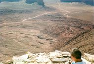
Mesas have a flat top and steep sides. The top layer of a mesa is often called a cap rock because it protects the underlying layers from erosion. Mesas often form from the erosion of a plateau. Mesas represent the remnants of a plateau, so they can show us what types of rocks covered a wide region. [23]
See Also
- High Resolution Imaging Science Experiment (HiRISE)
- HiWish program
- How living on Mars will be different than living on Earth
- InSight Mission
- Layers on Mars
- Mars Global Surveyor
- Mars volcanoes
- Rivers on Mars
References
- ↑ Blunck, J. 1982. Mars and its Satellites. Exposition Press. Smithtown, N.Y.
- ↑ "Cabrol, N 2010">Cabrol, N. and E. Grin (eds.). 2010. Lakes on Mars. Elsevier. NY.
- ↑ Banerdt B et al.: Initial results from the InSight mission on Mars, Nature Geoscience, 24 February 2020, doi: 10.1038/s41561-020-0544-y
- ↑ http://hirise.lpl.arizona.edu/PSP_010744_1840 | title=Southern Margin of Cerberus Palus (PSP_010744_1840) |
- ↑ Yue, Z., et al. 2017. AN INVESTIGATION OF THE HYPOTHESES FOR FORMATION OF THE PLATY-RIDGEDPOLYGONIZED TERRAIN IN ELYSIUM PLANITIA, MARS. Lunar and Planetary Science XLVIII (2017). 1770.pdf
- ↑ Keszthelyi, L. et al. 2010. Hydrovolcanic features on Mars: Preliminary observations from the first Mars year of HiRISE. Icarus: 205, 211-229. imaging
- ↑ http://www.psrd.hawaii.edu/June01/lavaIceMars.html
- ↑ Lanagan, P., A. McEwen, L. Keszthelyi, and T. Thordarson. 2001. Rootless cones on Mars indicating the presence of shallow equatorial ground ice in recent times, Geophysical Research Letters: 28, 2365-2368.
- ↑ S. Fagents1, A., P. Lanagan, R. Greeley. 2002. Rootless cones on Mars: a consequence of lava-ground ice interaction. Geological Society, Londo. Special Publications: 202, 295-317.
- ↑ http://www.psrd.hawaii.edu/June01/lavaIceMars.
- ↑ Jaeger, W., L. Keszthelyi, A. McEwen, C. Dundas, P. Russell, and the HiRISE team. 2007. EARLY HiRISE OBSERVATIONS OF RING/MOUND LANDFORMS IN ATHABASCA VALLES, MARS. Lunar and Planetary Science XXXVIII 1955.pdf.
- ↑ http://hirise.lpl.arizona.edu/PSP_008641_2105
- ↑ Wyrick, D., D. Ferrill, D. Sims, and S. Colton. 2003. Distribution, Morphology and Structural Associations of Martian Pit Crater Chains. Lunar and Planetary Science XXXIV (2003)
- ↑ Ferrill, D., D. Wyrick, A. Morris, D. Sims, and N. Franklin. 2004. Dilational fault slip and pit chain formation on Mars 14:10:4-12
- ↑ https://www.uahirise.org/ESP_019033_2495
- ↑ http://www.lpi.usra.edu/publications/slidesets/stones/
- ↑ Hugh H. Kieffer|title=Mars|url=https://books.google.com/books?id=NoDvAAAAMAAJ%7Caccessdate=7 March 2011|year=1992|publisher=University of Arizona Press|
- ↑ Christiansen, E. 1989. Lahars in the Elysium region of Mars. Geology. 17: 203-206.
- ↑ Cabrol, N. and E. Grin (eds.). 2010. Lakes on Mars. Elsevier. NY
- ↑ Burr, D. et al. 2002. Repeated aqueous flooding from the Cerberus Fossae: evidence for very recently extant deep groundwater on Mars. Icarus. 159: 53-73.
- ↑ http://themis.asu.edu/features/athabascafloods | title=Feature Image: Floods in Athabasca Valles
- ↑ Hartmann, W. 2003. A Traveler's Guide to Mars. Workman Publishing. NY NY.
- ↑ Namowitz, S., D. Stone. earth science The world we live in 1975. American Book Company. New York.


