Difference between revisions of "Mars Quadrangles"
| (26 intermediate revisions by the same user not shown) | |||
| Line 1: | Line 1: | ||
| − | + | {{Mars atlas}} | |
| − | |||
[[Category:Mars Atlas]] | [[Category:Mars Atlas]] | ||
| + | The surface of Mars has been divided into thirty cartographic quadrangles by the United States Geological Survey. The maps below were produced by the [[Mars Global Surveyor]]'s [[w:Mars_Orbiter_Laser_Altimeter|Mars Orbiter Laser Altimeter]]; redder colors indicate higher elevations. The maps of the equatorial quadrangles use a [[w:Mercator_projection|Mercator projection]], while those of the mid-latitude quadrangles use a [[w:Lambert_conformal_conic_projection|Lambert conformal conic projection]], and the maps of the polar quadrangles use a polar [[w:Stereographic_projection_in_cartography|stereographic projection]]. | ||
| − | + | See the [[Mars atlas|Mars Atlas]] for a general view of Mars. | |
| − | |||
| − | |||
| − | |||
| − | |||
| − | |||
{| class="wikitable sortable" | {| class="wikitable sortable" | ||
|- | |- | ||
| − | ! Number !! Name !! scope="col" class="unsortable" | Latitudes !! scope="col" class="unsortable" | Longitudes !! scope="col" class="unsortable" | Features !! scope="col" class="unsortable" | Map | + | !Number!!Name!! scope="col" class="unsortable" |Latitudes!! scope="col" class="unsortable" |Longitudes!! scope="col" class="unsortable" |Features!! scope="col" class="unsortable" |Map |
|- | |- | ||
| − | | MC-01 || [[Mare Boreum quadrangle|Mare Boreum]] || 65–90° N || | + | |MC-01||[[Mare Boreum quadrangle|Mare Boreum]]||65–90° N||180° W–180° E||[[Korolev]], Northern ice cap||[[File:USGS-Mars-MC-1-MareBoreumRegion-mola.png|alt=Topographical map of Mare Boreum|150px]] |
|- | |- | ||
| − | | MC-02 || [[Diacria quadrangle|Diacria]] || 30–65° N || 120–180° W || [[ | + | |MC-02||[[Diacria quadrangle|Diacria]]||30–65° N||120–180° W||[[Milankovic Crater]]||[[File:USGS-Mars-MC-2-DiacriaRegion-mola.png|alt=Topographical map of Diacria quadrangle|150px]] |
|- | |- | ||
| − | | MC-03 || [[Arcadia quadrangle|Arcadia]] || 30–65° N || 60–120° W || | + | |MC-03||[[Arcadia quadrangle|Arcadia]]||30–65° N||60–120° W|| ||[[File:USGS-Mars-MC-3-ArcadiaRegion-mola.png|alt=Topographical map of Arcadia quadrangle|150px]] |
|- | |- | ||
| − | | MC-04 || [[Mare Acidalium quadrangle|Mare Acidalium]] || 30–65° N || 0–60° W || [[ | + | |MC-04||[[Mare Acidalium quadrangle|Mare Acidalium]]||30–65° N||0–60° W||[[The Face on Mars|Face on Mars]], [[Cydonia]]||[[File:USGS-Mars-MC-4-MareAcidaliumRegion-mola.png|alt=Topographical map of Mare Acidalium quadrangle|150px]] |
|- | |- | ||
| − | | MC-05 || [[Ismenius Lacus quadrangle|Ismenius Lacus]] || 30–65° N || 0–60° E || [[ | + | |MC-05||[[Ismenius Lacus quadrangle|Ismenius Lacus]]||30–65° N||0–60° E||[[Lyot Crater]]||[[File:USGS-Mars-MC-5-IsmeniusLacusRegion-mola.png|alt=Topographical map of Ismenius Lacus quadrangle|150px]] |
|- | |- | ||
| − | | MC-06 || [[Casius quadrangle|Casius]] || 30–65° N || 60–120° E || | + | |MC-06||[[Casius quadrangle|Casius]]||30–65° N||60–120° E|| ||[[File:USGS-Mars-MC-6-CasiusRegion-mola2.png|alt=Topographical map of Casius quadrangle|150px]] |
|- | |- | ||
| − | | MC-07 || [[Cebrenia quadrangle|Cebrenia]] || 30–65° N || 120–180° E || [[ | + | |MC-07||[[Cebrenia quadrangle|Cebrenia]]||30–65° N||120–180° E||[[Hecates Tholus]]||[[File:USGS-Mars-MC-7-CebreniaRegion-mola.png|alt=Topographical map of Cebrenia quadrangle|150px]] |
|- | |- | ||
| − | | MC-08 || [[Amazonis quadrangle|Amazonis]] || 0–30° N || 135–180° W || | + | |MC-08||[[Amazonis quadrangle|Amazonis]]||0–30° N||135–180° W|| ||[[File:USGS-Mars-MC-8-AmazonisRegion-mola.png|alt=Topographical map of Amazonis quadrangle|150px]] |
|- | |- | ||
| − | | MC-09 || [[Tharsis quadrangle|Tharsis]] || 0–30° N || 90–135° W || [[ | + | |MC-09||[[Tharsis quadrangle|Tharsis]]||0–30° N||90–135° W||[[Olympus Mons]], |
| + | |||
| + | [[Ascraeus Mons]], | ||
| + | |||
| + | [[Pavonis Mons]], | ||
| + | |||
| + | [[Noctis Labyrinthus]] | ||
| + | |[[File:USGS-Mars-MC-9-TharsisRegion-mola.png|alt=Topographical map of Tharsis quadrangle|150px]] | ||
|- | |- | ||
| − | | MC-10 || [[Lunae Palus quadrangle|Lunae Palus]] || 0–30° N || 45–90° W || | + | |MC-10||[[Lunae Palus quadrangle|Lunae Palus]]||0–30° N||45–90° W|| ||[[File:USGS-Mars-MC-10-LunaePalusRegion-mola.png|alt=Topographical map of Lunae Palus quadrangle|150px]] |
|- | |- | ||
| − | | MC-11 || [[Oxia Palus quadrangle|Oxia Palus]] || 0–30° N || 0–45° W || | + | |MC-11||[[Oxia Palus quadrangle|Oxia Palus]]||0–30° N||0–45° W|| ||[[File:USGS-Mars-MC-11-OxiaPalusRegion-mola.png|alt=Topographical map of Oxia Palus quadrangle|150px]] |
|- | |- | ||
| − | | MC-12 || [[Arabia quadrangle|Arabia]] || 0–30° N || 0–45° E || | + | |MC-12||[[Arabia quadrangle|Arabia]]||0–30° N||0–45° E|| ||[[File:USGS-Mars-MC-12-ArabiaRegion-mola.png|alt=Topographical map of Arabia quadrangle|150px]] |
|- | |- | ||
| − | | MC-13 || [[Syrtis Major quadrangle|Syrtis Major]] || 0–30° N || 45–90° E || [[ | + | |MC-13||[[Syrtis Major quadrangle|Syrtis Major]]||0–30° N||45–90° E||[[Jezero Crater]]||[[File:USGS-Mars-MC-13-SyrtisMajorRegion-mola.png|alt=Topographical map of Syrtis Major quadrangle|150px]] |
|- | |- | ||
| − | | MC-14 || [[Amenthes quadrangle|Amenthes]] || 0–30° N || 90–135° E || | + | |MC-14||[[Amenthes quadrangle|Amenthes]]||0–30° N||90–135° E|| ||[[File:USGS-Mars-MC-14-AmenthesRegion-mola.png|alt=Topographical map of Amenthes quadrangle|150px]] |
|- | |- | ||
| − | | MC-15 || [[Elysium quadrangle|Elysium]] || 0–30° N || 135–180° E || [[ | + | |MC-15||[[Elysium quadrangle|Elysium]]||0–30° N||135–180° E||[[Elysium Mons]]||[[File:USGS-Mars-MC-15-ElysiumRegion-mola.png|alt=Topographical map of Elysium quadrangle|150px]] |
|- | |- | ||
| − | | MC-16 || [[Memnonia quadrangle|Memnonia]] || 0–30° S || 135–180° W || | + | |MC-16||[[Memnonia quadrangle|Memnonia]]||0–30° S||135–180° W|| ||[[File:USGS-Mars-MC-16-MemnoniaRegion-mola.png|alt=Topographical map of Memnonia quadrangle|150px]] |
|- | |- | ||
| − | | MC-17 || [[Phoenicis Lacus quadrangle|Phoenicis Lacus]] || 0–30° S || 90–135° W || [[ | + | |MC-17||[[Phoenicis Lacus quadrangle|Phoenicis Lacus]]||0–30° S||90–135° W||[[Arsia Mons]]||[[File:USGS-Mars-MC-17-PhoenicisRegion-mola.png|alt=Topographical map of Phoenicis Lacus quadrangle|150px]] |
|- | |- | ||
| − | | MC-18 || [[Coprates quadrangle|Coprates]] || 0–30° S || 45–90° W || [[ | + | |MC-18||[[Coprates quadrangle|Coprates]]||0–30° S||45–90° W||[[Valles Marineris|Valles Marienis]]||[[File:USGS-Mars-MC-18-CopratesRegion-mola.png|alt=Topographical map of Coprates quadrangle|150px]] |
|- | |- | ||
| − | | MC-19 || style="white-space: nowrap;" | [[Margaritifer Sinus quadrangle|Margaritifer Sinus]] || 0–30° S || 0–45° W || | + | |MC-19|| style="white-space: nowrap;" |[[Margaritifer Sinus quadrangle|Margaritifer Sinus]]||0–30° S||0–45° W|| ||[[File:USGS-Mars-MC-19-MargartiferSinusRegion-mola.png|alt=Topographical map of Margaritifer Sinus quadrangle|150px]] |
|- | |- | ||
| − | | MC-20 || [[Sinus Sabaeus quadrangle|Sinus Sabaeus]] || 0–30° S || 0–45° E || | + | |MC-20||[[Sinus Sabaeus quadrangle|Sinus Sabaeus]]||0–30° S||0–45° E|| ||[[File:USGS-Mars-MC-20-SinusSabaeusRegion-mola.png|alt=Topographical map of Sinus Sabaeus quadrangle|150px]] |
|- | |- | ||
| − | | MC-21 || [[Iapygia quadrangle|Iapygia]] || 0–30° S || 45–90° E || | + | |MC-21||[[Iapygia quadrangle|Iapygia]]||0–30° S||45–90° E|| ||[[File:USGS-Mars-MC-21-IapygiaRegion-mola.png|alt=Topographical map of Iapygia quadrangle|150px]] |
|- | |- | ||
| − | | MC-22 || [[Mare Tyrrhenum quadrangle|Mare Tyrrhenum]] || 0–30° S || 90–135° E || | + | |MC-22||[[Mare Tyrrhenum quadrangle|Mare Tyrrhenum]]||0–30° S||90–135° E|| ||[[File:USGS-Mars-MC-22-MareTyrrhenumRegion-mola.png|alt=Topographical map of Mare Tyrrhenum quadrangle|150px]] |
|- | |- | ||
| − | | MC-23 || [[Aeolis quadrangle|Aeolis]] || 0–30° S || 135–180° E || [[ | + | |MC-23||[[Aeolis quadrangle|Aeolis]]||0–30° S||135–180° E||[[Gale Crater]], |
| + | [[Gusev Crater]], | ||
| + | |||
| + | [[Ma'adim Vallis]] | ||
| + | |[[File:USGS-Mars-MC-23-AeolisRegion-mola.png|alt=Topographical map of Aeolis quadrangle|150px]] | ||
|- | |- | ||
| − | | MC-24 || [[Phaethontis quadrangle|Phaethontis]] || 30–65° S || 120–180° W || | + | |MC-24||[[Phaethontis quadrangle|Phaethontis]]||30–65° S||120–180° W|| ||[[File:USGS-Mars-MC-24-PhaethontisRegion-mola.png|alt=Topographical map of Phaethontis quadrangle|150px]] |
|- | |- | ||
| − | | MC-25 || [[Thaumasia quadrangle|Thaumasia]] || 30–65° S || 60–120° W || | + | |MC-25||[[Thaumasia quadrangle|Thaumasia]]||30–65° S||60–120° W|| ||[[File:USGS-Mars-MC-25-ThaumasiaRegion-mola.png|alt=Topographical map of Thaumasia quadrangle|150px]] |
|- | |- | ||
| − | | MC-26 || [[Argyre quadrangle|Argyre]] || 30–65° S || 0–60° W || [[:Category:Argyre quadrangle| | + | |MC-26||[[Argyre quadrangle|Argyre]]||30–65° S||0–60° W||[[:Category:Argyre quadrangle|Argyre basin]]||[[File:USGS-Mars-MC-26-ArgyreRegion-mola.png|alt=Topographical map of Argyre quadrangle|150px]] |
|- | |- | ||
| − | | MC-27 || [[Noachis quadrangle|Noachis]] || 30–65° S || 0–60° E || | + | |MC-27||[[Noachis quadrangle|Noachis]]||30–65° S||0–60° E|| ||[[File:USGS-Mars-MC-27-NoachisRegion-mola.png|alt=Topographical map of Noachis quadrangle|150px]] |
|- | |- | ||
| − | | MC-28 || [[Hellas quadrangle|Hellas]] || 30–65° S || 60–120° E || [[ | + | |MC-28||[[Hellas quadrangle|Hellas]]||30–65° S||60–120° E||[[Hellas Basin|Hellas basin]]||[[File:USGS-Mars-MC-28-HellasRegion-mola.png|alt=Topographical map of Hellas quadrangle|150px]] |
|- | |- | ||
| − | | MC-29 || [[Eridania quadrangle|Eridania]] || 30–65° S || 120–180° E || | + | |MC-29||[[Eridania quadrangle|Eridania]]||30–65° S||120–180° E|| ||[[File:USGS-Mars-MC-29-EridaniaRegion-mola.png|alt=Topographical map of Eridania quadrangle|150px]] |
|- | |- | ||
| − | | MC-30 || [[Mare Australe quadrangle|Mare Australe]] || 65–90° S || 180° W – 180° E || | + | |MC-30||[[Mare Australe quadrangle|Mare Australe]]||65–90° S||180° W – 180° E||South polar ice cap |
| + | |[[File:USGS-Mars-MC-30-MareAustraleRegion-mola.png|alt=Topographical map of Mare Australe quadrangle|150px]] | ||
|} | |} | ||
Latest revision as of 07:07, 13 November 2020
The surface of Mars has been divided into thirty cartographic quadrangles by the United States Geological Survey. The maps below were produced by the Mars Global Surveyor's Mars Orbiter Laser Altimeter; redder colors indicate higher elevations. The maps of the equatorial quadrangles use a Mercator projection, while those of the mid-latitude quadrangles use a Lambert conformal conic projection, and the maps of the polar quadrangles use a polar stereographic projection.
See the Mars Atlas for a general view of Mars.
| Number | Name | Latitudes | Longitudes | Features | Map |
|---|---|---|---|---|---|
| MC-01 | Mare Boreum | 65–90° N | 180° W–180° E | Korolev, Northern ice cap | 
|
| MC-02 | Diacria | 30–65° N | 120–180° W | Milankovic Crater | 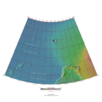
|
| MC-03 | Arcadia | 30–65° N | 60–120° W | 
| |
| MC-04 | Mare Acidalium | 30–65° N | 0–60° W | Face on Mars, Cydonia | 
|
| MC-05 | Ismenius Lacus | 30–65° N | 0–60° E | Lyot Crater | 
|
| MC-06 | Casius | 30–65° N | 60–120° E | 
| |
| MC-07 | Cebrenia | 30–65° N | 120–180° E | Hecates Tholus | 
|
| MC-08 | Amazonis | 0–30° N | 135–180° W | 
| |
| MC-09 | Tharsis | 0–30° N | 90–135° W | Olympus Mons, | 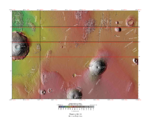
|
| MC-10 | Lunae Palus | 0–30° N | 45–90° W | 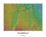
| |
| MC-11 | Oxia Palus | 0–30° N | 0–45° W | 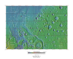
| |
| MC-12 | Arabia | 0–30° N | 0–45° E | 
| |
| MC-13 | Syrtis Major | 0–30° N | 45–90° E | Jezero Crater | 
|
| MC-14 | Amenthes | 0–30° N | 90–135° E | 
| |
| MC-15 | Elysium | 0–30° N | 135–180° E | Elysium Mons | 
|
| MC-16 | Memnonia | 0–30° S | 135–180° W | 
| |
| MC-17 | Phoenicis Lacus | 0–30° S | 90–135° W | Arsia Mons | 
|
| MC-18 | Coprates | 0–30° S | 45–90° W | Valles Marienis | 
|
| MC-19 | Margaritifer Sinus | 0–30° S | 0–45° W | 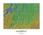
| |
| MC-20 | Sinus Sabaeus | 0–30° S | 0–45° E | 
| |
| MC-21 | Iapygia | 0–30° S | 45–90° E | 
| |
| MC-22 | Mare Tyrrhenum | 0–30° S | 90–135° E | 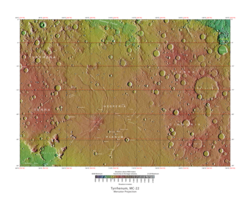
| |
| MC-23 | Aeolis | 0–30° S | 135–180° E | Gale Crater, | 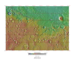
|
| MC-24 | Phaethontis | 30–65° S | 120–180° W | 
| |
| MC-25 | Thaumasia | 30–65° S | 60–120° W | 
| |
| MC-26 | Argyre | 30–65° S | 0–60° W | Argyre basin | 
|
| MC-27 | Noachis | 30–65° S | 0–60° E | 
| |
| MC-28 | Hellas | 30–65° S | 60–120° E | Hellas basin | 
|
| MC-29 | Eridania | 30–65° S | 120–180° E | 
| |
| MC-30 | Mare Australe | 65–90° S | 180° W – 180° E | South polar ice cap | 
|


